
The mountains of the Olympic Peninsula may have saved themselves by being just a little too hard to de-forest. They are not a huge set of mountains, but they bunch together in the center of the peninsula and may have made it just a little too expensive to destroy. Oh, of course there were some attempts, a few roads cut, a few canyons temporarily inundated with the waters from Hydro Electric Dam projects, but the core of the big mountains seems to have saved itself long enough for the National Park system to take over and make it more valuable as a recreation site than a wood mining site.
We are headed up the main park road into the mountains today. This road only goes up to the Visitor’s center at Hurricane Ridge and is only open from late spring until early summer. In fact, we got there a little early in the season. There has been a lot of snow this year and they still don’t have all of the roads and parking lots and trailheads on the mountain plowed and open.


Hurricane Ridge. It seems like all of the place names with “Ridge” in them that I know have a sort of ominous sound. Hurricane Ridge. Starvation Ridge. Skinner’s Ridge. I guess once you have got up to the top of the mountains you are not in such an optimistic mood.
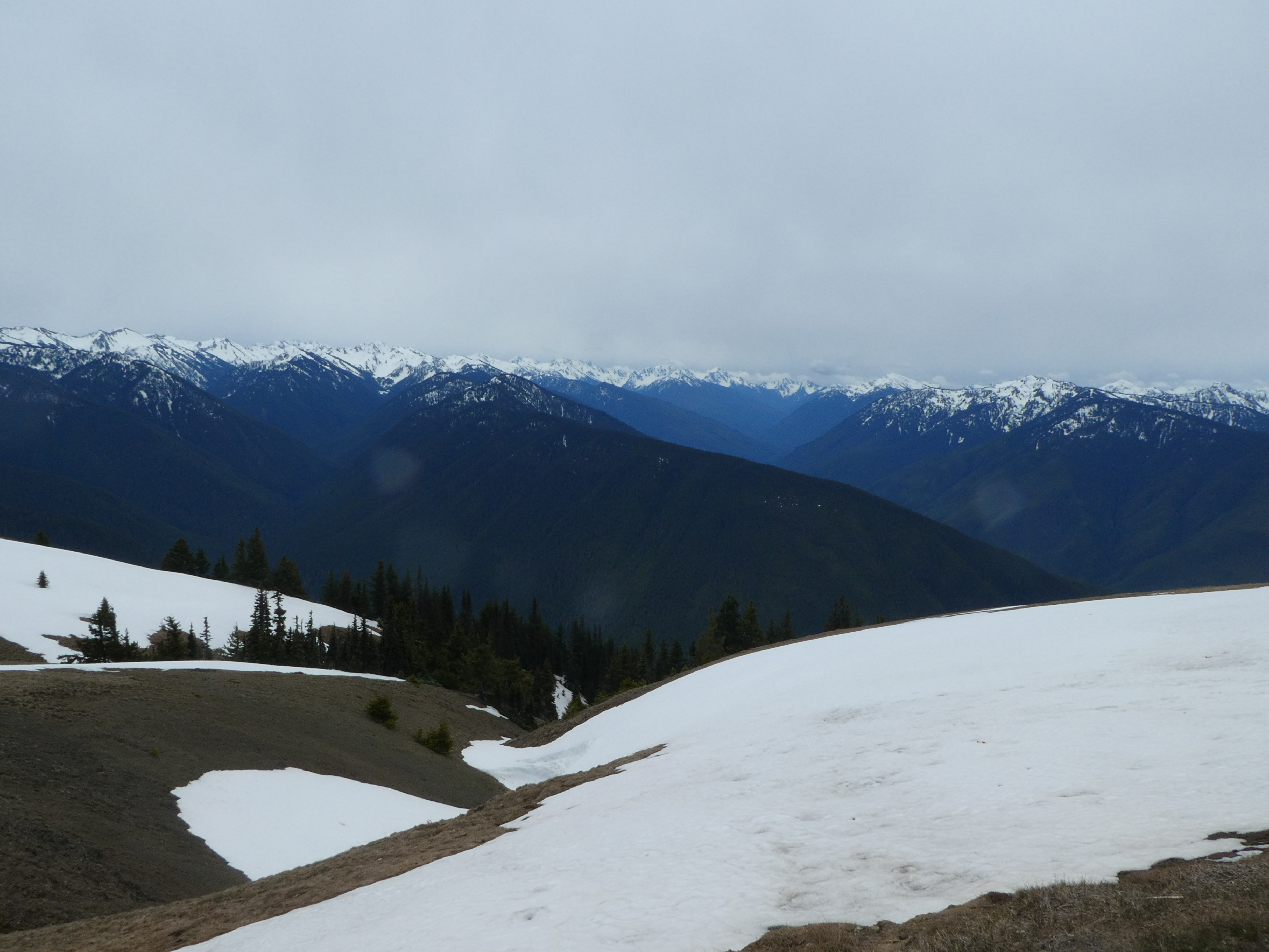
It is a nice drive up. Good Road. Nice Scenery. Takes about half an hour. We passed a few deer grazing on the side of the road. I guess we were getting there about a week before everything opened up officially, but the little store at the Visitors Center was open so we could go in and shop for coffee mugs. The air was crisp and cold. The occasional wind (Hurricane Ridge, after all) was freezing. And the view was incredible. From up there you are surrounded by snow covered mountains. Today we were actually above the cloud cover (we drove through it on the way up) and we could see for miles. In fact, from one corner of the road we could see past the mountains looking north and get views of the Salish sea and all the way across to Vancouver Island (Canada).

 |
| That is Canada out there |
Though the road was plowed, the sides of the road still had 2-3 feet of snow (and I don’t mean it was stacked up, that was the actual depth of the snow still left over). There were a few trails where people had hiked down (presumably in snow shoes) but most of the visitors up there were content to just walk along the road with us.
The thing about this park that we did not get to explore is that it is really set for backpacking. There are trails through all of the valleys and over all of the ridges and there are many designated backpacking camps and such. You need a reservation to go to these places and you need to check in and get a camping assignment before you go. And there are trails that can take Days to hike. This all sounds really lovely for me but I don’t know if anything but some of the shorter overnight trails are really within my capability. I mean, it is a mountainous area. You have to hike up and down a lot. Well, maybe something to think about…

To give you a mental picture of how close these mountains are to the sea, on our way back home we drove out to another federal nature preserve that is about 20 minutes from the main park visitor center of Port Angeles. This one is a long sand spit that sticks out into the salt water of the Puget Sound (or perhaps Salish sea). It has a somewhat famous lighthouse out on the end (that I almost visited once) and a bay that is has the same name as some delicious crab (Dungeness). We wanted a little walk and a picnic table on the beach where we could eat our lunch. Well, we couldn’t get to the beach because of fencing keeping us away. Very strange. So we had to walk the one mile nature trail to get to the beach access. That is where we came across this fabulous view of the spit and also found out what all of the fencing was about. We were like 80 feet up a huge sandstone bluff. Way up. The fence is to keep people from the ledge (and either hurting the bluff or themselves). We ate our lunch on the beach sitting on one of the massive flotsam logs that have been bleaching in the sun there for decades. We could see the lighthouse but it was a few miles away.
 |
| The Spit from the Cliffs (Well, that sounds disgusting) |
 |
| Dungeness Lighthouse |


So, Sea To Mountain in like 15 miles (as the crow flies) and perhaps 40 minutes drive.
No comments:
Post a Comment