
We are staying a few days in Central Oregon in the Bend area. We are here for the last annual Cascade Lakes paddle of our soon to be defunct Paddle Meetup, Kayak Portland. Sort of a bitter sweet kind of event. My partner and I met at a KP event and then our first big romantic adventure was the clubs first trip to cascades. A year later, at the same event, we got married.
This year we arrived a day before the club activities start. We have a very nice cabin rented at the La Pine state park. It is a great little place, it has two rooms, can sleep 5 or 6 pretty easily (if they like each other) and also has a bathroom, a shower, a sink, a microwave, a medium sized refrigerator along with the usual bunk bed and couch made out of this green plastic Naugahyde that the state is so enamored of. These are the “deluxe” cabins. There are only 4 or 5 at this site and all of them are handicapped access.
 |
| Deluxe Cabin Main Room |
The Deschutes river winds through the State Park and there are a number of very nicely signed trails that loop around the park. There are 10 or 15 miles of these trails and they are all OK for walking and trail bikes.
We are also here enjoying what is probably the first sunny warm weather of the Spring season in the high desert. Last week, it snow (a little) at the park. This week, it is going to be in the 70s and sunny during the day (still down in the 40s at night). We want to get the most out of our time here and we have the gear for Kayaking, Hiking, and Biking.
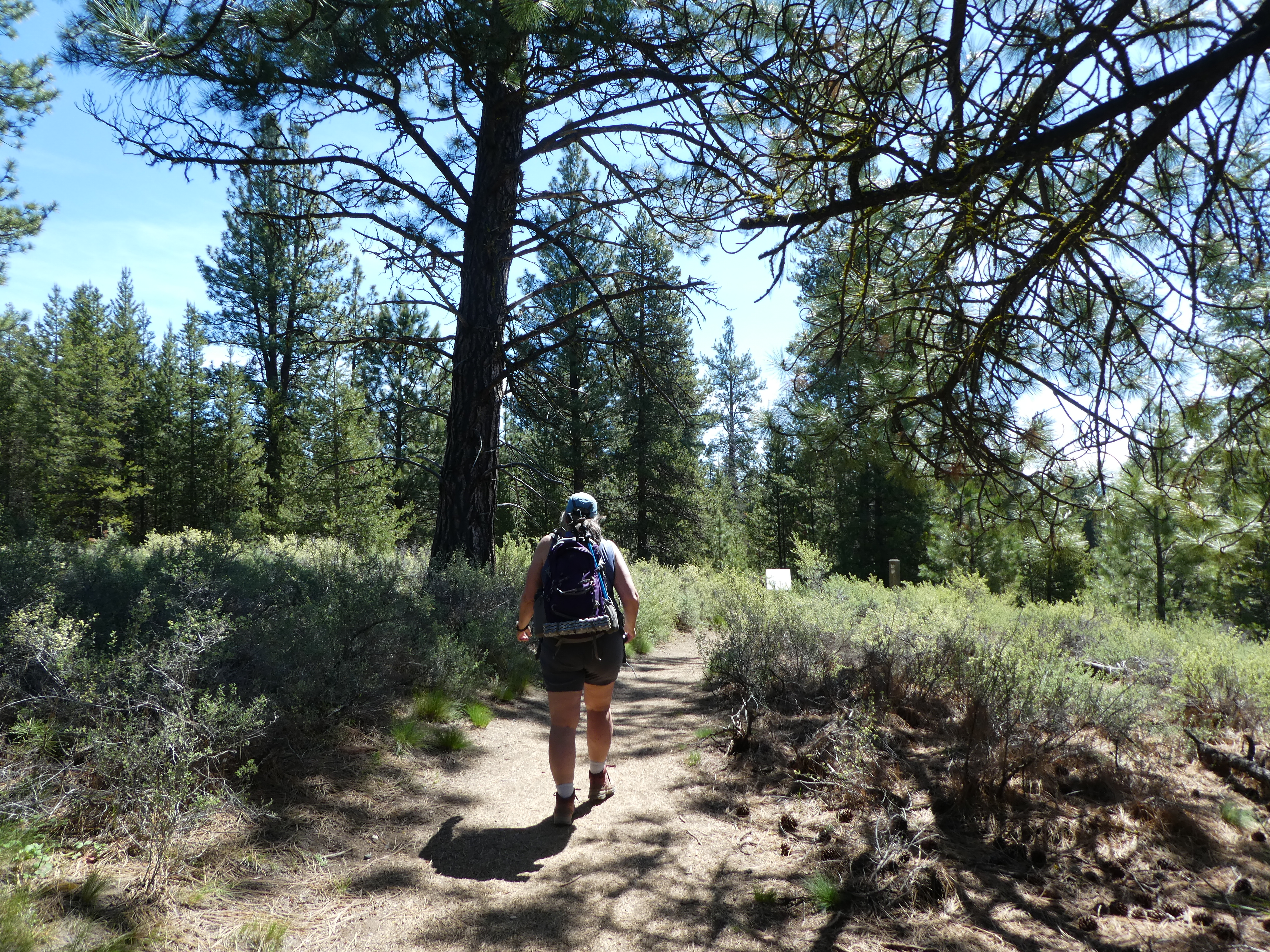
Today we went out for a little exercise and exploring on the Fall River loop trail. This trail starts at the beautiful McGrath viewpoint. The river along here is loopy and slow moving. Along here the West banks of the river are mostly sandy cliffs, perhaps 20 or 30 feet high. The East banks are low lying with marshes and forests.

Even though there are several small rivers and creeks winding through this area, once you get up on top of the 30 foot high sandy cliffs you are very much in the eco-system of the high desert. I believe that the land underneath is all ancient lava flows covered by many meters of volcanic ash and the water of the rivers down below is not accessible to most of the plants growing up on the flat lands. So our trail is dusty and travels through predominantly scrub pine forests. These are little pine trees, most only 8 or 10 inches in diameter. The ground cover is some sort of sage bush and everything is very dry.
The other dominant feature of the ground cover is old fallen logs. Dead trees everywhere. I am guessing much of the forest dies on a regular basis with a hard winter or a few dry summers in a row. Where we were walking was a lot of good firewood. It also looked like woodsmen or someone had been at work over the years building small fires to try and burn off some of the excess fuel. There were many circles of burned area, 10 feet across and very well defined. At first we thought they may be old campfires, but there were just too many of them too close together. It must be a lot of work to set so many little fires to try and prevent a big one. You can see similar signs of this kind of work as your drive or hike around the area. In some places, there are huge piles of slag in places that have NOT been forested. This is just natural deadfall that has been cut up into smaller sections and collected into heaps, the idea being that if a fire comes through the area, the heaps may burn, but it is harder for the fire to spread from one heap to another than what would have happened if the deadfall had been left alone. In other places, as you drive along, you can see that the small trees have been cleared and the larger trees left along a section of highway. The cleared sections stretch for about 100 yards off of the road and then the denser forests, with the closely growing smaller trees, can be seen again.
 |
| Burn Spot |

On occasion the trail runs up against the Deschutes river. In these cases the hiker gets a beautiful sweeping view from the bluffs of the slow running river flowing through the greenery of the riparian ecosystem. Things are lush and green down there by the river, so different from the more harsh environment up on the bluffs away from the water.
.JPG)
The larger trees that are growing in this forest are the beautiful red barked and majestic Ponderosa Pine. Called ‘Ponderosa’ for large. As in ‘Ponderous’.
The trail takes a left turn when it runs into Fall river (the namesake of the trail) and it then climbs a little to get above the small fall which I imagine gives name to the river. This river is crystal clear and has attracted a lot of fisherman, all of whom were eager to tell us of the fish they could see but had not quite been able to catch yet. I think most of these fishermen are catch and release type guys, which I don’t really understand. When I was a fisherman (I was like 8) I was very much a catch and eat sort of kid.

 |
| Fall River Falls. (Not to be confused with Falls Creek Falls) |
Coming back to complete the loop is more walking through the forests. Some of which have been obviously cleared. I found a site that talks about the proper management of the forests in this area and it says that to keep the trees healthy you need to leave the larger trees and clear out in between them. You stack the cleared wood into piles about 8 feet high and then you burn the piles when it is safe to do so. This leaves 20 or so feet between each tree and lets them grow tall and healthy and protects against large forest fires. But, my that must take a lot of work. And how did the forest get into such a unhealthy state to begin with? Surely this is not ‘Natural’. But if not, then what it is. I am guessing it is the result of unrestricted clearcut logging a hundred years ago. I need to find a source that can educate me. Where do I go? Perhaps start by calling a local ranger.
So we finished our hike, but there are several more hikes around the camp that we did. And all of the trails are accessible by bike, so we did a few bike trips to. They trails are well marked, in great shape, and just long enough to have fun. They have great views of the Deshutes river and Fall River and many great sightings of wonderfully majestic Ponderosa Pine.

The other interesting site we saw was all over the camp, and especially crossing the road. It was the caterpillar for the Pandora Moth. These bugs are exactly what you would expect to come from something that eats only pin needles. They were green and long and hard and where EVERYWHERE. Turns out we are at the tail end of an 8 year infestation of these things, which are natural pests in the Central Oregon pine forests. They have a 2 year life cycle, so one summer you see the caterpillars and the next summer you see the very large and pretty moths. They do some damage to the trees but they don’t tend to kill them. We are currently in the 8th year of what is supposed to be a 6 year infestation (from historical records) and there sure where a lot of the buggers around. I must have accidently run over 10 of them. I will try and find a picture of the moth for you.
Some Pictures from Internet:
 |
 |
As a final word, LaPine State Park is a very nice park with lots of fine access to the Deschutes river and 15 or so miles of good trails around the park. The deluxe cabins are great but there are lots of other sites for people with campers and such. We didn’t see many tents and I don’t know what it is like here in the summer when it gets hot. I guess the good thing about a camper is that most of them have A/C.
No comments:
Post a Comment