Edison Butte is a snow park and trail head on Mount Bachelor right off NF-45 which is the main drag from Sunriver to Mt Bachelor. The Butte itself is just across the road from the parking lot and trailhead. During the summer, this is a hiking trailhead and OHV area. During the winter, when the snow has coated everything with a layer of white fluff, it is an excellent destination for Cross Country Skiing, Snowshoeing, and other snow-based fun.
We have been staying for a few days in a rental in Sunriver, a sort of up scale outdoor adventure oriented community. Lots of snow covered bike paths and such to walk or snowshoe on here, but we wanted to venture out some and so we headed a ways up the mountain to find some excitement. Forest Road 45 starts just outside of Sunriver (near the bridge across the Deshutes River) and goes in pretty much a straight line right up the mountain. On Google maps, the road is occasionally labeled "Edison Ice Caves Road", which is interesting. There is also a Edison Ice Caves labeled on some maps not far from the Edison Snow Park. An ice cave is a lava tube that has had a ceiling collapse leaving an entrance from the surface. They are called ice caves because ice and snow get into them in the winter and pretty much don't melt even late in the summer. So you can hike into them and find the ice (or at least find them very cold). The largest publicly known lava tube in this area is a national park site and you can go there and park and rent a lantern and hiking the 2 miles down the 50 foot diameter tube to the sand filled terminus. Why this digression? Because the presence of a lava tube is also indicative of other big surface rock formations. Some of which we will see whilst out Snowshoeing.
 |
| Cars at the Trailhead |
We get to the Snow Park around 10:30, which is evidently pretty early to be arriving because the parking lot is only about a quarter full (when we left, it was at capacity). The temperature is a balmy 28. Yesterday it was 12. We lucked out.
The map mounted on the trail complex entrance tells a great story. First, note that there are 2 kinds of trails, those for Snowshoeing (or just walking) and those for Nordic Skiing. The Nordic Ski trails feature 2 tracks (one for each ski) and go around through the trees and stay away from rocky areas. The Snowshoeing trails have one well tramped 2 foot wide path going off through other interesting areas.
The other thing you notice is the cute trail names. Since this is Edison Butte (which I am betting has nothing to do with the inventor) many of the trails have electricity based names, like "Direct Current" and "High Voltage". One of the snowshoe trails is named "Tesla". I find this funny because the stories of Edison and Tesla always imply that they didn't get on so well.
Today, one of our party is going out to Cross Country skiing, so she is leaving us. My partner and I are going to do one of the descriptively named snow shoe trails "Long Loop" and "Short Loop". They should have consulted with a few more electrical engineers on these names. I think they easily could have called "Short Loop" the more apt name of "Short Circuit".
These two trails start off together, so we decided to put off making a decision as to which one we were actually on for as long as possible. Our main concern is that we are meeting our Nordic Ski friend back at the car in 2 hours. Short Loop claims to be 3 miles. Long claims to be 4.5 miles.
We tramp along. Everything has had a recent 6 to 12 inches of new snow (like in the last 48 hours) but the trails are well marked (with blue squares with little yellow snow shoe people nailed up high in the trees or on posts) and well tramped (by previous shoers). The trail starts to wend its way through an area that must be a tumble of boulders or lava rock uprising. It is hard to tell because of all of the beautiful snow. But the trail goes up and down and in and out in a maze like fashion and the view of the snow covered rock piles is stunning.
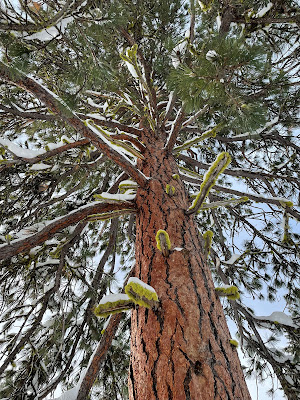
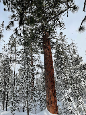
Our other stark vista is the red/orange giant of Ponderosa Pine soaring up through the snow and towering over the smaller lodge pole pine. I think I got a couple of good pictures.
 |
| Ponderosa |
Quite a few other hikers on the trail, many of these with dogs. Just about everyone is going much faster than we are. I could attribute this to my still recovering from knee surgery, but I think I will instead go with the fact that many people were wearing smaller and lighter snow shoes. More like wearing large tennis shoes. This has got to be cheating. I have to look into getting some of these things. My partner and I are wearing the $65 specials from Costco. They work fine. They get you up and down the hills and you can tromp off trail into the deep snow without sinking in over your head. But they are a lot bigger and heavier than what many of the fast movers around us are wearing.
The weather was pretty variable for our short time on the mountain. It snowed pretty hard during the drive up, but just after we passed the sign to "Chain Up" the snow stopped and the sun came out and it was pretty nice there in the parking lot whilst we geared up. We got a little snow before we got to the trail decision point but then the sun came back out again. Now we came to a big Ponderosa Pine with a trail map on it. We could go straight and be on the long and short loop, or go right and only be on the short loop. My partner pointed out that we had to pass this tree again to get back to the car. Nice to know. We realized we could go straight and once again avoid having to make a decision about going the short or long route.
Back into some even more intense rock pile areas. These were a little challenging to get up and down (at least for a 65 year old with a new knee). After another quarter of a mile we came to our real decision point. Long loop was about 3 miles back to the car. Short loop was about 2 miles back to the car. We had come about half a mile and used up about 40 minutes and were already feeling the burn a bit. We decided that we needed to take the short loop to be back on time. This turned out to be a good decision. We now hiked away from the bolder fields and through some lovely trees, crossing a Nordic trail track. We were heating up some and stopped to lose a layer. We usually carry small packs when we go snow shoeing. I liked to bring some extra layers (rain coat, fleece, dry socks, thick gloves) as well as water and some emergency gear. My usual thought is that I want to be able to spend a few hours (or a night) in the snow in case I fall and break a leg or something like that. Even if you don't want to carry the emergency gear, it is very nice to have a place to put your layers as you heat up or cool down.
After about half an hour we got to the place where the long loop intersects with the short loop. We were a mile and a quarter from the parking lot, had been hiking for an hour, and were halfway around the loop. Wow. that is pretty slow. It turns out it is much harder to walk through snow in snow shoes than it is to just go out for a hike in the forest. We turned down the trail back toward the trailhead. We pretty much immediately hit a bit of a slug uphill and at the same time, that beautiful sun disappeared. It started snowing rather hard and the cold wind was blowing. We stopped at the top of a rise and got our outer layer rain coats back out and put them on to stop the wind and snow. At this point I was glad that we had taken the short loop. Not only was it shorter, it was also labeled "More Difficult". Why is that good? Because the long loop was labeled "Most Difficult" and I was having enough trouble with some of the steps up into the boulder groups on the "More Difficult" path. I also find it amusing that the "More Difficult" route is the less difficult route.
The snow flurry did not last long. The sun came back out and we finished our hike with the sun shining. What a glorious day.


