Monday, March 27, 2023

West Ridge Loop: Redwood National Park


Sometimes you get more adventure than you were counting on. This is why it is helpful to pack for the adventure that you don’t expect to have. I mean, you don’t bring that extra pair of socks because you PLAN to have to cross a river that the Ranger didn’t tell you was missing the “seasonal” bridge. You pack the extra socks just in case you need extra socks. If you know about the bridge, the socks are not extra.

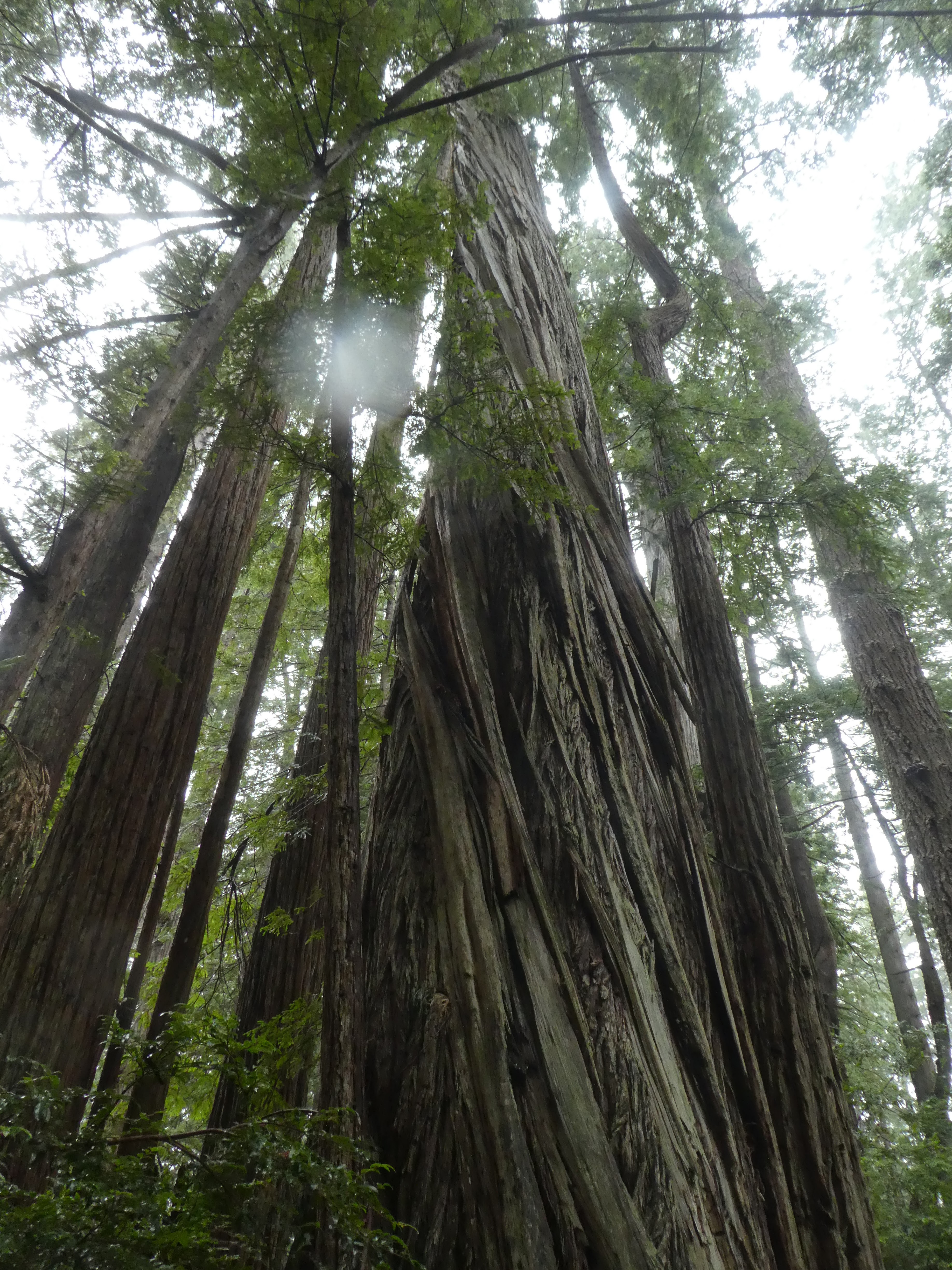
Wow. So. Here we are, safe and sound and dry in our little 13 foot Scamp camper in the middle of the Redwood National (and State) park. We have a quaint little campsite (no utilities) in the rather small Elk Prairie campground. I have never been to the Redwoods in Northern California before and I wasn’t really expecting the grandeur and quantity of magnificent trees that we found here. I have been to other Redwood groves and places around California and the usual thing is that you drive or walk down a given road and you get to the grove where the 40 or 50 trees are growing, along with 10 or so really really big  trees. Here, we look behind our campsite. We take the little trail through the woods beside the main road that goes the quarter mile from our campsite to the Park Information Center. The Trees are everywhere. They are huge, unique, beautiful, and older than western civilization (yes, even older than some buildings in Paris). 

Trees around our campsite


We went to the Information Center the day before our hike to talk to the Ranger about what sort of hikes we should try. We had been given advice from the guy at the Crescent City Information Center to do the Fern Canyon hike from Elk Prairie to the coast. It sounded really great to us but the local guys informed us that it was a 10 mile round trip and there would probably be deep creeks to ford. We decided not to do that hike. They did recommend a 6 mile loop hike that would take us through “Trees bigger than people would see if they stopped at Big Tree”. Big Tree is evidently not a tree but a sort of big rest stop where, historically, people would stop on their way north from San Francisco to Portland or Seattle. We are talking before Interstates. Before the completion of Highway 101. Model T’s. Like that.

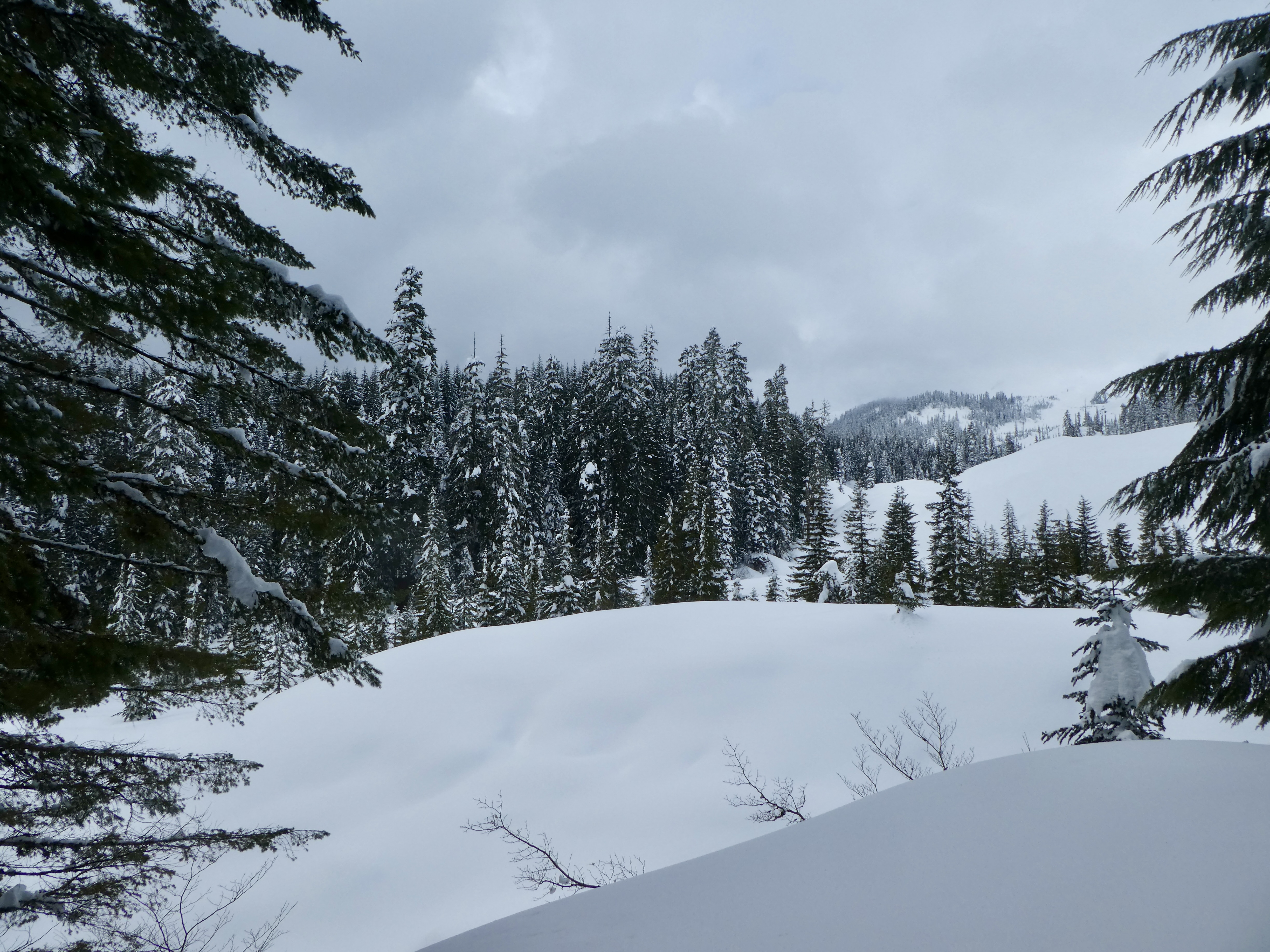
The Redwood State and National parks are a conglomerate of California State and United States Park Service Land, they have individual park names but they all sort of abut each other and many of their facilities are managed jointly. For instance, there is no open camping in any of this park area and to reserve a campsite you need to go through one reservation system. During off season you probably don’t need a reservation as there are often First Come First Serve sites available. Strangely to me (or perhaps to any Oregonian) is that none of the sites have any utilities. No Electric, Water, or Sewer in the individual campsites. There are pretty nice (heated, flushing) bathrooms and showers and freshwater available from public taps. There are also big metal bear boxes in each individual camping site. 

Prairie Creek Right Behind our Campsite


Elk Prairie

It was sort of wet

Our campsite, the second night we were here, was right on the little river that runs through this park and after which the park is named: Prairie Creek. The Prairie in this case is a big open field out by the road (excuse me, the ‘parkway’) where deer and Elk are often seen. 

I must go into this later, but I will say that when one is staying in a RV (in our case a little Scamp trailer) and the weather is cold and wet, one doesn’t really enjoy the splendor of the campsite as much as one might if one were in a tent and so huddled around a fire in the morning. Of course, one might not enjoy the outside at all if one was cold and wet and misserable and having trouble getting the fire lit and the coffee made. Trade-offs.

We had talked to the Ranger yesterday afternoon and asked about what trails from here would be within our capabilities and show us some good trees. Perhaps a trail that went through that Big Tree place. He told us that we would see bigger trees that at Big Tree in just about any trail that we walked around the campground. Big Tree is handy for people passing through because it has a large parking lot and a bathroom. And a big sign that says Big Tree.

He recommended a 6 mile loop (perhaps he listed it as 6.6 mileas) starting at the Information Center and going North first on the West side of the valley defined by Prairie Creek along the ridge and then down zig zagging down to the trail that follows Prairie Creek and then finally to a trail named after an old dead white guy. These trails were named 1) West Ridge 2) Zig Zag 3) Prairie Creek 4) KK (which stands for something that I can’t remember. Perhaps Karl)


It had been raining off and on all night but not so cold out. We chose a time when the rain had stopped and convinced ourselves that it was ‘over’, put on our rain gear, and set off to find West Ridge Trail.  This isn’t too hard. The trails are well marked. The difficulty is in walking at all when your head is crained up to stare at these Giant Fraking Trees. I mean, they are everywhere. You can’t swing a dead cat without hitting a GFT.  They have been out there living for a millennia (I mean, literally 1000 years) (and I mean literally literally) and during that time they have taken their share of random hits. So they have scars. Damage from a fallen brother that struck them and took off a big chunk about the time that Magellan was sailing around the world. The fallen brother is gone to loam, but the injured tree has healed and now has some huge beautiful woody scar that is sitting up 50 feet in the air, growing ferns and moss and looking like some Ent face. 

The natural growth cycle of the Redwoods leads them to spring up around ‘Mom’. So you see many places where there are 5 to 10 giants that are forming so tight an association as to appear at the base to be one tree. Perhaps you can see the remains of old dead Mom still sticking up a eerie skeletal stump from the center of the cluster. 

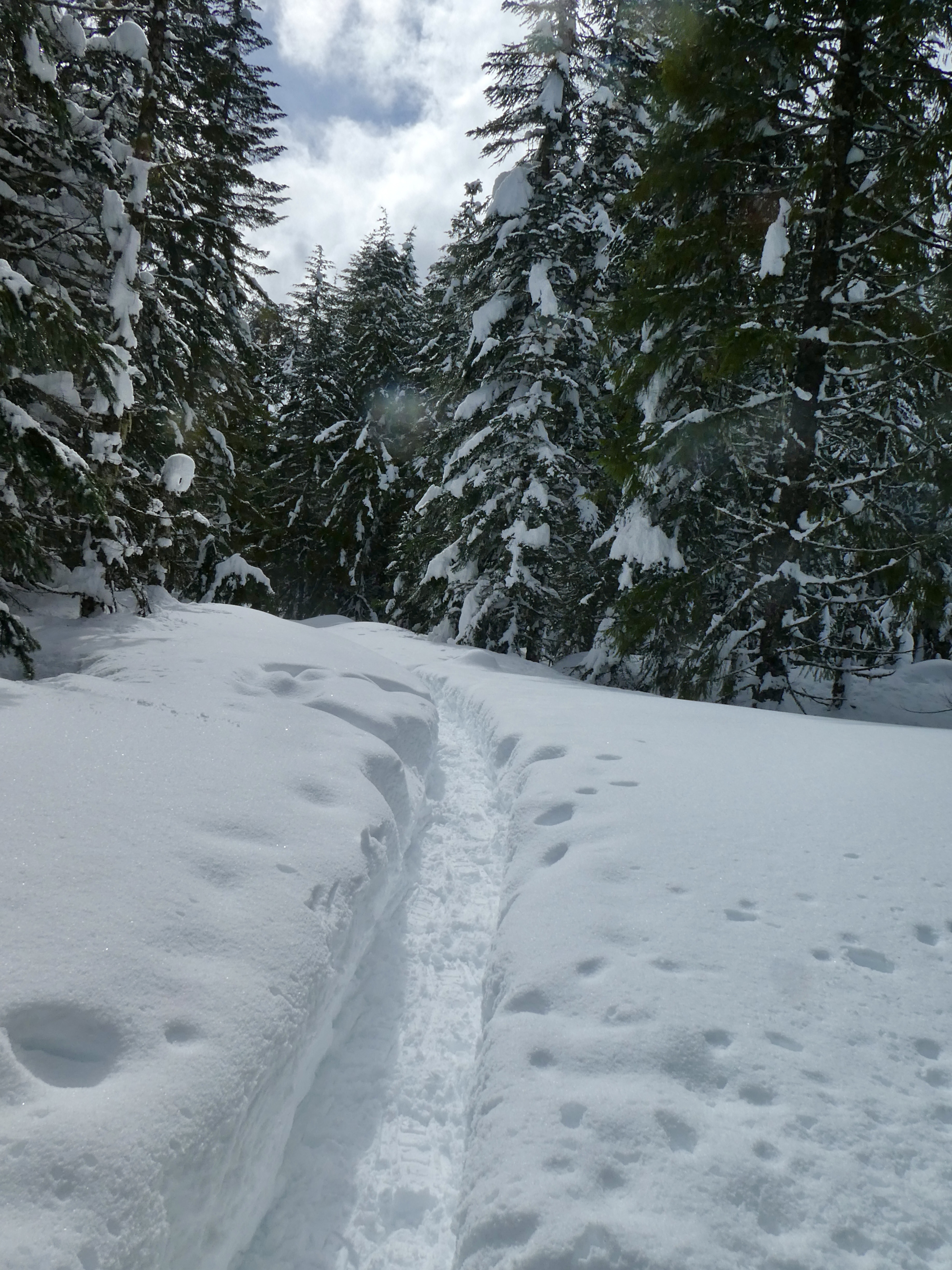
The trail starts out with a nice old bridge over the creek and then winds away for a while with easy walking that wanders through the old trees. Once you hit the West Ridge trail sign and turn north things get a little harder. The trail is on switch backs going up the hill and though the elevation change is not great (perhaps 800 feet) it is constantly up. Also the trail is sort of strange in many places. The Trees have taken over the entire forest, even where they are not standing their roots extend. So the trail is over top of the roots. Many hikers footsteps have polished these roots such that, even though it is not muddy, the trail is a bit slippery in the rain.  The trail is also often canted. I believe this is because workers cannot level the trail without cutting into the root system. So you get some patches of the trail that are canted and rooted and slippery in the rain. Did I mention that it is raining? It started raining on us pretty much as we set foot on the West Ridge Trail and it did not stop. It wasn’t a hard rain, must continuous. And the big trees would catch the little drops and conglomerate them into big drops that would fall down to us. So it wasn’t that we were caught in any downpour but more that we were subjected to death by 1000 drips. We have good rain gear, however, GoreTex jackets and good rain pants. We also put our rain covers on our packs to keep our back-up equipment dry. 

In this rain and cold, we are not seeing any fauna. No birds or mammals crossed our path during this part of the hike. The Flora, on the other hand, if pretty green and happy in this rain. The Big Trees domniate, of course, but there are places where I see a couple of sitka or Douglass Fir. On the ground is lots of plants found in Oregon (which is just north of here, after all) like Sword Fern, Deer Fern, and (a special treat for the first few days of spring) fresh blooming Trillium. Lots of moss. 

Every Quarter mile or so we would run into a Grove of Big Trees. Yes, I did use a lot of capital letters. Those Groves of Trees deserve them. I mean, these are just a few of thousands of groves in this part of the park, but each one is stupendous. Each one makes you set you hat back further on your head so you can look up high enough to see the top of this things, way the hell up there. I feel inadequate to describe these forest leviathan with my words. I had been hoping the pictures I took would capture some of the wonder but I find that they don’t really show the scale very well. But take a gander anyway.

I have found that I am becoming more and more untrusting of Map distance statements. Either that or Fit Bit and Gaia are teaming up. I say this because the Ranger told us we were going on a 6 mile hike and at the Gaia and Fit Bit 4 mile mark we still were not at the halfway turning point yet. I admit we were slowed a little by the gawking at Giants. And the sudden down pour and hail may have distracted us for a bit. And OK, perhaps we are not back into spring fighting shape yet after a long dark wet winter, but Still, Gaia and FitBit said 4 miles. And there was the trail sign for the turn onto the next Trail in the loop. Zig Zag #1.  And down we went.


Nurse Log


Now we come to our first big adventure on this hike. Halfway down the .5 file mile ZigZag (which I swear was at least 2 miles) we come to a tree that has very recently (last 48 hours) fallen across our path. Just think about that, this tree has been waiting for 1000 years just so it could fall at the best time to impeded my journey and give me some added adventure. 


Usually when a tree is in your path it is a tree. Not a Tree. This one may even have been a Doug Fir instead of a redwood, but it was still 5 foot in diameter and completely blocking the path. It didn’t look like we could go around it either uphill or down, the slope was too steep. We couldn’t fit under either. That left either going over or restracing our steps back to camp. Bah.  Over we go. The tree was too big to throw a leg over, so I sort of jumped up and put my stomach over the top and then turned my entire body so as to get my leg over. Now I am lying face down on the very large and wet tree trunk and holding on as I scrunch over and slowly lower my legs down till I touch on the other side. I must say that my new Rain Coat from LL Bean held up rather well. And It did get scratched around on the bark a lot. Better it than me…. My Partner came over next. She is a bit shorter than me but still managed to pull herself up onto the log with the help of some surrounding vegetation. 

OK. Now we  are over it and really wet. 

When we got to the bottom of Zig Zag #1, I thought we would reach a spot where we would have access to the main road (the Parkway). I was wrong. We did hit the Prairie Creek Trail, however, and so we were following that. The sign assured us that we only had 3 miles left to go before getting back to the missinformation Center. As you might imagine, this trail follows the creek which means we are winding around a lot not only with the creek but also in and around other groves of big trees. There are a lot of trees down in the area. Big Trees coming down with big violence. When they hit they tear down other trees, gouge huge holes in the ground and splinter apart explosively. Some fallen trees looked like they had been hit by mortar fire, huge splinters and planks thrown dozen of feet. Later on the hike we saw one that had fallen on the parkway in the last week or two. There was a 16 foot stack of broken up wood that had been shoved aside by some large bulldozer and a 2 foot deep hole in the road where the tree had hit.  Ah, but we haven’t made it to the road yet.


Ent

We crossed one little bridge over Prairie Creek and we were within 30 feet of the road (saw a car go by) but there wasn’t a trail there and the thicket was…. Well, thick. Is that why it is called a thicket? Perhaps it was originally thickette?

Anyway. We are hiking along, making good time now on this flat and realitvely open trail and I look down to the ground from the trees and I see….. a dissembled bridge sitting on the side of the trail. Oh, this cannot be good. I was thinking it was a seasonal bridge over the creek for some side trail. I was half right. Another 50 feet and we came to a side creek. A tributary. But a pretty wide tributary and currently running fast and sort of deep with all of the rain. And no bridge. I mean, you could see where the bridge was supposed to go, but it was in pieces behind us. I believe was I said was, “Well Fuck”.

Hey Mr. Ranger. Do you have any suggestions for a good hike. This 6 mile loop here? Well gee, I can’t expect you to know about every tree that may have come down in the last 24 hours, but I am betting that you would know about and have told me about any seasonal bridges that haven’t been put back into place for the year. Sure you would. Next time I will specifically ask:

1) Do you know of any obstacles that might deter a 66 year old man from going on this trail?

2) Any Trees Down?

3) Any Bridges Out?

4) Any infestations with brain eating Zombies?

5) How dated is your information? When did you last talk to someone that did this hike? Could they have been recently infected?


So…. We stood there and stared at the river for awhile. It wasn’t like it was going to be impossible to get across. Hell, it was going to be easy to get across. We were just going to get our feet wet. And then we would have to hike the remaining 2 miles in wet feet. Plus, we now didn’t know how many other “Seasonal Bridges” were not in place on this trail. I mean, if there was one that wasn’t in, then they were probably all not in. But which bridges were seasonal? The map showed 3 more crossings. Gaia said we had already gone 6 miles and had no comment about the existence of bridges. Now we get down to being prepared. Paige and I both had dry socks in our packs. Sigh. One Pair of dry socks. We don’t know how far back on the trail we have to go to access the road (where we know the bridge is in place because we crossed it yesterday in the car). We decide to ford the Creek and see what happens. As it turned out, her boots are a little higher than mine and she crossed with dry feet. I was swamped and had to get out my dry socks. And then I was only sort of swamped. Soggy.  The trail to the road was just on the other side of the river, so we hiked out to it and followed the road back to the disinformation center, where we had a talk with the guy that recommended the hike. “Oh, of course the bridge wasn’t in place. They are seasonal”. Fuck you.  (OK, most of that conversation was in my head, and the guy was trying to be helpful and friendly. Perhaps one should know that if one hikes in the late winter one will get ones socks wet)

In Truth, though it was a challenging hike, it was a lovely and truly awesome hike. I would do it again anytime. Well, once I have been into town to get all of my socks and gear dried. Did you know it is virtually impossible to get anything dry in a 13 foot trailer during a rain storm? You are lucky if you can keep your bedding dry. Hey, I have decided to start a new blog. It is going to be all about camping in 13 foot trailers. I will leave a link below to the first entry, just because I know you want to read it.


Wednesday, March 8, 2023

June Lake 2023 - Sure is a lot of snow this year


I have been to June Lake, on the South slope of Mt. Saint Helens, several times in the past decade. All of the memories I have of that trail are of difficult passages. Go to the June Lake Trailhead, in the Pinchot National Forest, in the summer (say, June) and will wonder why I might have such a bad time. There is a nice paved parking lot right off the nice road (that also runs by Ape Cave). The trail to the lake is well marked and is an easy 1.5 miles through pine and fur with maybe 500 feet of altitude gain. What is the big deal? I deal is that I have only been to this location in Winter, and so only as a snowshoe. The weather has always been a bit challenging and at least once I went with a large group where there were many people that needed help. 

This is all to say that this year, the snowshoe to the lake was even more of a slog that I remembered. But still and all, it was a great fun adventure and you might as well read along even if the going is difficult.

There has been a lot of snow in the Pacific Northwest in the last month. We have been lucking out in picking a non-snow day about once a week to try and get up to the mountains. This week we had another lucky guess and picked a day that not only didn't have (much) new snow, but even a little sunshine for lunch.  There are 4 of us going today and we are all loaded up in my trusty Subaru Forester with AWD and snow tires. I put the rocket box on the top so people could put their snowshoes up there. This is especially handy after the hike when everything is snow encrusted and frozen; keeps the water out of the car. 

As I mentioned, the road to June lake is the same road that goes to the turn off for Ape Cave. This time of year Ape Cave is "open" but it is not plowed or dug out. So good luck getting in. That is why we are going to June Lake. I was surprised at the cost of a Washington State Snow Park Pass. An Oregon pass is $5 a day. A Washington Pass is $25 a day. Wowsers. I guess we were paying for the guy that was running the snowcat to plow the parking lot. 

The drive was a bit longer than I thought, especially the part after the turn off to Ape Caves. Driving a long. There also wasn't much snow. We had our grown son along on this trip, his first snowshoe, and I was hoping for a lot of snow to show him and get him excited about the sport. But I wasn't seeing much. And then, right in front of us. An Elk. Hell, a herd of Elk (though only one standing in the road in front of us staring us down). That was sort of cool. 10 minutes further down I see a bunch of crows on the ground on the side of the road on some road kill. They all fly up as we go past and 3 of them fly down the road right in front and above the car. I look up at them flying right there 20 feet above the car and I realize that they are immature bald eagles. I flock of Eagles? Paige says that can't be true as Eagles don't do that. We could see a family of 3 however. 

Right about know is when I said, "This is just too far" and checked the map. Turns out we were going in the wrong direction. We should have taken that turn off to Ape Cave 20 minutes ago. Dammit. Of course, then we would have missed the Elk and the Eagles. It also had us drive back past that carcass. Turns out there were 3 Eagles and a Mess of Crows feeding on the thing. 

If you take the correct turn and head up the other road you get 1000 feet higher up the mountain and NOW you have snow. Lots of snow. The roads are not that well plowed and were are driving on a foot or so of compacted snow. There are places where it gets interesting even with the AWD of the Subaru. The Forester is an SUV but it doesn't ride as high as the Ford F150's that everyone else out on this road seems to drive (well, there was that one guy putting chains on his mini-van but we are going to ignore him). 


About 6 miles of snow, takes over half an hour, and we come to the end of the plowed road which is where the Marble Mountain Snow Park resides. During the winter you have to walk the rest of the way (1 mile) to the summer trailhead for the June Lake hike.  Lots of guys with big rigs pulling trailers with Snowmobiles at this Snowpark. This is not a place you bring the kiddies for sledding. The main road from here is closed but groomed and there are lots of snowmobiles driving down it. Snowmobile technology has changed a bit in the past few decades. Seems like they have more vehicles that have smaller louder engines and more narrow front ski's and real traction treads. Sort of more like a converted dirt bike, which may be what they are. 


We put on our snowshoes to walk the groomed road down to the trailhead, but we probably didn't have to. May have sunk a little in our regular shoes but not much. That all changed when we got to the sign that indicates the start of the June Lake Ski Trail. The snow there was deep and virgin. We were the first people that had tried this trail since the last major snowfall. We could see the groove in the snow that people made last week or last month, but nothing recent. We had something like 6 to 12 inches of new snow to tromp through. This gave us a great chance to practice snow breaking procedure. Mainly this means that the person out in front is doing most of the work tramping through the new snow and everyone behind him is doing a little less work until the person that is number 4 actually has a not to hard of a time. I started out in the lead and went perhaps 5 or 10 minutes. Then I stepped to the side and the person behind me (Nick) took the lead. I waited until everyone was past and then got in line at the end. So much easier at the end of the line. If we had 10 or 20 people this would have been cake. As it was, you might end up back at the front of the line before you were ready for it. 

Also I am stretching things a bit here. With 3 people in front of you, even number 4 is doing more work than it would be on a real flat trail. So we were all struggling. We also found that it is much harder to walk on these deep narrow trails if you have a pair of the big tube Snowshoes. They may be better for floating on powder, but it is hard to drive them through a narrow 4 foot deep gulch.  So the 1.5 miles from the road to the lake took us almost 1.5 hours. 1 mile an hour is pretty slow and we were all struggling. Well, all of us except the guy that drives his bike for like 30 miles a day. He was hopping around trying to find things to do whilst he waited for us. Even letting him take the lead for the last half mile didn't slow him down. 

We lost the blazes right around here


Just before we got to the lake, we lost the official trail. We had been following someone else's trail which had been following the blue diamond trail blaze markers but we went around a corner and the blaze's disappeared. The trail we were following went in some wonky directions. Clearly the guys from a couple of weeks ago trying to refind the trail (and failing). But after 100 yards of hard up and down, the trail did find the blazes again, right next to the bridge over the little creek that empties out of June Lake. 

Snow Art


One good thing about the slugging is that it encourages you to take frequent rests and look around at your surrounds. This were really amazing out in the keep snow. All of this unmarked white powder in every direction and large clusters of snow forming strange and wonderful shapes on the tops of trees and stumps. Lots of large spheres or cane heads. Big snow question marks.  Also, whenever you stopped and listened you would hear the  muffled booming of large drifts of snow hitting the ground as they fell from the sun warmed tree tops. Even standing under a big tree for too long seemed to be a bad idea as our proximity seemed to trigger the falls. I don't know if it was just random or if the vibrations from our footprints would jog things loose a bit. We all had big falls hit the trail just a few feet away from us. I don't think these big falls would have hurt us (too much) but you would have gotten 10 or 20 pounds of ice cold snow down your shirt collar.  And it could easily have knocked you down, which would not have been any fun. 

Snow Bridge

Where were we? Oh, yes, across the bridge over the creek. The bridge that has like 6 feet of snow on top of it and that is good as the trail goes over the a cliff of 10 feet of snow above the creek below. Don't slip. One last little push and you come out into a huge clearing area. Many Many Acres. Off to the right is June Lake. I think the lake is formed by a lava flow stopping the little creek and creating the small lake right at the bottom of a cliff face. I say "I think" because I have never seen the ground around here. All I have seen is the snow. I think the open area is a big lava flow. I don't even know if the trail from here is passable when it isn't covered in snow. Some of use agreed to come out this summer and check it out. Perhaps in June. 


We smashed down some snow to rest on and have our lunch. Did you know that it is a bad idea to try and walk backward in snowshoes? What happens is this: the rear of you snowshow folds down and gets embedded a little in the snow. This catches and makes you rock backward a little off balance. If you try and stop yourself, the show slides deeper into the show and grabs your more. Then you go down on your backside. Luckily you go down in the deep snow. Well, that would be luck except that you don't have anything to push on to get yourself back up. My method (yes, this happened) is to lay there absorbing the laughter of your fellows and shrug yourself out of your pack. Now you can roll over and use your pack as a foundation to push yourself back to you feet. Just like you planned the entire enterprise. 

Here are some pictures of the Lake. It is such a beautiful place and hard enough to get to that there is just about always a lot of virgin snow. I like the little waterfall and the fact that there is green moss growing down at one end. Why didn't it freeze over? I guess just because the water is flowing (though you can't see a current in the lake). Could it be heated by the volcano? I don't think so. (But we are on the side of an active volcano, so....).


Going back down to the road was a cakewalk. It was downhill and the snow had been trampled by like 10 pairs of snowshoes this time. 

The tradition of this hike is to stop in the little town of Cougar on the way off of the mountain to have dinner at the Cougar Bar and Grill. We have done that many times in the past and had decent beer and food there. This time we noticed that the big "change the letters" sign out had some new messages. From the North it read "Hot Beer and Bad Service!".  From the other direction it read "FJB Let's Go Brandon".

That may have impacted our decision to not eat there but the closer on the deal was that the place was closed. I don't know if the signage caused them to close or they put up the signs in anger after they went out of business. Sigh. No Cougar Beer for Jon. 


Saturday, March 4, 2023

Trillium Lake - Even More Fresh Snow

The Trillium Lake Trail is wide and accessible and starts from a snow park that is right next to Highway 26 and just down the road from Government Camp. Wide and Accessible? Hell during the summer it is the 2 lane paved road that goes down to the lake and the nice little state campsite there on the East side. This trail is heavily used by everyday outdoor people and by causal adventurers and even tourists. The local Cross Country Ski gang have up signage and do grooming for skiers. For much of the road part of the trail there are (or are supposed to be) 2 trails on the road. The one on the left (going down the hill) is a 2 track trail for cross country skis. The one on the right (going down the trail) is a 2 foot wide and deep track that is for snowshoe trudging. If you are a tourist, you can try in your sneakers, but don't wander out of the tracks or you are going to be up to the butt of your designer jeans in powder.

This is the second time this season that were lucky enough to score a sunny day right after a good snowfall. We got an early enough start that the roads, starting as low as Zig Zag, still had snow and ice on them. Coming up the steep winding road just below government camp there were even a couple of 16 wheelers (with chains on) that had stalled out and were slowly sliding/rolling back down the hill backwards. The traffic was just whizing around them so I guess this happens. The traffic was sort of whizzing past me also, as I am not a 'fast on ice' driver. Paige was assuring me that I was going at a reasonable and safe speed and I was assuring her (and myself) that we have a competent vehicle. We were driving our AWD Subaru Forester with Snow Tires (not studs. I hate studded tires for what they do to roads and the funny sound they make when they drive past my house). I also keep a set of cable chains in the car during the winter. I have never had to use them when I had the snow tires on, but it is one of those simple safety things you can do that could really save your ass if you got caught in an ice storm or something. 

The parking lot at Trillium Lake TH always has a few cars in it. There is a section that allows overnight parking and there were 3 or 4 cars there when we had arrived that had spent at least one night there (they had a foot of snow on top of them).  I find the idea of spending the night out in the snow (in 10 degree weather) to be intriguing and attractive but not so much that I would do so, at least not without some guidance from someone that knew what they were doing. Perhaps Chip will take me...

The first part of the trail is you only steep hill of the day. A good downhill plunge for a quarter of a mile. I have no idea how the X country guys make it back up this hill. Of course, I don't know how they go down it without using their face a lot. We did see some beginners out a couple of weeks ago and they were all laying down in the snow on that hill wondering what they hell they had gotten themselves into. 

Two Tracks

After this most recent snow either the X-country folk had been drifting too far right or the walkers had been drifting too far left because for much of the track there was only the one trail. The Skiers are very protectionist and snobby. They don't like it when "those Snow Shoe People" stomp around on their pretty 2 track trails. They complain. Snow shoers  probably don't know any better but they do know enough to point out that it is a public trail and all they are doing is walking on it. I think the Cross Country Skiers are all in a bad mood because they all know they have to go back up that big fucking hill to get back to their cars. 

The sun came out when were were at around the 1.5 mile mark. This is about halfway to the 'bottom' of the lake (where the little river exits and where there is a great view of Mount Hood).  There are a few turn offs here and there (the road that takes the big loop around the lake. The road that goes into the state campground, the road that goes to the boat launch. etc). The road into the campground had a single set of snow shoes going that way. We decide to follow the main road (and tromped trail) to the lake and then decide where to go from there. 

There are quite a few people out on the trail, but everyone is pretty spread out. It wasn't like we could usually see or hear anyone while we were moving. The new snow is deep and sooo white. Remember always to bring Poloroid Sunglasses with you when you go out to hike through the snow. Once the sun comes out you have no way to protect your eyes from the glare of the sun as it will come from all directions. Paige and I have good pairs of Maui Jims. I have had mine for a decade or more and really like them, though they are pricey. If I am wearing contacts, I just have a cheap pair of sun glasses from Costco. I like them too. The polaroid really cuts down on the reflected glare. Oh, and here is an article on Snow Blindness just for fun. 

Had a great view from the dam down at the bottom of the lake. A number of people down there sitting in the sun and enjoying the view and the lunch. Only one solitary set of tracks going across the lake. The sign near the road warning of thin ice due to warm weather might have had something to do with this. We were down here once with a group of people and had set up a little place to build a small fire and enjoy the evening. It was New Years Eve and we were waiting for the fireworks to go off at Timberline on Mount Hood. One of our party took off his snowshoes and walked a little ways from our trampled down spot and sunk up to his thigh in the snow. When he pulled his foot out, it was wet. Evidently there wasn't any ice down there under the snow, just water. And it was very cold out that night.


There is a trail that goes around the lake. It is marked on our new Gaia maps and someone had skied it recently so we decided to follow it along the lake into the campground and then back out to the main road. We were hopeful that we would find a picnic table along in there someplace in the sun that we could clear off and use for our lunch spot.

It was pretty cool snowshoeing back there in the trees. The snow was deep and the going was a little harder. I kept getting snow on my shirt from overhanging heavily laden branches. I didn't like this much because I was only wearing a light layer at this time and the snow would melt quickly and make we wet and cold. Best to brush it off fast. 


Perhaps this is a good time to talk about the whole 'layering' thing. Out on a strenuous snowshoe on a cold day is a good time to use layers. I usually start off with a good base layer (I am currently in love with this smartwool offering) and a good (perhaps down?) vest. On top of that I have a light fleece jacket that I wear until I warm up a bit. On my hands I usually have fingerless wool gloves and over then, a pair of windproof water resistant shell gloves. On my legs I wear a light under layer (will try the wool next year) and a good pair of tech material trousers. I also like to wear knee high waterproof gaiters. They keep the snow out of my shoes and. help keep my legs warm, and they look so fetching. All of this is fine as long as the wind doesn't blow and it doesn't rain or snow. Well, and the temperature is say... above 20. If it is wet or windy, then I have my rain gear to put on. I have rain pants and a nice goretex jacket from LL Bean. What about my head? I have this wool pendleton cowboy hat I like. But if it gets too windy I can't wear that so I have a watch cap I can put on and then pull up my raincoat hood.  What else? I have a couple of those general purpose Buffs that I can use as a neck gator or pull up over my ears and/or face. 

The important part about layering is to use the layers to moderate your temperature on a constant basis. If you get hot, don't wait until you start to sweat, that will just make you wet on the inside. Stop and take off a layer. I have a good outside stretch pocket on my pack I can stuff my light jacket and vest into as I go. 

Stellar's Jay


Pushing through the trees and the campground was hard work. We never did find a picnic table in the sun though we did see a few snowed in shelters and pit toilets.  We ran into this guy towing a sled carrying a lot of gear (he wasn't wearing a pack). Also on  the sled was his 8 year old son. They were going out to spend the night someplace around the lake. I asked him how it was, he said, "very quiet". Lucky for us, his towing that sled left a good big wide track for us to walk in. 

We ended up stopping out at the road intersection because the run of the main road left a big clear area for the sun to shine through and it was glorious and warm out there. Didn't have the view of the mountain, but we did enjoy that as we went along the lake.  When we eat lunch we stomp down and area in the snow. Just walk around for a few minutes until you have an area that is safe to sit down without sinking. Then I throw out my red tarp and we have a seat. We have these little foam pads to keep our buts warm. You can sure tell when you have slid one cheek off of that pad, let me tell you.  We took off our snowshoes today and sat a while enjoying the sun and watching people ski or shoe past us. A number of skiers out. 

After our lunch and rest we packed up and started back the 2 miles to the car. We immediately came across a young woman that was walking down the path in little white sneakers and talking to someone on her cell phone. She was sinking a bit in the snow but clearly didn't care. She asked Paige which way to go. Paige told her to stick to the main road. She would have gotten mighty wet and cold if she had wandered off the trail. Of course, she was already 2 miles down the road, a long walk for a visitor to the snow but she was probably out hunting that classic Mt. Hood view that comes with any description of Trillium Lake.  And most of the warning signs were covered in snow...