Elk Creek Trail and Elk Mountain Trail Loop
About once a year I loose my sanity for
a few hours, forget my age and that I vowed I would never do this
again, and I hike Elk Mountain This year
was a good year at least in the fact that I am down a few pounds and
must be in better shape. I also decided to fool myself by doing the
loop in the opposite direction from that which I usually use.
This time I went counter clockwise. I
started at Elk Creek Campground and then climbed up Elk Creek Trail.
I ate lunch on the unnamed summit (which I am trying to name by
Google Earth is giving me issues) and then I hooked up with the Elk
Mountain trail and came down the “short” way.
View Elk Creek Trail to Elk Mountain Loop in a larger map
View Elk Creek Trail to Elk Mountain Loop in a larger map
Here is how it goes.
Most of the trails in this area are
either part of old logging trails, or connect old logging trails
together. The Elk Creek Trail is actually listed on Google earth (and
other maps) as Elk Creek Road. It is pretty recognizable as a road at
the parking lot (where you leave your car) as there is still a bridge
in place across Elk Creek. In fact, you drive across this bridge to
park in the lot right there where the road is blocked. Personally, I
think they should move the boulders blocking the road and open up the
Elk Creek Campground for another half mile. Could probably add
another dozen walk in campsites.
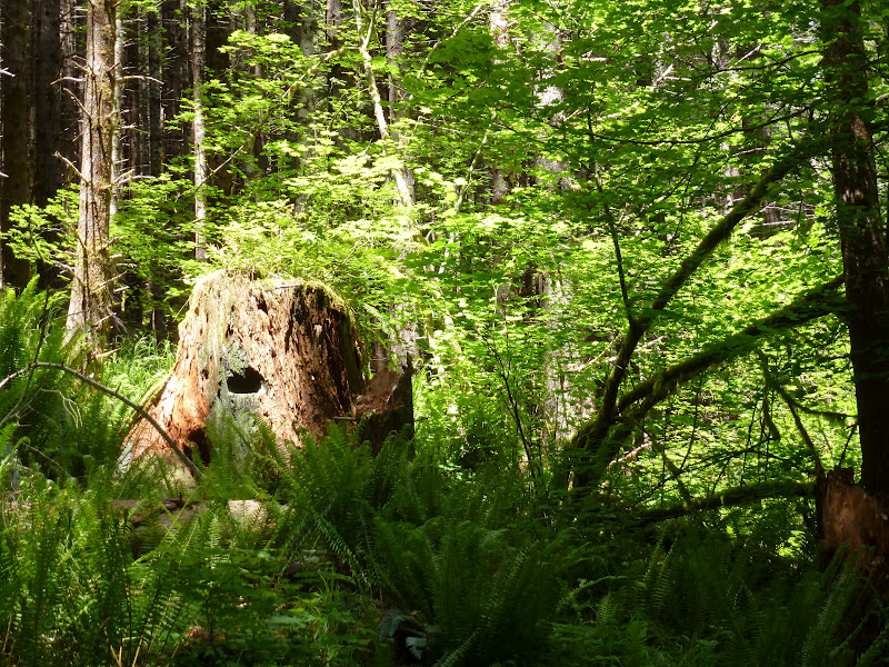
Anyway, you start up the trail. The
first mile or so is down by the river and not very steep. It is very
pretty with lots of Alder. I have seen salmon in the river. Just
before the fork in Elk Creek, there is a new trail head that does a
wet ford of the creek and heads up the East Branch of Elk Creek as
the Idiot Creek Road Loop Trail. Haven't done that one yet. It is a
new trail just opened last year.
Now the trail gets steeper. I think of
this section as the first of the 4 hard parts. This is a little bit
of a joke since there isn't much if any rest between the hard parts.
About 5 years ago we had a bad storm right here in Elk Creek. The
river flooded big time, put the campground under a few feet of water
<find pictures> and must have really been something to see in
the tight river valley. Lots of debris up higher than we are hiking.
Sometimes I wish I could have been here to see it, but surviving may
have been problematic. Because of this, we get a little side jaunt
off of the old (now partially missing) road and into the forest. The trails in
this area are maintained by guys from the local prison. It is a low
security type arrangement and the inmates do trail maintenance and
fire fighting. My understanding from the Rangers is that getting into
this job is very popular with the inmates.
At around 2000 feet, just after the
first set of switch backs, I got quite the surprise. I ran into a
very nice stand of blooming Bear Grass. I usually think of Bear
grass as being around fourth of July (but also higher up). I haven't
seen it down this low on this trail before. Though I have seen it at
around this altitude over on Storey Burn, so there you go.


The other big flower surprise for me
was the Indian Paint Brush. I have done the Elk Creek part of this
hike many times and I have never seen the Paint Brush out like it was
today. You will be seeing lots of pictures of it through this blog.


 |
| columbine |
 |
| Indian Paint Brush |


 |
| Paint Brush and Harebell |
There was No One on the trail today (a
Monday). I thought I heard voices at one time at around 3000 feet,
but no one ever caught up to me. Of course, I was moving really fast.
I guess the hiking I have been doing has gotten me into good shape,
but I also think the 2 weeks I took off (to go to japan, see my other
blog <link to other blog> helped my knee a lot. I was also
traveling really light.
Usually, when I go hiking, I carry a
lot of “emergency” gear. I carry so much that people often ask me
if I am out on a weekend trip. “No, just don't want to die” I
say.
Anyway.
I usually carry:
- a fleece or light jacket.
- Rain coat.
- 6x8 tarp
- sleeping pad (to sit on for lunch)
- Emergency Bivy (really just a space blanket sack)
- First aid kit
- Something to purify water (usually a filter).
- Extra socks.
- Compass and flashlight
- SPOT emergency locator beacon.
- Knife
- and depending on the season: Stove and pot for making soup and tea.
However, since I have been packing up
and planning for my overnight Tillamook Railroad hike, I have had
everything in a different pack and I didn't get it into my day pack
this time. So I was very light.
It was summer so I didn't pack Fleece
and I didn't have the shelter or the sleeping pad. Or extra socks.
And it rained on me and was very cold
and stormy. And I find that your shoes don't fill up with water
because it is raining, they fill up with water because the low level
plants are all wet, which makes your pants legs wet, which soaks into
your socks and that makes your shoes fill up with water.
I also didn't have my gators. Who
knew?
At 4 miles, you get to the end of the
Elk Creek trail. Now there is a little connector trail that takes you
to the intersection of the Elk Mountain Trail and the Kings Mountain
Trail. But before we head out that way, let's take advantage of the
little stream here to re-fill our water bladder. Good thing we
remembered to bring a filter. I am using a little in line filter from
a cut off 1 liter pop bottle that feeds by tubing right into my
platypus 2 liter water bag (in my pack). This creek is going to be
dry in another month. Too bad.
So we head off down the ridge trail
toward Kings Mountain Trail. About 2/3 of the way down this ridge
trail, there is a unmarked but pretty visible branch to the right.
Take this up to the Un-named Ridge. This is a cool place to go. It is
actually higher (according to Google Earth and other geo maps at my
disposal) that either Elk Mountain or Kings Mountain. And it has a
great view. Only not today because it was all rainy and such. There
is a nice flat place up there. Several old fire rings. I want to
spend the night up there one weekend this summer. I will have to do
an ultra-light pack to get up there, which means it should be when it
is warmer. Of course, when it is warmer, there won't be that water at
the end of Elk Creek trail.


 |
| I told you it was raining |
 |
| foggy view from the summit. |
 |
| well, actually, that is the summit up there. |


 |
| That is Kings Mt in the background |
 |
| The fog is cooking up over the ridge. |
But why is it “Un-named Ridge”? I
figure, since it doesn't have a name, I should be able to name it. I
mean, if someone else cared, they would have named it. So, I am
adding trails and such to Google Maps using the new Map Maker
Application, and I try naming the trail “Ridge Trail” , I mean,
it is a 100 yard abandoned logging road that leads to the ridge.
Clearly it is Ridge Trail. But the reviewer says I can't name it that
because the trail doesn't have a name. Duh. If it doesn't have a
name, then I should have the RIGHT to name it.
Perhaps I will try naming the ridge,
“Jon's Ridge”. See if they catch that one.
The little summit you get to at the end
of Ridge Trail (damnit, perhaps it should be “summit trail”) has
lots of flowers for most of the spring and summer. Right now it was
Indian Paint Brush and Harebell. Later it will have mountain (or
perhaps bog) Gentian. I really like the purple of Gentian.
After lunch I headed over to the Elk
Mountain and Kings Mountain trail crossroads. I figured that if I got
there I could convince myself to do the Ridge over to Elk Mountain
and then do the descent. Part of myself wasn't falling for it, so I
distract myself by singing, over and over again, the Monkies hit
song, “Day Dream Believer”.
That worked pretty well.


From the junction it is 2 miles to Elk
Mountain Summit and then another 1.5 miles to the campground where we
started (and our tent is set up. Hey, did you bring the beer?). The
first mile or so of this is deceptively gentle. We are still on old
Lumber road, going through pine forest, with some very nice views of
Kings Mountain and Dog Creek drainage. Would be better if it wasn't
for the clouds.


But we soon hit the end of the road. Now we are REALLY on the ridge. I mean, we are scrambling hands and butts up and down these rocks that are the ridge between Dog Creek Drainaige and Elk Creek Drainiage. There it is, steep to in both directions.


 |
| This is looking North West. |
 |
| Poor lonely Bear Grass against the fog. |
 |
| bunch berry |
But we soon hit the end of the road. Now we are REALLY on the ridge. I mean, we are scrambling hands and butts up and down these rocks that are the ridge between Dog Creek Drainaige and Elk Creek Drainiage. There it is, steep to in both directions.
 |
| That ridge is steep too on both sides |


 |
| Just some Stone Crop. I like Stone Crop. |
This is a very hard little section.
Kept switching between thanking god that I had my trecking poles and
putting the damn things back on my pack so I could use my hands to
climb the wall. This goes on for just long enough for you to thoroughly curse the Monkies and their fraking day dreams. And who wrote those
lyrics, for gosh sakes, “But it rings and I rise, wash the sleep
out from my eye, the shaving razor's cold and it stings”.
But I digress.
As I mentioned eariler, I have never
hiked this section of the hike in the so called “Down Hill”
direction. At this point of the trail, the entire down hill thing is
open for argument. In fact, the last 60 feet to the summit, is very
much a hands and feet rock climb. I am sure my friends children that
do competitive rock climbing would laugh at all of this, but lets see
them try it with a 100lb pack on their back!! (I am, of course,
adding additional pack weight to offset the difference in weight than
me and a 15 year old girl rock climber.)(hmm, perhaps that should be
a 150 pound pack).
Anyway. The summit.


 |
| oh look, Pain Brush !! |
 |
| This looked a lot more straight up when I was climbing it. |


 |
| Bear Grass on the summit. Cool |

now we have 1.5 miles and 2000 feet
(down) to go. All of this is right straight down the ridge line. I
get to put this into Google Maps too. (I hope). This is very slow
work. It took me around 2 hours. People with better knees or less of
an imagination can probably do better.
Lots of cool views of the Wilson River
Highway (and River) way down there. Oh, and more Indian Paint brush.


 |
| looking down on Wilson River Highway (and Wilson River) |


I fell once. I almost fell more than
that. My good knee was stressing out from taking most of the strain
on the down steps. But, all in all, it wasn't as bad a going up.
And when I got back to my car, I was
content to know that I had a tent set up and ready for me in my
campground, so I could go ahead and have a cold beer from my cooler.
(Oh what the hell, 2 cold beers).