Wednesday, January 27, 2021

Deshutes River Trail: Covid Winter Edition


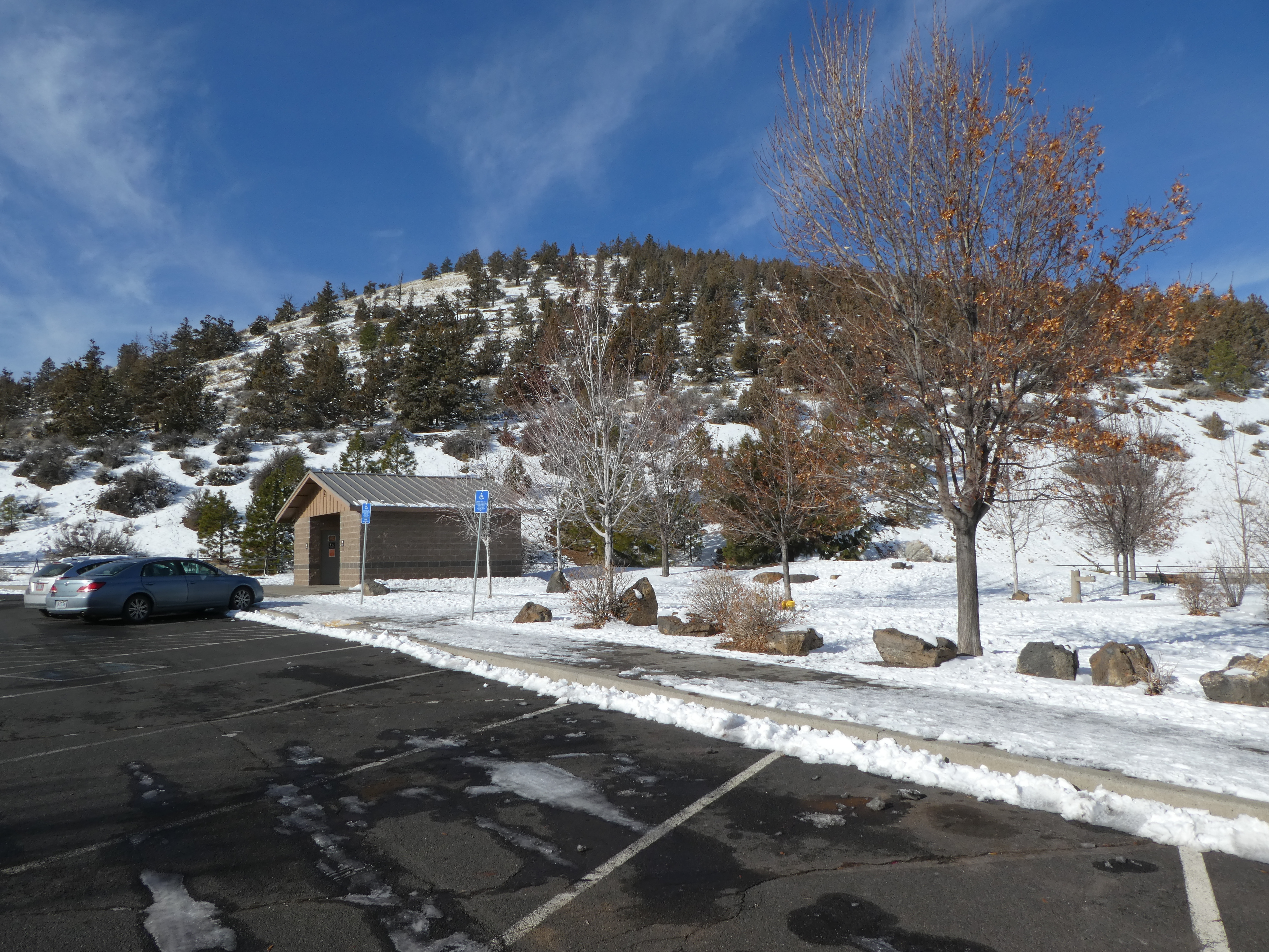
 If you look down the cliff from the resort at which we are staying (Mt. Bachelor Village Resort) you can see the upriver part of the Deshutes River Trail. This is a lovely Urban trail that starts out down in the Old Mill district but then winds its way from the open spaces of Bend up the developing canyon of the river. The canyon part of the trail is a loop from Farewell Bend Park (and bridge) to a little foot bridge about a 1.5 miles up river.  You can access the trail from a couple of location up on the ridge (including a trail from the resort) but my Knee is REALLY bugging me today, so my lovely partner suggested that we drive the 5 minutes down to Farewell Bend park and avoid hiking an steep sections. She is so wonderful.  More about the loop here:  Deschutes River Trail

Bend has a couple of things that make it a rather unique Oregon city. There are the obvious ones, like it isn't on the Willamette river and it is in the high desert instead of the rain swept West side of the Cascades, but one of its more surprising and challenging oddities is the ubiquitous use of Rotaries (or, as Siri would have it, Round-a-bouts). They are friggin everywhere (thus my usage of ubiquitous).  You have to go through 3 of them in that 5 minute drive to the cute little roadside parking area for Farewell Bend park. 

Saw Mill Play Structure. Keep your fingers away from the blade

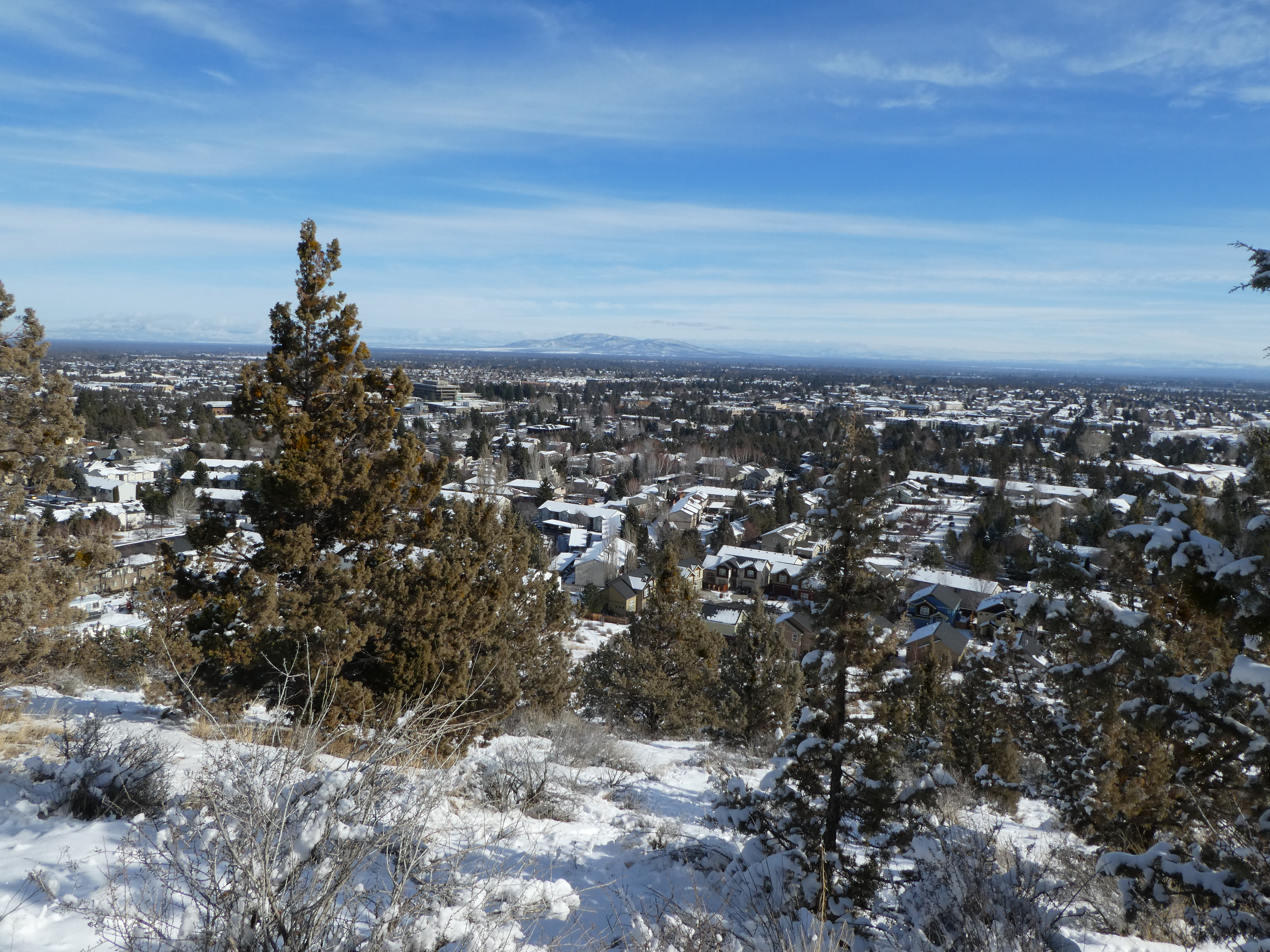
Looking toward downtown Bend.

Business Buildings up on the ridge.


Right before the river narrows and speeds up in the Canyon

Farewell Bend is evidently the longer name for Bend and I am sure has something to do with a Bend someplace in the river, but there are so many of them. This Park is dedicated to everything cutting down tree-ish. There is a lovely Saw Mill themed children's play structure in the middle. I know that as a child I just loved to pretend to be sawing timber into boards. Oh, the smell of saw dust in the morning. It smells like..... Progress.

Today, we are walking a little into the park (away from the canyon trail) to get to the little foot bridge that will lead us to the west side of the river so we can walk South up the west side of the Canyon. In normal times we could have walked up the East Side and around clockwise. But these are not normal times, they are Covid Times and one of the things that has been done to promote safe human interactions is to make the canyon part of the river trail One Way (counter clockwise).  Now, this is all well and good because we wanted to hike the entire loop anyway, but when your knee is killing you it might be nice to be able to re-trace your steps to take the shortest way back to the car. 
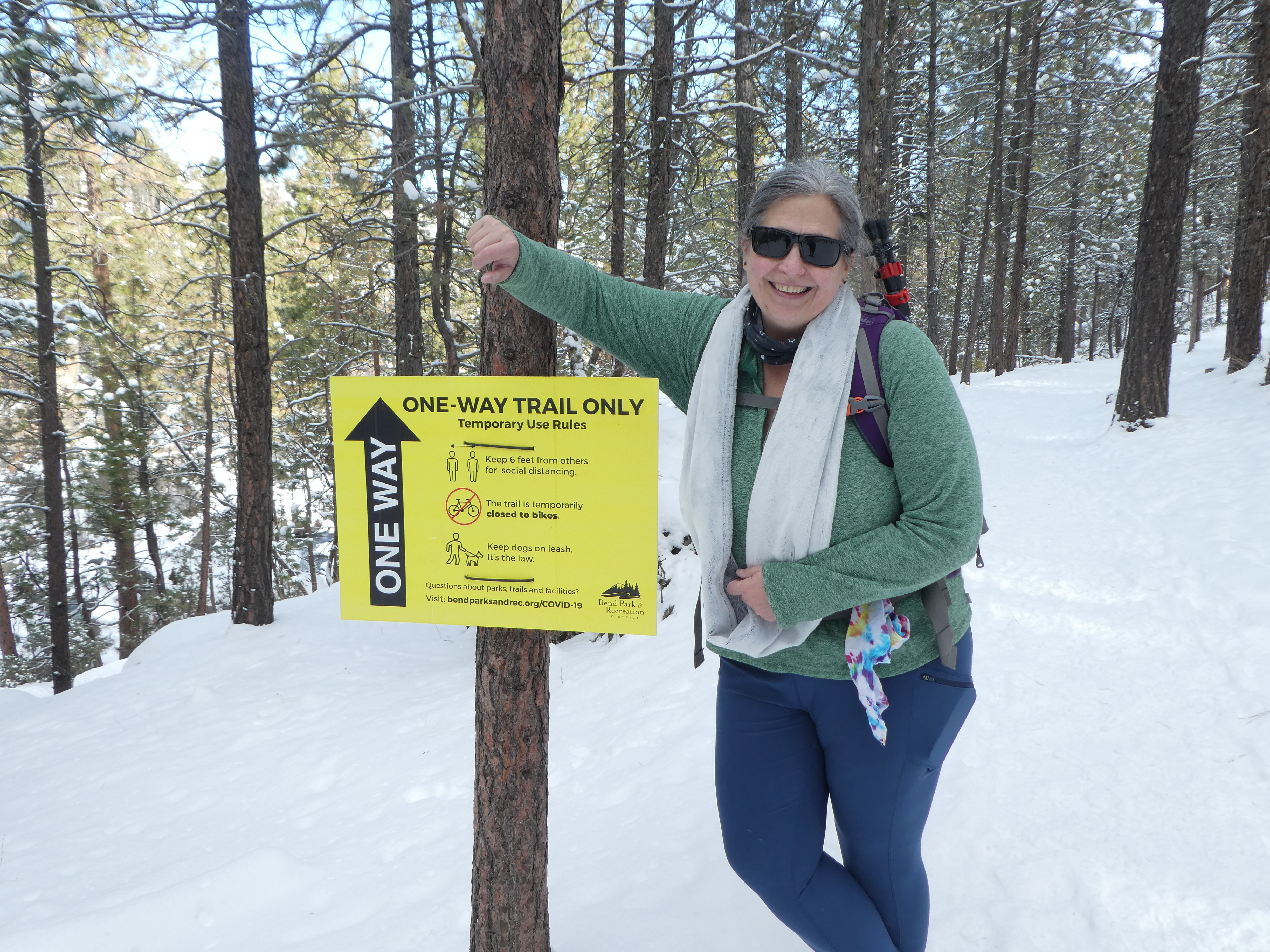
The One Way Sign. 

Actually, I sort of like the idea of a One way trail. If you are a normal person, it means that just about nobody, except perhaps runners, ever passes you. It is like you are walking through a little time island of your own isolation. Of course, if you are an old guy with a bum knee, everybody still passes you, but they do it less often. There sure are a lot of thin, healthy, fast moving people in tights running around Bend, let me tell you. Besides Rotaries, the most ubiquitous thing in Bend is healthy thin good looking people in tights. Well, and Micro Breweries.


Little Critters


One of those is the one we are staying in.


The river is really beautiful in the snow. Everything takes on a sort of Black and White picture feel that is only broken by the dusty orange hew of the Ponderosa Pines and the Green on Gold of Manzanita. This part of the trail is surrounded by high cliffs. Up on top of the cliffs are Condos and Resorts, but they are very nice ones and don't detract too much from the natural beauty of the area. In many places, the river is cutting through big boulders, so the trail climbs up a bit to go around them, but most of the trail is easy and even and wide and simple to manage. 

The little bridge at the halfway point is a great spot to take a few minutes and enjoy the sun sparkling off of the river. 

The View from the Bridge


We didn't have much wild life sighting but we did have a Douglas squirrel, the cute little local PNW squirrel, barking at us from a tree branch for awhile. I love seeing those guys.


And then back down the East Side. In shadow on this side of the canyon, but you get great views of the sunlit west canyon wall. There are also a couple of places where the trail winds up on the boulders and you get a good view of the rapids eating their way through the narrows.


And then you are back to the Reed Market Bridge (with pedestrian underpass) and the wide paved sidewalk of Farewell Bend park. Oh, look, there is the beach where you can put your raft or tube into the river and float down to the takeout at Mirror Pond a hour or so float away. In the summer there is a shuttle that runs to carry you and your float back up river. No shuttle today. Also perhaps a bit to much snow.


Post Script:

On Ubiquituity: We decided to reward ourselves for dinner with Covid takeout from a local Brewery. There were many to choose from but we ended up going with 10Barrel, mainly because they had an easy way to order takeout over the net (and their close by competitor wouldn't even answer the phone). It took them 15 minutes to prepare our burger. It took us 6 minutes to drive to the pub. During those 6 minutes we passed through 5 Rotaries (Round-a-bouts). Editor's note: And the food was delicious! 


Tuesday, January 26, 2021

Pilot Butte


Pilot Butte from the State Park Trailhead


Pilot Butte is a lovely little Oregon State Park right in the middle of suburban Bend. Bend is in the high desert of Oregon and the high desert is basically this huge (and deep) lava bed. Perhaps better described as many different eras of lava beds that have flowed over one another over the years. So, the terrain viewed at a distance is all flat, but viewed up close is all a jumble of broken lava rock. Pilot Butte is one of many cinder cones from where the lava flows bubbled out of the earth back in the most recent flow times. As such, the Butte pops up out of the flat terrain of Bend in this beautiful round symetric cone that can be seen from pretty much anywhere in the city and from which you can (conversely) see the entire city.

My partner and I are in Bend for a week long vacation and were looking for a place to hike where we could get some exercise, get a view (on our one sunny day), and be gentle to my poor Knee, which has been acting up the past month (may be about time for a new one….).

So to Pilot Butte we go.

It isn’t hard to find the place, just drive toward that big thing sticking up over there. The park entrance itself is a bit hidden behind some condos and a nice office park, but there are signs to follow. I bet that on a nice summer day, the little park is swamped, but today, even in the sunshine, the 30 degree temperature is probably limiting the crowds. 


Snow pretty much all the way up


You start getting a view right away.


There is a few inches of snow on the ground in Bend this end of January day, but the sun is out and shiny and the wind isn’t blowing too

badly, and we have plenty of jackets and other gear. We put on our “tire chains”. That is what we call the wire and metal slip guards you can wear on your boots to give you a grip on ice and packed snow. They make a HUGE difference, especially if you are not as young as you used to be and a little concerned about taking a fall.

So, up the hill we went. What a cool hike. There are actually 2 paths that go up the hill. The hiking trail and the “road” (which is shared by Cars, Pedestrians, and bikers). They both wind up counter clockwise and only intersect at the very top. So we hiked up the mile or so long trail and never even saw the road until we crossed it at the very summit.


Looking West to the Cascades


The trail is wide and well maintained. Today it was all covered in snow, which added to the beauty. After just 5 minutes of walking, you are suddenly above the height of the surrounding condos and the scenery opens up immediately. Wow, what a view, the big open plains of the high desert, dotted with occasional butte and cinder cone and then off in the distance, in all directions, various snow topped mountains (or larger buttes).

Powell Butte (no relation)


The rotational period of the trail is pretty much 1/hike. That is, you go around the butte one time on your climb to the top, which is an elevation gain of about 470 feet and a linear distance of about a mile. So you get a nice view of the entire panorama on your way up. The butte itself, by the way, is just a mound of dirt covered with juniper bushes. I think the view of the surrounding high desert is the pull here.

And now for some history:

Depending on who you trust, Pilot Butte was formed during a volcanic eruption about 200,000 to 800,000 years ago. That is pretty old compared to some of the other lava flows in the area. The lava field just South of Bend, for instance, is only around 10,000 years old. It is pretty cool too, you can see on a map how the lava flowed into the Deschutes river and changed the course of the river. (perhaps click here and take a look). After that eruption, the Butte did nothing but erode for a few hundred thousand years until it was donated to the state of Oregon by the Foley family in 1928. It is currently one of only 4 volcanos that are inside of an American City (another one is in Portland).


Peak Finder in the Middle on Top


The Top is a big round flat space. Great View.


Hard to believe that there aren’t more cities that want desperately to have their own Volcano.

Covid Comment:

We did this hike during the Covid Pandemic. Masks are currently required on the trail (and in most state parks). Most people were complying and everyone was thoughtful about personal distancing. The driving road to the summit is currently closed, not sure if that is a covid thing or just a winter a snow thing.

Benham Falls, In Snow


Hundred Year Old Log Jam

 January can be a great time to get away to Central Oregon. So quiet. So uncrowded. Well, perhaps being in the middle of a Covid Pandemic has something to do with it. And when do you know that you are NOT in the middle of the Pandemic? Seems like All of America has been thinking "Well, we must be halfway through this piece of shit" since last May.

But I digress.

We are staying in a cute little condo up on the ridge of the Deschutes River canyon, just south of the Old Mill area. We had a lovely sunrise over the ridge with blue sky and sun glinting off of the snow on the local roofs and landscape. Very cold. sub 10 degrees (F) when we got up and were having our coffee. We almost decided to just stay in and do crafts all day, but that sunshine was pretty inviting.  So we put on our long underwear, jumped into our Subaru Forester and headed south on highway 97 toward Lava Lands, in the Newberry National Volcanic Monument.  

We had hoped to drive up Lava Butte to get a view of the surrounding territory, but the visitor center and road up the butte were closed (for the season). So we just pushed onto our main objective which was to drive down the little road to the river where the hiking trail along the Deschutes River begins. There was about 5 inches of snow on the road and it had not been plowed, so we took it slow and stayed in the ruts in the center of the road. To either side were lodge pines and lava rocks and snow.  


This is a geologically fascinating area. Around 7000 years ago, a rupture of lava (from nearby Newbury Volcano) exploded out of the ground forming Lava Butte. The lava flowed down hill in a tall wall (very visible today) until it interested with and changed the course of the Deschutes river. The river created a number of lakes in the area for a few hundred years and then formed a new course around the lava as what we see today. 


At the Trailhead

We parked at the Benham Falls Trailhead which is right on the river. During non-snow times (like, oh, summer) this is a boat launch and raft/tube take out area. It is a popular thing to launch a float at Sunriver (just upstream) and then float down to this location and take out.  This time of year, you really can't float any further as there is a big manmade (and nature enhanced) log jam a hundred yards downstream. During the summer at high water, you might be able to float over the log jam, but if you do, you will probably die, because just around the corner (the corner cause by the huge Lava Wall) is the start of the rapids that turn into Benham Falls. 


The reason that log jam was created was to protect the little bridge that was across the river. The bridge that was used to bring timber to the lumber mill that was sitting right near where the parking lot is now. As you cross the bridge and hike along the trail beside the river, you initially get a great view of the suspiciously slowly flowing river and the 30 foot high cliffs of lava just on the other side. Note that these lava cliffs were not carved by the river. This is just where the lava decided to stop flowing one day 8,000 years ago.

Note the Lava Flow just behind the trees

Ponderosa Pine
Once a train track?

It was especially stunning views today, with the snow and sunshine. Ice on the river, snow on the lava rocks on the far side. 

The sign at the parking lot says it is a half mile to Benham Falls, but we clocked it as a mile (never argue with fitbit). As you start to get near the falls, you can certainly hear them. I recall seeing signs out on the river something to the effect of "Get Off The River Now. Falls Ahead are not Survivable"


Benham Falls Scenic Overlook and Wedding Chapel


Walking along the trail it is pretty obvious that this was once a Railway. It is flat and wide and built up from the surrounding terrain, probably with stone cut out of the hill from the area ahead near the falls where you suddenly have walls on both sides of you.

Once you get to the falls area you come on another parking lot and trailhead. You come at these roads from the other side of Bend on the road going up to Mount Batchelor. They are not plowed and are not very accessible during the winter. So, no cars there. There is a vault toilet and a signpost map. Follow the signs and the railed trail down to a perfect overlook of Benham Falls. Enjoy they view. My partner and I really like this place, though I admit we have a bit of a selfish reason for the enjoyment. See around seven years ago (during the summer) we got married here. 

I realized this today, many people get married in a church or other building. You back to that site in a couple of thousand years and you probably won't find so much as a familiar window, but my partner and I can go back to this spot and still find the falls falling and the river shining.


I love the red of the Ponderosa against the White of snow

The long straight road