The Head Waters of the Willamette
Every year the Oregon Ocean Paddling Society (OOPS) goes on a big long weekend adventure to Waldo Lake in the Cascades. OOPS is a great organization to go off exploring with because they are so Friendly, Organized, and Safety Conscious. Part of the organized part is that they have a lot of kayak day trips planned for the weekend and the safety conscious part is that they have a knowledgable group leader along on each of the day trips.
On this particular Friday, OOPS had so many trips planned that my partner and I were the only (non-leader) members of the adventure that we had chosen. Our 3 person team was going to be starting at the group campsite at Shadow Bay on the South East side of the lake, crossing over to the West side around Rhododendron Island, and then paddling up the West side to Red Beach and then on to head waters of the Willamette. My partner and I have never been to the head waters and it was one of the main new things we wanted to see on this trip. So we were psyched.
The weatherman was slightly less psyched. He was predicting 15 mph sustained winds from the west with gusts to 30. Not terrible, but something to be aware of and to have safety mitigation plans in place. OOPS is all about safety mitigation plans. This is a good thing for people that like the whole living and breathing thing. Our main mitigation was to stay on the west bank in the wind shadow of the trees if necessary (instead of cutting short cuts across a couple of big bays). Our float plan had us doing around 13 miles of paddling and it would be a few miles longer if we had to hug the shore the entire trip. The other semi-weather related thing going on in this area is forest fire. Oregon (like perhaps the rest of the Northern Hemisphere) is having a very dry and hot summer. We had some thunder storms go through a week or so ago setting off numerous forest fires around the state. The fires are not actually at Waldo, but they are close enough that the west side of the lake is closed to all access. No camping, no hiking, no mountain biking. We hypothesize that this is because there are no roads on that side of the lake and so it would be very hard to find and evacuate people if the fire took a wrong turn and headed this way (like, due to the projected 15 mph sustained winds from the West). And there is fire in the west. Highway 58, which comes from Eugene east to the mountains, was so smoky around the little town of Oakridge that there were road signs instructing cars to slow down and turn on their headlights. There were also dozens of fire, police, and rescue vehicles. We saw a Hot Spot team (4 trucks with “Hot Spot Team” painted on the side. Go figure). A little scary driving through; the sun, deep red, setting through the thick haze and the smell of smoke pervasive and a little choking.
But Friday morning at Waldo Lake dawned bright and clear. Some smoke haze in the distance but no sign of anything untoward around the lake itself. So, we packed our dry suits in our stern compartments in case we wanted them in the afternoon and ventured out onto the lake in our swim suits, sun shirts, and PFD's.
 |
| View from the beach |
 |
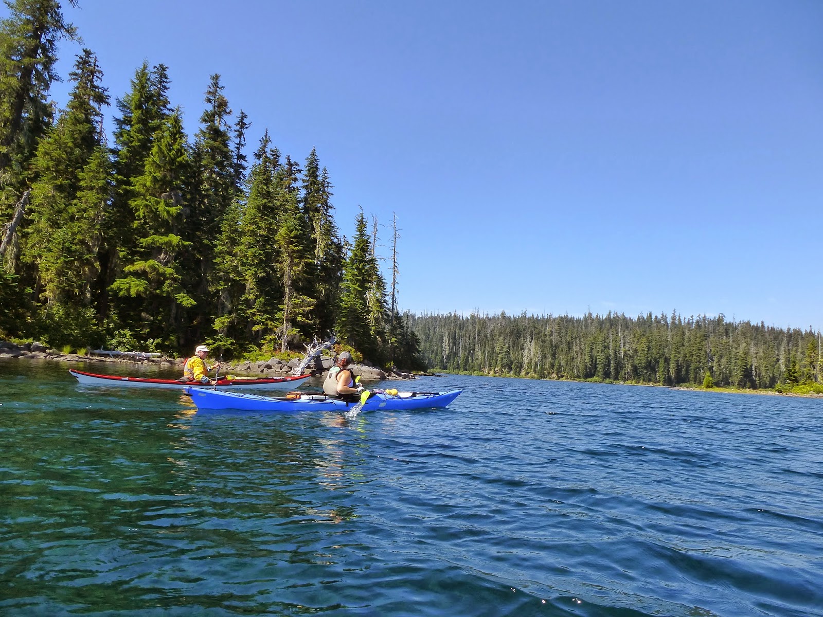
| Our starting point was pretty shallow. These are some guys on a different trip. |
We paddled up the east shore a little to the narrowest part of Waldo and then headed across to Rhododendron Island. On the crossing you get a good view of the surrounding countryside. South and West there are some low hills and a lot of smoke haze. North and East you see a long run of lake and then the old burn site. If you look at Waldo on Google Maps you will see this huge brown area on the North side of the lake. It looks a lot like a lava flow from the overhead and that is what I had originally thought it was. But closer inspection (and like, by walking through it) reveals that it is a huge area of dead (and partially burned) forest that is left from a forest fire some 20 years ago. You think that a burned area would be black with no standing trees, but what must have happened was the fire roared through on the ground and didn't burn the living trees but did kill them. So 20 years later they are still standing, though falling more and more every year as they decay. What they look like to me is a great set of tinder for another burn. They also make me think that we (humans) should have replanted the area. I guess some would argue that we should let nature take it's course. Perhaps.
 |
| The Burn |
 |
| Action Adventure Team Candid Shot (in the middle of the lake) |
Looking ahead of us now, as we paddle across the lake, all is green and beautiful. The other way to look is down. Down down down, into the crystal almost painfully blue depths of the lake. The water is so clear that in the places where the lake is deep (100 feet?) you can see all that way down. Well, if the wind isn't blowing and the water is calm and the sun is shining bright. Even in our slightly blustery conditions, however, we can still occasionally see the bottom because there are many places that the lake shallows. Even out in the middle, at this narrow section, the bottom suddenly rises up to where you could get out and stand if you were so inclined. Not saying you won't get your chest wet, mind you, but you could stand.

We finished the crossing and cut up around the inside of Rhododendron Island and then stopped to look at our map and plan our next segment of the paddle. We decided to head directly for Red Beach. There is (what we thought was) a standing rock there and we headed to that. The rock, by the way, was noticeably red which was different from the color of the other rocks and promontories in the area. Cool, something unusual to steer toward.
 |
| Rhododendron Island |
 |
| Rocks |
And now we get out into this second crossing and we are exposed to the wind from the North West. It is blowing right in our face and pushing up some minor wind waves. Not a huge deal, but you do have to paddle a little harder to make forward progress.
And so we approach Red Beach. As you may have surmised, Red Beach is called such because of it's color. In this one little cove, at this one little point, out of all of the coves and points around the lake, is a place where the predominant rock is a volcanic red. Remember that red rock we were steering for? That turns out to be a bank of red sand. The same stuff that the beach is made from. Lots of red sand and stones and rocks. Very lovely. As we paddled up to the beach we entered into the wind shadow and we glided for a bit and enjoyed the beauty and serenity of the area. Here are some pictures.
We took a 10 minute break on the beach. Ate a Cliff bar. Then headed on. We are going to paddle on North and around the tip of the peninsula. At that point we will have a great view of the burn area and will be exposed to the wind again. If the wind has blown up to velocities that have been predicted, this may be the place that we decide to turn around.
On the way to the point we pass a small and well used camp site. From the water we can see up on the rocks where there is a clear fire ring and even some rough benches made from logs. Our leader comments that you really aren't supposed to camp so close to the lake. There is a lot of effort made to keep the lake clean and prestine. They don't want fires close to the water. Or perhaps they just don't want dirty humans and their crap (literal) so close to the water. On the other hand, what a Great place to camp!!
No one is there today. It seems that no one is out on the lake at all. We have not seen any other people except for a lone sail boat out in the large open part of Waldo. No campers are out because of the burn closure. Makes for sort of nice kayaking.
 |
| Closer to the Burn |
We turn the corner and the wind is, if anything, less than it had been. We are fine. On to the headwaters of the Willamette.
The approach to the headwaters is visibly different from other parts of the lake. There is the expected dip in the surrounding countryside (how else would the water get out?) and then there is some low lying marshy areas. You get to the lake outlet and there isn't too much to see. Just a little flat stream that flows out of the lake. Waldo has no streams flowing in, by the way, the entire lake is fed by underground seepage through the local volcanic rock. This explains why the water is so clear and perfect. We couldn't paddle very far down the river because our way was blocked by a fallen tree. So we beached on the north bank and walked up the trail to see what was going on.
 |
Not sure what this is, But I like it.
|
Now, the Willamette River is one of the big rivers that goes through downtown Portland. We have paddled on it many times (for instance, Ross Island Paddle link, Agate Hunting Link) down where it is huge and slow (and perhaps dirty). Now we are standing at the point were it starts. A little 4 foot wide creek. Of course, this is really just one place that it starts..... but still. As we walked along the trail I realized we were walking along a man made barrier, a dike, perhaps a dam. It extended out into this marshy area and it forced the little proto-river to remain in a narrow channel as it headed downstream. Strange. At the end of the dike was a strange little tower building. No idea what it was for. Perhaps a river flow monitoring station, but the entire setup, dike and tower. I was much too done up to be just a measurement point. Someone, at sometime, had spent an awful lot of money moving all of the chipped up rock that had gone into building the dike. Also, at the end of the dike was a metal structure built at the narrow part of the river. A set of iron grooves and bars where it was clear that the planks of a small dam could be easily put in place to dam the river up for perhaps 2 feet.


A 2 foot high dam. Sure doesn't sound like much. Why would you do that.
My Theory.
Last year when we came to Waldo we visited the dam down on the south end we learned about this project early in the 20
th century to drill a tunnel through the moutains south of Waldo and bring the lake water through that tunnel to generate electricity and provide irrigation.
(see myblog on that topic). Well, if you are going to be letting the water out of one side of the lake, you certainly don't want your water leaking out the other side and flowing down the Willamette. You want to dam up that other outlet. And you are going to have all of these chunks of broken rock from dynamiting out the tunnel. You have to put that stone someplace and you don't want it in your reservoir. You might as well put it on a barge and haul it north and use it to dam up that pesky outflow.
I should mention that right now I am sitting in my campsite around our campfire and trying to decide if I would rather be bothered by campfire smoke or mosquitos. We are like 30 minutes from a town here and so also 30 minutes from a cell tower. So I can't at the moment do any instant internet research to figure out if my theory may be true. I also suspect that I may have to go to a library to get data on something this obscure. Geeze, not sure I have been in a reference library since college. Could be fun. And then once I have written about it, it will be On Line and no one else will have to go the library. Of course, given that, I could just make something up.
Well, days later, the online research turns out to be pretty interesting. I am getting my pictures and quotes from:
He wrote this paper as an argument for making the Tunnel and Headgate a national historic location. He argues that it should be historic not so much for what it did but for what it could have done if the project had been successful. According to this document, the work we see at the Headwaters of the Willamette is actually the first part of a project to turn Waldo into a reservoir to be used for irrigation and power generation for the Willamette Valley. Up there at the north end they originally cut a canal (the Black Cut) to carry more water out, but that was eventually deemed to be too limiting so they came up with the idea of building the tunel through the volcanic rock with the large cement and brass head gate at the Waldo end. (you know, reading this again, I just don't believe it. That broken stone up there had to come from someplace and it just makes sense that it came from digging the 500 foot hole. Or they just dumped the stone into the lake. That would not have been very nice.) From the documentation it is hard to tell if the entire thing was a legitimate “reclamation” project or just some sort on ponsi scam with some construction going on to make it look like things were happening. It does seem certain that the engineer in charge of building the tunnel (Klovdahl) was sincere. He spent a lot of time and effort and personal treasure to build the tunnel and head gate, both of which would have been operational if they had decided to use them. Imagine the effort that went on here. It is 1910, there are no roads or railroad lines that come within 70 miles of the proposed tunnel site. All men and cement and materials have to be brought in by mule train either hauled up hill from OakRidge (which had a mill and so must have had some sort of road or rail) or downhill from the Bend area (where a train line came through). Some materials were brought both ways. To come from Bend they had to improve the existing wagon train roads including building two bridges. The main piece of material that needed to be transported were the 8 huge bronze gates that were made in Eugene and then transported by rail to Bend before being hauled by wagon up to the lake and then barged across. Wow. When completed, the system would have consisted of the tunnel, the black cut at the north, and then a set of gravity fed generator systems and canals. The idea was to generate the electricity and additional irrigation by only using extra water from Waldo. I think this was the important thing because all of the other water that was naturally in the Willamette was already under claim by the Electric company that supplied power to Portland and had their generators at the falls at Oregon City. That was the rub. You couldn't Dam or Divert the water upstream (at least in the dry months) because that water was already owned. But you could divert or dam or whatever you wanted this new found water in Waldo.
 |
| This is from that paper I cited. Note that a Coffer Dam is holding back the water, these guys are below lake level. |
 |
| This is a picture from last year. We must be floating about where the Coffer Dam was. Perhaps they never really removed the Coffer Dam. |
So, what was the problem? Why wasn't the pristine waters of Waldo permanently destroyed by rampant commercialization? Seems like a couple of things stopped it:
Franklin Roosevelt was getting conservation crazy. He had this idea that large use of natural resources could not be left to private enterprise. (“One point must be made clear however, Rosevelt's (sic) federal conservation policy was not against private enterprise per se, only those who would unscrupulously squander and deplete public resources for private gain “) This made for more hoops to jump through in the quest for water rights. The Waldo Lake company had the Oregon rights but not the national rights.
The actual markets for the water and electricity did not show up. The farmers were using well water and electricity demands either weren't as high as expected or were being met by other competitors.
There just wasn't enough water replenishment capability in Waldo. In fact, later studies showed that if they had drained the water to the capability of the tunnel (25 feet) it would have taken 10 years to refill the lake.
Fortunately, drawback 3 was never actually realized as the company that was building the tunnel ran out of money shortly after completion of the headgate. So the lower river power generation projects were never built and the gates were apparently never opened in earnest. So other than some rather substantial leakage, the Klovdahl tunnel was never used. Unclear if the thing is plugged or open on the far end. Sounds like an interesting hiking adventure for the future.
Where was I?
Oh yeah, Lunch at Dam Camp (it is really called that on the map). Just a pleasant little lunch, but we did get a visit by a very interesting little bird. It was about the size and shape of a finch. It had red and black markings and a strange beak with an over and under cross bite The female was there also, a sort of rusty orange. We later had the OOPS bird experts identify it as a
Red Cross Bill.
Our ride back down the lake is a bit faster than our trip out. We have the wind at our backs much of the time and that is pushing us right along. For awhile we are crossing with the wind on our quarter with the occasional wind wave breaking over our bows. Makes me glad that I am wearing a skirt to keep the water out of my cockpit. When you are paddling in high wind, there is this tendancy for the kayak to point up into the wind (to weather cock). I am very used to this phenomena in a sail boat. Our leader gave us a technical explanation for this (which I will have to look up when I have internet again) and said that if you are really have a problem steering away from the wind, the thing to do is to paddle backwards until you have corrected your direction. Now that sounds like a fun experiment to try out.
Rhododendron Island is a very pretty and popular location and this afternoon it turned into the random meeting place of 4 of the little OOPS days excursions that are out. Our trip, the other “end of the lake” trip (who decided to extend and go longer) and the little half day trip to the island all ended up on the beach at the same time.
OOPS has a number of uber kayak enthusiasts. They have the best gear and the best skills and like to get together and practice with both. Today on the beach we had a large set of nice kayaks, one equiped with a new sail. I like to watch these persons in their Tideraces out doing rolls. They can pretty much do a roll nonchalantly. They just seem to lay on their backs and then sit up and there they are paddling again. Very different from my simulated drowning attempts. So it was nice to see everyone before taking our little individual outing back across the lake to the campgrounds.
The predicted wind never showed up. We had a little bit of a tail wind back to the beach but we continued to have bright sunshine and a beautiful day.
But don't get me started on Saturday......