High Water on the Willamette (well, and the Columbia)
 |
| In the Trees at Scappoose |
We sure had a lot of rain and snow last winter. We had 12 inches of snow on my front lawn for a week in January. The two snowplows in Portland were very busy. Whenever we have a winter like this, a bunch of people write the mayor and ask him why he doesn’t have the equipment to move all of that snow and clear the roads. He replies that since this only happens about once a decade, it is cheaper to shut the city down for a few days then to buy, staff, train and maintain all of the plows that would be needed. Take the long weekend off, he says. We had like three weeks of long weekends this winter.
And now? The snow in our mountains is melting and all of that water is coming zooming down the local rivers. The Clackamas is high, the McKenzie is high. All pouring into the Willamette (and eventually the Columbia, but enough about that). My partner and I went out to a few of the local boat ramps on the Willamette up above the falls a couple of weeks ago. The water levels were at like 6 feet above normal. The place we had planned on launching from was underwater. The Ferry wasn’t operating yet for the season. Usually by now everything is more or less back to normal, but man, we still have water.
Here are four examples.
Bachelor Island
Bachelor Island is on the Washington Side of the Columbia, across the river from Sauvie Island. My Partner and I did this paddle on our first date that I was pretty sure was an actual date. We even named the beach we ate lunch on "First Kiss Beach". There is probably a story there.
Today, we launched from the new "Kayak Launch" in Richfield (just a skip away from the main boat launch where they let you park and launch for free as long as you stay out of the real boaters' way). The water was so high that the big five foot bank on the other side of Lake River was just gone. We paddled down river a bit and then turned left into Bachelor Slough. This is usually a nothing little hunk of water. Sometimes it is so shallow that you have to be careful not to run aground. Today the water was high and there was a pretty stiff current coming from the Columbia. In this case, the current was around 1 or 2 knots. Now, that may not sound too fast, but it is about half of your usual boat speed, so it turns a half hour leg into a one hour leg. The slough was also home to a couple of large old abandoned cabin cruisers. You know, old ones like for Giligan's Island. They were floating back there on anchors looking like they should sink. And to top it off, they had Sheriff's office tow notices taped to their windows. I wonder if we can read the notices from the pictures I took.


We usually rest when we get to this nice beach at the end of the slough on the Columbia. Today, most of the beach was underwater, but there was still enough room to pull up and rest. We had some water and a power bar and then set off down the Columbia. I am usually a little trepidatious about this leg down the Big River because there are these man eating Wing Dams out there that stick out in the water. You have to go around them or they'll reach out and kill you. Lots of swirls and such coming out from them and sea monsters like to lurk in their wake, awaiting the unwary.


But today. No Wing Dams. Nothing, Nada. They were all too deep underwater. Perhaps a little swirl here and there. We did run into a couple of little sea monsters (sea lions, actually) but they left us alone. Probably because I look so intimating in my color coordinated paddling outfit.
 |
| Now that is beautiful |
As we were going down the length of Bachelor Island, we were looking for possible camping spots. Even with the river high, there were still some good high sandy places that people could (legally) camp. We were going passed the last one when I pointed out to my Partner that we might want to land and cook our lunch since First Kiss Beach might be underwater. She wanted to risk it though, so we pushed on. The current in the Columbia was going good and we got to the beach quickly. Well, we got to the place where the beach would have been quickly. No Beach. Hell, the beach was deeper underwater than our paddles reached. Ha!
 |
| No First Kiss Beach |
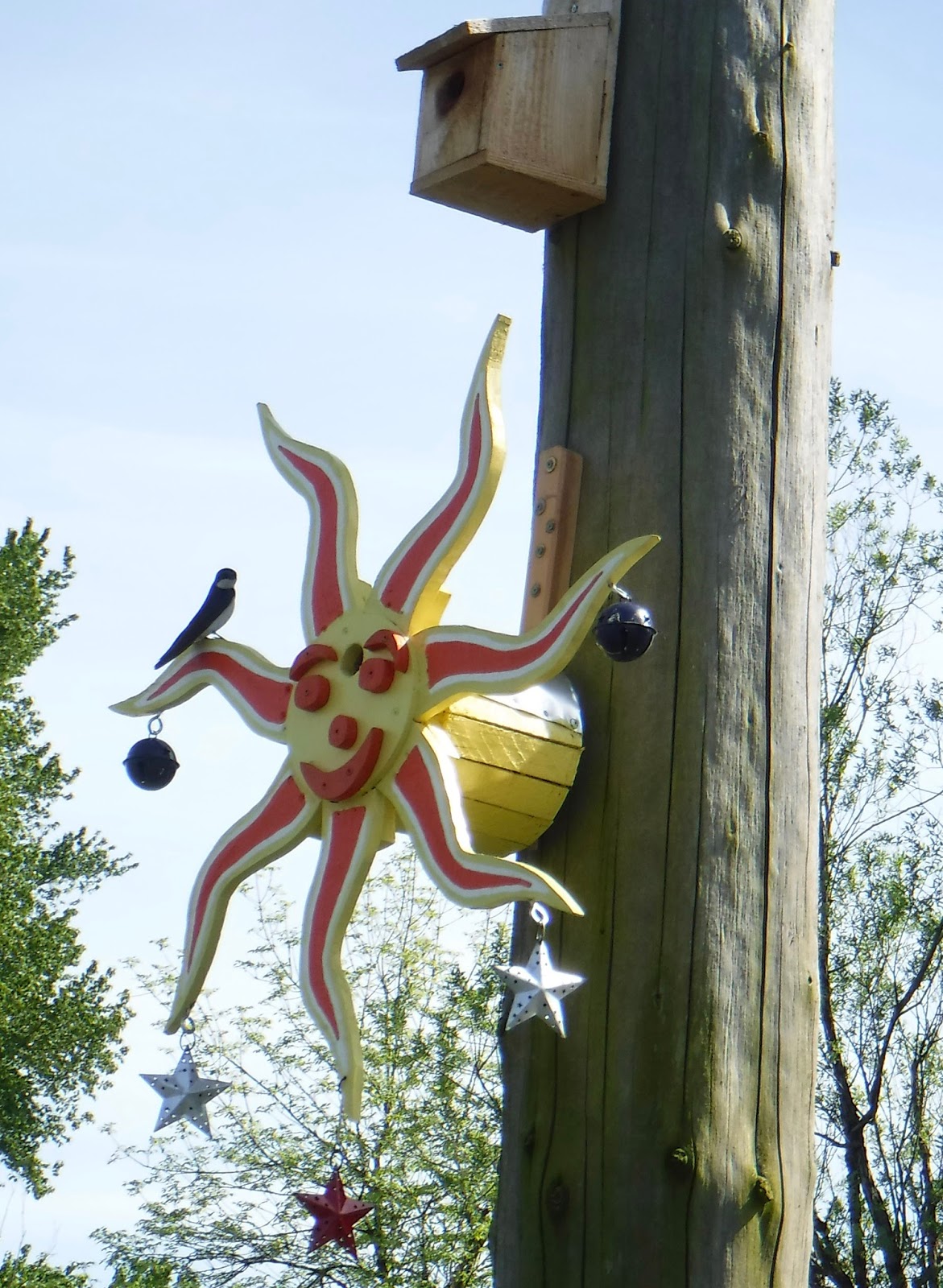
Then another strange thing. I figured the current we had in the Slough would be mirrored in this part of Lake River, since that Slough current dumped into it. But no. Hardly any current in the river as we went back up to the landing. We did run into a community project, however. People had been making and placing bird houses for the local swift population. There were dozens of these beautifully built and decorated houses mounted on old pilings in the river. They were fun to see. And already full of swifts!


Ross Island
We live in the city of Portland. If the weather is nice, we can paddle around Ross Island (a little island in the Willamette River inside the Portland City boundaries) as a quick get-away and exercise workout. It takes about an hour to paddle around the island if you put your mind to it and don’t stop to hunt for Agates. Well, there was no hunting for agates (at least, very little) for the past couple of months because there were no pieces of land showing where you could get out of your boat and search. Toe Island? Completely underwater. I mean, almost unfindable underwater. A good four feet down to the top of the island. Some tops of bushes were showing. A bunch of new logs caught up in the mess. Even down at the north tip of Ross Island, where we often stop to sit on the beach and enjoy a picnic and view of the city. Even there we were paddling through the trees and looking down on our usually resting spot.
 |
| The keep out signs were almost under water |
 |
| Paddling across the North End Beach |

The water isn’t running fast or anything. So it isn’t like some of the scary flood times in the winter. It is just high and slow. How can that happen? Perhaps the Columbia is also high and slow (but enough about her).
The nice row of house boats seem to be OK, however. The rising waters didn’t flood them a bit. Strange. They probably have flooded basements.
There is a path (the River walk) that goes down the west side of the Willamette, past a nice little condo and boat dock area. In a few places the walkway is flooded under four feet of water. You have to go out to the main street to get around it.
 |
| All that is left of Toe Island |
 |
| This goose is nesting on flotsam |
Once again, this sort of thing usually happens in the winter, but not this late in the spring.
Candiana Bar
This rock and sand bar (which also has a good stand of trees on it) is just up river from the San Salvador landing in St. Paul. If we want a short but good rock hunting trip, we will launch from San Salvador and then paddle our way up river to the Bar. This paddle is just about always a challenge. It is very seldom that we can paddle hard enough up current to make any headway unless we hug the sides of the river (where the current is often much less intense). Usually, there is a 4 to 6 foot embankment on both sides of the river (often there is a 40 foot cliff on one side also).
Its hard to tell what the river is doing from a still, So I am trying to embed a video.
Two weeks ago, when we headed up, the embankment on the east side was pretty much GONE. The water was just too deep. The river was running fast and hard, but because of the added depth, there were more places on the side to hug. We could paddle through some grass and such, for instance. So we were able to get most of the way up river until we came to a large tree that had fallen and was sticking 40 feet out in the flow. When we tried to go out and around it, we were caught in the current, which was even more intense shooting around the end of the tree. The water flows and bangs and makes things exciting, but, even when paddling full out, we just couldn’t make any headway beyond the tree. So we did a ferry crossing and headed over to the West bank. You know a ferry crossing? That is when you keep your boat headed around 45 degrees up stream and paddle. You cross slowly, but if you are lucky you don’t loose too much of your headway and get swept back down the river. The way the river runs, if it is too swift on one side, there is usually some slower water or even a eddy on the other side. That is how it was today.

 |
| I guess the water was up here sometime ago... |

I will tell you that the crossing was a bit exciting. In truth, the depth and speed and swirliness of the river had me anxious and concerned. That makes you even more wobbly. I have a bit of a fear of going into the river in the cold water and running into a submerged tree limb and being impaled. My partner is rolling her eyes now.
On the west side we were able to rest a bit. Usually there is a rock bank where we stop to catch our breath, but not this time. It was a foot underwater. So we worked our way up that bank as far as we could and then ferried back across, this time fetching up on the tip of Candiana bar. There was still a good amount of rock bar sticking up out of the water and we had a great time agate hunting. I am still amazed how deserted that island is. It is a pretty nice beach, though I guess it is pretty hard to get to (well, unless you have a power boat). I don’t think I would take anyone with me that I didn’t consider a strong kayaker. If you flip over in the current, it would be hard, cold rescue. (and you would be a mile downstream…). We had a great day of picnicking and Agate Hunting.
On the west side we were able to rest a bit. Usually there is a rock bank where we stop to catch our breath, but not this time. It was a foot underwater. So we worked our way up that bank as far as we could and then ferried back across, this time fetching up on the tip of Candiana bar. There was still a good amount of rock bar sticking up out of the water and we had a great time agate hunting. I am still amazed how deserted that island is. It is a pretty nice beach, though I guess it is pretty hard to get to (well, unless you have a power boat). I don’t think I would take anyone with me that I didn’t consider a strong kayaker. If you flip over in the current, it would be hard, cold rescue. (and you would be a mile downstream…). We had a great day of picnicking and Agate Hunting.
 |
| See the Agate? |

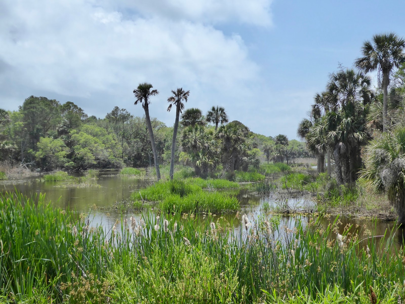
Scappoose Bay
I have been saving the best for last. My oh My, the water is high at Scappoose bay! Now, some pendantic sorts may insist that the Scappoose is off of the Multnomah channel which is a part of the Columbia (though enough about her) but I have looked at the maps and it is pretty clear that the water in the channel is coming from the Willamette. Also the Willamette River Keepers claim the channel and I am with them. So Scappoose.


Across the bay is a low lying island/peninsula. There have been times when you can paddle a little up in the trees and get up the little streams easier than others. But today, they water was WAY over the trees. Like 5 feet over the roots. You could pretty much paddle anywhere you wanted right through the woods. Pick your path and dodge the tree trunks and duck the limbs. And… shit… is that blackberry bramble? OK, you really want to avoid raking the blackberry thorns across your chest as you glide through. That is a bit uncomfortable. Could take your eyes out or something.
 |
| ah ah, the brambles got me ah |
We went there with a big group (30 something) of kayakers from our Meetup, Kayak Portland. It was great fun. Some people played follow the leader and some got tired of being at the end of the line and headed out on their own through the woods. At one time we found ourselves in this big pond that turned out to be the farmers field that we usually see cows grazing in. I had never seen the farmers house before, because we had never been up so high out of the culvert we are usually paddling in when we go that way.
 |
| In the Cow Pasture |

Scappoose Bay, by the way, isn’t really a bay. It is a big pond that is an offshoot from the Multnomah Channel. This part of the Columbia (Willamette) is running North-South (which is hard to remember) so if you get lost in the trees, you want to head West to get back out to the main part of the bay and the highway.
 |
| Mt St Helens from the Bay |
My partner and I split off from the group and paddled through the forest until we came to the main part of the bay, then we turned south and went to the Great Blue Heron Rookery that we often visit. It was the wrong time of day or year or something, however, because there were not many Heron at home.

Summing Up
The water level is coming down, but is still higher than I am used to. I'm not sure when we will see Toe Island again. I will have to keep you informed.