Camping on the Columbia: Part II
Boy, it is early Sunday morning right now and the wind is really howling here. Hope it settles down. Don't really want to be on the river in a big wind. I guess we can always cancel the camping trip if the weather is too strange from the get go. I can remember one of the main things that was important to learn about doing SCUBA trips. No matter where you go or how much effort you spend getting ready for a dive, if the weather looks bad, cancel. Too difficult to recover from dead. And the resultant newspaper articles will make you look like an idiot.
Nothing to do but to hunker down.
At this point I think I should relate to you the plan.
Meet at Scappoose Bay Kayak at 11:00am
Transfer my boat to the alternate Action Adventure Mobile.
Drive to a state park on Sauvie Island
Leave Car, Be packed and on the water at 1:00pm
Paddle downstream to Coon Island. Arrive by 5:00 pm
Camp overnight.
Perhaps drink a beer
Paddle more downstream to Scappoose Bay.
Get car 1
Drive to car 2
Go home.
It would look something like this:
Now let's see what happens when reality meets plan.
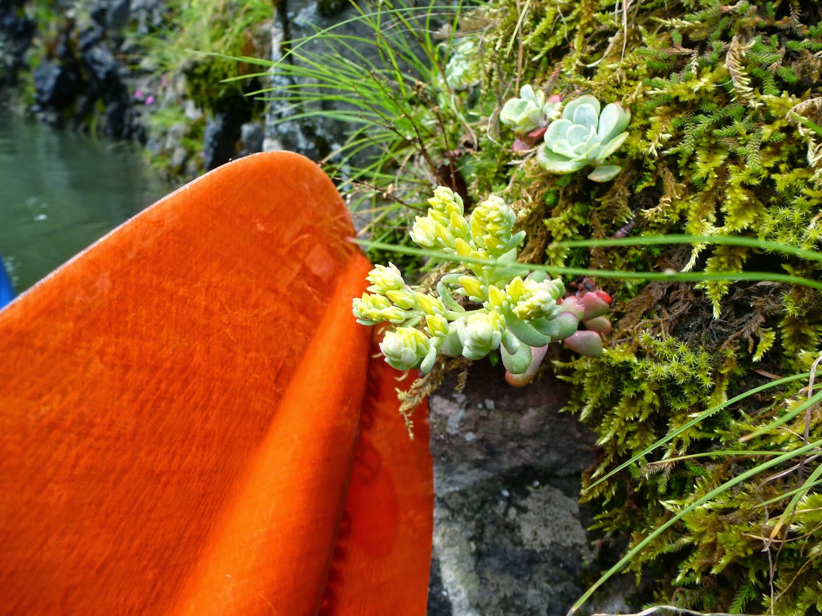
I am so glad I got that new Tempest 170 at the swap meet. It seems like whenever you are packing for a trip there are always a couple more things that you just REALLY NEED to bring. Like another bag of bagels. And the stick stove. And ….... DAMMIT, I forgot my folding saw. The weather did mitigate somewhat. We had some wind on Sunday morning but everything was looking pretty doable as I drove up Highway 30 toward Scappoose Bay. Ran through one pretty intense rain shower, but what the hell, this is Oregon.
I arrived at the Scappoose Bay parking lot a little early so I parked in front of the kayak shop there and went in to look around. They have a Fathom hanging on the wall. Very pretty. But I have my new tempest so I am only slightly tempted. The guys there asked where we were going and I explained about “the plan”. They told me that Coon Island was a great place to camp. Well, except for the mosquitos. I bought some bug repellant. Of course, the mosquitos probably wouldn't be that bad this early in the season when the river is up. During the summer the center of the island is a nice meadow (good thing because that is where we are going to pitch our tents) but this time of year that meadow is a pond. (Ok, not going to pitch our tents). But there are designated campsites all around the edge of the island with benches and fire rings and such. OK, that works. Hopefully we won't need to do the pitch the hammocks in the trees to be dry thing, (Dammit, I forgot my Hammock).
Chip arrived and we loaded up his truck and took off for the put in sight. This is where we started to have some problems.
Sauvie Island is said to be an island in the Columbia river, but when I look at a map it appears to be more proper to term it as a an island between the Columbia and the Willamette rivers. I say this because the Multnomah Channel has all of it's water coming from the Willamette. But even given that, it is the largest island in the Columbia and one of the largest river islands in the entire United States (that is to say, it is bigger than Manhattan). It is a largely agricultural and wildlife preserve type setup with only about 1000 year round residents. Cyclists and kayakers like to go there (presumably for different reasons) and in the fall it is a great place for pick your own corn and pumpkins. Sauvie was first documented in 1792 by a British Lieutenant who named the downriver tip “Warrior Rock” after he was greeted there by a group of armed Multnomah Indians. That rock is still there (mostly) and is still called Warrior. We have kayaked there before. It was from the other end of Sauvie that this same Leautenant got the first white invaders glimpse of Wy'East and promptly named it Mt. Hood, after one of his Admirals (presumably in consideration of advancement). Notice how I haven't named this guy? Hey, he was just the lieutenant, there are lots of crew members I am not naming.
The next contact we have is when Lewis and Clark came rolling through. They named the island Wapato, after a local potato like plant that was a main foodstock of the indigenous population. And while they were there, they evidently gave their most popular and abiding gift to the locals who immediately started dying out from syphilis, measles, and smallpox. So much so that in in 1832 the tribes were so eradicated that the Hudson Bay company removed the survivors and burned the villages to prevent spread of contagion. That contagion is described as “ague” and was presumably some flu.
Then came the Oregon Trail and more settlers and eventually.... pumpkins.
Oh, and Day Use Only parks.
And that was our problem. We found the put in place easy enough, but there wasn't anywhere around it that we could park overnight. Everything had these “day use only” tags on it. We went back to the little grocery store right by the only bridge onto the island and asked the guy there about parking. Interesting that at the only store on a little American island like this you would find a guy who didn't speak english very well. Actually I suspect he spoke just fine and was playing with me on account of the Leautenant and the smallpox, but I could be mistaken. Anyway, he said we could park anyplace we wanted as long as we had a parking pass. OK. So we asked for an overnight parking pass. “Oh.... no. No overnight. Only Day.” Dammit. Evidently you can only park overnight on private property. We would need to have a “friend”.
So we left Sauvie and tried Rocky Point marina. Same deal. No public parking. Need a “Friend”.
Dammit.
We went back to Scappoose. We knew we could park there. The problem was that it is was now 1:00 and it would be 2:00 by the time we got into the water and Coon island is now both Upstream and Upwind.
Dammit.
Well, let's get going. I have never packed a kayak for camping before. There was a class in how to do it last week at the swap meet but I only heard that part that said “Any Questions?”.
I looked it up on the internet but that was full of useful advice like “Pack Carefully”.
The rules as far as I can discern them are:
Assume everything will get wet that isn't in a good dry bag.
Put heavy stuff in the center of the boat.
This essentially means to put water right behind your seat.
Perhaps your stove and pots and pans go in the rear compartment as close to you as possible.
Stuff light stuff (clothes, sleeping bag, tent) up into the narrow tips of the bow and stern.
This turns out to be easy to do but hard to undo. You can stuff things up there by pushing on them with the next dry bag in line. But how to you get them out? Hell, you can't even see up there to tell if there is anything there unless you take a picture with your camera.
This is where the advice to “attach a string with a whiffle ball at one end to your bags” must come in handy.
A LOT of stuff can go in at this point.
You will always forget to put something in and have to start over.
The Day Hatch on the Tempest came in really handy here. It is right behind you on the right and is meant to be a waterproof chamber that you can access without getting out of your boat. So you put things like a first-aid kit, binnoculars, rain jacket, snack. Things like that. It is a pretty big chamber though. This is because, even though short, it is a cross section of the largest part of the boat. So I put all of the heavy personal stuff there. Repair Kit. Stove. All of my little bags of personal items. (lead handle tooth brush). I like the Day Hatch. But I have not yet been able to access it whilst boating without the fear of flipping my ass over. Perhaps with practice.
We finally climbed into our laden boats and headed out on the water. Here was my first test of driving one of these things whilst full of gear. (Hey..... 2 uses of whilst in the same blog !! (3!!)). Not sure what I was expecting. Perhaps a bit more tippy. But stability wasn't an issue. Definitely felt harder to push through the water, but the Tempest feels harder to push than Journey anyway. So it wasn't that big a deal. I guess this is why people like kayak camping. So much easier to move stuff around once you get going. Of course, it is a bitch to get it on and off the water.

We got out to the mouth of the bay and now had to decide where we were going. Do we paddle our (newly revised) plan and head up-current and up (growing) wind and up (it turns out) tide toward Coon Island? Or do we change directions and head out on the Columbia to Sand Island over by the little town of St. Helens?
If they are equidistant, we are doing Coon. But I pulled out my iphone and had a look and Coon was like 3X further. And it was already 3:00 and we were already hungry. We ate our Subway sandwiches and headed toward Sand. On the way the clouds darkened up and Chip finally put on his full emersion gear. Just in time too, cause as we crossed the confluence of the Multnomah and Columbia to Sand Island, the skies opened up and it just poured on us.
 |
| Had us Some Rain |
 |
| And then Sun |
Getting rained on when you are in full emersion gear isn't any big deal. Your hair might get wet but everything else is going to stay dry. And really hard rain flattens the waves and makes really neat little explosions of water drops across the river. I pulled out my waterproof and tried for some pictures. They can't show the glorious impact of if though. So, not adding up to 1000 words.
Chip has camped on Sand Island before a few months ago and he pointed out the tree he slept under. He said that was an OK spot, but it didn't have a fire ring or a table. He wanted to check out the main part of the island. So we slotted into the current and headed up the South side of the island. This is when I realized the current was Really chugging along. I mean, a few knots. Not faster than you can kayak, but definitely faster than I have seen the Columbia move. And we were headed for the large (and empty) docks on the island. Just before we got to the docks I realized that there was a set of floating log barriers. Big Log Barriers. Now that I think about it, these barriers are at all places in the river where there are floating docks or neighborhoods. It is clear that their job is to stop oncoming debris (like Trees) from coming in and taking out the expensive part of the structure. But they also look like they could do a pretty good job on an unwary kayaker. I mean, here you are, floating toward a 3 foot diameter string of logs that the current has jammed up tight against a set of upright pilings. The river is piling up against the logs before forcing its way under them. You realize that if you are swept into the barrier you will be pushed broadside and then have 1 of a few things happen:
You will sit there is a silly fashion until you can work your way around the barrier.
You will be flipped over and drug from your boat and pulled under and pop up on the other side.
You will be caught in a circular eddy that will flip you round and round and round until you have the wherewithal to extricate yourself from the boat, at which time you can use the boat to force yourself up and onto the floating log. Here you will find the slippery round purchase of the log untenable and after a few moments of scrambling your legs will be forced downstream under the logs and you will be once again spin around until you are carried below the logs and into a morass of old trees and debris where you will be trapped until Search and Rescue finds you when the river level goes down in the summer.
I preferred to use the “paddle like hell to get around the death trap” method. Chip followed me though with a laughing attitude that implied he had not read possibility (3) above. Funny, I have no pictures of that.
 |
| Tempest on the beach. |
We beached in some muddy sand (perhaps it was sandy mud) and walked up onto the island. Sand Island is part city park (for St. Helens) and part State park (via the Oregon Maritime Association). It has an interesting mix of hopes, dreams, and reality mixing together. The hopes and dreams are realized by the extrememely nice and expensive set of docks on the Oregon facing side. Room for hundreds of small craft. I understand that during the summer the town of St. Helens operates a little ferry so that anyone can go over to the park and laze in the sun and swim or have a picnic. There is also a picnic shelter, a bunch of randomly placed benches and picnic tables and fire pits, and 3 high tech advanced solar powered composting toilets. Well, I am sure they were high tech advanced solar power composting toilets when they were built, 10 years ago. Unfortunately, they built them out of wood, which doesn't do so well on a flooding island in a rain forest. Now they are mainly composting themselves. Still usable, but under hearty disrepair. And thus we find the reality part of the mix. Decomposing toilets, invasion of the island by blackberry and some kind of bamboo, and a lot of Budweiser cans curtesy of the local highschool seniors with small boats escaping to the island for a night of beer with their football buddies because all of the senior girls are dating lumberjacks and U of O seniors. Damn Them.
After some inspection of the island, we decided to paddle around to the Columbia side and beach and camp there. Now, that side has a steep bank of 7-10 feet, so this involved pulling up on the rapidly shrinking beach (it turns out the tide is coming IN), pulling out our gear and tossing it one bag at a time to the top of the embankment, I person climbing up the sand and then working together to push, pull the kayaks up on the top.
 |
| Climb up That, it is always harder than the pictures make it look |
 |
| Camp Here |
But once up there we had a nice flat sandy (good drainage cause it is gonna rain soon) camping area AND a picnic table. Unclear if the picnic table was worth pushing those damn kayaks up that fraking embankment. Actually, the worst thing about the embankment was that the river was only 20 feet away, but we couldn't get to it to wash our hands or such unless we walk several hundred yards down the beach. This was because scrambling back up the cliff would certainly involve getting your hands (and such) dirty and sandy again.
First thing is first. Set up tents.
Chip and I had a collision of one man tent technologies.
First up: (The Chip Tent)
This thing is really a bivvy sack with an inflatable collar that holds up the “crawl in” end. It does boast strongly for the lightest and smallest tent available (there is a picture of it jammed into a liter water bottle) and it does set up pretty quickly. It also looks hilarious when the owner is down on his hands and knees blowing the sucker up. It is sort of breath assist. You blow into a tube that inflates a small bladder with a one-way valve, and then you hand squeeze the bladder to blow the higher pressure air into the bicycle tube like semi-circular tent pole. I am pretty sure a video would not be allowed on you-tube.
The unknowing review that Chip gave during the evening was. “Damn, how do you? Where do your? I can't get into this... ouch. Damn. Oh. OK, I got it. Well. “
And then in the morning, “Hey, where did all of this condensation come from?”
Second up: (The Jon Tent)
Six Moon Designs turns out to be a local shop (Beverton OR) so I am consuming locally. One of the things that attracted me to this nifty little one man tent was that it is designed to use your trecking poles as the main support structure. You peg out the 2 bottom corners and the top one corner and then crawl inside and extend your poles into the roof. Comes with a little cross piece that goes in the central roof beam that has safety slots where the pointy ends of the trekking poles go. You then guy out a few other places to set up your entrance and there you go. Enough room in the center to sit up and room in the alcove where you could run a little propane boiler if you had to. There is also quite a bit of room on the floor above your head to put your gear and such. The design also has an integrated net design that allows you to roll up the sidewalls and provides good ventilation at all times to minimize condensation.
This tent is heavier and larger than the Elite but it does come in (more expensive) lighter materials that make it competitive in the weight category as well. The Scout version (that I have) is made of common inexpensive (though still rugged) materials and is cheap enough for boy scouts to own it (thus the name).
My unknowing review (according to Chip) was very loud snoring.
I recommend you get at least one of each and try them out for yourself. Though I can't use the Elite because I am betting I couldn't get into it without sitting in the mud and extending my legs.
Once the tents were set up I pulled out my large sil tarp and we used our paddles and good boy scout knots to set up a fly over the picnic table. Cause it is GONNA RAIN. The sand was just too... well.... sandy, to get the tent pins I had to stay in. Chip showed me this trick that you use when you are setting up a tent or shelter in snow called “Dead Manning”. You dig a narrow (3 inches) long and deep (12 inches) hole that looks sort of like a grave and you bury a stick just like a body but you put your tent rope around it first. Pack the sand down tight and exert the pressure from the side and now you have a good secure position for you nice tight shelter. I also used the kayaks to hold down two of the corners just cause they were there and I thought it would make for good photography (oh, and I hadn't learned about the dead man yet).
 |
| That is a might fine shelter |
Dinner Time.
For dinner I had planned that we would do some aluminum foil cooking. This is another classic boy scout trick. You take a big sheet of aluminum foil, cut up some potato slices and carrot slices. Perhaps an onion. Add a hamburger patty. Wrap the whole thing up and bury it in the coals of your fire for an hour. Of course, for this to work, you need a fire. With Coals. For that, we were going to need some fire wood.
 |
| Guess the Joke I just told |
There really wasn't much fire wood to be seen in the area. In the little forest on the island everything was very wet and rotten. Not much good for burning. What I had been counting on was some good drift wood on the bank of the river. When we stopped out near Ridgefield the other day the beach was just covered with good firewood. But I think that the wood condition is very much dependent on the river topology in that area. Over by Ridgefield the currents were making the wood collect. Here on the embankment, all of the drift had been swept away. So. We took my little backpack and we walked down the beach gathering all of the twigs and sticks we could find. There was one place closer to the South end of the island (I think this thing runs North-South) where there was a least a slight larger collection. And then we found some pretty good long pieces and DAMMIT, I still forgot my collapsable saw. If we had brought that saw we would have had more firewood than we would have know what to do with. As it was, we had a pack full. I got the fire lit, prepared the hobo dinners, knocked down the coals and threw in the packages. Then I walked down the beach and called my Partner on the cell phone.
I admit to being a little concerned about dinner. I had put the little bit of remaining firewood on top of the foil packs, but there really wasn't the size of fire I would have liked. I ended up taking a long walk down the beach and when I got back the fire was pretty much burned out. I fished out the foil packs and let them cool in the sand. I wondered if we were going to be able to eat them. They felt very.... light. Perhaps I had completely desiccated them. But no, they were fine. We opened them up and hand a grand old dinner. Chip even made CoosCoos.
 |
| AH, dinner fit for kings !!! Kings I tell you !! |
After dinner I got out my
Solo stick stove. You ever use one of these things? I think I have blogged about them a couple of times. In their pure essense, they are a couple of small paint cans stuck together, but I bought mine from Amazon. You need a few handfuls of finger sized sticks and you can make a little fire that burns hot and you can boil water in 10 minutes or so. The only problem is that the sticks burn pretty fast and you have to keep stuffing them into the little opening on the side. I have seen some other stick stoves on the market that seem to be lighter and cheaper and fold flat. Hmmm. May have to try one of those guys out. But tonight, we had tea. We had hot tea and sat in little fold up chairs in the sand and watched the last of our wood burn down.
Then we climbed into our respective one man tents and listened to the cargo carriers going by on the mighty Columbia.
During the night I was awakened twice. The first time was by a container ship lit up so bright that it lit the beach as bright as dusk. Wow. What was up with that? We saw other ships going by without anything more than running lights and wondered how they navigated. This one was a blazing torch on the ocean. The other time I was awakened by a loud crashing as something that had snuck by in the dark cast a huge wake wave onto the sand embankment. Wooooosh – Crash – Booom in the night. What kind of ship makes that kind of wave? Perhaps a dinosaur.


So you ever wonder what kind of traffic is using the Columbia? From where most people live in Portland, the Columbia and it's large river traffic is not visible. So I bet there is a bunch of stuff of which most are unaware. We saw some barges going up river (and then, later, back down). That is the common traffic that people see because that is the shallow water traffic that goes all of the way up to the Bonneville Dam and through the locks and up to the inland parts of Oregon and Washington. They are usually carrying grain, wood pulp, and wheat. Where do they ship out of? Much of the traffic is going from the Port of Portland to upland destinations like Pasco and Lewiston (Idaho). But what is being shipped on this stretch of river, the 100 miles from the ocean to Portland?
I did some research. Seems there are a lot of barges that just go back and forth between Portland and Longview. Some ships loading and unloading in Longview. Want to see what ships are out there right now? Take a look here:
See where they are.
The biggest news I saw was the story about trying to ship coal out of St. Helens. That is the little town right across the water from where we were camping. A company wants to ship 2500 coal barges a year into St. Helens and then load the coal onto big ships and so to
China.
So. Boats going by.
And then it rained. It rained pretty hard a couple of times, but I was warm and dry in my little tent. Presumably Chip also survived.
The next morning we rolled out of bed to a partially sunny sky. Some nice clouds. And we still had a high tide.


For Breakfast, Chip made his specialty, Hard Boiled Eggs. Don't laugh. Chip has one of those miracle instant boil hiking cooking devices
(jet boil). He can boil water 100 times faster than I can using my stick stove. It also comes with a frying pan attachment, but when you are in a hurry and don't really want to do an extended morning KP, then being able to Jet Boil some eggs is pretty nice. I believe that he puts the 6 eggs into the boiler, fills with water, Bring the things to a boil in like 60 seconds and then just let it sit for 10 minutes. Serve up some bagels and have a breakfast fit for kings.
A noise on the river. A very loud boat throwing up a HUGE rooster tail behind it. This boat was very strange looking. It reminded me of the Japanese Whale "Scientific" boats. The black sleek ones that are the deadly hunter killers that go along with the whale gathering mother boats and slaughter whales for scientific purposes. (oh, I almost said Scientific Porpoises. I am such a card)
 |
| What is this thing? |
 |
| This threw a bigger wake, with bigger waves on shore, than the barges |
So we packed up our gear and did a short portage over to the docks (thank God Chip had his kayak wheels). It only took a couple of trips. The Tempest 170's that we are using are only like 10 or 20 pounds heavier than my Journey, but you can really feel that difference when you are slugging overland with a load of gear.
On the Dock side (the south?) of the island we decided that it would be easier to load the boats and launch from the bank, so we did that. This was mainly because the current was still zooming by out there in the river.
 |
| Kayakman |
I mean, the current was really strong at the crossing from the island to the Oregon mainland. We had a pretty hard first hour until we got back into the Multnomah Channel again. We did have a healthy hard paddle along the pleasure boating docks of St. Helens. A few people stopped to watch us paddle like hell and hardly move and comment on how pretty our boats were.
This is Osprey season. Lots of pairs of the birds raising babies and yelling at hapless kayakers that happen to be wandering by. Where did Osprey build their nets before people started placing pilings for them? You never see Osprey nests in a tree or a cliff or whatever.
And so we quickly wound our way back to the docks at Scappoose, where our cars were waiting. What fun. I do have to evaluate this entire idea of taking wheels with you when you go kayak camping. It seems like such a strange thing to do..... and yet........
 |
| No Fish Glory |
So, dear reader. Yes, I am talking to you.
This was a long post. More of a story. More research. Took me a couple of weeks of free time to write. Which is better? Long posts like this, or short, to the point things. What are you looking for? Make your voice heard, leave a comment.
Cheers,
jon