Tuesday, December 18, 2012

Lake Cave

Lake Cave


If you are not claustrophobic and you don't mind a little hard climbing and cold, wet, darkness, you might set out to do a hike through one of the Northwest Lava Tube caverns. There are a many scattered around the Volcanic rich cascade mountains. Some are miles long many 50 feet high, others are just little things you can barely crawl into. The biggest 3 that I know about are the Lava River Cave near Bend, Ape Caves, on Mt. Saint Helens, and Lake Cave, which is close to Ape caves.

All three of these caves are fun to hike and each has its own personal charm. Lava River is the longest and highest. It goes for like 2 miles, at one time you pass a sign indicating that you are under the highway. When you get to the end, you are really just at the spot where the sand has filled in the hole. I understand that the rangers are now encouraging everyone to bring a handful of sand out with them, finally a way to have park theft do something good.

Ape Caves was first discovered and explored by some boyscouts back in the 50's. They named it (or rather, it was named after them, “the apes”). It's unique feature is that you can hike the upper part (1 mile or so) and eventually come to the end and ascend a ladder to another exit and then loop back to your car.

Both caves are run by the National park service and have rangers and such at them. Ape caves is “open” year round (and 24 hours a day)(cause there is no fence). I think Lava River cave has a fence and hours associated with it.

But today, I went hiking with some friends in Lake Cave. This is a slightly smaller cave near Ape caves. It's location is not marked on maps nor by signs on the highway. And I am sworn to secrecy (well, unless I am with you). On this particular Sunday, myself and two of my adventure buddies are going to spend a dark and dank day hiking the cave and doing photography.

Chip has enough gear to sink a fish


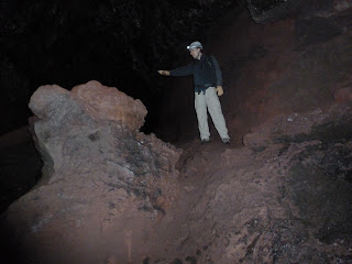
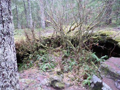
Lake cave starts out as all of these lava tube caverns begin, a part of the ceiling has colapsed down into the cave and you have to climb down the rubble to get inside. The big park caves have nice stair cases that get you down in comfort (you and the 100 or so other people in the cave). Lake cave is a low ceiling and scramble down some rocks to the upper flow cavern, and then a rickety ladder down to the bottom of the second flow tunnel. 


This is a good picture of the collapsed cave ceiling, that is our entrance

See, Bigger than you thought. Why is Bryan going that way?


THis is the only ladder. After this, you slug it.


I think the lava caves have this same “double flow” construction. Like a lava tube on top of a lava tube. I am guessing they came from consecutive flows. Anyway, they often combine together and you get this double tube shape, And then the tubes will separate and come back together.


Lake cave has a lot of places that you have to rock climb or sand crawl to get past rock jumbles caused by partial ceiling colapse. Gloves, Hard Hat, and Helmet light are pretty much required. (Bryan found one low hanging rock with a large mass of hair stuck to it. Someone not wearing a helmet).


More (once) Molten stuff.


That is our backpacks down there (our lunch spot) while were are up on these boulders setting up our candle shots. I took this one with a 60 second exposure and lit the area by just tracking my headlamp around. See how that right wall looks like flowing water?


One of my favorite features of this cave is the curious melted mineral that looks for all the world like solidified molten Lead. It appears to be silver colored at least by out headlights and the smoothness has the appearance of metal also . I am guess if it was silver, it would be gone.

That Silver Lead like stuff.


It was raining pretty hard when we started the hike and descent into the cave, and it is raining pretty hard in the cave also. A lot of water dripping down from the roof. By the time we got around a mile into the cavern, there was a nice little stream running down the middle of the tunnel. Just a crick really, it didn't cover your shoes, except in the places where the fallen ceiling made little dams and little lakes. 

Negotiating one of the little dammed areas on a previous hike.


Toward the end of the tunnel, it slopes down pretty sharply and the river was loudly running. Right into the lake at the end of the tunnel. And thus the name, Lake Cave. In the middle of the summer there is no lake, but you can still only get made 50 yards further than we on this day.
We threw a flashlight into the lake and took us some pictures:


I brought booties for the occasion

because someone has to put the light out there.

while Chip and Bryan set up "real" cameras


One of Chip's Masterpieces (copyright(c) 2012 Chip MacAlpine)


One of the other standard properties of these caves is that they are cold. They are like 42 degrees all year round (which is pleasant enough in the summer). Once you get warmed up in your hiking, you can see your breath, which makes photography hard because all you can see in the flash is steam.

On our second setup shoot Chip wanted to experiment with some remote controlled flashes he had rented. That didn't work so well, but I got a few cool shots of people wandering around with their headlights on. I call it my Plasma Discharge shots. Lave cave is an energy Vortex, you know.

Plasma Discharge in Vortex Cavern


Another fascinating object found in these caves is the predominant life form. There is a very shiny and wondrous form of Lichen. There is yellow and green (perhaps some black) varieties. They are so shiny because they have little water drops clinging to them.

Freddie Fungus and Susie Sludge Lichen each other
Or maybe it is Freddy Fungus and Annie Algae.


For our next location, I wanted to get some pictures using candle and antique lantern light on a group of boulders to try and show what it would have looked like to explore a cave like this before electric lights. We did some long time lag photos. Here is one Chip took.

Journey to the Center of the Earth (Copyright (c) 2012  Chip MacAlpine)


Being underground for so long is a strange experience. When your batteries go dead, or if you just forget that you had your light off during a camera shot, you suddenly find yourself in a blackness that one just does not get on the surface. There is NO light. No passing cars, or street lamps, or night lights, or even stars. Just Nothing but black. And the sound of running water. And that strange growling noise. Better be my stomach.
Really Really Dark. ....ah.... is that a glowing eye?


We sat still so long doing this shoot that I got pretty cold (and cranky) and so decided that it was time for us to get moving. We couldn't see the entrance to the cave even when we got close to it, it was dark outside!! It was also pouring rain. We had spent 7 hours underground hiking and taking pictures. There is a little adventure for you.

After a long hike on the backside of Mt. Saint Helens, I encourage you to stop at the Cougar Bar and Grill(in Cougar WA). What a great little place. Lots of local color and stuffed cougars, plus great food and beer.

Wednesday, November 21, 2012

Cedaroak Park to Willamette Park, Kayak


Willamette River – Cedaroak park to Willamette Park.

I recommend that all young inspiring technical engineer types go into the weather prediction sciences. God knows there is a LOT of work to be done there and a lot of money to be made by someone that can do the hard stuff, like predict if it will rain tomorrow.
As it happens, Chip and I cancelled our epic overnight trip down the Multnomah channel of the Mighty Columbia river because of the not quite super storm that was predicted to roll through here on Saturday. Yes, Yes, why would a transplanted Oregon boy be afraid of a little rain, don't you have the gear? Of course I have the gear. It was the wind and possible waves on the exposed river that freaked me out. And Chip was gracious enough to let me cancel without an over abundance of abuse.
And then....... nothing. A little water. Oooops, storm now coming on Monday !!

So, we decided to do a day trip on Sunday.

We picked up Kayaks at Portland Kayak (right in front of Willamette Park) left a car there and used my Subaru to transport our boats up river (also up tide and up wind) to Cedar Oak Boat ramp (usually written as Cedaroak. But Apple red underlines that. And what could a Cedar Oak possibly be, anyway?). I got to reserve my new (and hopefully ongoing) favorite kayak, an Eddyline Journey.

From the kayak store, you just drive up the road by the river until you get far enough away for your tastes. Since we are still trying out this whole trip thing and since the weatherman was still making some nasty (and wrong) wind predictions, we chose 7 miles. (Thus Cedaroak). There is a nice 2 dock launch ramp there and just one other Subaru in the parking lot. (by the way, my little Forester did great carrying the 2 kayaks on my new roof-rack and thule stacker) We loaded up and took off.
One amusing start to the trip was a sign way up at the top of the posts that moor the floating docks. It was at least 30 feet over our heads and it read “High Water, 1996”. Explains why the huge expensive houses are set so back from the river.


The River at this point immediately starts off being ….. interesting. This must be a rocky area where the river is compressed. Not only is the current greater (perhaps a knot or so) but there are a lot of cross currents and strange upwellings that cause eddys and mini-maelstrom. The consequence is nothing drastic but in a little (mostly flatbottomed) kayak, you do find yourself gently but firmly pushed around in unexpected directions. Just don't fight it and relax. Most of the current seems to be going down river.

And no matter where you look, there is a house that you wish you could afford. Or maybe that your best friend could afford and would let you keep your kayak there; perhaps next to his yacht and float plane.

Not much traffic on the river today. A few kayaks. A stream of yachts that were so identical we thought 1 guy was circling us (how did he get back upriver so fast), and , just beyond us as she turned around, The Portland Spirit (largest boat on the river. A dinner cruise ship).

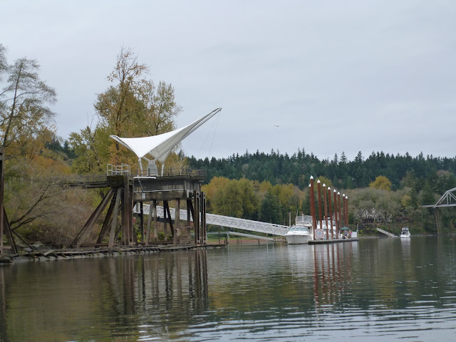
Lake Osswego Park

That would be a great Kayak Boat House.


Float Boat


The predominant wildlife was Mallard and Cormorant. Lots of those. Cormorants do make lovely pictures as they pose up on the poles, especially when you can put the sky in the background.

One nice house to comment on, we hit it just after we passed the Lake Osswego park area. It is a huge beautiful house, with another huge beautiful house attached to it and its own little Vineyard. And behind it, he has his own Railroad bridge !!! We even saw a train go by while we were waiting. So much noise!! I wonder if he knew about the train when he bought the place?

My little place on the River.


Da Train !!


At the halfway mark, we can to Elk Rock Island, where we set up a little camp for lunch. Elk Rock Island is a park with people out walking and fishing. It is really only an Island when the river is up, This time of year it is a peninsula. Back in the 30's (perhaps Prohibition?) it used to be a very hot night spot. I guess people would tool up in their boats, or perhaps walk out to the island where there was a Pavilion setup for Dancing and drinks. I was told that it was a substantial building and very famous at the time, but I could see no sign of it. Perhaps I need to explore the depths of the 100 yard wide island a little more.

The Beach on Elk Rock Island


Beaver
A little Rain. No Big Deal


Our lunch View.


Continuing on down the river. When ever you pass a bridge or get close to the shore, you can tell how fast the current is running. I am glad we are not trying to go in the other direction. We could do it, but we would be doing 2 knots instead of 4. And it is calming to stop and rest on your paddle while you watch the shore slip by. Gives you a chance to take some pictures. I believe that if you want good pictures of yourself, you have to spend some time taking pictures of the other people in the group. (well, in this case it was just Chip, but we are working on adding more to the team).

The controversial construction on the Sellwood bridge is underway. When ever I see these things I wonder what we are doing, letting our infrastructure get so worn down. Don't we aspire to the works of our Grandfathers?
Construction at Selwood Bridge


We did a water takeout at Willamette Park, just because I didn't want any embarrassing pictures of me doing a Dock exit.


Total Paddle Time, around 3 hours (with an hour or so lunch).

Some things to consider: We had an outgoing tide. It is unclear if an incoming tide would have changed the current. It has rained a bit lately. The river was up, but my no means high. I could see how a spring flood could make some things much more exciting. I can also see how it could be pretty glorious on a nice summer day. There are put-ins listed up and down the river at various mile marks. I like the idea of leaving a car at either end of your trip and traveling mainly downriver.

(KAYAK UPDATE: I ordered a Journey)


Wednesday, October 24, 2012

Nehalem Bay


Nehalem Bay

Spent the weekend out on the Oregon coast enjoying the scenery and the, rather intense, weather. I have got to figure out a way of doing car camping that doesn't involve carrying my own weight in gear. But I just can't bring myself to the lack of luxury of a hiking trip when I can just throw anything I want into the back of the car.
The purpose of this trip was to be set up for being at the Nehalem Bay public boat ramp on Sunday morning at 10:00 to take a kayak tour with Kayak Tillamook. The reasonable way would have been to get up at 6:00 on Sunday morning and jump in the car. Eat a leisurely breakfast in Tillamook and then make the 20 minute drive up the coast to Nehalem river (and bay).
But Chip and I were having none of that, and we arrived with camping gear at Nehalem Bay State Beach around 5:00 in the evening on Saturday. We had driven down route 6 to the shore (a GREAT drive) and had hit a few little rain storms on the way in, but no big deal. But as the sun was setting, there were some proverbial dark clouds on the horizon. So Chip and I set up our tents (he a nice little REI half dome, me a rather huge $20 monstrosity from Dicks) and then we proceeded to rig a tarp over the picnic table in case of rain. The tarp I had wasn't quite big enough, but it was what I had and I thought it would work just fine for the usual misting that we get in Oregon.
So, our dinner was cooking on the coleman on the picnic table and the campsite was tied down and stable, so I got out my axes and started to split some wood and lay a fire for a nice evening campfire. As I was setting the tinder down a few drops of rain started to fall. You know how you can tell that those few drops are going to lead to something bigger real soon? Perhaps it is the size of the first drops, perhaps your subconscious hears the approaching torrent hitting the trees in the distance, but either way, I knew it was coming and I quickly put the firewood and stuff up under the shelter and then move my ass over to the safe side of the table.
And down it came. It was quickly raining so hard that Chip and I were standing in front of the stove holding up the tarp with our hands and protecting our dinner. Wind and Rain and Dark.
Chip when off to do something and he flashed the car headlights at me. Man they were bright. I looked over to yell at him but he wasn't in the truck, he was over by his tent and BOOOOOOM, crap, it was lightning. And really close. Less than a 2 second lag.
Luckily Chip and I have a good attitude about this sort of thing. We were both laughing about as hard as we could, and also starting to shiver. But the pork chops were done and looking good and so we popped open some beers, loaded up our plates, and hid in the truck to eat our dinner. Such fun. We even started up the engine to put some heat on us. I was wearing 5 toe aqua shoes and my feet were sopping wet and a bit cold.
And rain came down. And then the hail came down. Much louder inside the truck. We ate our dinner and after a bit the weather backed off. We went outside, and the tarp and tents were ringed in white ice, and there was an inch of water in our firepit and our firewood had floated away.
So we went to bed.
In my tent I had this queen sized aerobed (autoinflating with the 120Volt power supply I had brought with me). I also had my Ukulele, so I played a couple of songs. Including “California Dreamin”.
It rainined off and on throughout the night. We were up around 2:00 to chase off some Racoons and re-secure our food (foolish mistake) and saw a beautiful few of Orion and Jupiter. This was a view opportunity for the Orionide meteor shower. I didn't see any. Chip said he did but I don't believe him.

Up early the next morning. Break camp and off to our Kayak tour. Appologies for not having pictures of Nehalem Beach State Park. It is a gem of a park with some great access to the beach. But we hadn't come for that and really didn't explore it properly. Next time for sure.

Josh, our Kayak Tillamook guide, met us at the boat ramp and got us into some nice kayaks and shoved us out into the bay. I was loving it from the very start.

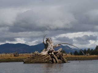
The tide was going out, and the very first thing we float past was this huge nurse log. In the water with its own cool eco system. We were floating by kinda fast, and I was shooting pictures of Cormorants, so I will get more of it on the way back.


First thing, we jinked to the left as we floated toward the ocean and went up a little tidal creek. It was only a few hundred yards long, and not very deep (as the tide was getting LOW) but it was pretty cool. There are a lot of old huge stumps and logs up these things. Josh said that back when Wheeler (the nearby town) was a big lumber town. The logs would come floating down the Nahelem river and would form this huge log jam, and they would set them loose with dynamite.


On exiting the creek, Josh asked us whether we wanted to work now or later, because we needed to get upstream sometime. We elected to work now. So we paddled up current to a little slough that took us off a very shallow area (we were running aground a bit) toward the ocean. You know how you can tell the water is shallow? The seagulls are walking instead of swimming. Another good indication is when your guide puts his paddle down and places his hands on the bottom and lifts his kayak up and over a mud bar.


Live Bird Walking

Don't Go That Way Josh !!


And this is where we found the Eagles.


We exited the slough back into the main channel and hooked a left up stream back to our start. But, the tide had changed and now we had an easy time back up the bay.
Lots of pillions in the water. Remnants of the hey day of fishing, canning, lumbering, and Locomotion.

Oh, and this cool Kingfisher.


It was a pretty cool tour. Josh was very informative, and he took advantage of the fact that were only 3 customers and that all of us had experience (oh my, Lynne had a nice boat) and so he took us further than an other tour could have gone. What fun.

And here is that Nurse Log: