Saturday, October 1, 2022

Blue Pool


The Cascade Mountains of Oregon hide many a natural wonder. Our hike along the McKenzie river to the Blue Pool let us encounter three of the grander ones. We are traveling up into the mountains during the shoulder season between Summer and Winter. The weather has been pretty warm and dry but that is due to change at any minute and this area always gets lots of snow. The Ranger we talked to said that the main highway here, 126, is kept officially open by ODOT but once a good ice and snow storm hits the road is often closed due to drivers that don’t know how to drive in the snow. He said “those drivers from Georgia” but I suspect he may have also meant “Those drivers from the city”. 

This is also one of the river valleys that was closed 2 years ago by the big wind storm that triggered the huge fires that burned down from the mountains for days and days and encased the entire state in a thick blanket of brown smoke. In Portland, we were pretty far North from the worst of it and we still had to close up our home and run the filters continuously to make the air inside the house healthy. Outside the smoke was so thick we could barely see the house across the street. Of course, in the Fire Valleys, the impact on the residents was much greater than a little smoke. 

Driving up the McKenzie River valley now the natural and human toll of those fires is still apparent these 2 years later. Up on the hills across the river are entire mountains full of dead and burned trees. Acre upon Acre. Down along the river on the 126, the fire scorched through the many little fishing shacks and country homes that had been built along the river.  Here much of the burned down houses have been removed and either rebuilt or are in the later stages of being rebuilt. Home after home of brand new, and usually large, dwellings. Mixed in there are the occasional lonely stone chimney, testament to the lost homes that could not be rebuilt, whether from lack of treasure of lack of will. Imagine how this must have looked a month after the fire. Just miles of burned-out homes.

When driving through this place and you have a very good view of the surrounding terrain because all of the small understory has yet to recover. Many of the biggest tallest trees are still alive in some places, though their bases will be black for another century. Then, suddenly, you lose your view and everythng is green. The winds had pushed the fires steadily West, so once you get East of the fire starting point, you are out of the burn. Or at least out of this burn. When you walk through the forests of Oregon you always see big old trees that are burned on the base. Burned from fires that may have occurred a hundred years or more ago. 

The green also marks a change in the land as the mountains get steeper and the road heads up the river gorge that has been carved by volcano and river. Volcano and River, 2 of the 3 wonders that I promised you we would have on this hike.

The McKenzie is a working river. It supplies much of the water and electricity for the city of Eugene and the surrounding towns. This means there are many dams, reservoirs, diversion reservoirs, and generation plants along the way. Just at the top of one of these reservoirs is the well marked turn off the lower trailhead to Blue Pool.  The parking is along the dirt road by the Trailhead, only a few hundred yards off of 126. This is a well hiked trail. We are here on a Wednesday in September and there were still 15 or 20 cards parked along the road by the seemingly new pit toilet at the trailhead.  Hiking Hint: Even if you know there are toilets at the trailhead, bring your own Toilet Paper. 

At the trailhead there is a sign that says that this part of the trail is for hikers (pedestrians) only. Trail Bikes are directed to a different nearby parallel trail. This is presumably because this section of the trail is so popular.  There is a short descent from the road to the river and then you are hiking a wonderful wide stone bordered trail through some lovely old growth forest. This is some of the little unsullied forest that I have seen in Oregon. There are no old tree stumps left over from a previous lumber operation a hundred years ago. It must have been too hard to drag these trees out back then and they managed to survive until someone had decided that they were worth saving. Now there are all of these magnificent old Douglas Firs and Cedars growing huge and gnarled and beautiful. There are still many stumps and falls, but these are all natural and the trees are still there, just laying on their sides and providing a natural growth medium for the next generation, that have started growing on top of them. There were many of these ‘Nurse Logs’ just off the path. A couple of these were going across a creek and one was across a trough in the earth and was making a sort of nurse log bridge with trees growing on top of the bridge. I wonder how those trees will finally end up. Will they extend roots into the earth, or will they collapse and die when their nurse finally decays to nothing? I must come back in a few hundred years and check up on them. I will make sure and update this blog with a picture from then.


This is a Nurse Log Bridge !


that log is only cut because it was blocking the trail

a walk in the woods

Some of these rocks were human placed


After a mile or so and a wide bridge made from a 5 foot diameter tree across a little creek we come to a change in the terrain. Things get rockier, the going gets more complex, and we are starting up an incline that is leading us quickly away from the level of the river. We are still beside the river, mind you, but it is now down in an ever deepening gorge. We have reached the start of an ancient lava flow and are now hiking through wonder #2 on this 3 wonder hike. 


flow rippled lava

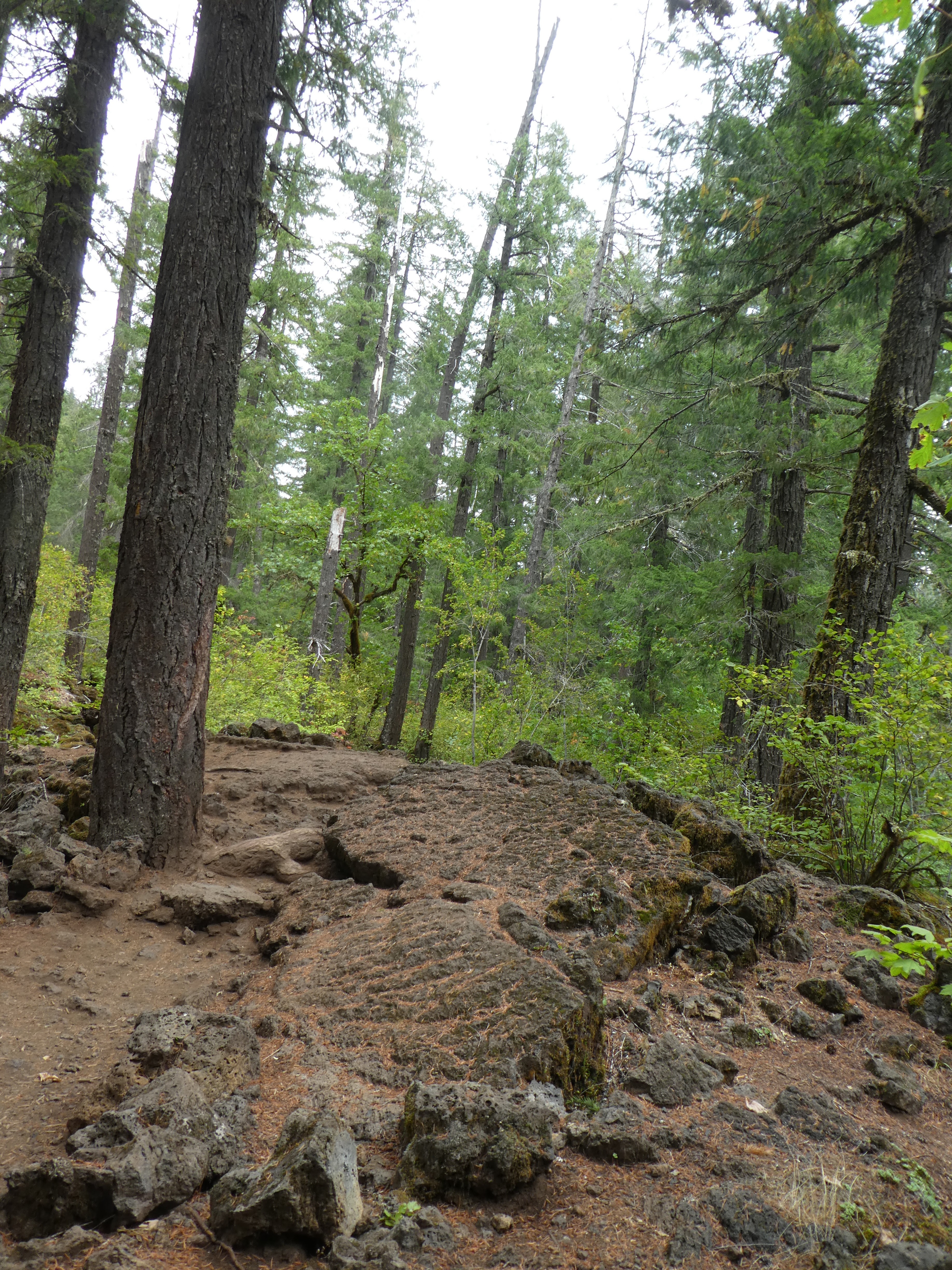
Lava. This lava flow, though old enough to have 200 year old trees growing out of it, is young enough that the forms and movement of the molten rock are still very evident as you walk over it. This section of rock is raised above the rest and flat with wavy little patterns in it. It is easy to imagine this as molten and moving and then freezing into place. That section over there was probably the top of a Lava Tube. A hollow tube of lava that extended down the valley with a river of lava hot and flowing down the center while the top and sides cooled and hardened. When the lava river stopped, the molten lava flowed out leaving the tube standing and intact. For a while. But sometime over the centuries the ceiling of the tube collapsed into a jumble of rocks and that is what we are seeing now. Trees and bushes are trying desperately to grow in the jumble but the ancient pattern is still easy to discern. 

The trail winding its way through this is pretty unique also. It seems like the trail has been carved right through this mass of lava flow, but I could not find any obvious signs of the carving. No sharp edges or things like that, and there are mature tree roots along the trail suggesting that only thing that may have been doing any carving is Nature and the many boots of tourists and hikers. My partner and I discussed it and we agreed that we couldn’t figure it out. It is clear that the trails had been cleared of easy to move debris, like bowling ball sized rocks, but unclear if anything more dramatic (like dynamite blasting) was done. Certainly the use of dynamite was common in carving some of the trails that go up the river valleys of the Gorge, so it isn’t a completely silly thing to suggest.  Anyway, very nice trail, slightly more challenging than the Old Growth forest part. A good pair of boots is suggested. 


Was this trail dug? Natural? Worn by feet only?

If a tree falls in the woods and there is no one around, does it make a sound? The answer is Yes, it makes a hell of a loud sound. We had a tree go down across the river as we walked by. No rain. No wind. It just spontaneously fell. We heard a CRACK and looked over and saw it break off and go down. And it fell down the gorge into the river. KABOOM. A much louder sound that I was expecting.  How often does something like this occur? I mean, where people are around to here it? This is the second time in a couple of years that my partner has seen/heard a big tree fall. I have only had evidence of them. Like the tree wasn't blocking the trail on the way out and now it is...

This time of year there is also some fall color in the Vine Maples that congregate along the edge of the river cliff in the ample sunlight. We might be a week early for really good color, but we did see the occasional bright orange Tree. That also led us to see the towering cliff, going up a shear 100 feet on the other side of the river. Where did that come from?

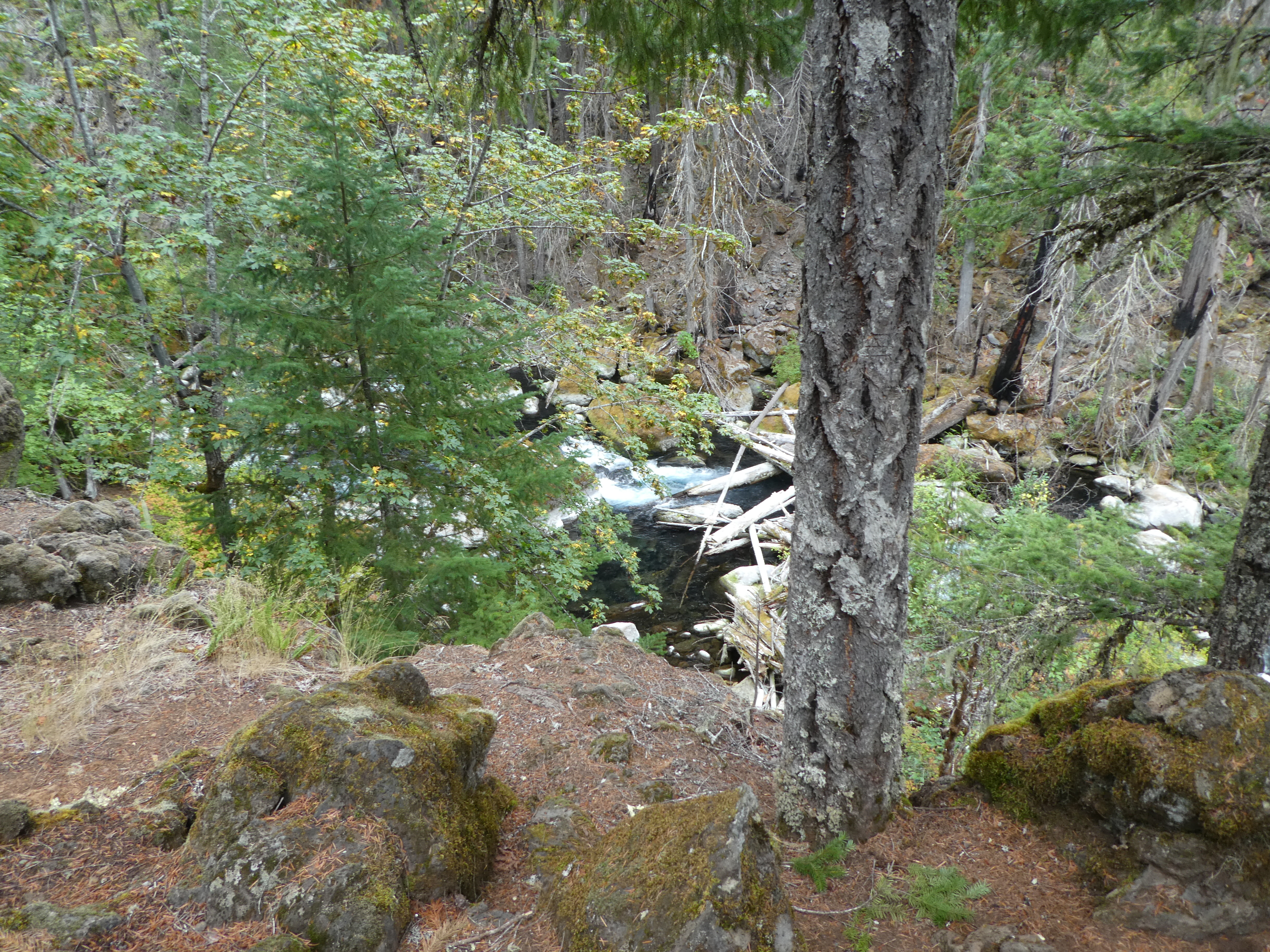


Our trail curves around a rock outcropping and then leads up back to the edge of the cliff overlooks the river and suddenly we are at our destination. Wonder #3. The Blue Pool. This is one of those things that if very aptly named. There spread out below us is what appears to be the magical beginning of the McKenzie river. A 100 foot diameter, 20 foot deep, bright blue pool of still water, surrounded on  3 sides by 50 foot high dry rock cliffs. The river exits full and lusty on one side but no water enters the pool from any obvious direction. Wow. What is happening here is that someplace upriver a bit the McKenzie enters into one of those Lava Tubes I told you about. It goes underground and even has an underground water fall. It then comes up from the bottom of the pool. There must be a pretty good current down there but it is not apparent from up here on the cliffs. You can see what appears to be a sort of dry waterfall cliff area. This turns out to be where the river comes tumbling over the cliffs when the river re-asserts its rights during times of heavy rain. 
The Dry Falls are Top Left


I wouldn't sit there....


We hiked around this area a bit, just doing some exploring. Of to the side is the place where the trail splits into Bike and Pedestrian Trails. Above the pool the trail is mixed use. By the way, this is just a 2.25 mile stretch of the McKenzie River trail. The entire thing is around 26 miles long and stretches from Clear Lake on down the river to McKenzie Bridge.

A really beautiful hike. I am so glad my Partner took me on this hike.


Thursday, September 22, 2022

Mirror Lake and Tom, Dick, and Harry Mountain


Since the beginning of time, Portlanders have been driving to Government Camp along highway 26 and have driven past a bend in the road, just before the mountain pass summit, and have seen a large number of cars parked at a road siding. At that siding was also a large sign indicating that this was the Trail Head for the hike (or winter snowshoe) to the very popular Mirror Lake. There were always too many cars parked there and the Portlanders never stopped there. It was one of those places that no one ever went to because it was just too crowded (thanks, Dad).  To make matters worse, this stretch of highway 26 is steep, curvy, and has sheer rock wall on one side and treacherous cliff drops on the other. During the winter, the snow and ice build up and it can be an exceeding exciting 10 minutes of driving. This makes parking at this curve less than ideal. 

For a few years, they had closed the corner to parking and you could see people making their way down the side of the road from the town of Government Camp to access the trail head. Usually these people were walking on the other side of the highway road barrier, but in the winter, with the snow pilled high by the plows, they would be walking on top of the piled snow, just a slip away from the highway.

Sometime in the last 5 years or so, without notifying me or seeking my approval, the NPS put in a brand new parking lot up near Ski Bowl (right at the start of Government Camp) and re-routed the trail to be away from the highway and join up with the old ‘historic’ trail about a mile up the mountain.  How did I not know about this? The old trail head is all NO PARKING and the sign is gone and the old trail is completely blocked, so don’t even think about it.  The new Trail head is a large parking lot and a very nice 2 seater pit toilet. The first quarter mile of the trail is paved and you could walk down it with your Aunt May for a lovely stroll in the woods. I think I would advise against a wheel chair unless it had good brakes. 

I think that is a cedar stump. Just saying.


So there it is. If you have a Northwest Forest Pass or a Old Geezer For Life Card, you can park in the lot and have access to this wonderful hike. Fair warning, the place is still crowded. We left Portland around 9:00, got to the Trail Head just before 11:00, and the parking lot was 80% full, on a Monday in late September.  We were not sure what to expect from this hike nor from our knees so our plan was to hike the 1.9 miles up to Mirror Lake and see how we were doing. Hopefully we would continue the extra 1.8 miles up to Tom, Dick, and Harry Mountain. (and yes, that is really the official name of the mountain. Look at a map). 

As I noted, the first quarter mile or so is a wide paved and winding trail. This takes you down a little slope through the woods and away from the highway.  When the pavement ends, the trail levels out and you start a sort of meandering way around the mountain over to the intersection with the old trail. They spent a lot of money on this new section. It is wide, with a lot of clearing. There is some indication that there may have been a road here at one time, uncertain. What is certain is the many (at least 8) brand new and well built bridges that go across the many small streams that are coming down the mountain during this little traverse. 

Stump with Standing Hole

The area was, of course, lumbered in the distant past. There are many stumps that show the telltale marking of a hole cut for the boards that the lumberjacks would stand on to get their saw cut up high enough to be above those pesky root systems.  Also, many of the stumps were cedar, but I saw no live cedar trees. Down here near the valley (or gorge) floor the undergrowth is very sparse. There is littered tree branches, dropped from the 30-50 year old trees, everywhere on the ground but very few green plants. Where are the fern and Sallal? Is it too dry? Or has the undergrowth not yet recovered from the logging. Perhaps there is too much snow in this area, we are right next to a ski lift. 

There is also the mystery of the big boulders. Randomly distributed through the woods are these large (cow sized) white rocks that are sitting up high on the surrounding wood mulch. It sort of looks like, 10 years or so ago, someone was throwing boulders with a giant sling shot into the forest. The rocks don’t look like they belong and they don’t look like they have been here for very long. I am thinking that perhaps they broke off from some escarpment up the mountain during the winter and then slid down in the deep snow to rest in this area. They then slowly settled into the mulch as the snow melted. It is also possible that the National Park Service carted them in by Zeppelin and place them here just to be a conundrum to me. They do things like that. Just ask Anna Pigeon.

Once done with the 8 (or so) bridges, the trail heads up the mountain and starts on a set of long switchbacks. There is about 2000 feet of elevation gain you need to pay for in order to see the wonderful view from Tom, Dick, and Harry and this is the first down payment. Lots more views of very majestic tree stumps. 

Mirror Lake is sitting at the top of these switchbacks. It is a little round pond, really, that sits in a small floating valley at around 5000 feet. Must be lots of snow up here during the winter. There are a number of “Most Difficult” signs, perhaps for Cross Country Skiers, 10 foot overhead on a number of trees beside the trail.  Things get green as you get to the lake. There are suddenly plants in the understory. There is both more water and more sun near the lake. The trail splits at the lake. There is a loop around the lake and on the far side of the lake is the continuation of the trail up to TDH mountain (I like the initials better). 


And now I am wondering. Is it “Tom, Dick, and Harry” or “Tom, Dick and Harry”. Personally, I think that the extra comma (what is that called? Some city in england) is absolutely necessary. Anyone who says otherwise really doesn’t understand the intense and complicated relationship that Dick and Harry have with Tom. 

Mirror Lake. Why is it called that? It is because there is this great place to stand on the Mountain Slope side where Mt Hood is in view rising over the lake. On a calm morning, the placid waters of the lake make a perfect mirror for the majestic image of the old Volcano. By the way, I think Mt. Hood was used as the model for the Lonely Mountain, the home of Smaug in “The Hobbit”. 

We have decided that we are doing well and have not hiked enough for today. We are going up TDH. Lots of people are going up TDH. In fact, lots of people are coming down. There must be many people that got an earlier start than us and have already enjoyed their view and are not heading home. This would certainly explain all of those cars in the parking lot.  You go up, up , through the woods. Gone is the wide track. This is a single person trail with steeps sides, the kind of trail where you need to look for a good place to get out of the way of the people coming in the opposite direction. There is a section where you have to traverse a big tallus field. This is a area of broken basalt (about bowling ball size) that the trail crosses through. Up close, it looks like a jumble of big rocks, but if you look across the valley (that is now visible as there are no trees) you can see similar rocks slides on the hillsides across the ways. They look like grey sand from any distance. Just a place on the mountains where there is a cool grey shape stamped into the forest on the slope. Oh, look, that one looks like a map of the lower 48. 


This section of trail is a steady up hill climb that puts you to the top of the ridge of TDH. You can tell you are at the top because you will run into a huge pile of head sized rocks. This cairn is around 20 feet in diameter and about 15 feet high. Oh my. What is this doing here? We asked an old white guy who we met hiking (Oh, this is your first time up? He said) and he said that the Cairn (which he pronounced “Cairn”) is just a thing that had grown organically from hikers placing a stone there. Just years of people being copycats and placing one stone every time they did the hike. I don’t know if this is a true story or not but it certainly sounds like the kind of story that I would tell people if they asked me. The pile was a little large for a prehistoric Mountain Rock Beaver den. And you don’t see so many of those this far south. 


Pre-Historic Mountain Rock Beaver Den


Last bit to the top


Now you are on the ridge. Shouldn’t be so steep. Right. OK. So you take a left at the Mountain Rock Beaver Den and you head up the ridge. Lots of stones for tripping on though it is pretty level for the first 15 minutes or so. They you have a last big climb. This is the second steepest section of the trail. This is also a different ecosystem than we have been in. My partner commented that the smell had changed, and she was right. It is drier up here on the ridge. The trees are shorter and stubbier and the undergrowth is different. She said it has the spicy dry smell that she associates with walking through the pines of the high desert, like near Bend. I had to agree.  Up, up, this last short way until you see a big pile of rock shale break out through the trees. This is large flat rocks  jutting up above the trees and is clearly our final destination. Up the trail to the top of the rocks and a large flat area with a number of other hikers and a great glorious view. This is a 360 degree view with Mt. Hood sitting there in all of its late summer splendor (that is, not much snow). 

What can you see? You can see the valley that highway 26 is in that we drove up to get here. You can see Government Camp down there in the valley. You can see the Timberline Lodge, which strangely enough is right at the line where the timber stops and the grey rock/snow starts on Mt Hood. You can see the ski lifts and such further up the mountain. Just to the West of Hood you can see Mt. St. Helens in the background. If you spin around and look south, you can see Mt. Jefferson way over there. All around you is the heavily forested cascades. I understand that people Snow Shoe up here in the winter. That must be a view. 


There were several groups of people up on the top. Everyone is happy and talkative. The people that are not natives want to know what things are. Where is Timberline? Where is Mt. Hood? I have this theory that the further you get from the parking lot the friendlier people get. The real grouches just can’t make it up the hill this far. My partner disagrees and points out some counter examples but I am ignoring that for the sake of this blog.  We meet one couple that asks us to take their picture and then tells us that they got married 2 days ago. They eloped and ran away to Portland to get married and are on their honeymoon and have decided to leave their home in Austin and move here where there are actual mountains. I used to live in Dallas. That is a few hours drive from Austin. I think you can drive from Dallas to Austin and never have a elevation change of more than 17 inches. 

We had lunch sitting on a couple of big flat rocks put there by the NPS just for this purpose. The trip back down was much faster and easier. I like it when they build the trails that way. We did the loop around Mirror lake on our way down, we didn’t have a good mirror because of the afternoon breeze but it was still a great view.  My partners Fitbit said we did just over 8 miles once we got back to the trail head. What a glorious hike.


like my new watch?


Mirror Lake not so Mirrory


Friday, September 9, 2022

Cape Arago - East Loop Trail


A big wind hit this ridge

Here is a challenging hike that also offers a few easy levels of confusion just to add to the sense of adventure and wonder. I could not find this hike on any official State Park trail map. I also couldn’t find the name of this trail listed on any of the many hiking sites that do have the trail shown on their (probably FITBIT generated) overlay maps.  However, we ran into a Ranger at one of the state parks and he said it was a great trail, that it was called the East Loop Trail, that he hiked it yesterday on a nature talk hike that no one showed up for, that it wasn’t marked, and that it started just across the main road from the entrance to his access road that leads to his maintance area and no we couldn’t walk through it. 

To get there, you drive through Sunset Bay State Park and then park your car in Shore Acres State Park. Then you walk across the street and hike in Cape Arago State Park. These 3 parks are contiguous and the main difference seems to be that you need a state parks pass to park in the big parking lot at Shore Acres (but that is also where the nice bathroom and gift shop are).  

There are a lot of trails hooking these 3 parks together. We are going to hike the hardest and least scenic today. We are doing it because we didn’t know that it was the hardest and least scenic and because we wanted to hike a new trail. The other trails all run along the coast over tall (75 foot) bluffs with stunning views of the Ocean and the off shore sea rocks formed by the unique geology of this cape. At the furthest tip, Simpsons Reaf, shows a large off shore colony of Sea Lions barking and basking on the up-jutting rocks a few hundred yards off of the coast.  So if you are into that sort of thing, you might not spend the effort finding and hiking the East Loop Trail.

Let me give some directions on how to find this trail,  just in case the Ranger isn’t walking by on the sidewalk when you park your car. You can start this hike from anyplace that you want in the park and just head toward the bathrooms at Shore Acres,  but we were looking for about a 5 mile hike and so we parked our car right there by the bathroom and world famous Gift Shop (they actually sell pocket knives WITH YOUR NAME ON THEM) (HOW DO THEY EVEN KNOW MY NAME?). If you don’t have a Oregon State Parking Pass, and you don’t want to pay the $5 parking fee, you can usually find a place nearby to park on the main drag (Cape Arago Highway).  

This East Loop trail is referred to as part of the Perimeter Trail in all of the (non-official) maps that I could find online.  The Ranger insists it is called The East Loop Trail, it just doesn’t appear on any maps and isn’t signed. It is a real trail, however, and a lot of work has been done on it. Amongst other things someone has hauled an awful large number of large concrete blocks up the hill to make a number of stairways on the trail. This trail is NOT the Pack Trail. The Pack Trail is a well marked old road (at least at the start). We are going to be hiking on it later but we don’t want to start on it. It is also not the road/trail that goes up to the old WWII bunkers. I don’t know where that is but everyone asks me “Oh, did you see the bunkers?”. No, I did not. It also isn’t the trail that goes down to the surfing beach. It is the trail that goes way the fuck up the  hill that I didn’t even know was there. 

Dang. We haven’t even found the Trail Head yet. 

OK. Here it is. Park your car near to the bathroom. Follow the parking circle around back to the entrance to Shore Acres. That is, go back out to Cape Arago Highway. Turn right (south) and head down Cape Arago Highway until you see a little paved utility road on your right. There will be a “Authorized Personel Only” sign near the entrance. Now look to your Left, on the East side of Cape Arago highway. Look hard. There is no sign. There is a trail that goes on a short scramble up the roadside and then continues into the dark of the trees and heavy foliage. That is the East Loop Trail. Or you have found some other unsigned trail. But lets go with the idea that you have found the East Loop Trail.  My partner and I searched around in this area for 5 minutes before we convinced ourselves that we had the right place. 

Up the hill the trail goes. This area is extremely green and lush. My first time finding mountain huckleberry in the wild, and it was everywhere with lots of berries. Add to the underbrush a profusion of blooming deer-fern along with the usual Oregon mix of Mahonia, Salal, and ever invading Himalayan Blackberry. The trees towering overhead were mainly Sitka, and there were some giants there. 

The footing in this area is all a thick layer and moss and pine needles. I haven’t seen this kind of ground in other places. Everywhere you walk there is this springy effect on the ground like you are walking on some advanced rubber covered playground. It makes for a very comfortable walk. 

The first mile of the trail is very intent on getting to the top of the ridge. Once there you break out into a large flat area that appears to be an old burn. There are many large old burnt remnants of trees but the surrounding  growth is still recent enough to be low lying, so you get some sun. This area has a lot of newly sprouting Rhododendron which should offer some nice color in a few years. Watch your step here, the trail was cut through a thicket of small growth and there are a lot of short small bush stumps in the ground to trip you up. My partner was also sorry that she didn’t wear long pants and shirt, just because of the many sticks (and sometimes thorns) that were crossing the trail. 

Along the Oregon Coast (and this area was certainly no different) it is hard to get an appreciation of what a Natural setting would be. What would a healthy natural forest look like in this area? What do I mean? If you are hiking through the wonder of nature and you keep coming across huge tree stumps, much larger than the growing trees, and these stumps have the flat top to show that they were harvested a century ago by some logger baron, then I would argue that you are not hiking through a natural forest. Not hiking through an area where the trees are born and grow up and die in a sort of long term cycle of death and renewal. You are in an area that was stripped clean and then all of the trees started growing at the same time. I guess a big forest fire might cause that sort of thing, though I am guessing you don’t get 500 year old trees in places that have forest fires. 

After you leave the clear area, you enter back into the Sitka forest. There were some HUGE old skeletons of trees back in there. See the pictures. These were burned some but it was unclear if the fire killed them or they were husks a century before the burn marks. We continued deeper into the forest and now we were in a area that was big trees continuously. The trees were all about the same size and height and they blocked enough sun that the undergrowth was only the low lying shade loving plants like Oregon Grape and Deer Fern and the like. Things were a little soggy underfoot and so there was also the occasional profusion of Mushroom and other fungi. We are up on the ridge now, which afforded some good views of the trees. You need to do some slugging along now. The trail is general winding up, but it does duck suddenly down a time or too to cross a small water course. We are hiking late in the season (September) and we have a glorious warm and sunny day, but we don’t have any wild flowers. 

At this point in the trail, as you wind up and down the ridge, you will encounter the many concrete block steps that I had mentioned. These are the kind of stones you might use in a large retaining wall in your yard and are all over the ridge. I am guessing this trail is pretty muddy in the winter and spring and the stone may be necessary to keep the trail safe. 


Rhododendron in the burn area

This is one stump with 3 sections left. Huge.

Another half mile or so on and the East Loop Trail intersects the Pack Trail. Once again, this intersection is not marked. If you were on the Pack trail and trying to find the East Loop Trail, it could be a bit challenging. The Pack Trail, however, is an old jeep track going right up the hill and you can’t miss it when the East Loop dumps you out on it. Take a left and head on up the gentle slope. This is a great time to walk next to your partner and catch your breath. But don’t do as I did and assume that the pack trail stays this wide track all the way to the end of the cape (even if you have been to the other end of the trail by car and saw that it was this wide at the other end). 

The Pack Trail continues nice and wide but then takes an easy right turn and narrows back down to a single track trail. 

My sister lives out this way and she told us last year that she had talked to some ranger friends and they had told her that a storm had made the Pack Trail impassable with downed trees all over the place. However, since then, the trees had been cleared and the Ranger we talked to said that the trails were now open. We had run into some cleared trees but nothing that I would have called ‘impassable’. Yet. Did I mention that I am taking this writing correspondence course and we have just reached the chapter on foreshadowing? 

Right about now, in the midst of your quandary over my use of foreshadowing, you will come to a fork in the road. Two trails of equal size and use, one to the left, one to the right. The one to the left seems to be going more in the right direction. The one to the right goes right down the hill, which isn’t really what I was expecting. The one to the right, however, had a big tree cut off at head height by a chain saw right there with fresh saw dust on the trail and bulk of the tree down in the gulch. So. Trail Maintenance. We go right. And we were never seen again. 


Man oh man, I really wanted to end the blog there. My partner really wanted to end the hike there too. But since I couldn’t drive our car to that part of the trail, you are going to have to keep reading. I admit that though this part of the trail was the most challenging, it was also the most interesting. There were large trees down everywhere. They had been blown over in that storm and they littered this drainage that we now have to cross. 

Sitka Spruce are a thick bodied tree with many symmetric branches that grow on the wet rocky mountainous Oregon coast. They maintain their hold on the hillside with a large shallow spreading root system instead of a deep thick root ball. If you were to make a model of the Sitka and its root system you could easily set it flat on your kitchen table, that is how flat the root system is.  I was looking at this many toppled trees and I realized that this root system (though perhaps ideal for the rocky terrain) means that the trees have a very definite center of balance. They don’t so much dig into the ground but sit uneasily upon it. You push hard on the top and you can over balance them and then down they come. That is what that big wind storm did. And the trees don’t break (at least not until they hit the ground) but rather push over taking their bit round flat root systems with them.  Once pushed over, the root systems stick 20 or 30 feet into the air and created a sideways forest with bushes growing out of the once tops of the ground. 

The guys with the chain saws put in a lot of effort to clear the debris and construct new trails through this mess. You have to climb over and around a number of falls. In one place, a 15 foot stairway has been constructed with log rounds cut from a felled giant as stepping stones. 

You have to go way down into the gulley and then back up to the ridge. I don’t know if this is the historic trail or if we are going around some other blockage. I also don’t know where that left turn in the trail went. Need to find that Ranger again and ask him. Maybe I can send an email. 

Once back up to the ridge, you run back into the wide part of the Pack Trail, and this will lead you an easy half mile down to the loop a the end of the Cape Arago Highway. 

Somewhere in there is a unmarked turn right off of the Pack Trail and onto the new trail that goes through the woods over to Simpson Reef parking lot. I think I saw it, but wasn’t really sure. We had decided to walk the road back to Simpson Reef. 

And there you go. Oh shit, we didn’t make it back to the car yet. Haven’t even stopped at the world famous Gift Shop. 

Also Simpson Reef.

Simpson Reef


OK. As you walk the road toward Simpson Reef, go over on the left side (facing traffic) and take the little beside the road trail that goes behind the fence. You will come to a place where you get a big view of the ocean and will no doubt be attracted to the loud noise that all of the Sea Lions are making on their rocks a quarter mile or so off shore. There are hundreds of the noisy guys out there. There is an equally good view from the Simpson Reef parking lot. Just past the parking lot is a little white arrow on a post that leads into the forest along the cliffs. Follow the trail with plenty of nice views through the close growing salal until you eventually come out to Simpson Beach and then the Shore Acres parking lot. Here is the bathroom. 

And The Gift Shop !!

The gift shop has a nice selection of historic books for sale as well as plenty of tea shirts and sweat shirts that say “Shore Acres State Park” on them. You might even find a pocket knife with you name on it. 


I love these little Douglas Squirrels. 
Even when they sit and yell at me.