
The Cascade Mountains of Oregon hide many a natural wonder. Our hike along the McKenzie river to the Blue Pool let us encounter three of the grander ones. We are traveling up into the mountains during the shoulder season between Summer and Winter. The weather has been pretty warm and dry but that is due to change at any minute and this area always gets lots of snow. The Ranger we talked to said that the main highway here, 126, is kept officially open by ODOT but once a good ice and snow storm hits the road is often closed due to drivers that don’t know how to drive in the snow. He said “those drivers from Georgia” but I suspect he may have also meant “Those drivers from the city”.
This is also one of the river valleys that was closed 2 years ago by the big wind storm that triggered the huge fires that burned down from the mountains for days and days and encased the entire state in a thick blanket of brown smoke. In Portland, we were pretty far North from the worst of it and we still had to close up our home and run the filters continuously to make the air inside the house healthy. Outside the smoke was so thick we could barely see the house across the street. Of course, in the Fire Valleys, the impact on the residents was much greater than a little smoke.
Driving up the McKenzie River valley now the natural and human toll of those fires is still apparent these 2 years later. Up on the hills across the river are entire mountains full of dead and burned trees. Acre upon Acre. Down along the river on the 126, the fire scorched through the many little fishing shacks and country homes that had been built along the river. Here much of the burned down houses have been removed and either rebuilt or are in the later stages of being rebuilt. Home after home of brand new, and usually large, dwellings. Mixed in there are the occasional lonely stone chimney, testament to the lost homes that could not be rebuilt, whether from lack of treasure of lack of will. Imagine how this must have looked a month after the fire. Just miles of burned-out homes.
When driving through this place and you have a very good view of the surrounding terrain because all of the small understory has yet to recover. Many of the biggest tallest trees are still alive in some places, though their bases will be black for another century. Then, suddenly, you lose your view and everythng is green. The winds had pushed the fires steadily West, so once you get East of the fire starting point, you are out of the burn. Or at least out of this burn. When you walk through the forests of Oregon you always see big old trees that are burned on the base. Burned from fires that may have occurred a hundred years or more ago.
The green also marks a change in the land as the mountains get steeper and the road heads up the river gorge that has been carved by volcano and river. Volcano and River, 2 of the 3 wonders that I promised you we would have on this hike.
The McKenzie is a working river. It supplies much of the water and electricity for the city of Eugene and the surrounding towns. This means there are many dams, reservoirs, diversion reservoirs, and generation plants along the way. Just at the top of one of these reservoirs is the well marked turn off the lower trailhead to Blue Pool. The parking is along the dirt road by the Trailhead, only a few hundred yards off of 126. This is a well hiked trail. We are here on a Wednesday in September and there were still 15 or 20 cards parked along the road by the seemingly new pit toilet at the trailhead. Hiking Hint: Even if you know there are toilets at the trailhead, bring your own Toilet Paper.

At the trailhead there is a sign that says that this part of the trail is for hikers (pedestrians) only. Trail Bikes are directed to a different nearby parallel trail. This is presumably because this section of the trail is so popular. There is a short descent from the road to the river and then you are hiking a wonderful wide stone bordered trail through some lovely old growth forest. This is some of the little unsullied forest that I have seen in Oregon. There are no old tree stumps left over from a previous lumber operation a hundred years ago. It must have been too hard to drag these trees out back then and they managed to survive until someone had decided that they were worth saving. Now there are all of these magnificent old Douglas Firs and Cedars growing huge and gnarled and beautiful. There are still many stumps and falls, but these are all natural and the trees are still there, just laying on their sides and providing a natural growth medium for the next generation, that have started growing on top of them. There were many of these ‘Nurse Logs’ just off the path. A couple of these were going across a creek and one was across a trough in the earth and was making a sort of nurse log bridge with trees growing on top of the bridge. I wonder how those trees will finally end up. Will they extend roots into the earth, or will they collapse and die when their nurse finally decays to nothing? I must come back in a few hundred years and check up on them. I will make sure and update this blog with a picture from then.

 |
| This is a Nurse Log Bridge ! |

 |
| that log is only cut because it was blocking the trail |
 |
| a walk in the woods |
 |
| Some of these rocks were human placed |
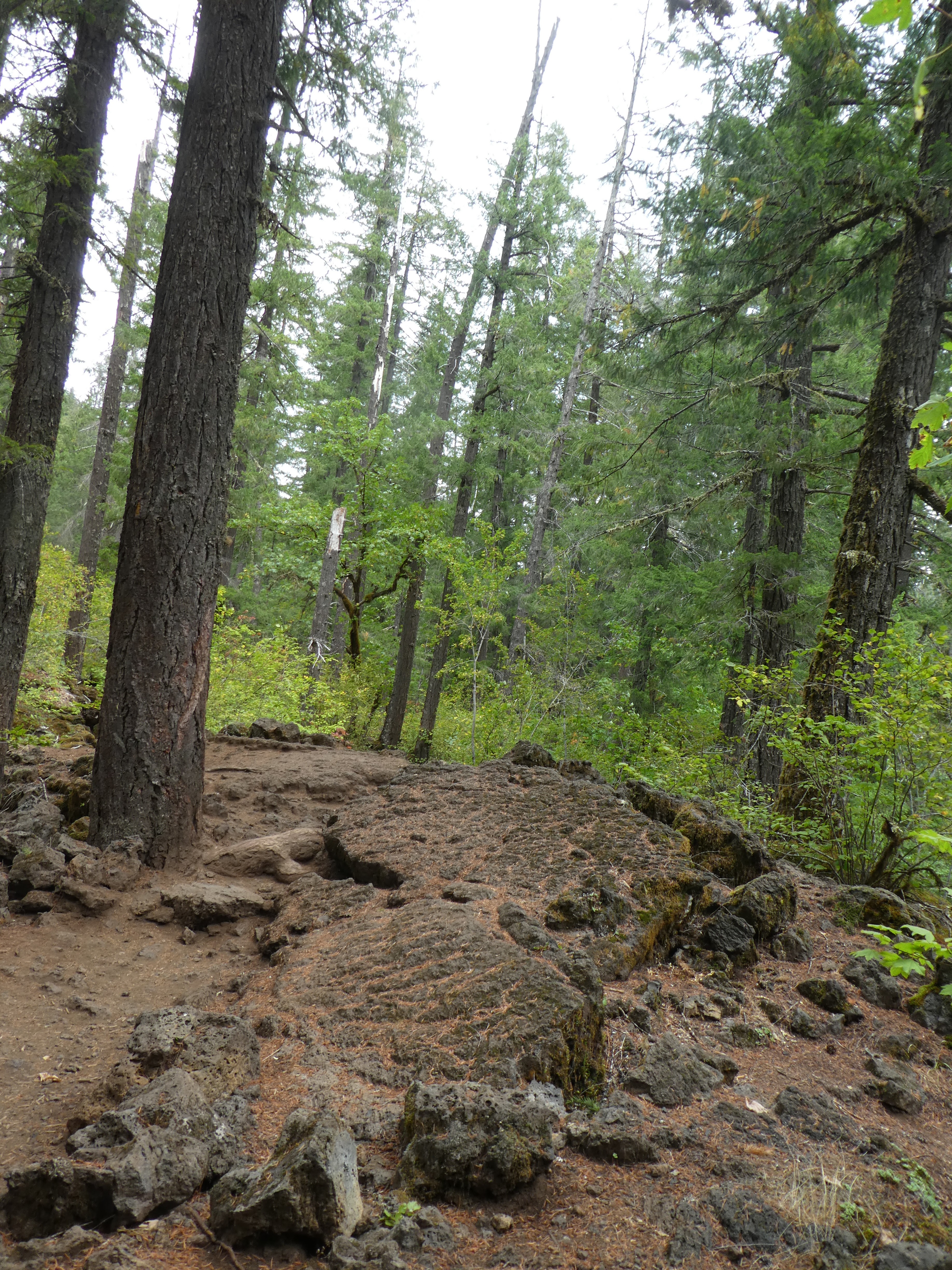
After a mile or so and a wide bridge made from a 5 foot diameter tree across a little creek we come to a change in the terrain. Things get rockier, the going gets more complex, and we are starting up an incline that is leading us quickly away from the level of the river. We are still beside the river, mind you, but it is now down in an ever deepening gorge. We have reached the start of an ancient lava flow and are now hiking through wonder #2 on this 3 wonder hike.


 |
| flow rippled lava |
Lava. This lava flow, though old enough to have 200 year old trees growing out of it, is young enough that the forms and movement of the molten rock are still very evident as you walk over it. This section of rock is raised above the rest and flat with wavy little patterns in it. It is easy to imagine this as molten and moving and then freezing into place. That section over there was probably the top of a Lava Tube. A hollow tube of lava that extended down the valley with a river of lava hot and flowing down the center while the top and sides cooled and hardened. When the lava river stopped, the molten lava flowed out leaving the tube standing and intact. For a while. But sometime over the centuries the ceiling of the tube collapsed into a jumble of rocks and that is what we are seeing now. Trees and bushes are trying desperately to grow in the jumble but the ancient pattern is still easy to discern.
The trail winding its way through this is pretty unique also. It seems like the trail has been carved right through this mass of lava flow, but I could not find any obvious signs of the carving. No sharp edges or things like that, and there are mature tree roots along the trail suggesting that only thing that may have been doing any carving is Nature and the many boots of tourists and hikers. My partner and I discussed it and we agreed that we couldn’t figure it out. It is clear that the trails had been cleared of easy to move debris, like bowling ball sized rocks, but unclear if anything more dramatic (like dynamite blasting) was done. Certainly the use of dynamite was common in carving some of the trails that go up the river valleys of the Gorge, so it isn’t a completely silly thing to suggest. Anyway, very nice trail, slightly more challenging than the Old Growth forest part. A good pair of boots is suggested.


 |
| Was this trail dug? Natural? Worn by feet only? |
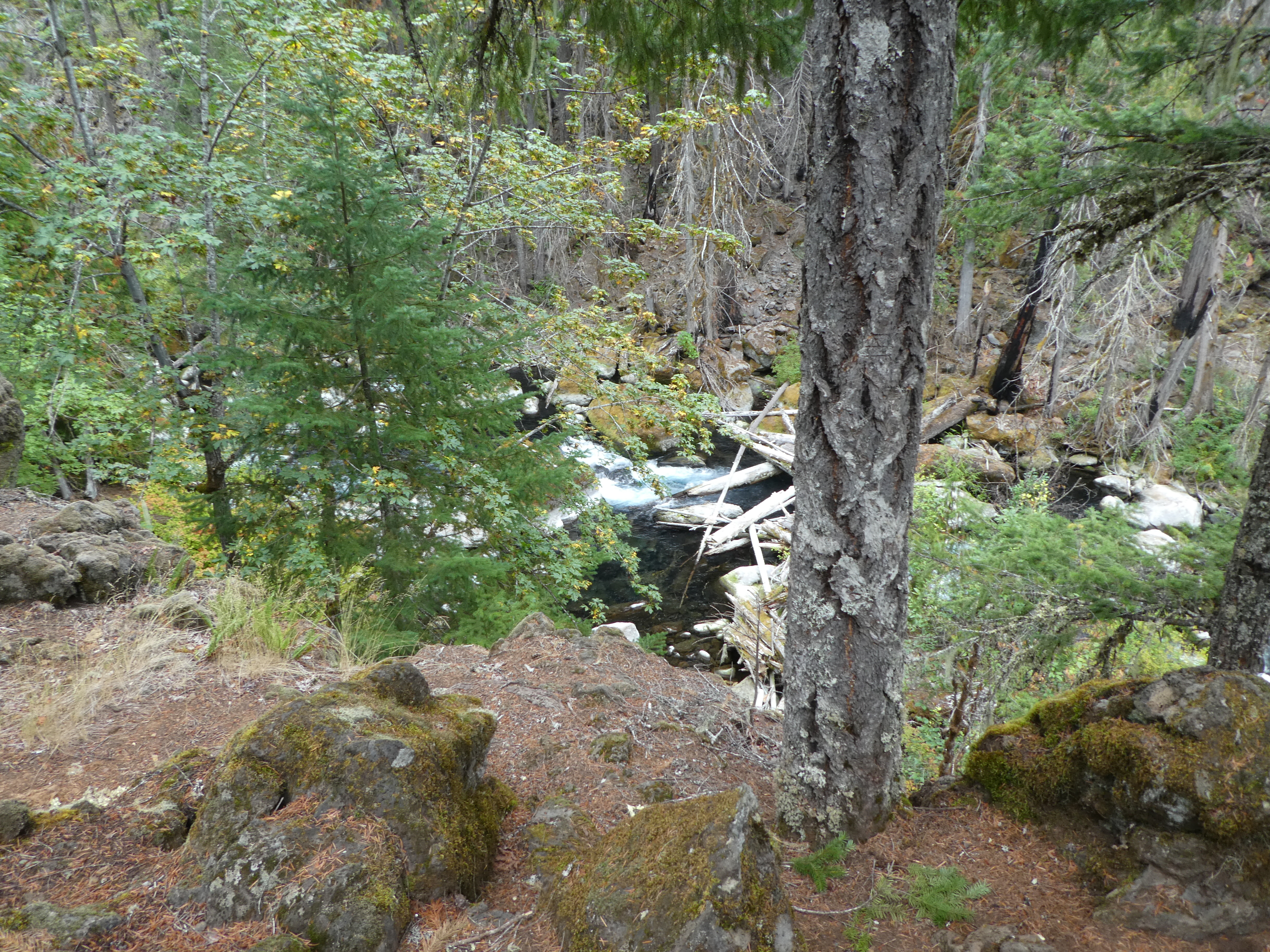
If a tree falls in the woods and there is no one around, does it make a sound? The answer is Yes, it makes a hell of a loud sound. We had a tree go down across the river as we walked by. No rain. No wind. It just spontaneously fell. We heard a CRACK and looked over and saw it break off and go down. And it fell down the gorge into the river. KABOOM. A much louder sound that I was expecting. How often does something like this occur? I mean, where people are around to here it? This is the second time in a couple of years that my partner has seen/heard a big tree fall. I have only had evidence of them. Like the tree wasn't blocking the trail on the way out and now it is...
This time of year there is also some fall color in the Vine Maples that congregate along the edge of the river cliff in the ample sunlight. We might be a week early for really good color, but we did see the occasional bright orange Tree. That also led us to see the towering cliff, going up a shear 100 feet on the other side of the river. Where did that come from?


 |
| The Dry Falls are Top Left |

 |
| I wouldn't sit there.... |

A really beautiful hike. I am so glad my Partner took me on this hike.

No comments:
Post a Comment