
I have done some hiking around the base of Mt Hood, mainly a few times to Ramona falls, but I have never done anything significant up at the timberline. I don’t know why. I guess I didn’t realize that the Pacific Crest Trail runs right behind Timberline Lodge nor that the PCT is part of a trail that circumnavigates Mt Hood at around the tree line. Both of those things sound pretty great to me especially since I had set this personal goal of losing enough weight and getting myself into good enough shape to go out and hike part of the PCT (I had not been silly enough to mentally designate a particular spot or length of spot, mind you. But at least one night).
Today we have some good friends visiting and they had a personal reason for wanting to go to the section of the PCT that overlooks Zig Zag river gorge. Zig Zag, besides the curious name, is a glacier on Mt Hood and so the headwaters for the Zig Zag river that comes rushing down from the mountain through Zig Zag (where lies the Zig Zag Inn and Zig Zag Café) and then into the Sandy River, which itself is coming down from a different glacier.

We pick up the trail in the parking lot for the Timberline Ski area. In the winter, this would be a big deal. There would be lots of ice and snow on the drive up from Government Camp, the (huge) parking lot would be full of snow and Subarus and you would need to have a Snow Park Pass on your window. But before Nov. 1, None of those things are true. The sun was out, it was like 75 degrees with a crystal blue sky, the parking lot was empty and it was free to park there. Mt Hood was looking positively naked with perhaps the least amount of snow I have ever seen there. Usually at this time of year they have already had at least a dusting on the mountain (it is Mid October 2022) (if you are reading this in 2042 you are probably thinking, ‘Wow, there used to be snow on Mt Hood. Imagine that’).

We parked at the trailhead and then made our way up through the Ski Lodge (for a bathroom) and so around the main lodge to meet up with the trail. In doing this we are passing through the main skiing area and under the ski lifts and such. It is a very different area with no snow. I mean, I have never been skiing here but I have looked down at the area from the lodge in winter. Everything is dirt trail with scattered trees. The dirt is white volcanic and glacial dust so there is a very Brown-and-Green on White effect. The trees are the low stubby things you would expect to grow right at the edge of the timberline and the area around the ski resort has had the trees with temerity to grow out in a relatively open area cut down so they wouldn’t be hit by a wayward skier. Timberline has a lot of big lifts. It made me wish that I had done some skiing here when I was young enough to enjoy it and, you know, survive. I had a little day dream of being a millionaire and buying up a few rooms in the lodge for myself and my extended family and then everyone going skiing and meeting in the lodge in the evening for conversation and dinner. It was a very short day dream because that was all I could afford.

Timberline Lodge is on the South(ish) face of Mt Hood. Zig Zag is off on the SouthWest. So we picked up the trail (it is marked in a few places) and made a left turn to head clockwise around the mountain. The lodge was built in an area that was already sparse of trees and had a more gradual slope to it. Probably because cliffs are so hard to Ski. We hiked through this area at first. There are many seasonal water courses that the weather has dug into the mountain. Most of these are dry as this the very start of the wet season. When the trail turns and dips into the little gully the area around you is open and you get a good view of the mountains and lakes to the south. I am not sure of the lake names. I thought I could identify Mirror lake and Trillium Lake, but then I decided that Mirror had to be more off to the right on the other side of Ski Bowl. Hmm. Once again I need some sort of map kind of thingee.
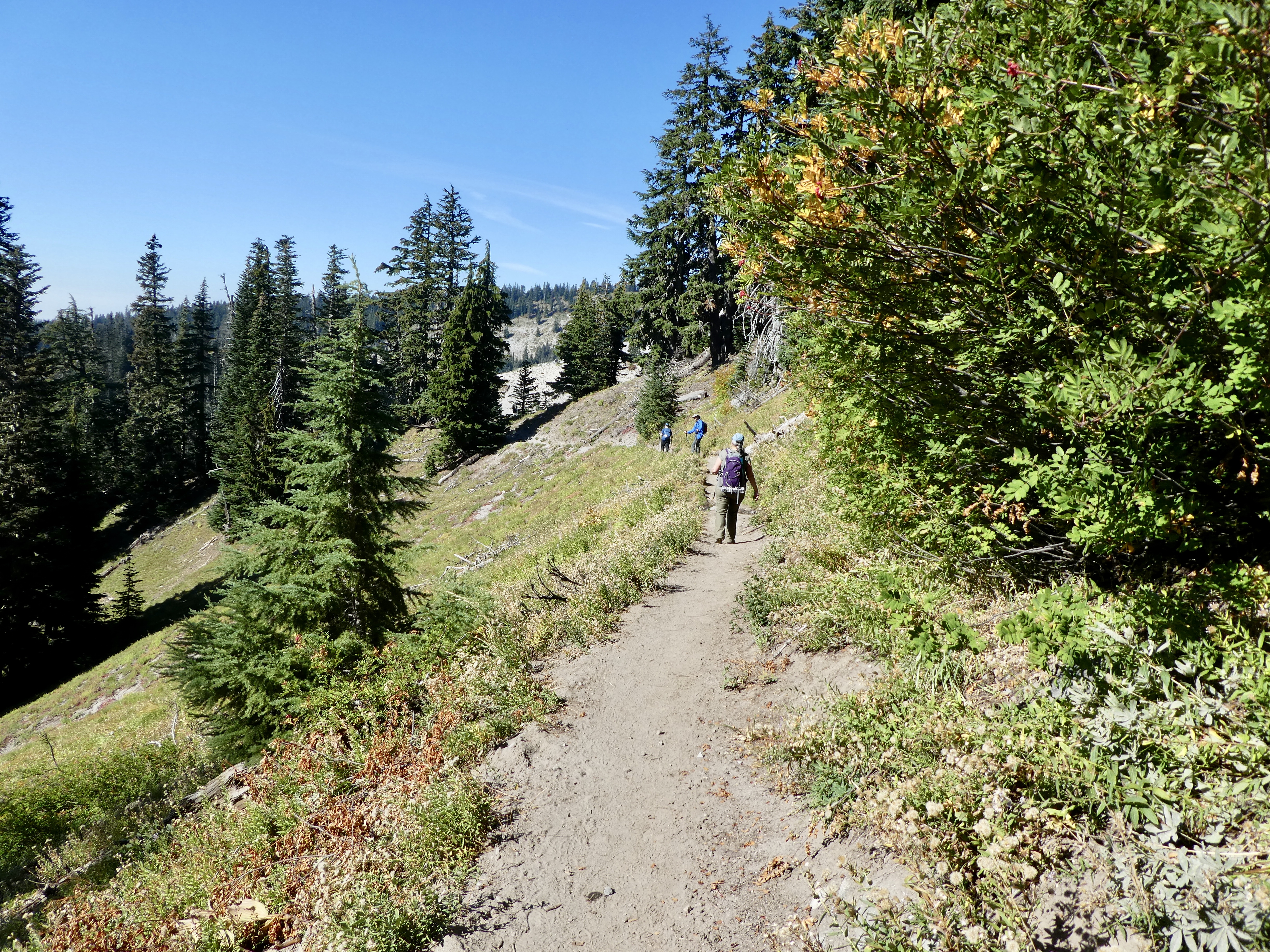
The trail does a little bit of a drop, perhaps a few hundred feet, during the course of the hike. But that is enough to bring us into a much more forested section of the trail. Bigger trees. All pine and fir. Lots of what is either blueberry or mountain huckleberry (no berries this time of year). On the big open areas, growing in the rock scree, there is occasional blueberry giving some autumnal color.


 |
| little zig zag |
About a mile in we come to a largish gulley that is still damp down at the bottom. This is Little ZigZag river (creek?). During the summer it usually has some water in it and the guide book says you have to use stepping stones to get across with dry feet. We only saw damp earth. It is about a 100 foot descent to the stream and then a quick climb out. The gorge is all rock and dust and boulders. There is some stone crop growing in patches. Was this all dug by the retreating glacier or is this just the result of water erosion?
At the top you get back into the trees and now you see lots of little flat areas where people have been camping. This is the PCT and lots of people do through hiking along it. If I was through hiking, I would have spent my night at the Timberline Lodge and not at a No Water site a mile away. But maybe there weren’t any rooms. We did hit one little creek that was making just enough water to fill a water bottle, so maybe people were walking over to that.
The next big gulley looks like it should have a bigger creek in it, but it is bone dry. I can hear a loud water noise however. We hike through the bottom of the gulley and start up and there down below us I can see a substantial creek, just coming to life in the middle of the gulley. The water was underground until then. This is the neat little secret of the mountain streams. The land around here is all glacial silt and volcanic dust and rock. Very porous. The water is seeping down from glacial melt and staying underground until it hits some solid rock base that forces it to the surface. During the high summer, where there is a lot of melt, it is probably percolating to the surface a lot further up the mountain, and places like this have running water. At this time of year, just before the first rain/snow, not so much.


There are signs up at the trail heads warning about crossing these mountain streams. They can be very dangerous when their flows are up because 1) They are very cold 2) They are faster and deeper than they look 3) they have largish rocks on the bottoms that make for lousy footing. People die crossing them on a regular basis. They recommend crossing in pairs using each other for support. They also recommend that you do your crossing of the major streams (like Zig Zag and Sandy) early in the morning. Why early in the morning? Because the streams are significantly smaller in the morning before the sun has come up and starts the Glaciers and snow melting. During the late afternoon the streams can be twice as large. Think about that, if you are doing an out and back you could cross in the morning with just a little difficulty and then get back to the same place at 4:00 and realize you are in serious trouble.
 |
| ZigZag River Gorge Overlook |
 |
| actually a pretty big stream, just far away |


We round another bend and we come to an obvious place to turn around. The trail comes right up to the side of the gorge over Zig Zag river. Down below, several hundred feet, is an active flowing creek. The gorge extends steep and rocky up to the right all the way to Mt. Hood. If you go up the ridge a little way to your right you will find a couple of trees and a good place to get out of the sun for lunch. This is also a good place to contemplate the mountain and the gorge. I realize that the gorge is all rock and dust except for a couple of outcroppings of green growth. Closer inspection shows that there are wet spots on the gorge wall around those green growths. Water is seeping down through the sand and dust and hitting a rocky layer, which you can see on the gorge wall, and then coming out into the gorge and heading down toward the creek below. Life is taking advantage of this permanent vertical spring just as one might expect.
The sun is high in the sky. The sky is an unadulterated blue. The mountain looks close and two dimensional against the bright blue backdrop.
On the way back we had just got to that little Zig Zag gorge when we heard a loud noise. Really loud. Clearly rock and/or water falling. Was it some sort of afternoon flash flood from the glacier? Was it time to hurry our asses out of this ravine? Then we saw it. It was a very large rock fall way up near the top of Mt. Hood. It fell from the big cliff into the main crater and put off a cloud of dust so large that it was about half the size of the top of the mountain. This is evidently why you don’t summit Mt Hood during the summer. Is that true? Such excitement.
 |
| See the Dust. The Fall was on the flat face on the right |

 |
| Note the ski lift towers about mid picture |
A lovely hike. We ran into a fair number of backpackers that all seemed to have European accents.
We had gotten a late start so it was around dinner time as we made the drive down from the mountain. We decided we would stop in one of our favorite little places for dinner. The Zig Zag Inn is right at the turn off for ZigZag road and is a lovely little log cabin building and a family business. They have a selection of homey food. Nothing too classy. Their pizza is good and I enjoyed their Pot Roast. I mainly like sitting in their main lodge room and looking at all of the stuff on the walls. The chandeliers are made from deer antlers. The eagle is carved from a Moose Antler. The giant pocket watch. Stuff. You can also get yourself a ZigZag Inn coffee mug or shot glass. What could be better? Now if I could only get them to advertise on my Blog…
 |
| The back side of Timberline Lodge |
 |
| a long walk to Mexico |
As a Post Script: according to my spell checker – Zig is a word. Zag is NOT a word. ZigZag is NOT a word. Zigzag is a word.
This is also the Guinness book of world records for the most frequent use of Zigzag.
No comments:
Post a Comment