
I haven't paddled in the San Juans for a decade and never on the American side. In Late August my paddling club (OOPS) did a 4 day trip to Orcas Island in the San Juans up North of Seattle. Take a look on google maps if you don't know the area. It is a bunch of small and large islands cut from glacier and tide and volcano and making up a delightful matrix of waterways that are protected from much of the ocean storms but still slip and surge with the wind and (especially) the tide.

Oh, but first. We have to get there. Though you can fly to Orcas, in a small plane or float plane, most people get there by riding on a Washington State Ferry from Anacortes. I have never ridden this ferry before and never ridden any ferry towing a Scamp trailer. So I was a little apprehensive about the journey. Things like: Did I get the right trailer length reservation? How early do you really have to be there to guarantee that you will arrive "At the front of the check-in line at least 30 minutes before scheduled departure".
For this particular journey it turned out that it was easy. We arrived about 70 minutes early and there was no line. We just drove up to the ticket booth and they processed us. Part of this is the ticket person using a measurement wheel to check the combined length of my Car-Scamp. I had said it was under 30 feet. Turns out I was something like 30feet 3 inches but the lady said she wasn't going to ding me for that. Of course, now I don't know if the next time I travel if I should say the same thing and expect the same thing to happen or what. How did I arrive at "Under 30 feet". Well, Subaru says my car is 17 and Scamp says the trailer is 13. But then.... you have a couple of inches of tow hitch and that is the rub.
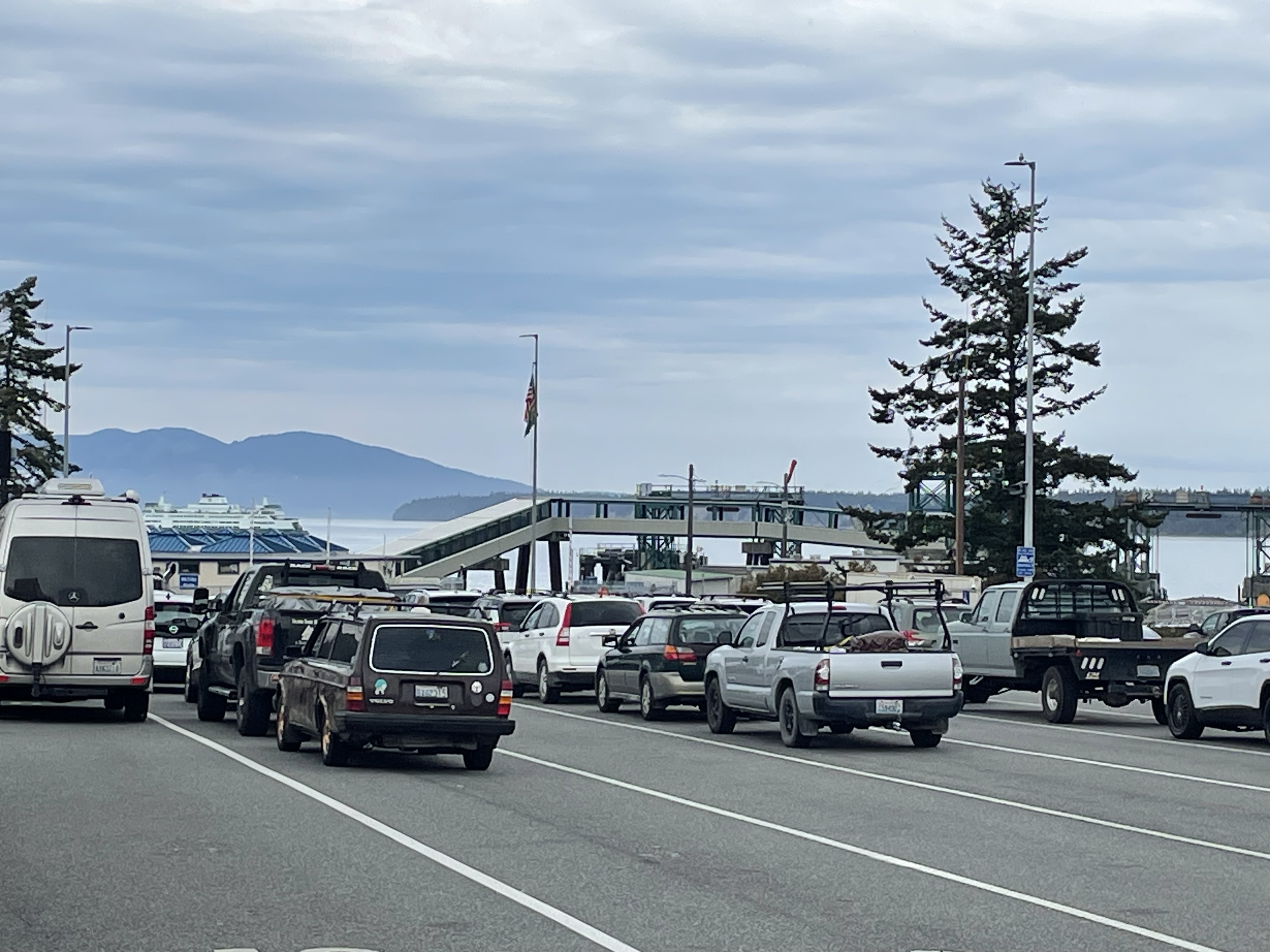 |
| In Line at the Ferry |
Anyway - when you arrive at the ferry terminal they put you into different lines that sort you by loading order. Normal sized cars go into one set of lines and they load first. The ferry we were on had 2 stories of car carrying. You drive up to the bottom deck and then the cars go up a ramp inside the ferry to the second floor where they spread out a bit and park.
Once most of the cars are loaded they start with the trucks and trailers that have reservations. Vehicles with reservations have loading priority. Doesn't mean they load first, but it does mean they have the guarantee of loading. The over-length and over-height vehicles (which often include cars with kayaks on top) load on the main deck. This deck has a very high overhead. It was easy to pull the car and Scamp into this area and park behind the huge truck in front of us. The problem was that once we were parked, and the vehicle behind us closed us in, it was difficult to get out of the car and past the other vehicles to the stairs that went up to the passenger deck.


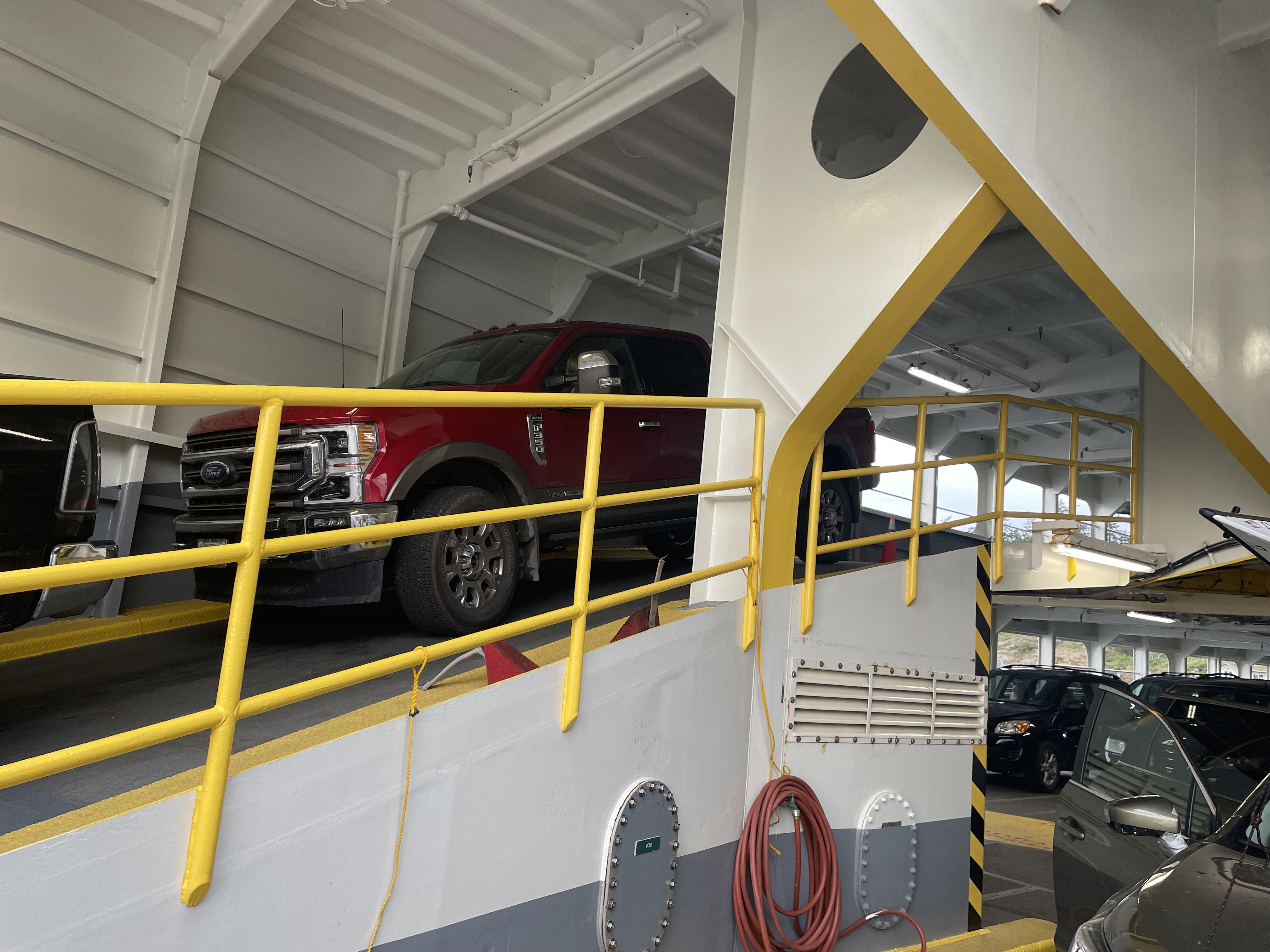

You really don't want to stay with your vehicle during the trip, though I think you could. It is much more fun to be up on the passenger deck where there is ample good seating and lots of windows to look out and seen the wonderful scenery of the islands passing you by.

The ride was about an hour and it was very smooth. In some places the channel is narrow and you get a good view of the rocks and trees and houses and such on the islands. We also saw many seals but no whales or Orcas.
Riding the ferry was great fun for me. Also, once on the ferry, I felt I had accomplished most of my trip obligations and so the stress was off.

We launched and proceeded across the sound to a small group of islands. I like paddling close to shore. There is more to see and the water is calmer and easier to enjoy. We were seeing seals a lot swimming around but very few other boats out. Paddling south down the west short of West Sound we saw a number of very nice homes built up on the cliffs.
We turned the corner going west and then had to pass through a narrow passage between Orcas Island and Crane Island called Pole Pass. Pole Pass is perhaps 50 feet wide and has a medium strong current through it that runs in different directions and speed based on the tide. Due to our timing, we had the current against us during both of our passages through the pass. Not a big deal, but it did string out the group a little. You also have to be more aware of motor craft when going through the pass since there isn't much room for larger boats and kayaks at the same time.


From there we struck out West across the channel going from Crane Island to Reef Island. We could have taken a more direct approach to Yellow Island by going south around Reef, but decided to enjoy the scenery and some protection from the wind by Reef Island. We turned south after Reef and head down to the next island, McConnel, where we stopped on a sand spit for lunch.

 |
| Shortest Portage and Lunch Spot |
While eating lunch we were joined by a group of tandem kayaks that were people out on a several day kayak trip with a professional touring company. I should say at this point that my club is known for going interesting places with an emphasis on safety. Everyone out in kayaks in our group today was wearning cold water immersion gear and PFDs (Personal Flotation Devices). In Addition, everyone in the group had demonstrated that they knew how to get out of their boat, should they be capsized, and be able to get back into their boat with a little assistance from another kayaker. It is something we practice a lot in the group, especially if you are a Trip Organizer (TO). We all were wearing spray skirts (so a big wave wouldn't necessarily swamp your boat) and several of the members were carrying VHF marine radios that could be used to call for help. The people on the tour, and the tour guides themselves, had pretty much none of this. They were wearing PFDs, but I don't know how you would have rescued them if they had gone in the water. It must be pretty hard to rescue a long heavy tandem and those people would have been getting pretty cold sitting in the ocean while the rescue occured. The group leaders were wearing jeans and sweat shirts, for gosh sake! In OOPS we say "Cotton Kills" and don't allow the wearing of cotton on cold water paddles. This is because cotton becomes more cold when wet. Something like wool or new high tech fabrics can still keep you (a little) warm when wet, but cotton just makes you colder.
After lunch, we did the worlds shortest portage and carried our boats the 10 foot over the spit to the Yellow island side. Right ahead of us was our destination, Yellow Island.


 |
| Care Taker Lodge and Original Owners dwelling |
Yellow island owned by the Nature Conservancy and access is restricted to one beach on the East side. We paddled around to the beach and then hiked up into the island. The island has very few trees on it compared to other islands and is being actively kept in a meadow state. The wild flowers are supposed to be really great here. There is a reason there are not so many trees here, but I don't know what it is. I may do more research later, so check back here every decade or so.


Paddling in the Ocean, even a protected ocean like the sound, is very different from paddling on the river. I am not sure I can quite say why but I find the long rolling swells and occasional confused waters on the sound to be more challenging that what I usually encounter on even big rivers like the Columbia. It takes a little getting use to.
I also discovered that I really don't like being out on a trip without my own chart to keep track of where we are. Even in a small place like the sound, it is easy to get confused about what little island is what and it makes me feel better to know where I am. I had thought that I would use my phone and mapping ap Gaia to track things. This is all well and good except that it had been raining off and on the entire time and my hands were so wet that the touch screen on my phone was not operational. May be time for a more updated phone since my partners phone was working just fine. Anyway, from now on I am going to try and have a paper (plasticized) chart on my fore deck.
The trip back to our cars was a retracing of our steps. The group paddled mostly together. It was a long paddle. We ended up going almost 12 miles and were pretty tired when we turned to make that last big crossing over West Sound back to where our cars were parked. And THEN we had to lift the boats up the 20 foot of stairs and onto the cars. Always try and save some energy for the whole boat loading on cars thing.
No comments:
Post a Comment