Eagle Creek with Youngsters
This weekend I did Eagle Creek with the
Intel Hiking Club. Eagle creek is probably one of the top 5 beautiful
hikes in Oregon (which means, top 3 in the Universe) and I like to do
it a couple of times a year. This trail was cut during the same time
as the building of the old gorge highway <link to Mosier twin tunnels hike> but there is some argument (between George, the hike
leader, and I) as to whether this was for amusement of the workers or
to spur tourism. Frankly I find both arguments pretty weak as this is
a long and awesome and EXPENSIVE trail. As we shall see. (update: Chip says the trail was blasted out as a recreation destination to help draw people out and showcase all the work that had gone into making the old highway...which was also blasted out in many places.)
I do a few hikes a year with the Intel
Hiking Club. Just enough to remind me that I really can't keep up
with 20 year olds. Of course, George is my age, and I couldn't keep
up with him either. But what I lack in speed I make up for in
botanical knowledge. “look, there is poison Oak !!!” too bad you
were 5 minutes ahead of me and already trailed your hands through the
stuff. (reminder to future self, never shake an interns hand). Oh,
because many of the summer hikers are Interns. Just at Intel for the
summer seeing what real life is like. They all look scared shitless
and walk VERY fast; as if they are trying to escape some horrible
fate.
One of the nice things about Eagle
Creek is that you go along way, and you are up pretty high, but you
never have anything killer steep. So I can do the 7 miles out to the
lunch spot pretty much with out a rest (which is good, because I burn
the rest stops just catching up with the rest of the club).
We start off down by the water as we
enter into the canyon.


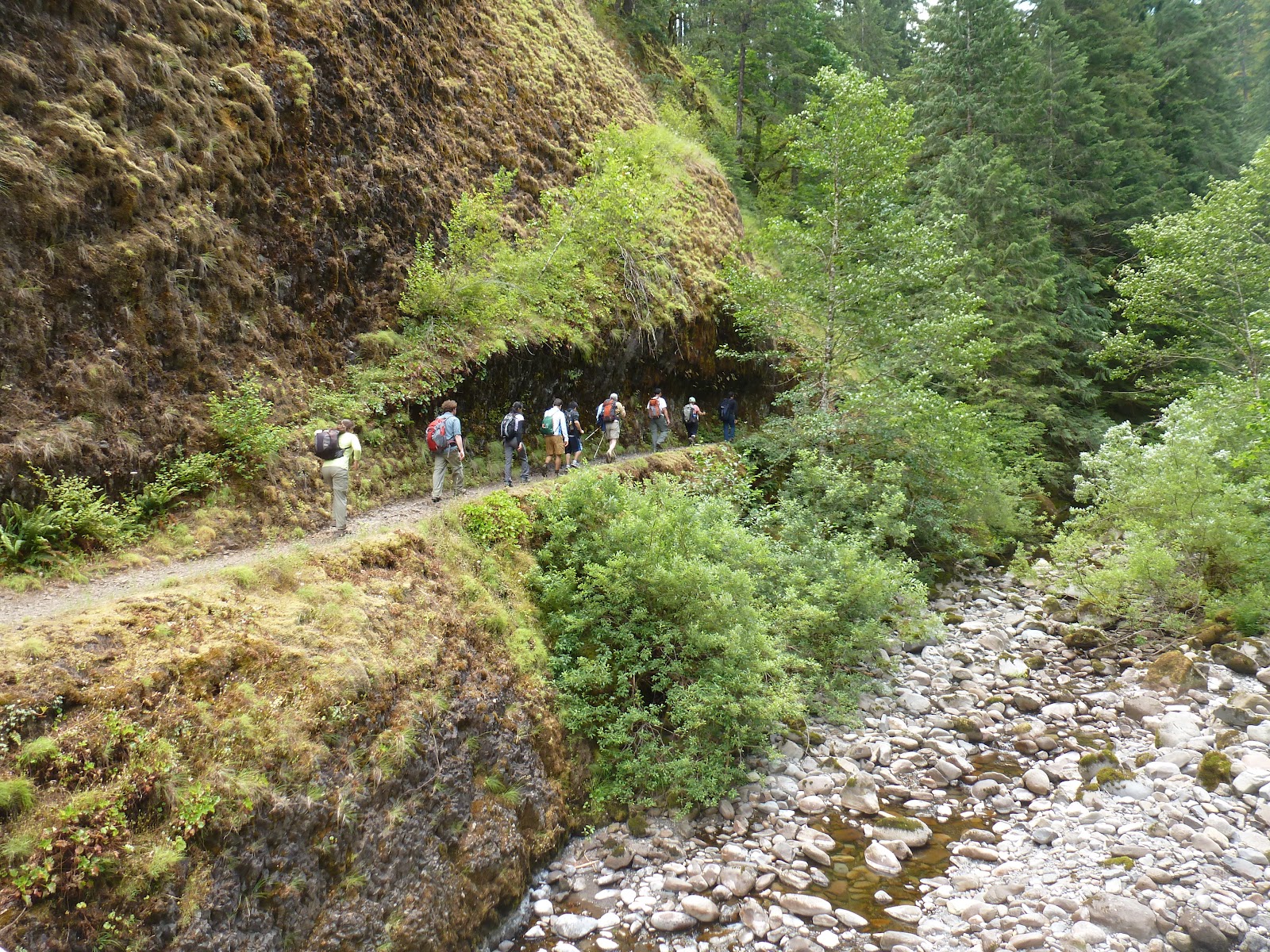
The first part of the trail is in the
forest. We will be in and out of forest on this entire hike. We will
alterante that with hiking on the thin ledge blasted out of a basalt
cliff. And I do mean blasted.

 |
| The cable is handy. The drop is 200 feet. |


The main attraction of this hike (along
with the cliffs) is the many waterfalls. Most of them have a little
turn out where you can leave the trail and get off to a good
overlook.
 |
| Melako (?) Falls |
 |
| No One seems to know which way to look. |
At punch Bowls, however, you can hike
down and really get into the water. I am told that in the afternoon
this is a favorite swimming hole for the locals. Beer and Nakedness
can be found. I looked around really hard for some beer but saw none.
Sigh. Perhaps if I come back later in the day.


The potential is certainly apparent,
there are LOTS of people on the trail. Many of them that look capable
of both nakedness and beer.
After we leave punch bowls we have
some more forest and cliff. And we start to hit some bridges.


 |
| Naked People Even Take off Their Shoes. |


and then we get to some fun stuff.
High Bridge.
No idea why they call it that.


 |
| Cool Cliffs over High Bridge |
 |
| What should we call this rock? |
 |
| This is not High Bridge |

High bridge is at the 3.3 mile point.
Half way out. Look at the cool cliffs over our heads.
This is where the legal camping areas
start. There are always tents out here, but I have never seen the
campgrounds completely full. There were a lot of people with fishing
poles on this trip. How did the fish get up here in the mountains?
A couple of final things to talk about.
Talus Slopes:
This is places where the rock side of
the mountain has erroded away into little (relatively) rocks that
have fallen down onto a 45 degree slope. (I bet they all have a
mathematical exact slope, but I don't know what it is).
 |
| Talus Slope. That is the trail in the middle |
Basalt Columns: These cliffs are
Basalt, and Basalt likes to form octangonal crystal. Even ones that
are 3 foot in radius.
<Where are my Basalt Column Pictures???? Must look at past hikes. Will fix this>
And just when you thought you had gone
far enough: Tunnel Falls.
And yes, they blasted a tunnel under
the falls.

 |
| From the Tunnel |

 |
| This ledge isn't big |

\


This is the scariest cliff by far. With
all of the people up here (must be over 100 a day on the weekend, not
to mention the Damn Dogs) it is a wonder SOMEBODY doesn't go over.
Hell, I have several old girlfriends that would have given me just
that little push....
Just a half mile beyond that is criss
cross falls. Also known as twister falls. Also known as “No Name
Falls”. Also known as “How can it be no name falls when people
have named it twister falls”. Or “Don't give me that crap, you
know why it can be no name falls”.
And “Do Not”
or “Do too”
and finally, “No Officer, I never
game him just that little push” falls.
I got some pictures:


 |
| This is actually a very high falls. |


\
 |
| Oh Look !!! Tunnel falls again on the way back !! |
After a very pleasant lunch (thunder in
the distance, but on a very few rain drops, and a nice cooling in the
air) we headed back to the cars. All down hill. George (the hike
leader) told everyone to go at their own pace. He told me he was tire
of keeping up with the young kids. Hell, I was tired of NOT keeping
up with them. I pulled out my trekking poles and I FLEW down that 6.5
miles back to the car. Did it in just at 3 hours. Pretty good for a
multi ledge trail with the occasional bikini.
And how long had the other hikers been
waiting for us (owners of cars) when we got back to the lot? “Oh,
about an hour”.
That was 3 days ago. I wonder if they
have made it back to Portland?


