Hi There.
Welcome to my descriptions, stories, and sometimes out and out lies about my weekend adventures around the North West. Though most of these are about Hiking, I may take you on some other outside adventures. Please leave me comments or suggestions and have fun.
On the Kenai Peninsula, the thing that dominates the (hidden) landscape and feeds all of the large glaciers is the Harding Icefield. This is a thousands of feet pile of snow that is on top off and behind a big circle of mountains. This is a wet area and a lot of snow falls up there during the winter. The snow gets very very deep and eventually the pressure of the snow crushes the lower levels into dense crystal ice. This ice, under pressure and with time, begins to flow down hill very very slowly. It creates a huge river of ice that moves perhaps inches a day but still forms a well defined and visible flow that cascades down from the mountains into the fjords and is what we then call a glacier.
Today we are going to climb partway up a trail that lies on the side of Exit Glacier, which is a popular hike in the Kenai Peninsula national park. There is a visitor center at the trailhead and as you drive the access road there you begin to see little marker signs with years on them that represent where the glacier was at a certain time. They begin around 1870 several miles from the visitor center. When you get to the visitor center you are around 1940. You come to the conclusion that the glacier is retreating very quickly and has been doing so since the very start of the industrial age. To me this implies that the initial retreat of the glaciers was more a part of the end of the last little ice age than global warming brought on by man. Of course, in recent times, this retreat has greatly accelerated and now the difference of 10 years is huge. It is sort of sad to see these huge beauties die this thawing death. Perhaps they are somewhat cyclic and if we humans can get our act together we will see them return. Well, Not anyone alive today, but perhaps some human.
As you go up the hike, your are very close to the side of the glacier, though you can’t see it for the trees. These trees were not here 100 years ago because the entire area was under a hundred feet of ice. You can see the effects of the ice in the stone you scramble over as your wind you way up the steep hill. In many places the large bolders under your feet are etched flat and smooth by the sliding ice.
Hikers out on the glacier
The trail is a bit difficult in places, much of the trails seems to be built an old watercourse that probably came down under the glacier. Lots of broken rocks and haphazard but natural steps going up the cliff side.
About halfway up the trail we come to a viewpoint called Marmot Meadows. We stopped there (along with many others) to enjoy the view of the glacier, eat our lunch, and to decide if we could do the next bit of the hike that featured a even steeper cliff climb. We decided that we didn’t have it in us this time and turned around and started by down the trail.
There had been reports of a she-bear and her cubs on the nearby hillside but we did not see any sign of them. We did have bear bells and bear spray in our party, however, and were rather stringent about making sure people hiked close to a person with deterrent. Many other hikers were carrying automatic pistols. Very strange to see a Colt 45 or a Glock strapped to someones chest as they hiked with their family. Though I have heard it said that you can’t stop a grizzly with a pistol, I am thinking that they sure make a lot of noise and perhaps just shooting it in the air would scare away most critters in most situations.
Still…. It is a little strange to be walking a trail with young men that are carrying pistols at the ready.
On the way back to town we stopped for a view of glacier from across the valley.
To get maximum enjoyment out of a visit to the Kenai Fjords and Glaciers you evidently have to go twice. Once on a spectacular day where you can see for miles and the ocean is flat and your tour boat can go fast and stop in lots of beautiful places, and once when the weather is normal and the mountains are hidden and half the people on the boat get seasick. We were lucky enough to have the spectacular day but we were warned that we won’t really appreciate what a wonderful experience we have until we come back another day and have a more normal experience. Got it.
That said, you want to hear what a numero uno, ichi ban, number one experience is like?
The Kenai Fjords National Park is the sort of south middle of Alaska near the fishing and shipping town of Seward. Seward itself is on the end of a long glacier carved Fjord with mountains on both sides. This means that the water is deep and just about always calm and protected. This make Seward a historically important port for bringing in supplies for Alaskans that were then shipped by Alaska Railroad to cities and points north. You can’t really ship many goods by train or truck from the lower 48 because of that Canada thing.
Anyway, Seward is also the boating hub for vacationers and adventurers that want to see the national park by water. This is one of those places where you can do things like kayak up to a glacier and watch the giant ice bergs calve into the water and put out waves that swamp your kayak and kill you. Actually, I think there are better places in Alaska for that, ones where Cruise ships can get closer to the glaciers. These glaciers you can’t really get close to in a large vessel because of the water depth. More on that later.
We got on our vessel promptly at 08:00. We were so prompt that once the captain had taken role call he announced that we were all present and might as well get this show on the road a half an hour early.
Our boat was named the Viewfinder and it was a single deck (covered) ship that would hold perhaps 50 passengers. I think we were more like 35 passengers on this day, so we were not crowded. The ship had a little galley where you could get snacks (featuring your favorites from CostCo) and a little bridge above that. There were 2 crew (the captain and the guy that ran the snack bar and lines) and the vessel cruised at a top speed of around 22 knots. We negotiated the harbor and then the captain spun up the engines and we went flying down the length of the Resurection Fjord. Seward is on the North side of the end of the Fjord and we cruised down the South side. This is all glacier carved landscape, it is very steep to from the top of the local mountains right down to the bottom of the sea. This means that there was deep water pretty much all of the way up to the rock facing and the captain took advantage of this to give us close up looks at the passing landscape. Once you get away from the city, everything is barren of human life. There are no roads or electricity out there. The very few dwellings that you see have been built and are supplied from the ocean. We did see a couple of nice places and a couple of summer cabins. What would it be like to spend a winter out there? I am guessing it would be cold.
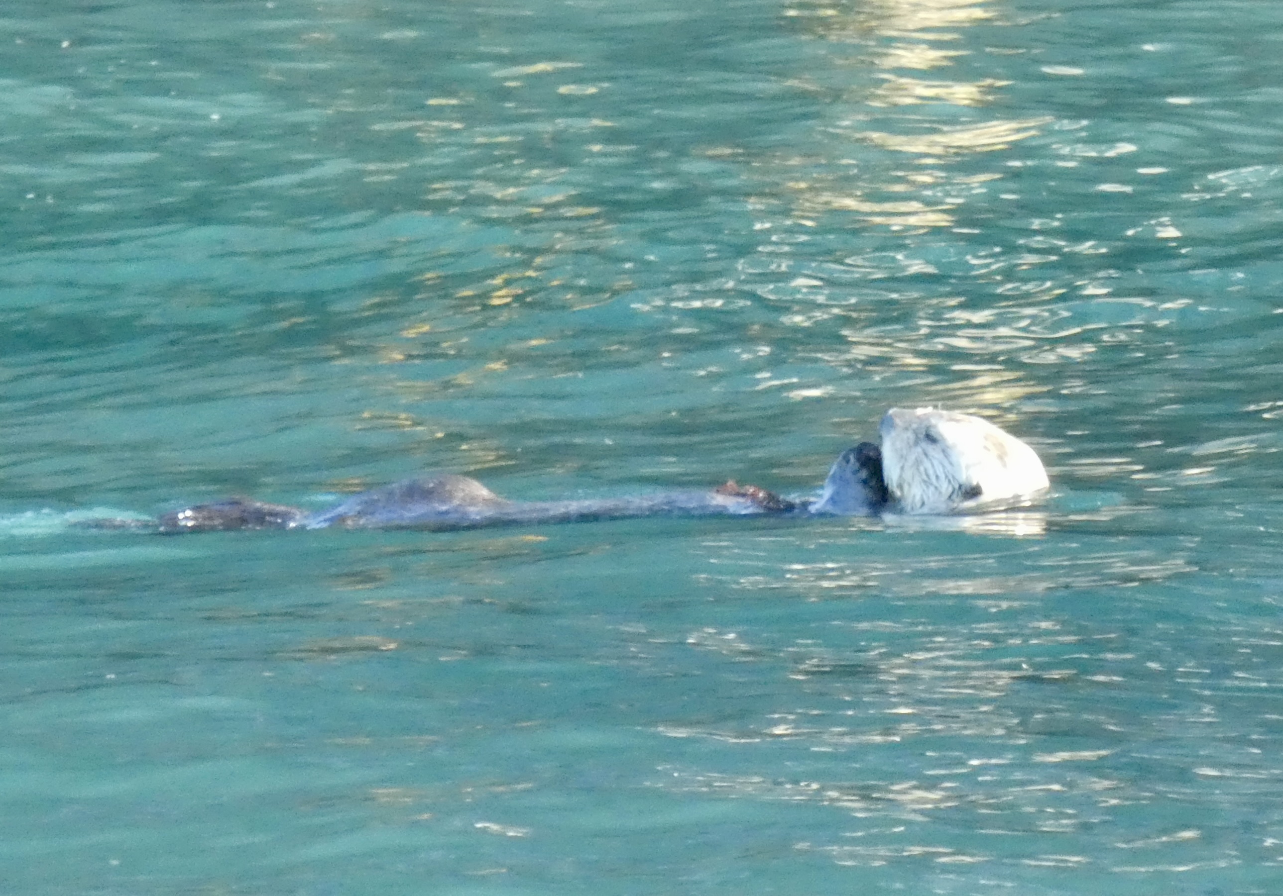
One of our first stops was to watch a sea otter feeding near the coastline. The skipper just stopped the boat and we floating and everyone left the cabin to crowd the port rail and watch the cute little sea otter. Then we motored across a little bay to a place where the skipper could put the boat right up against the local rocks and we could see the cliffs towering above us and watch a little waterfall come down the rocks. We did this sort of thing at a few different spots throughout the day (did I mention we were on the 8.5 hour tour?).
Our next view was of a low lying flat island covered in the stumps of old dead trees. This is the remnants of two geologic forces. First a glacier left a large moraine at this point which stuck up out of the water enough for local trees to grow. Then, in 1964, a great earthquake caused many areas to subside and sink up to 2 meters. Easy to imagine that a moraine island, made up of a pile of glacial stones, could settle down lower after a good 8.2 shaking. The resultant island was under salt water enough of the time to kill all of the trees and preserve the stumps and so there they sit as either a part of or adjacent to Fox Island out at the entrance to Resurrection Bay.
The rest of Fox island is also somewhat unique in this area as it is made from layered sedimentary rock that has been pushed up and driven sideways over time. Much of the rock in other areas is granite or basalt.
We had one more little stop on the bay side islands to see an established Eagle nest and the large eaglets there. I am guessing they ready to fly the nest if they had not already done so a couple of times.
Here is some live action for you, put you right on the boat:
Now we set out across the Guly of Alaska. This is open ocean, a straight line 5 thousand miles to Hawaii. This crossing can be quite rough for a boat the size of ours and explains why pretty much every passenger I sawy (including my little group) were wearing scopolamine patches behind our ears. They also sold various remedies OTC on the boat. Some of these were things like special mints and pressure point bracelets. The first mate did tell us that none of these things would work once you were sick. They were all preventative. Today, however, the ocean was flat and loving and we zipped across this expanse of water in half an hour with very little boat roll.
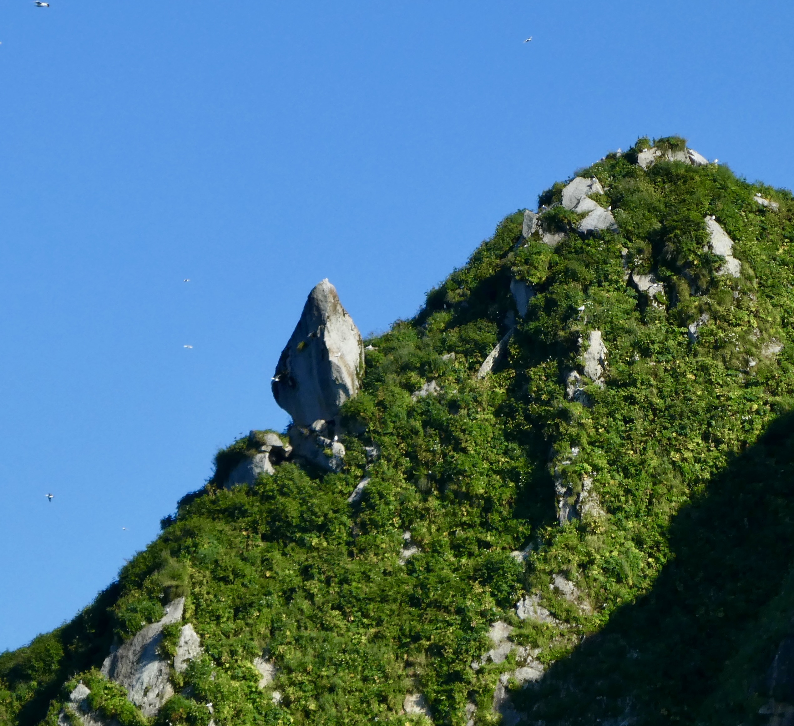
Out on the edge of the Ocean and the border of the National park is a little group of islands that is a unique home to millions of sea birds and some large aquatic mammals. The Chiswell island lie just a mile or so offshore from the Harris Peninsula but they are isolated enough to provide safe nesting for many creatures. We saw a number of Puffins, the rock dwelling TBD and the tunnel digging Tufted (also TBD) as our boat floated up close to the island sheer rock faces. The Chiswells also have a few favorite Stellar Sea Lion pull-outs. These are places where the island shoreline is gradual enough for the large mammals to pull out onto the rocks and catch some rays. One point, which was on the land facing side of the island so not exposed directly to ocean storms, was also the only known Stellar Sea lion rockery. The only place known where the Stellars mate and give birth. The males (more than twice the size of the females) come up on the beach (the rocks) and claim a section and then the females seek them out to mate. The males may not go back in the water for months, which means they don’t eat for months and may loose half their weight during this process. These males are called BeachMasters.
We say 3 or 4 males, perhaps twice that number of females and a about the same number of juveniles laying on the rocks or playing in the sea.
In the distance one of our tour members spotted a blow and yelled up to the Captain that there were whales off in the nearby ocean. But the Captain was all over that. He was probably on the radio to some of the other boats that were over by the whales and he told us he was waiting a few minutes until the other boats had had their time and cleared out of the area.
We finally headed over. There were a lot of blows going on a half mile away across the water. More than 10. As we approached it became clear that the animals were doing more than just swimming through. They were bubble net feeding. This is a rare behavior where a number of humpback whales get together to herd and feed on small fish. Humpback whales are baleen whales, filter feeders, and they rarely get together in large pods except for this specific behavior which appears to be a learned behavior which is traveling north up the coast of Alaska. The whales dive down and one whale takes the lead. This lead whale will swim below a school of small fish (sardines?) and circle them while blowing bubbles up from below. As the curtain of bubbles rise, the air expands and makes a larger barrier. This upwelling air scares and perhaps even stuns the small fry and drives them into a clump. Meanwhile, the group of whales are rising with the bubbles and now the open their mouths and erupt from the water 3 or 4 forming a tight cluster and getting big mouthfulls of fish.
From the surface, it is hard to tell what is going on . The whales are swimming along and blowing and showing their flukes and then they all dive. Side Note: Did you know that humpback flukes are unique to an individual. They can be identified by the black and white markings and the shape of the fluke. Really. The whale watching boats carry books of pictures of all the known individuals in the area and track them with photographs through a humpback fluke tracking website. End Side Note. Now the whales have all gone under and they are going to stay down there getting set for a couple of minutes. No telling where they are. Not telling where they are going to surface. No telling unless you are a huge flock of thousands of seagulls must waiting for small fish to be driven to the surface. In that case, you will be flying around and will see the bubbles and the whales coming to the surface and you will scream and cry and go flying to the right place for humans to point their cameras just as the whales come up, mouths agape, breaking the surface which much alacrity.
Our boat sat quietly with the engine off for much of this exercise, The first mate put a hydrophone over the side and we could hear the whales making their hunting noises. They have identifiable signals as to when to perform various parts of the maneuver. I wonder how they decide who gets to be in the middle at the end and get the big gulp of fish.
OK, time to move again.
During a normal (not wonderful) day this is the part of the tour where the skipper would duck in between Granite island and the mainland to stay away from the blast of the Pacific Ocean. But today, the whole world is calm and so he takes us blasting down the seaward side of the island. This is a steep to island with very little big vegatation on the seaward side but lots of trees on the protected side. Halfway down the island he takes us into a little bay that he says is rarely accessible. Another chance for him to get us into a close little bay and demonstrate his skill of boat driving by putting us up against the sheer rock faces. Such fun.
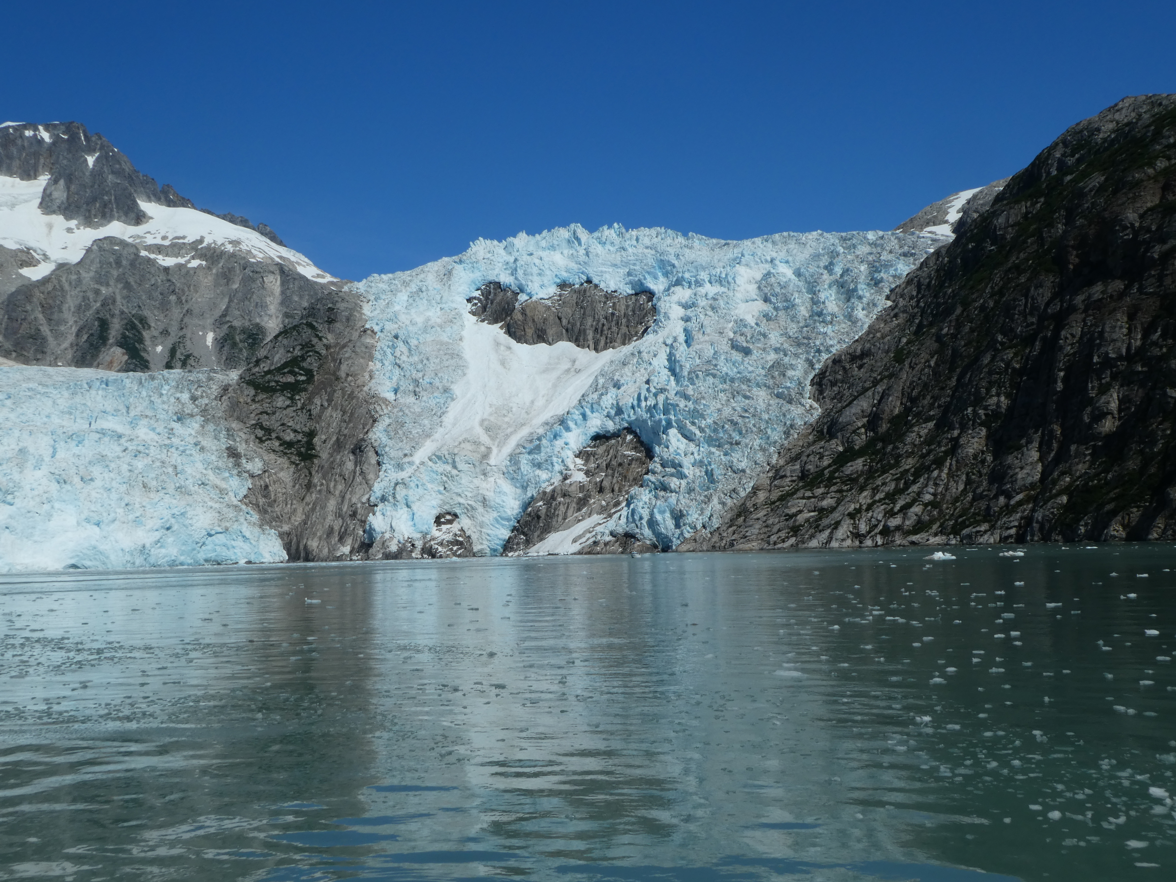
Now it is time to get on to the star of this show, the Northwest Glacier.
I should tell you the Glaciers Story.
During the last Ice Age, the Glaciers ruled the northern continents. Where the town of Seward is there was 4,000 feet of ice which flowed down from the Harding and other ice fields and flowing down the fjords and cutting them sharp and deep. The ice age ended and the ice receeded. Then a couple of centuries ago we had a little ice age and the ice came back a little bit, enough for the tidewater glaciers to flow out from the ice fields for several miles past their current positions. The Northwestern Glacier flowed out to this one point in its fjord where it sat and calved ice and rocks for a century or so creating a terminal moraine out toward the middle of the length of the fjord. A moraine is a pile of rocks and debris that has been swept down by the ice, well perhaps bulldozed down by the ice and has either been pushed to the side of the glaciers (like a road grater) or pushed on down to the terminus of the ice, the terminal moraine. The Northwestern Terminal Moraine is in the ocean and comes up almost to the current sea level and blocks most of the width of the fjord. This keeps large boats from approaching and even our middle sized tour boat had to go way around to the deepest location to make it across this barrier. The fjord on the other side of the terminal moraine is deep again because the ice receded so quickly and so far. On the approach to the current position of the glacier, there is this 1000 foot high island that was unknown before the 1950’s or so. This 1000 foot above sea level island was completely covered by the glacier. This means the ice was more than 1000 feet high as it swept over and around the island. We past a little side glacier that used to be part of the Northwestern but is now its own flow of ice.
The captain had to motor slowly up to the glacier as there was a lot of ice floating in the bay. None of it was house size but there were quite a few refrigerator sized chunks and they made a loud noise when we bumped against them.
It is very hard to get a feeling for scale when you are up close to the glacier. Things appear to be small because you have nothing to compare the size of the ice to. Then I saw a small piece of ice calve off of the main glacier. It fell as in slow motion and then hit the water. A second or so later the sound reached us….. BOOOOOOOM. It sounded like a cannon going off. That piece of ice must have been bigger than a car. This happened a few times while we were there. Nothing really big that would make a wave or anything like that, but lots of booms and grinds and crashes.
When we were sitting there (and we were floating in front of the glacier for almost an hour) the captain kept the engine turned off as much as possible so we could enjoy the noises of the ice.
The other feature here was a large number of harbor seals that were sunning themselves on the flow of floating ice that was just in front of the glacier. The water in this area was a slightly light blue color, from glacial silt, and was very calm. We are several miles in to the fjord at this point and protected from wind and wave action. The only wind was the occasional katabatic wind blowing down off the ice.
We started back. Passed a few swimming sea otters. Had another chance to go into a little cover and look up the close cliffs as the water falls came streaming down the rock.
But, in truth, we were all starting to get a little tired. Still a long way to go to get back to our hotel, however.
We came across another couple of humpbacks playing in a bay. The captain thought they might be a mom and her (older) child. Then we saw a goat on the beach. The captain thought this was really cool but I just thought it was a goat.
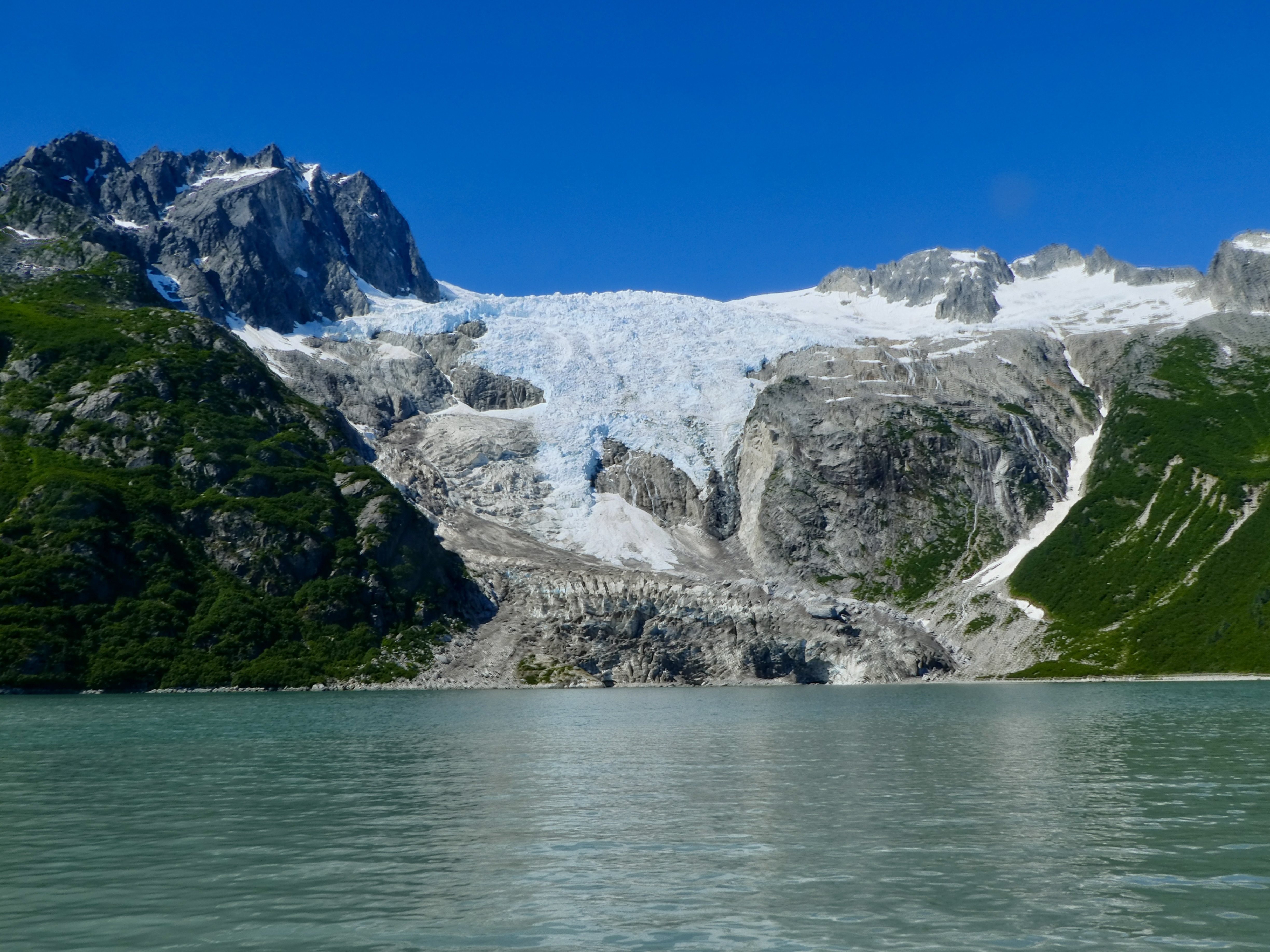
We past another big glacier, the Bear Glacier. This one's terminal moraine had create a little barrier island with a bay behind it that the glacier was calving big icebergs into. We could see the tops of the things floating there across the moraine dam.
Here are some more pictures. I want to get off the boat now.
The Cove Palisades State Park is, in general, down close to the river. Down in the canyon. But there are a couple of parts of it, called "the Island" and "The Peninsula" that are up on the level of the top ancient lava flow.
The Island is strictly guarded area and is the plateau between the Deschutes and Crooked rivers with its tip at the historic confluence of those rivers (now dammed lakes). What makes it an "island" is the fact that the flat top of the plateau is seperate from the other parts of the high desert that are above the canyon. Turns out that the Platea is geologically different that the other high dessert flatlands and was created by an inter-valley lava flow. And no, I have no idea what that means. But it is lower.
The Peninsula also has The Deschutes and The Crooked on 2 sides of it, but its main side is connected to the rest of the high desert (you an drive there). The vegetation and terrain, however, are very similar to that of the Island and you can see down onto the Island from the viewpoints up on the Peninsula.
Today, myself and Rory the wonder dog, are going to climb that state park trail up the rim of the Peninsula from the Deschutes upper day use area and boat launch. We dropped Paige off at the boat launch for her to do a paddle with the OOPS club while Rory and I have a puppy/dad hiking date.
We are hiking the Tam-a-láu Trail. There seems to be some argument as to where this trail starts. There is a trailhead marked in the boat launch parking lot, but there really isn't any single car parking there (don't know if it matters). The real trailhead is over in the C loop of the Camping Area, but there is really no place to park there. I would recommend parking in the car parking for the upper Deschutes day use area and then follow the path (or road) the short ways to the camping area. You will see the trailhead sign. Of course, if you do start at the boat launch parking area you get to hike through a rather nice boulder field.
Today I am hiking with my friend, Rory the wonder Dog because my usual hiking partner is out kayaking with our OOPS friends. We just dropped her off at the boat ramp and then headed up the trail. The cove palisades A,B, and C camping loops are down in the valley below the Peninsula. The trail climbs from the canyon floor up through a lot of scree and boulders to eventually end up in a loop around the Peninsula.
This is not a difficult trail to hike, though there are a couple of hairy places, especially if you have problems with heights. From the official trail start at the Loop C dog park, you climb over some rolling hills and then overlook a wide little valley strewn with large boulders that have come tumbling down from the rock face 800 feet above. Some medium sized trees and brush in this area. Also a number of switch backs with wooden steps built into some of the most steep places. These steps are the first hazard as the dirt fill around them is heavily eroded and the steps themselves are often to high for comfort (I had a bitch coming back down). But you wind your way up pretty quickly and then turn off what looks like a seasonal creek to head along the edge of the cliffs still below the top of the plateau. This time of year I am seeing many of the beautiful yellow balsamroot flowers.
Basalt Cross-section on the Rim across the river
Now comes the area that is steep too on both sides and can be a bit of a slipping and falling danger. The trail is loose gravel. My puppy has no problems, however, and we go right up this section until we arrive at a little depression below the main plateau. This is our step to get up top. Just a couple of more short switchbacks. This little area must hold some of the local water because there is more vegetation here that up top. Keep an eye on your dog when you are out walking, this area has warnings for rattle snakes. She did pull me off at one time and I saw a snake that I pulled her off from. But on seeing it it was clearly not a rattler. It was a gopher snake or something like that, about 2 feet long. So we zigged back up the last little bit before the top and hiked past a nice tree overhanging the trail and making a perfect shady spot for lunch. We will come back here later toward the end of our hike. Much too early right now.
There were a number of people out hiking. A few groups doing the entire 6 or 7 mile loop. I didn't have time to go that far so Rory and I just headed clockwise around the loop to quickly get to the couple of over looks that had the best view of The Island.
The top of the plateau is very flat and looks like much of the high desert in the vicinity. Scrub pines and perhaps creosote bushes. Some little flowers. The trail had been very muddy in the last few weeks and there were so good deer tracks running through the now rock hard mud. This part of the hike, the loop around the top, is all close to the edge of the cliff, so you always have a view of something. The canyons and lake, the snow covered Cascade mountains, the surrounding high desert. It is a lovely place to visit.
We went about a half mile to the closest good outlook. From here we could see across the chasm that is where the A,B, and C loops are for the park. This is a wonderful view of "The Island" which is the plateau between the two rivers. This flat area is not readily accessible from anywhere and is a bit lower than where I am hiking as it was created by a different lava flow condition. If I understand the geology report correctly, the island was formed by lava flowing down the river valleys and then over between them. I really need to investigate this more.
On the way back down, Rory and I stopped under a shady bush for some lunch. She didn't see it, but there was a snake just like that previous snake (perhaps the same one) just lazing out on one side of the trail. We sat down about 10 foot away from it for out lunch and some water and that snake didn't move the entire time. I have heard that snakes have no scent, and that would explain why Rory never noticed it.
Back down we go. Those wood plank steps proved to be much harder for my bad knees going down then they were coming up but I guess that is the way of old knees. Rory didn't seem to notice them.