Wednesday, August 9, 2023

Fort To The Sea Trail


A 15 minute drive from our campsite at historic Fort Stevens state park is the even more historic Fort Clatsop. Never heard of it? It is the place that Lewis and Clark spent their last winter after completing their epic journey from the Eastern baby United States to the pacific ocean, exploring the newly acquired lands of the Louisiana Purchase.  It makes sense that this place would be close to where we are staying since Lewis and Clark came down the largest West flowing river, The Columbia, and we are camped at the mouth of the Columbia. Clark and Lewis paddled their canoes up the little tidal creek that was just before the big turbulent mouth of the river. I need to check my history but what I remember is that they wintered near a settlement of indigenous peoples. They built a sort of lean-to structure that may have had a small perimeter fence. They called it Fort Clatsop sort of in the manner that I called my structures of sticks out in the woods a ‘Fort’ when I was 8 (Mine was called 'Fort Maple').

They spent the winter sitting in the gloomy rain of the Pacific Northwest, hunting Elk and Deer, Salting said Elk and Deer, and trading with the locals. I am sure the spreading of venereal diseases was one of the common pastimes.  The other big thing they did was to hike the 6 miles over the small mountain ridge to the ocean, where they kept a couple of guys stationed in some little shelter. These guys job was to keep a driftwood fire burning in order to boil seawater and make salt. The salt they needed to preserve the hunted elk meat that they needed for supplies to travel home. They shot over 130 Elk and hand stiched together over 300 pairs of elk skin moccasins. I am guessing you wear through those puppies quick on a long walk back to Virginia. Did they bring a big pot to boil the sea water? Or did they barter for a clay pot from the locals. There was a suspicious sign near the National Park that said “Clay Pit Trail”.  Evidently they used small pots they had brought along.

National Park? The area around where the Fort Clatsop is located is now a National historic area. It has a nice (currently under renovation but due to open next week) Visitor Center (where I am sure I could clear up my history questions) and a copy of the Original Fort (that I think was made from drawings and descriptions left behind in Lewis and Clarks notes). If I make something up, but then it turns out to be right, is that really making something up? 

Today we are going to hike the trail that the expedition people hiked to get from the Fort to the Sea. This was probably a trail used by the indigenous peoples at that time. Today it is a amalgam of different trails and roads and narrow rights of way that winds its way through a patchwork of different terrains. 

You start off near the Visitor center hiking through flat and pretty standard Sitka and Sword Fern. The trail is a standard woods trail and nice hiking. You cross the road the climb up a little hill. At the top of the hill is another trailhead, this one evidently for bikers. There is a bathroom there and a parking lot. There is a link here to other trails that head on up the Lewis river. We follow the main trail which is now a graveled path wide enough to be an old jeep track (which I suspect it is).  You follow this track for around a mile. There are side trails leading off that I may want to explore on some other day (the Kwis Kwis trail, in particular). The Gravel (bike designated) trail ends at the top of the hill and a nice overlook. There is a sign at the overlook that tells of the history of the North West facing view that you are enjoying. It mainly says that the lumber companies cut down all of the trees. The trees consisted of many varieties and species that are required to live together and make a healthy forest. In their place the lumber company planted only Doug Fir, which is relatively quick growing and good for the lumber industry. Then the Forest Service acquired the land and they are now in the process of naturalizing the area. In The Future the land will be all happy and natural again. Trust us. We won’t loan it  back to the lumber companies in 100 years for them to use for a few months or nothing.


Wow. Where did that come from? I don’t know, because just after this lookout, you enter the nicest part of the trail. Another 2 miles of wonderful descent through mature growth. Big nice trees. Shady walk. Lots of deer fern and sword fern and Huckleberry.  After a while you descend into a more flat area that has little fens areas with skunk cabbage and devils club. It is very pleasant and good hiking. There is some water flowing but not enough to filter for drinking at this time of year. 


a Nice bridge across one of those rolling dune lakes

A Maze of Cow stoppers

x


The coast in this area is built of cycles of sand deposits that create repeating lines of high dunes and low areas. The further you get from the ocean, the more the dunes have become covered in dirt and are growing trees and such. The low areas are usually meadows, marshes, or cute little finger lakes, like the one at our camp where we went kayaking the other day. 

We now descend into this area. There are a number of nice bridges on the trail that you use to get across some of the largest wetlands. Now you come to another big sign post. There is a dirt road there but it doesn’t look like it is used. There is also another nice Forest Service pit toilet there. So handy! Clearly a lot of money was spent on this trail. The signage is great. The upkeep is great. And there are toilets and bridges where you need them! So nice. 

There is also a sign that says it is 3 miles to Sunset Beach. Our Destination. You are halfway to the Sea. 

This is also where the wonderfulness of the trail ends. The rest of the hike sort of sucks. First you go through a stretch of unhealthy forest. It is all Doug Fir, maybe 30 years old, and the trees are crowded together and have, as such, shed all of their lower limbs, which have made a mass of dead fall on the ground. A great place for a fire. Not many ferns or other undergrowth life. We do see a couple which appear to be hunting mushrooms in the debris. Seeing people hunting mushrooms is not uncommon as charrels grow in this area and sell for a pretty penny. They are also one of the easiest edible mushrooms to identify without accidently poisoning yourself. 

Next you come to the first strip of private property. There is a cow pasture with electric fencing off to your left. The property is trash strewn and not exactly scenic. At the end of it you come to highway 101. There is a nice paved path here that leads down the road a bit and then through a tunnel with a very nice façade printed with “Fort To The Sea Trail”. Someone spent a lot of money putting nice stone work up and making the tunnel look very pretty. And then they let blackberry grow up all over it and obscure it. 

Out the other side and you go down off the pavement onto a sandy narrow path. The trail now winds for the remaining 2.5 miles through a narrow carved out right of way between privately owned cow pastures and the Oregon National Guard training facility of Camp Rilea. So you have barbwire on your left and chain link topped with barbed wire on your right. The Right of Way is about 10 foot wide and it is not signed very well. We lost the trail once where it started to go through very constrictive wooden corridors designed to stop cows but allow hikers. Skinny hikers. It is sort of strange, this mixture of nice trail, with lots of money trail, and shit trail. Since we are hiking on occasion through cow pasture, the shit trail thing is literal. You hike for a ways out in this sort of barren place and then you come to one of those big finger lakes in the undulating landscape and there is this really nice big expensive footbridge. The bridges are clearly just for the trail and they look so out of place. If you hike this trail you need either a detailed map or a good piece of mapping software on your phone. There were at least 2 places where the correct turn was NOT where the main foot traffic seemed to go and the signs that marked the turns were either obscured by plant growth or non existent.  So. 2 miles of walking. Some of it is strange non-trail walking along beside the military base fencing. The sound of automatic rifle fire in the distance so reassuring. Some of it is nicer trail through wooded beach area forests. 

We finally came out at the parking lot at the end of the trail. It is a nice parking lot with a nice bathroom and good signage. I will say that this last 2 miles of trail did not look well trodden. One area through a grass run was barley trampled at all. I am thinking that not many people hike the beach end of this trail. This makes me think that this parking lot is one of the least used beach parking lots in America. I mean, you could park here and do the last half mile to the beach, just  like Lewis and Clark, or you could drive to the beach and park there. Much less far to carry your beach chair and umbrella. Do you think that Lewis and Clark carried their beach chairs and umbrellas all the way from the Fort every day?

I may come back here someday, mainly to remember to bring my National Parks pass and go for a good tour of the historic site. If I do, I will hike the Kwis Kwis trail loop that includes the nicer parts of the hike we just did. That seems like it would be more fun as I really like hiking in the coastal Sitka. 


Saturday, July 22, 2023

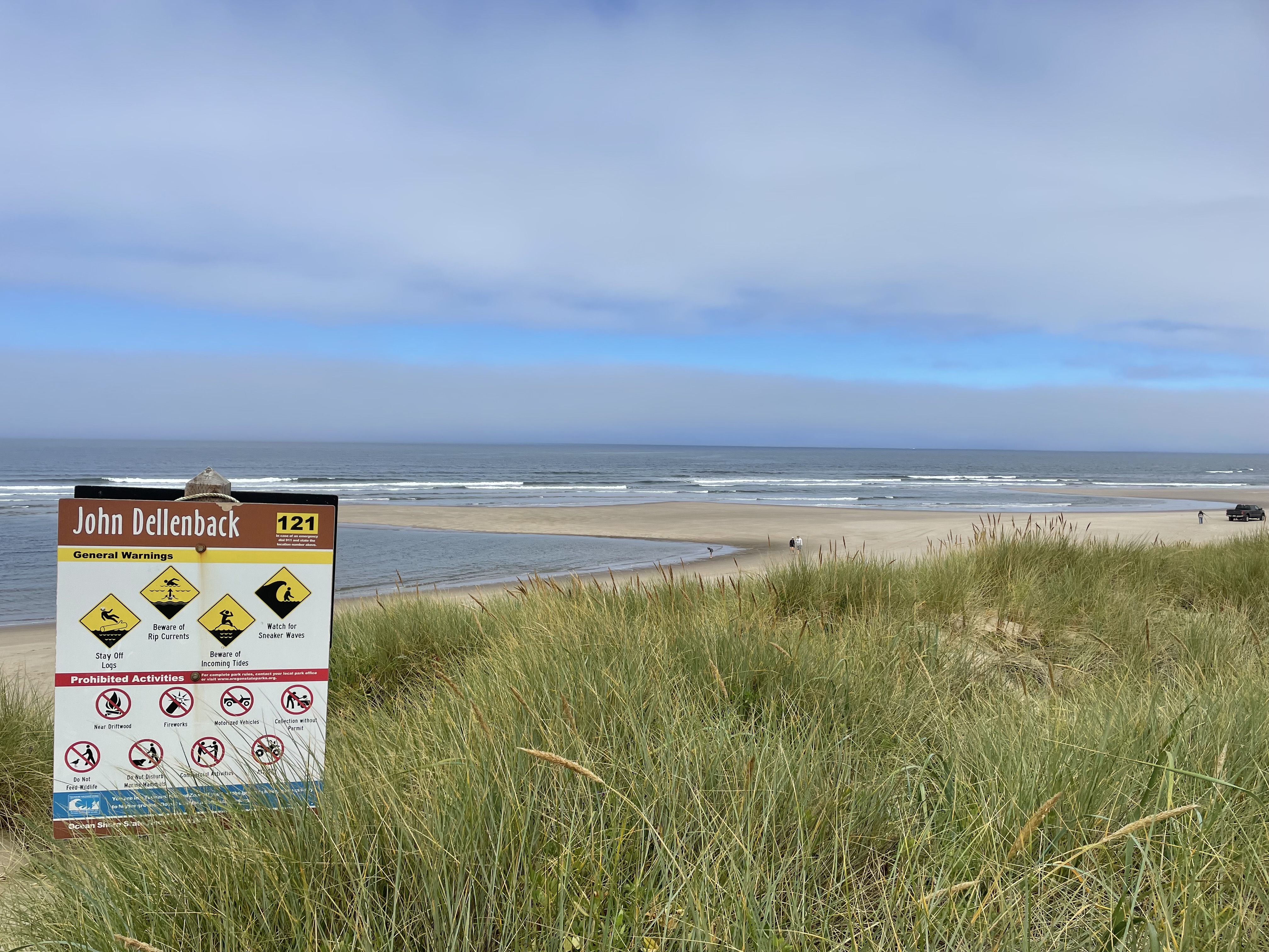
John Dellenback Oregon Dunes Hike


There are a number of similar hikes on the Oregon coast that lead one through a wide array of terrain and hiking and visual experiences. These hikes feature some big walks across majestic shifting sand dunes as well as interludes through Sitka forests and low coastal scrub oaks and brush. You ultimate reward is coming over a dune a deserted ocean beach. 


John Dellenback Trail is a great example of this class of hike. It starts out near Eel Creek Campground in the Siuslaw National Forest and comes over a low forested rise to suddenly hit the encroaching dunes. This hike has almost 2 miles of dunes, which is longer than other dune hikes I have done. The sand is always shifting so there isn't a trail, per se, but you do need to be looking ahead to find the blue stripe topped wooden poles that rise out of the Dunes. They are usually placed in a local prominence where some grass or earth is present, but sometimes they are just out in the sand. 


Trail Marker

We started out across the sand on a cool slightly overcast day. There was some tendrils of fog blowing in from the Ocean. Be a little careful on days like this because if the fog blows in you won't be able to see the trail markers. In our case, there were lot of footprints roaming around in the sand and in general we agreed with them and followed them. We were trying to find the easy way to go, however, and sometimes these footprints were clearly looking for fun. We were trying to avoid going up and down every dune by following a imaginary topo line around the sides of the dunes. 

The sand out on the dunes is not very predictable. A lot of is was soft, letting you sink up to your ankles in the stuff. Not easy to walk through. Other times the sand would be firm enough to support our weight and we could make much better time. But the surface ahead of us, in both cases, looked the same and you never knew when you were going to sink or be held up. 


The poles were presumably all planted at the same height, with the blue stripe sticking out of the ground around 6 feet. But with the constantly shifting sand, we found a couple of poles with only a foot showing and there could easily be some that were buried completely. It took us around an hour to get across the sand and then we came to a wide tree island that seperated the dunes from the ocean. Here the trail got firmer and was easier to walk. The trail runs parallel with the ocean for a quarter mile or some and then turns and leads you to the coast. The trail through the tree island is pretty cool. You go through a bush covered tunnel for a bit, something that was clearly cut through the dense foliage.  Then you come to an area that must be marsh or shallow lake during the wet season. This area has a very strongly built boardwalk that extends for nearly a quarter of a mile. That is some boardwalk! Thick pilons placed every 10 feet or so and bit think boards spanning them. Must have had some big equipment in to build it. 

This one was hard to find


Tunnel of Trees


The boardwalk ends at the grass covered dunes near the beach and it is just short walk to your view of the ocean.  The ocean along here is all sand (as one might expect for the Oregon Dunes) so don't expect to be able to do much rock hunting.  We just sat in the sand and watched the waves, always a peaceful activity. We did find the creators of the footprints that we were occasionally following. It was a family of 6 (Mom and Dad and 4 kids). There was a truck on the beach when we got there and we thought at first that the family had cheated and drove out along the shore (which is evidently a thing), but no, they walked out from the same parking lot as us. 

We had a little snack and then headed back, at the same time as the family headed back. We ended up walking part of the way with them. They could go faster through the woods but it turns out that trying to gets kids to walk steadily through sand is like herding cats. 

Now we come to the cautionary part of this trail (or trail). Conditions change at the coast. The wind had come up a little bit and it had blown away our fog cover. The sun was out and it was much hotter and drier out on the dunes. If it had been this way in both directions I would not have been carrying enough water (I only had 800ml)(That is right, I drink in metric).  The other thing we found is that we could not easily retrace our steps because many of our steps had already been erased by the wind and moving sand. 

Centary Plant. Perhaps "Stomach Bitter"
Either way, evidently exotic


If you can keep going in a straight line, or just head generally in the right direction, you will probably be OK, but you need to hit the edges of the dunes close to the place where you came in or you won't find the trails that have been cut through the woods back to the parking lot. I would not want to bushwack through those woods, they are very dense and difficult.  We did have Cell Phone access the entire time, so mapping on our phones works just fine and that can keep you on the trail pretty well. 


The start and stop of this footprint path was covered by moving sand
while we were on this hike. 


This is a great hike. A little over 5 miles and it took us around 3 hours of walking time. It is a great deal harder than a hard trail hike what with dealing with the sand and all. We were certainly ready to stop walking when we got back to the car.


Friday, July 21, 2023

From The Falls of Willamette to the Cliffs of Insanity


This weekend myself, my wife, and my youngest son participated in a Level 2 kayak training put on by Alder Creek Paddling shop. This is a 2 day class that  introduces a paddler to some advanced paddling techniques as well as some more challenging water and wind conditions and group management.  No one else signed up for the class so it turned into a 2 day family guided adventure session. We went to two locations (one I have never paddled) and did a bunch of new things.

Willamette Falls

The Falls of the Willamette are the second largest falls (by volume) in the USA. Think of that, only Niagra has more water going over it. These falls have the potential to be a destination spot but right now they are surrounded by abandoned factories. They are somewhat the victim of being too close to Portland. The deal is that Portland is just a couple of miles down the river North (yes, this is also the second largest North Flowing river in America) and that proximity made the falls extremely valuable... for electricity production.  There was a time where there were commuter train lines all over the Portland area, running as far south as Salem, that were all powered by the hydro generators at the falls. Think on that, in the early 1900s there was great commuter rail in Portland. That hasn't quite recovered from the invention of the car but they are working on it. These days the Electricity comes from the falls that were drowned by the dams on the Columbia. 

But if you are in a boat, the falls of the Willamette are still pretty and you can get up pretty close to them especially this time of year when the water flow is low. 

And that is what we did. We paddled from the confluence of the Willamette and the Clackamette. This is called Clackamette park and there is an old boat launch there. It isn't used anymore because the Clackamas river flow changed and there isn't deep enough water to safely launch a fishing boat anymore. But it is still a great place to park your car and launch a kayak.  We paddled up the Willamette talking about different safety and paddling issues and "eddyline jumping". When there is moving water on a river there is usually protrusions into that water flow, either rocks or trees or bridges.... something. These protrusions create water current diversions that often make a swirling back current that is called an 'eddy'. You can sit in an eddy behind a little rocky outcrop and be in water that is relatively still with a slight current the opposite direction of the main. The main current can be only a few feet away racing down the main channel. This means that in front of you is a place where the current direction changes rather suddenly from upchannel to down channel. This change in water direction makes a very visible line in the river and that line is called the eddyline.  


Crossing a eddyline line can be challenging especially if the current differentials are large. The trick is to rock your kayak up on its side to prevent the fast moving 'other current' (the current you are not in) from building up water on the side of your boat and rolling you over. You do this by lifting one of your knees such that it engages with the hip pads on your boat and lifts that side of the boat.  But which side do you lift? This was always confusing to me because it seemed like you alway get different advice on this depending on whom you ask. Well, it turned out I was getting identical advice just in situations that were different.  The first time I was told about when to do this 'don't flip over' edging was when I was trying to learn how to surf small waves in the ocean. The advice was to 'moon the beach'. In other words, lift the knee that causes the bottom of your boat to face the beach. This puts your torso facing the wave and also lets you put your paddle in the water to help keep you up right while the wave tries to roll you over toward the beach.  Works great.  When you cross an eddyline in a river the advice is 'moon the current'. This means pointing the bottom of your boat toward the current. So if you are crossing from a slow moving eddy into the main river you would point your bottom up stream. This seemed to me like the opposite of pointing my bottom at the beach when surfing. An instructor pointed out to me that I was thinking about it wrong. He said that when surfing, the dominant current isn't the wave, it is your boat slipping across the top of the water toward the beach. So, effectively, the current your are mooning is coming from shore. So mooning the beach is mooning the current. Ain't physics grand?

Sorry, that was a lot of reading just to get across one damn eddyline. Today, that wasn't even the hard part. Our job was to 'ferry' all the way across the river (about 50 feet) from the eddy on one side of the river to the eddy on the other side of the river. Eddy hopping. This meant that no only did we have to cross the eddy, but then we had to deal with the fast moving, bumpy, swirly, scary water of the river and then cross back into the eddy on the other side.  Which is what we did. The 'ferry' part was trying to keep yourself pointed enough up river to cross the moving water without losing too much distance downriver before you made it across. Important to not be pushed backward into things you can't see. 


We did this ferrying a couple of times back and forth. Our instructor was giving us hints and directions along the way, but mainly he was getting us used to the lumpy water and more confident of our abilities to stay upright in the adverse conditions. Then he demonstrated a crossing to us and I noticed he was using a stroke I had not seen before to go in the opposite direction than I expected. I asked about it and he showed us how to do it and said it was a good stroke to use in these bumpy conditions. Well that may be true it turns out it is very hard to try and learn a  new stroke  when you are doing everything you can to stay upright and freaking out a little in the process. The first time I tried it I almost flipped and ended up abandoning the crossing and being swept downstream a ways into calmer water. Before I could work my way back upstream Nick tried the same thing and he did go over. So now we have someone in the water and our instructor took off after him. 

I think the essence of these advanced classes is that Someone has to go swimming. It helps the people in their boats practice rescues (or just staying out of the way) and it gives the person in the water the chance to realize that flipping over isn't that big a deal. It is just going for a swim. Note: If you are in a situation where 'going for a swim' is dangerous, you probably should not be out boating.  At least not at our skill level and physical abilities.  Nick has been practicing his self rescue lately and he got back in his boat pretty fast unassisted. Then we pumped him out and decided it was lunch time. 

We stopped on a local beach for lunch. After lunch it was getting pretty hot (we were having a scorcher in Portland that weekend) so we all did some rescue practice in the calm water near shore. Just flip over and get someone else to pull your boat up on there boat, dump out the water, and then help you get back in by holding you boat for you. It is a bit of a  chore but something that I have decided that I need to do at least once a year just to prove to myself that I can still do it. Once again, if I can't get back into my boat, I probably should go anyplace where I can't just swim to shore. 

For our next trick we went back to the confluence of the two rivers and were going to see how far up the Clackamas we could paddle. Maybe find some fun water. Well, it turned out that we had launched at high tide (yes, below the falls the Willamette has a tide) and the falling water level had made a great little standing wave in the Clackamas right at the old boat launch. Our instructor didn't think we could get further upstream so he taught us how to cross a fast small current like this. It is essentially a very quick and hard eddyline cross. He said it was called an "S" turn. You moon the current hard as you enter, it pushes you bow down river and tries to swamp you, then you enter the reverse current on the other side and you have to reverse you moon and you bow swings the other way. Your boat makes a nice S shape in the water. I went first (after the demo) and made it through the rough water but switched my moon to early and went right over in the water.  It is sort of funny how this works. I am a little apprehensive about going over but once I flip and find myself upside down in the fast moving water with my boat on top of me, I am really OK. I am not afraid of swimming, just of flipping over.  I got of my boat and thought I could just stand up, but the current was having none of that. I had to pull my feet back up because of was hitting some rocks. The instructor was there with me but I think he wanted to see what I would do. I ended up leaving him my boat and just swimming to shallow water on the opposite shore. I took my paddle with me and the instructor (Andrew) brought my boat over so I could empty it out and get back in. Paige and Nick were waiting back up by the fast water and we went back up there and tried it again. This time all of us made it across with  different approximations of the S curve. We sort of wanted to play more in the standing waves that were there, but the water was a little shallow for people that didn't have their kayaking helmets.  So we called it a day. 


Rooster Rock and the Cliffs Of Insanity

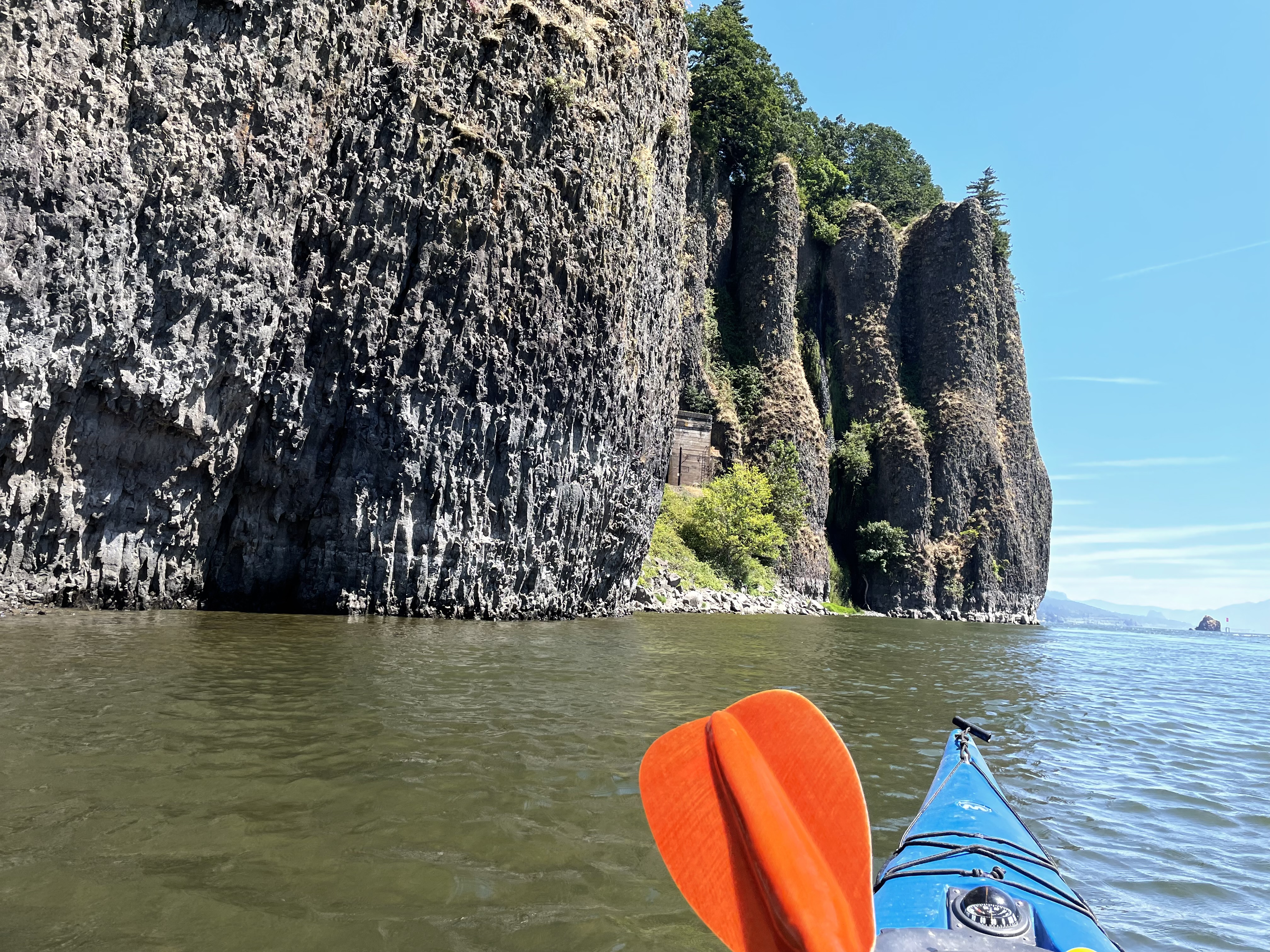
On Sunday, we went to Rooster Rock state park on the Columbia. The plan was to launch at the boat ramp there and head up the Oregon side of the Columbia. When we got to a relatively narrow section we would cross the river to the Washington side and then paddle more upstream to the "Cliffs of Insanity".  Andrew told us that all of the local paddlers called them that, evidently a reference to the movie "Princess Bride". We told him that we thought their actual name was Cape Horn, which is just a different copied name, but this one is on the maps. 


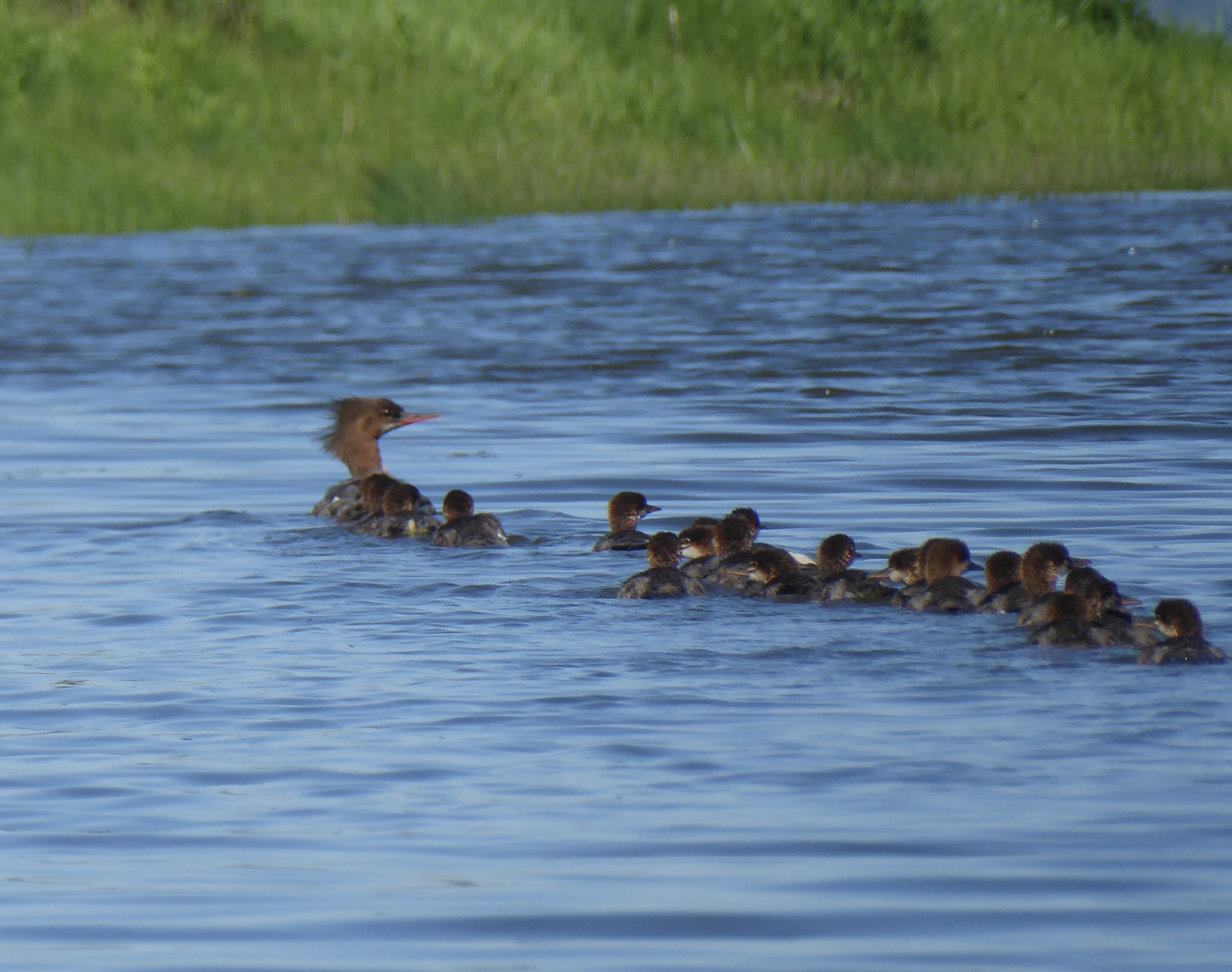
This Mama Merganzer had somehow adopted 20 babies
perhaps they adopted her.


Today we are practicing pretty much the same skills as yesterday but on a bigger river. We also did a lot of talking (whilst paddling) about the importance of weather monitoring and how things can quickly change when you are out on the water.  Andrew had used an app called 'winds' to check on the weather forecast for the area. He said this app pays a lot more attention to wind variations than other weather sites. The forecast was for 3-5MPH in the morning and then building to 10 to 15 this afternoon. He said he wanted us back on this side of the river and in a safe area by 3:00 to avoid any trouble. Sounded good to me, one thing I have especially hard problems with is padding with the wind. That is, a following sea. Paige likes to ride the wind waves but they freak me out a bit.  We crossed the river right below the cliffs. Cape Horn sticks out a bit into the water and it make a larger eddy there.  This means you can ride this back current right up the sides of the cliffs and enjoy the view. It is quite a view too, the cliffs are stunning and the rock is beautifully textured. We road some wind waves into the calm of the eddy and then got to take some great pictures. 


There is a train track line that runs up both coasts of the Columbia. The one on the Washington side carries Amtrak travel from Chicago (The Empire Builder) and we saw it run by going West when we were taking a break before the cliffs. The line is actually drilled right through the Cliffs of Insanity and a train went Eastbound through the tunnel right above us while we were floating there taking pictures. Such fun.

As we were floating up river in this back eddy, further and further East, we were also getting to a place where the river was more constricted by the cliffs on both shores. This was causing the wind to funnel and build and the water to funnel and build and outside of our little eddy things were starting to look pretty bumpy and challenging. Andrew was planning this. Now we were going to enter the rough water and be paddling with the current but against the wind. He said if we had trouble we could just dump back into the calm eddy to recover. If someone flipped, they needed to hold on to their boat so the wind wouldn't blow it away from them, but the river current would soon take us to a calmer spot. A complete rescue in that bumpy conditions would have been difficult, but I guess it wouldn't be impossible. When two boats are pulled up side to side, they are pretty stable.  We paddled in this rocking and rolling water for 20 minutes are so. It was a little scary and very exciting. I was getting a bit tired when we finally pulled out of the rough water and back into the eddy along the side of the river. At this point, we had rounded the turn in the river about were we had crossed over the first time and things were settling back down.  Please forgive me for not really having any pictures of things when they were "rough". I guess I need a go pro.


Across the way we could see a nice sand beach with people sitting in the sun, we decided to head over there for lunch. That side of the river is funny this time of year, it is a foot or so deep for a few hundred yards into the river. We were running aground before we got very close to the little island. I was wondering how all of those people got out to the island, turns out they walked from Rooster rock.  We finally got to land and sat down to have our lunch and we found another surprise; this is a clothing optional beach. Wow. Did you know that the original name for Rooster Rock was Cock Rock? Because of its shape. But the map makers changed the name when they made the public maps. Who cares what Lewis and Clark called it !! Not sure what made me think of that. 

The afternoon wind never did show up so we didn't get to do even more practice in bumpy water. Instead we found a shallow place and did brace practice. This is where you tip yourself until you are no longer stable and definitely going over unless you do something and then you slap the water with your paddle and try to save yourself. If you don't flip over, your probably aren't trying hard enough. 


Paige does a great self rescue


Anyway, a great weekend of lumpy water and new learnings. Now I want to go back to both the falls of the Willamette and the Cliffs of Insanity and practice. Need to make sure and bring along people that can pull me out of the water when I fall in.