South Slough National Estuarine Research Reserve
It was 100 degrees in the Willamette Valley this week so my partner and I took our boats to the Oregon coast for a long weekend and managed to actual get out on the water one day. We had made it down to Charleston (a little fishing town near Coos Bay) and decided to do a paddle up into the National Estuarine Reserve that is the historic South Slough.
The local kayaking guide book I had recommends that you start your paddle in Charleston at low tide and then ride the tide up into the estuary, getting out at a tidal creek about 5 miles into the slough. It advises to be aware of the North wind that often blows in the afternoon.
The book leaves a few warnings out.

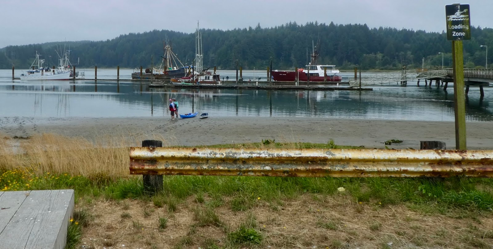
We launched at the well marked kayak launch on the east side of the Charleston bridge, right next to a big oyster catching factory (Lots of oyster shells) and the local ship yard. There is a little dock there and a ramp that is blocked such that only small boats (hand carry) can be launched. We had to carry the kayaks down through some shallow mud (muck?) to get to the very low tide level. But the tide was making fast.

We launched and headed up the slough. We immediately noticed that there were mud flats all over the place, including dead in front of us. So we ran aground in the first 15 minutes of the paddle. Not very pleasant to run aground. The wind is blowing and the tide is flowing fast over the mud flat and so you get pushed around a lot. I guess in the worst case and you flip over, you can just stand up and get back into your boat. As long as you don't let your boat blow away while you are doing that.

We got past the flats and now tried to stay more in the main channel. We were looking for the island that is shown on the book map. Our plan was that it would take about half of our time (an hour) to get to the island, at such time we would stop and have lunch and then continue our way up the slough to our car. We figured it would be difficult to get lost as long as we steered toward the west side of everything.
 And now for some history:
The South Slough National Estuarine Research Reserve, besides being quite the mouthful, is a 4700 acre area that preserves a number of estuarine habitats. It was established in 1974 as the first in a national network of such reserves. It is managed by NOAA and Oregon BLM. There is a interpretative center and a number of trails that snake around the property, including a long boardwalk over a marshy area. For today, we are going to be paddling past the interpretive center, maybe we will see some of the paths or some hikers out walking. Our car is parked up on another piece of the Reserve where there are additional (though perhaps not marked) trails that go up the peninsula between the sloughs two large south fingers. There is a full time science staff working on the property and they host visiting scientists doing various studies.
Meanwhile, out on the water, we are making good time. Hell, we are flying. We are not paddling or anything and the wind and tide is ghosting us along at at least 4 knots. There are a lot of marker sticks in the water. We were not sure what they were for. We were trying to stay out in the central part of the channel where the current was strong, but that was also where the wind and wind waves were strong and farthest away from the cool stuff that I was sure was happening on shore.
Our problem was that we couldn't find the island in the middle of the slough. Things just didn't look like they did on the little map that was in the guide book. Perhaps it was because the tide was so low. It would have been nice to pull out our phones and check things with a live map update. Here is another Warning: Cell reception out on the Slough is really poor. Like..... no bars. So it is difficult to get a live map. I guess if we had downloaded a map previous to the trip, the phones internal GPS would work just fine to locate us on the map. Do that. But you can't call for help.
So, speaking of calling for help. I know that they have those satellite tracking and messaging systems that can let you call 911 from a lot of situations, but do you know what I think places like this should have? I think the Reserve should host at least one (perhaps a few) base stations for a mesh net. Have you seen these things? There are a few of them on the market, they are little walkie-talkie transmission boxes that hook by bluetooth to your phone and then proceed to establish a little local area Mesh Network with any other compatible boxes that they happen to be able to ping. With them, you can send text messages to people on the mesh, even if you are not close enough to the particular node that you want to message. I think they will also allow you to message outside of the mesh (like through the internet) if one of the mesh nodes is a internet host (a base station). So you keep one of these in your kayak (or your backpack) and then you can have some level of network access through your phone even when yo can't see a cell phone tower. I believe these things have a range of around 2 miles for voice and up to 4 miles for data (text). I have seen them advertised a lot on Facebook and with kickstarter, but haven't really seen the products in the stores yet. They are not very usable unless either a number of people have them (and they are compatible with each other) and/or the various ranger stations start having base stations for people to ping. Here is one kind on Amazon .
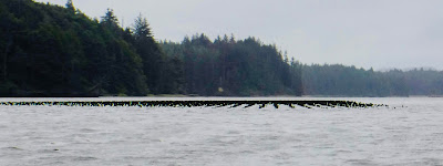

Well, my partner is trying to get me to stay out in the main channel, you can sort of see where the water must be deep, but I am straying off toward the shoreline, where I think we will be more protected and out of the wind. We 3 have strayed a little apart from each other, perhaps 50 feet separation. And then I hit something. It made a good crunching sound. Looking down I see a post sticking up all encrusted with Oysters. Ouch. Hope I didn't hurt my boat. Where did that come from..... shit, there is another one. Crap, and another. Some waves come sloshing through and reveal that I am in a field of oyster encrusted punji sticks of death stick up from the bottom. How long are they? A couple of feet? If I hit them will they high side me and flip me over? If I flip over will I be impaled? This seems non-ideal.
"Don't Come over hear" I yell to my companions. "I am in some sort of old dock area or something. Don't come over here". I am a little too bush being scared and trying to stay calm so I don't flip over. I figure I may take one of these things through the boat bottom, so I am trying to float between the rows. That isn't working so well. I yell again for the other 2 to stay away from me.
They really aren't listening to me so much. They are both trying not to get high sided and flipped over and implied and yelling for me to stay the hell away from them. Holy Shit all three of us were in trouble. We all floated clear in 20 seconds or so but it was very frightening. Like, what do you do if you land in that mess? You may not be impaled, but you will be surrounded by razors and if anyone tries to come get you they are going to be in trouble. If we had come by here 10 minutes later, the water probably would have been high enough that we wouldn't have noticed these things and would have cruised a couple of inches over the death punjis. hmmmm... Maybe we did.
When we went around the corner we saw another field of these things, but they were clearly out of the water and easy to avoid. What are they? I am guessing they are some sort of remnant of a commercial oyster fishing area. Hell, perhaps still an active area, that might be what all of the marker sticks are.

Now that the excitement is done, we continue our streak up the slough. We really are not having much time to look at wildlife and enjoy the day, we are just moving too fast. And we can't find that island that marks the midway point. I thought it would be easy to see. We come to another bend and see some interesting hillocks in the water. They sure look man made, but what are they? Turns out they are the remnants of dikes that had been built in order to isolate a marsh area from the slough such that the water could be pumped out and cows could be grazed in the freshly made field. But in recent years the Reserve staff have dynamited the dike and let the tides flow back through again to flood the field. Returning things to nature.


But we still don't know where we are. I am beginning to think that we must have passed that island someplace, but how could we have missed an island? We turn another corner and now were are in an area that looks a lot like the coastal areas I used to play in when I was a kid in South Carolina (a different Charleston). We have the inflowing tide and a lot of sea-grass and mud. This is also what the place would look like where we left the car. Could we be at the end of the Slough already? We have only been traveling for one hour and it was supposed to take us 2.5 hours to get here. But we are either at the car or we are completely lost and will have to turn around and fight our way back up against wind and tide (which waits for no man).


But no. We turn a corner and there is the bridge. Go under that and the car is on the right.
By the way, the water under the bridge at this time was about 2-3 feet deep. When we parked the car I would have said it was 2-3 inches deep. So. Incoming tide. If it was a high tide, you might have trouble getting under that bridge.
Wow. What a whirl wind.
 The next time I do this trip I might try it a different way. Perhaps coast up on the tail of a high tide and then ride the falling tide back to the car we launched from. The only problem with doing that is the wind. It was blowing pretty good and it can be very hard to paddle a kayak upwind. Would also have been nice to go on a sunny day, but those are hard to come by on the Oregon coast. And, or course, when the tide is falling, if you get stuck in the mud you will be stuck there for a long time.
So. Here is my final advice.
Don't go on a Sunday or Monday, the Interpretive Center is closed on those days.
Do go by the Interpretive center before you paddle and ask for a kayak map and perhaps some advice on things to see or be careful of. Get and extra map and send one of them to me.
Don't trust the map from the local guide book. It is not to scale and very misleading. Make sure and have a compass.
Oh, and where was the island? It turns out we were right next to it when we ran into those Death Punji sticks. We just couldn't recognize it as an island because the tide was so low.

 |
| The Launch |

We launched at the well marked kayak launch on the east side of the Charleston bridge, right next to a big oyster catching factory (Lots of oyster shells) and the local ship yard. There is a little dock there and a ramp that is blocked such that only small boats (hand carry) can be launched. We had to carry the kayaks down through some shallow mud (muck?) to get to the very low tide level. But the tide was making fast.
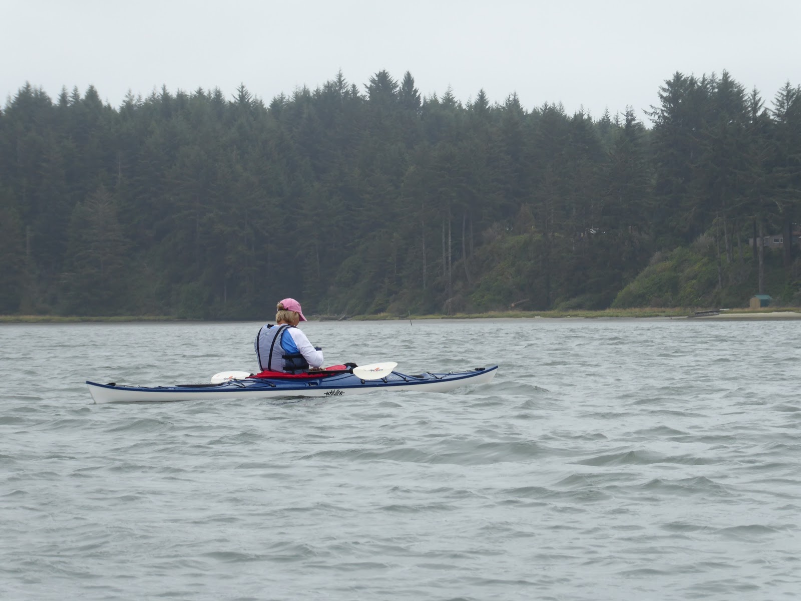
We launched and headed up the slough. We immediately noticed that there were mud flats all over the place, including dead in front of us. So we ran aground in the first 15 minutes of the paddle. Not very pleasant to run aground. The wind is blowing and the tide is flowing fast over the mud flat and so you get pushed around a lot. I guess in the worst case and you flip over, you can just stand up and get back into your boat. As long as you don't let your boat blow away while you are doing that.

We got past the flats and now tried to stay more in the main channel. We were looking for the island that is shown on the book map. Our plan was that it would take about half of our time (an hour) to get to the island, at such time we would stop and have lunch and then continue our way up the slough to our car. We figured it would be difficult to get lost as long as we steered toward the west side of everything.

The South Slough National Estuarine Research Reserve, besides being quite the mouthful, is a 4700 acre area that preserves a number of estuarine habitats. It was established in 1974 as the first in a national network of such reserves. It is managed by NOAA and Oregon BLM. There is a interpretative center and a number of trails that snake around the property, including a long boardwalk over a marshy area. For today, we are going to be paddling past the interpretive center, maybe we will see some of the paths or some hikers out walking. Our car is parked up on another piece of the Reserve where there are additional (though perhaps not marked) trails that go up the peninsula between the sloughs two large south fingers. There is a full time science staff working on the property and they host visiting scientists doing various studies.
Meanwhile, out on the water, we are making good time. Hell, we are flying. We are not paddling or anything and the wind and tide is ghosting us along at at least 4 knots. There are a lot of marker sticks in the water. We were not sure what they were for. We were trying to stay out in the central part of the channel where the current was strong, but that was also where the wind and wind waves were strong and farthest away from the cool stuff that I was sure was happening on shore.
Our problem was that we couldn't find the island in the middle of the slough. Things just didn't look like they did on the little map that was in the guide book. Perhaps it was because the tide was so low. It would have been nice to pull out our phones and check things with a live map update. Here is another Warning: Cell reception out on the Slough is really poor. Like..... no bars. So it is difficult to get a live map. I guess if we had downloaded a map previous to the trip, the phones internal GPS would work just fine to locate us on the map. Do that. But you can't call for help.
So, speaking of calling for help. I know that they have those satellite tracking and messaging systems that can let you call 911 from a lot of situations, but do you know what I think places like this should have? I think the Reserve should host at least one (perhaps a few) base stations for a mesh net. Have you seen these things? There are a few of them on the market, they are little walkie-talkie transmission boxes that hook by bluetooth to your phone and then proceed to establish a little local area Mesh Network with any other compatible boxes that they happen to be able to ping. With them, you can send text messages to people on the mesh, even if you are not close enough to the particular node that you want to message. I think they will also allow you to message outside of the mesh (like through the internet) if one of the mesh nodes is a internet host (a base station). So you keep one of these in your kayak (or your backpack) and then you can have some level of network access through your phone even when yo can't see a cell phone tower. I believe these things have a range of around 2 miles for voice and up to 4 miles for data (text). I have seen them advertised a lot on Facebook and with kickstarter, but haven't really seen the products in the stores yet. They are not very usable unless either a number of people have them (and they are compatible with each other) and/or the various ranger stations start having base stations for people to ping. Here is one kind on Amazon .


Well, my partner is trying to get me to stay out in the main channel, you can sort of see where the water must be deep, but I am straying off toward the shoreline, where I think we will be more protected and out of the wind. We 3 have strayed a little apart from each other, perhaps 50 feet separation. And then I hit something. It made a good crunching sound. Looking down I see a post sticking up all encrusted with Oysters. Ouch. Hope I didn't hurt my boat. Where did that come from..... shit, there is another one. Crap, and another. Some waves come sloshing through and reveal that I am in a field of oyster encrusted punji sticks of death stick up from the bottom. How long are they? A couple of feet? If I hit them will they high side me and flip me over? If I flip over will I be impaled? This seems non-ideal.
"Don't Come over hear" I yell to my companions. "I am in some sort of old dock area or something. Don't come over here". I am a little too bush being scared and trying to stay calm so I don't flip over. I figure I may take one of these things through the boat bottom, so I am trying to float between the rows. That isn't working so well. I yell again for the other 2 to stay away from me.
They really aren't listening to me so much. They are both trying not to get high sided and flipped over and implied and yelling for me to stay the hell away from them. Holy Shit all three of us were in trouble. We all floated clear in 20 seconds or so but it was very frightening. Like, what do you do if you land in that mess? You may not be impaled, but you will be surrounded by razors and if anyone tries to come get you they are going to be in trouble. If we had come by here 10 minutes later, the water probably would have been high enough that we wouldn't have noticed these things and would have cruised a couple of inches over the death punjis. hmmmm... Maybe we did.
When we went around the corner we saw another field of these things, but they were clearly out of the water and easy to avoid. What are they? I am guessing they are some sort of remnant of a commercial oyster fishing area. Hell, perhaps still an active area, that might be what all of the marker sticks are.
 |
| Dike Remnants |
 |
| Pretty much the only wildlife we saw. |

Now that the excitement is done, we continue our streak up the slough. We really are not having much time to look at wildlife and enjoy the day, we are just moving too fast. And we can't find that island that marks the midway point. I thought it would be easy to see. We come to another bend and see some interesting hillocks in the water. They sure look man made, but what are they? Turns out they are the remnants of dikes that had been built in order to isolate a marsh area from the slough such that the water could be pumped out and cows could be grazed in the freshly made field. But in recent years the Reserve staff have dynamited the dike and let the tides flow back through again to flood the field. Returning things to nature.


But we still don't know where we are. I am beginning to think that we must have passed that island someplace, but how could we have missed an island? We turn another corner and now were are in an area that looks a lot like the coastal areas I used to play in when I was a kid in South Carolina (a different Charleston). We have the inflowing tide and a lot of sea-grass and mud. This is also what the place would look like where we left the car. Could we be at the end of the Slough already? We have only been traveling for one hour and it was supposed to take us 2.5 hours to get here. But we are either at the car or we are completely lost and will have to turn around and fight our way back up against wind and tide (which waits for no man).


 |
| The Bridge !! |
But no. We turn a corner and there is the bridge. Go under that and the car is on the right.
By the way, the water under the bridge at this time was about 2-3 feet deep. When we parked the car I would have said it was 2-3 inches deep. So. Incoming tide. If it was a high tide, you might have trouble getting under that bridge.
Wow. What a whirl wind.

So. Here is my final advice.
Don't go on a Sunday or Monday, the Interpretive Center is closed on those days.
Do go by the Interpretive center before you paddle and ask for a kayak map and perhaps some advice on things to see or be careful of. Get and extra map and send one of them to me.
Don't trust the map from the local guide book. It is not to scale and very misleading. Make sure and have a compass.
Oh, and where was the island? It turns out we were right next to it when we ran into those Death Punji sticks. We just couldn't recognize it as an island because the tide was so low.