Monday, July 2, 2018

Paddling Portland - by the Bridges

Paddling Portland - By the Bridges


My partner was working this Weekend Tuesday and I needed some exercise, so I decided to take myself on a tour of Portland (OR) via the Willamette river. Lots to see, so I took a lot of pictures. It was a great paddle but it took a few hours (9 miles round trip) so lets get started. Since a river city depends on its bridges, lets take note of each bridge as we pass it.

Sellwood Bridge

The Sellwood Bridge is a recent replacement of an old bridge that goes from the Sellwood district to the John's Landing area of Portland. This is the first crossing of the Willamette since Oregon City and used to be the busiest 2 lane bridge in Oregon. When they replaced it they first lifted the old bridge and moved it over 50 feet but left it operational while they built the new one.

Sellwood Bridge

I launched at the community park at Sellwood. This park is just across the Sellwood bridge from Portland, over by the Oaks Amusement park and Oaks Bottom wildlife preserve. I wanted to start sort of at one end of the city and see how far I could get. This park doesn't have a whole lot of parking, but it is free and not very busy at all on a Tuesday morning. There is a dog park there, so a number of people playing with their dogs. There is also a dock that just about always has a few boats tied up and a decent river beach for soaking your toes or taking a little family swim. I launched from the sand next to the dock (I used the dock ramp to get my boat down to the water as the other access points have stairs).

The sun was out bright with scattered clouds, but there was a pretty good breeze blowing down the river and it was a bit chilly in the shade of the cottonwoods at the river's edge. So I got out on the river. Right away I ran into a pod of kids (high school or maybe college) learning how to row and skull. A few people in doubles and one quad. The people in the quad had not been out before (except for the guy rowing stroke). They were turning around just when I was getting started. I wonder who they belong to?

Just down the river a few hundred yards from Sellwood, still close enough to hear the screams of the kids on the new roller coaster at Oaks Amusement park, is a row of fancy floating homes. More on them on the return trip, but for now, I was sitting in their lee and using the flat water to take some pictures of the floating homeless encampment that has grown up across the channel on the South tip of Ross Island.

Floating Home-Less?


These all appear to be non-operational
There used to be just a couple of boats, and some of those still in sailing shape, but more and more boats have been showing up and these are looking in worse and worse shape. And they are starting to aggregate. It looks like you have one, say 40 foot cabin cruiser. Something with a kitchen and a sitting room and a head. And then tied up alongside you have one or two old 25 foot sailboats. I was thinking of them as extra bedrooms. So you have a three bedroom floating house. There were 5 or 6 of these aggregates plus a few solos all in this little bay. I sort of wonder that the authorities let these boats float there. Last year there was a floating dock with a porta-potty on it. But this year there is nothing like that and I don't think these boats have any regular servicing. They certainly aren't sailing to the local marina to have their holding tanks pumped. The local kayak store used bring their classes to this bay for water rescue practice. A good place to go swimming on a hot day. I don't think they are doing that now.

Eagle on Blue

As I glide through the boats there is some commotion overhead. Not one, but two bald eagles are flying around up there. And both of them are being harassed by little birds. One has a seagull chasing after him, and the other has some little black bird literally nipping at his tail. And I use the word Literally advisedly. I saw the bird grab the eagles tail feather right over my head !!

On the other side of the little bay was a group of Canada Geese, I think they were sitting on their eggs on the little rock cropping. I paddled around them and then through the channel between Toe island and Ross Island. My partner and I like to go to Toe Island. It is only 100 feet long (at low water) but it is not visited often and we like to hunt agates there (or go swimming).

This part of Ross Island gives you the impression that the island is very big. What is hard to tell from here is that the steep embankment leads up to a stretch of treed ground that is only about 40 feet wide. Right on the other side is the Ross Island Lagoon.

John's Landing Area

To my West is the John's Landing area of Portland. Down by the water is the sailing club, with all of the little Lasers out with new sailers. Next to the club is a number of condos for those that like to live by the river. It is a nice area. And there, at the end of the condos, just before Portland Proper, is the blue roof of the Spaghetti Factory. This is a great big beautiful building right on the river with that Iconic blue roof and food that actually tastes like it was made at a factory. Go Figure.

Spaghetti Factory and New Condos

Ross Island Rock Beach


I stopped at the North Tip of Ross Island (did you know that the Willamette is the longest North Flowing river in North America?) for a little stretch and to hunt for Agates. Across in Portland is one of the areas that has been having rapid growth over the last 10 years. Six or so tall glass condos have gone up. I bet they have awesome views of the river. Also right in this area is the big OHSU expansion where the Arial Tram runs down from the main OHSU campus up on the hill. Portland State University (PSU) also just built a new Computer Science joint facility (with OHSU) on the other side of the Ross Island Bridge. The only old thing over there is the small barge building ramp where river barges used to be built. The last barge rolled down the rails last year. I hear they are going to tear that site down and put in either more OHSU or more condos.

OHSU up on the hill. Barge Production by the River.

Ross Island Bridge

The Ross Island Bridge carries Route 26 over the river. This bridge was built in 1926 during a mass bridge building boom. It was originally painted black, but in the 1950's it was decided to paint all of the Portland Bridges a different color and Ross Island Bridge was painted Phthalo Blue. It has four lanes of traffic and one pedestrian walkway.

Ross Island Bridge


New PSU Science building (I think)

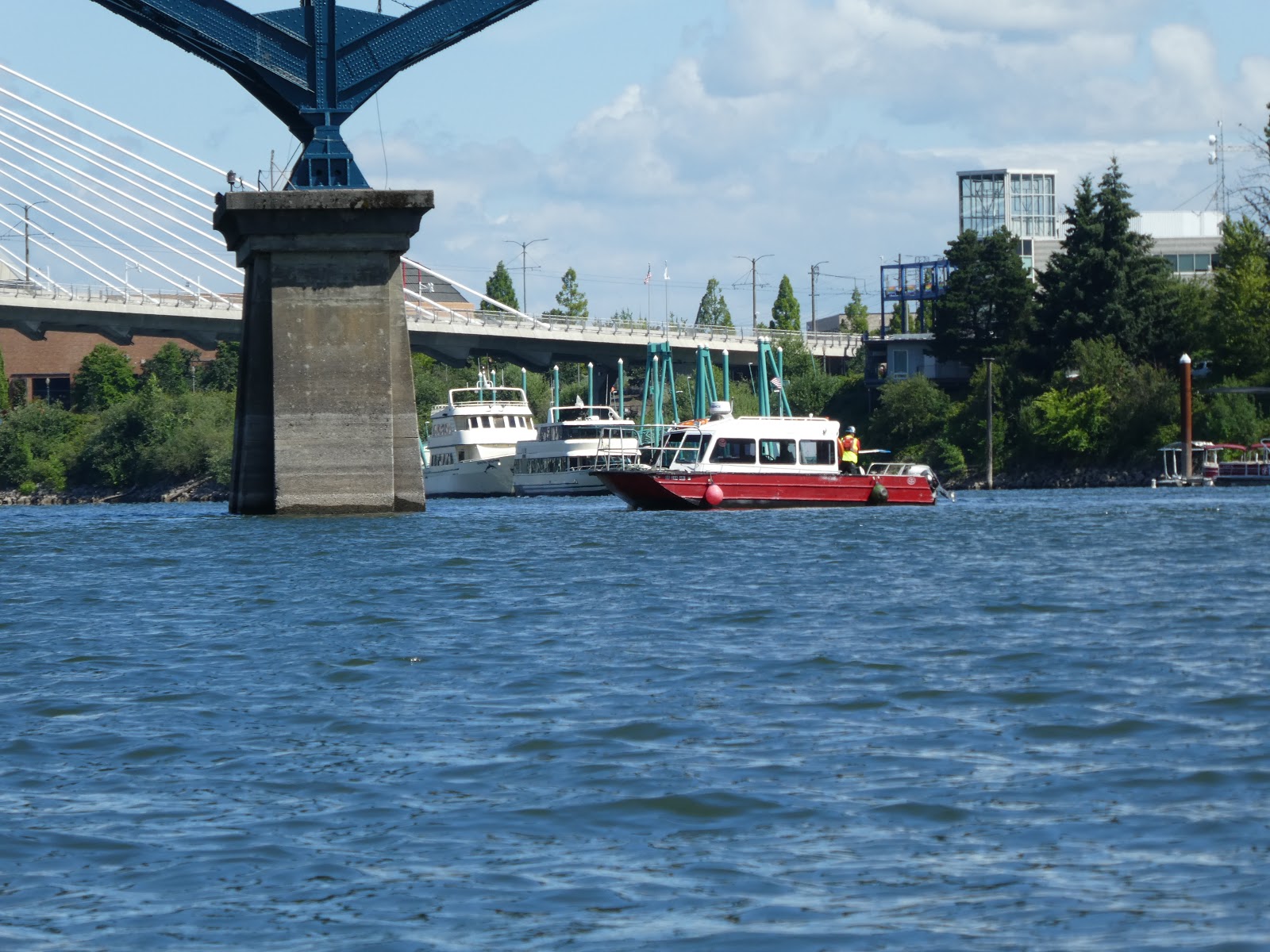
When you paddle under these big bridges, it is always a little eerie. No telling what might be coming down from up high. In this case, there is a bridge crew working on the underside of the bridge and a couple of guys in hardhats riding in a medium sized power boat running around making sure boaters don't get in the way. I was just starting to push out on the East side of the channel to avoid the construction when I realized that the big thing in the water out ahead of me was moving. It was a tug boat pushing one of the big barges full of gravel and dirt out to the Ross Island Gravel processing plant. I let it have the right of way.

Gravel Barge and Tug

Work Crew Safety Boat.


Just shortly after crossing under the Ross Island Bridge you come to Portland's newest bridge. This is my favorite bridge in Portland (and I watched them build it). It is named Bob (OK, Tillikum Crossing)

Tillikum Crossing

This is a light rail, street car, bicycle and pedestrian traffic bridge. It is the first bridge in the United States that was designed to carry only mass transit and emergency vehicles. With its completion you can ride the Portland Street car in a big circle all around the city. It is a beautiful suspension bridge.


Tillikum Crossing Bridge


The next big thing on the river is the Oregon Museum of Science and Industry. OMSI. This is fun to paddle by because of two features, the terminus of the Willamette Jet Boat rides, and the big huge Submarine. They used the interior of this sub for some shots in "Hunt for Red October". This is the last modern NON-Atomic hunter killer submarine and is available for tours on a daily basis. And hey, while you are there, why not go on an exciting Jet Boat Ride!! I recommend the tour that takes you up to the falls of the Willamette in Oregon City. Go on a hot day. Wear sun screen and clothes you can get wet. If you get motion sick, don't sit up front.

Jet Boat

But meanwhile, Holy Moly, it is time to pass under another Bridge. This one is the Ugliest bridge in Portland. It is very noisy under this bridge, what with all of the big trucks and such.

Marquam Bridge.

The Marquam Bridge was built in 1966 to carry Interstate 5 across the river. It is the busiest bridge in Portland. It is two levels with 4 lanes of Northbound traffic on top and 4 lanes of south bound on the bottom.

Marquam Bridge


The Marquam casts a large shadow. Once under, the big shiny part of Portland opens up to the west across the River. I don't know the names of any of the big buildings, but there are new ones going up every year. You can see the Marriot there down by the river. That is where the Big Float is going to be in a couple of weeks. The big float is a Portland Summer party where people get into all sorts of crafts (mainly inner tubes) and paddle their way across the Willamette. The river is a few hundred yards across at this point. It is supposed to be quite the site. My kayak club does safety boats for this event, I should probably volunteer and go see what is up.

I would also like to note that every time I look up a bridge in Wikipedia it is listed (for some reason) as "The Busiest Bridge". Each one has more cars, or more busses, or more pedestrians, or more cars per lane or more pigeons ...

Hawthorne Bridge

Hawthorne Bridge is the country's oldest operational vertical lift bridge. It runs right into the heart of downtown Portland and is one of the busiest bridges in the city. It was built in 1910. It originally carried cars, pedestrians, and the street car. But now is has busses, cars, and people.

Hawthorne Bridge.
You think you can live up there? Looks like a 3 bedroom apartment.

Along the river on both banks is a walking path. Here on the East side starts a part that runs very close to the river and will eventually come down to the water and follow along a path on a floating dock. Not as much wildlife here, as the East bank is mainly highways and overpasses. I did run into a few Canada Geese and 2 goslings. (Not Canadian Geese, mind you. Canada Geese)

Spirit of Portland.
Dinner and River Tour in Style

The Morrison Bridge

This bridge is the largest mechanical device in Portland. It was built in 1959 and like all of the older downtown bridges is a draw bridge. The Morrison swings up and open from both sides. The footings of the bridge have large wooden wharves which have controllable colored lights for artistic display that one can evidently rent out.

Morrison Bridge

Just past the Morrison the shore just below the esplanade looks like some sort of sandstone cliff. But at the base of the cliff, embedded in the rock, is what are clearly the remains of wooden pilings. And then some layers of the sandstone look very much like concrete. I think this must be a place where over the last, say, hundred years, a lot of cement and gravel and sand and such have been dumped and that has built up to make this cliff. (see the picture).


Man Made Layering?

Across the river is the downtown wharf area. This is a cement wall going 20 feet above the water with a metal railing separating the drop from river walk. Floating there is also the steam powered stern wheel tugboat, the Portland. The Portland was an active tug at one time and I had assumed that time was like the 1850's because of the paddle wheel. But it turns out this boat was built in 1947 and was the last steam powered stern wheel tug in America. At first the boat was supposed to be diesel powered screw driven, but the stern wheel design was chosen evidently because all of the pilots and tug operators of the day knew how to use that kind of tug. She is still operational and goes out every few years. They power up the engine and turn the wheel once a year during the Rose Festival. She is now a museum and you can get a tour for a few bucks. Pretty cool if you like steam power. (She was also used in the movie, "Maverick").

Now the East Side Esplande comes down to float on the water for the use of bikers and pedestrians. The people going by seemed a little surprised to see my kayak right there on the water.

The Esplanade comes down to float on the river

City Scape

The Burnside Bridge.

The Burnside Bridge was built in 1926 and is similar in appearance and draw bridge style to the Morrison. It continues Burnside street from one side of the river to the other with 2 lanes of traffic in each direction.  Burnside divides the city into North and South sections.
Burnside Bridge
Below the Burnside on weekends is the iconic Portland Saturday Market. A great place to shop for local crafts and street food. Standing up over top of this bridge is the another Icon, the Portland Old Town sign with the white stag on it.

In December, this sign has a red nose.

When my partner and I went down to the Waterfront a few weeks ago it was Rose Festival and a number of large military vessels were tied up on the wharf along here. A Canadian Frigate was there just South of the Burnside bridge and on the side North were a couple of US Navy vessels. I paddled along the Eastside Esplanade for a while until I came to a little city floating dock. I guess you can tie up a boat here and then walk up to the Convention Center. Perhaps see the Trailblazers play some basketball. Right now I just pulled into the calm water and rested a bit. Over my head the I-5 to I-84 on-ramp soared. Just down river the old Steel bridge had all kinds of traffic on it.
Two different MAX trains going over at the same time in different directions.

The Steel Bridge.

Opened in 1912, the Steel Bridge is a double decker lift bridge with Amtrak Train rails and pedestrian traffic on the bottom level and car and light rail traffic on the top level. The lift spans can be independently operated, the only bridge of this kind in the world. The bottom level can be lifted up and telescopes into the upper deck such that upper deck traffic is not disturbed. The Bridge is named after the new fangled metal that was used to build the original bridge.


I did not cross under the Steel Bridge. I was too tired. Time to start home. I crossed the river here and fetched up against the west coast embankment just in time to see an Amtrak train heading South out of Union Station.

Amtrak on the bottom


On the way back up the river, I stopped at Ross Island again and then took the east channel round. I got some pictures of the Ross Island Lagoon. This lagoon had been used by the Ross Island Cement and Gravel company for decades as a source for round river rock to make Portland Cement. This lead to a huge enlargement of the Lagoon and deepening it to some 100 feet. In more recent times the company has started to fill in the lagoon with clean fill and is doing restoration work on the island. I think the plan is to turn the island over to the city as a park and nature preserve at some time. Currently there is still this huge ugly piece of machinery that apparently does sand and gravel sorting and loading.
Conveyor Belt Sand and Gravel Sorter

My last little piece of scenery is the return trip down the line of expensive floating homes that sit right next to the Oaks Amusement park. I should probably dedicate a complete blog covering each house on the line. Suffice it to say that there is a eclectic mix of old and new, traditional and Avante-Garde, Expensive and Less so. They are all built on big old logs and they all float (as a community) up and down on the big poles stuck into the bottom there.


Look at all of the trees.


My arms are tired. I turn the corner and there stands the Sellwood bridge again with the little beach park there on the East bank. Time to go home and have some lemonade.

But First, a quick wildlife recount from this trip:

  1. Bald Eagle
  2. Osprey
  3. Great Blue Heron
  4. Lesser Merganser
  5. Canada Goose (many, and 2 chicks)
  6. Sea Gull
  7. Some little black bird who thinks he can pick on Eagles.
What else might you have seen?
  1. Deer (on Ross Island)
  2. Beaver (you can see their sign all the time. A friend of mine says they will come out and mess with you at night).
  3. Mallard Ducks. (Usually all over the place. Not sure why I didn't see any).


Monday, June 4, 2018

Wildwood Trail - Zoo (MP 0) to Pittock Mansion

Wildwood Trail - Zoo (MP 0) to Pittock Mansion

Wildwood Trail is one of the many hiking trails that runs through Forest Park in Portland Oregon. There are miles and miles of trails running through the 20 or so miles of the wooded and hilly Forest Park. Wildwood runs the length of the park as one of the "main thoroughfares". It is 24 miles long (it is very serpentine) but is accessible by a number of trailheads throughout its length. Near downtown, the trail starts within earshot of the Oregon Zoo.

My partner and I have decided to hike all of the segments of the trail in medium length day hikes. Maps are available from Portland Park and Rec. that details each of the hikes and I will make sure and find a pointer to what they have online. But I may have some other insights or stories too, so I encourage you to read along. Otherwise I am just typing to myself. For the exercise. I am getting really strong fingers.

There is ample parking throughout the park. Most of it is free (and hidden), but the parking up close to the Zoo (inside the arboretum) is metered. Depends on how brave you are feeling. The metered parking is probably safer from random theft.
Fog over the Forest. That is Council Crest Radio Antennae sticking up there.

The actual start of the Wildwood trail is close to the Vietnam War memorial. This is an unusual war memorial. It is in the shape of a circle, with the walkway spiraling up out from the center. As it unwinds, it tells the history of the war in plaques that represent each year of the war. On that plaque will be some news about what was going on in Oregon at the time, what was going on with the war at that time, and the names of the Oregon citizens that were killed in the war that year. The Tet Offensive year is a big sign with lots of names.

Vietnam War Memorial Spiral Path


Now the Wildwood is winding through the Hoyt Arboretum. When we hike in the Arboretum (which is the part of Forest Park right next to the Zoo) we usually park at the Archery Range. Yes, it is a real Archery Range. It is set up with straw targets at a number of distances up to around 100 yards. Last year a big old Doug Fir fell out of the adjoining hill across the trail and into the range. They just cut it up where it lay and made it into very nice seating for people waiting at the firing line. This is a free range and there are almost always people there. Most are casual target shooters with recurve bows, but you see the occasional serious shooter (or hunter) with the big compound bows, and you often see more interesting things. One time it was a guy doing Japanese style archery. He had the asymmetric Japanese bow (made for shooting from a horse) and used the Japanese style of pull and release. I might want to get me a bow sometime. I need a left-handed one. I see them on Amazon.

Archery Range


Wildwood goes right past the range, you can grab it going North or South. If you go South, you follow it to the Zoo (at MP0) and then grab another trail to loop through the arborteum and back to the Wildwood. We use this for a 2 hour, 5 mile loop on days when we just want a quick hike. The Arboretum is fun to hike in. As you might have guessed from the name, there are many collections of trees and flowers. The trees are often marked, so you can learn tree names to try to impress your friends and relatives (Oh, that appears to be a Birch Bark Cherry tree, Sis. Didn't you ever study those?)

Birch Bark Cherry Tree
Dogwood in Bloom
Newton Sentry Maple
(no branches!)


As you hike west (north?) from the Archery Range you will pass a number of fun sights. The Portland Rose Gardens are someplace down there through the trees. You can't really see them (for the trees) but you do get a view down into the the formal Japanese Gardens. These gardens are worth their own visit and blog post, but I did stop to take a picture looking down into the big Koi pond.

Japanese Garden Koi Pond
This entire Forest Park is up in the hills west of Portland. Altitudes range from 200 to 800 feet with a lot of little streams and such snaking through. So there is a lot of up and down to the hiking. In one nice little gully,  just down hill from the visitor center, is the Redwood platform. This is a little wooden viewing platform set in a glen of towering redwoods (as opposed to a platform made from the wood of a Sequoia). It is protected and quiet with a view down to a little brook among the giants. This is a favorite place for weddings and other little social gatherings, so you must be able to rent it. But most of the time, you can just sit there for free and enjoy the trees.

The Redwood Platform (Built Amongst, not From)
View of Redwood Grove from platform

Not far past the redwoods, the Wildwood trail takes a turn off away from the Arboretum and heads North-ish.  Forest Park runs along the Multnomah Channel of the Columbia (or the Willamette) which is on the northeast side of the hills that separate the river from the Beaverton and Hillsboro flatlands. You are out of the Arboretum proper now and the Flora landscape reverts back to something a little more primal and a little less planned. This means mainly Doug Firs, Big Leaf Maples, and Alders as the main big trees with the usual Sword Fern, Oregon Grape, and Salal  as the non-invasive ground cover. Unfortunately, much of the ground cover is of the invasive sort and for that we have tons and tons of Swedish Ivy.

Sword Fern, Salal, Oregon Grape, and some of that dang Ivy.


Salmon Berry. I think called thus because it looks like
a cluster of Salmon Eggs.

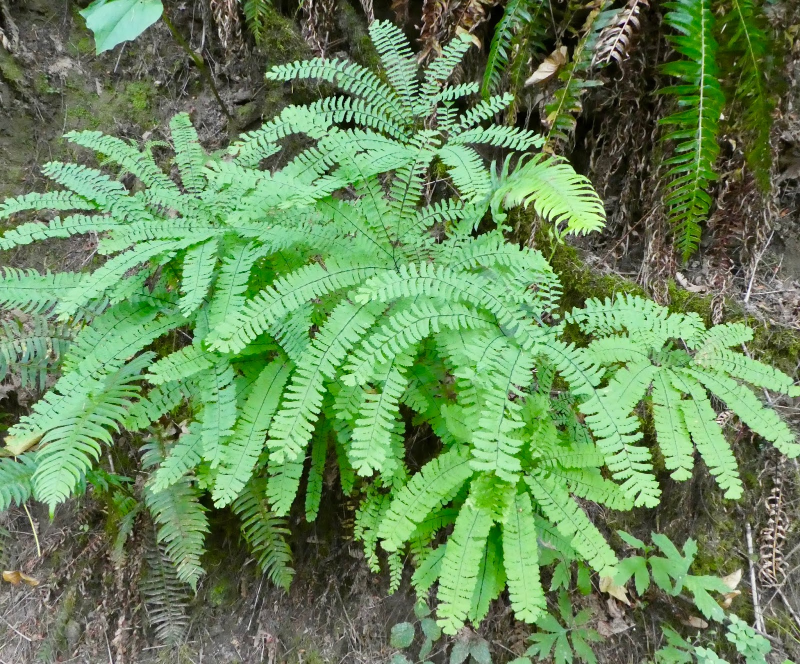
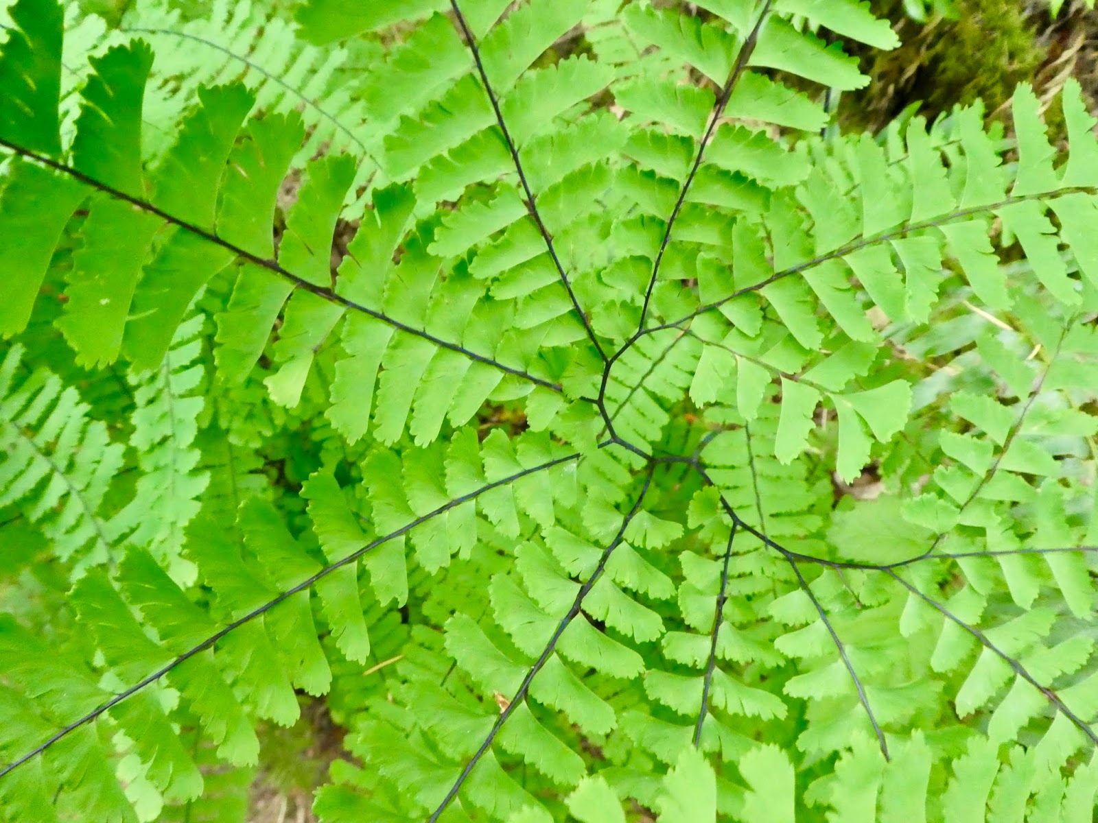
Maiden Hair Fern

Lots of big Doug Firs in the Park.

There is a major street crossing pretty soon after leaving the Arboretum. Careful here. It is marked for crossing, but not very well and the cars just come blaring down the street and seldom stop for hikers. Once across, you have to climb back up out of the gully. Pittock Mansion is up near the top of the hill, don't you know. With the view for the rich people. The trail winds its way up the Hill and right below the backyard of the mansion. Right now, a part of the trail that goes up from the Mansion access road to the parking lot is closed from a land slide. So you need to just follow the road up the last little bit. That is OK. This road isn't that heavily traveled and the cars are looking out for people. You also get a good view of the Mansion from the street.

Pittock Mansion:

We went up to see the Mansion on New Year's Eve. This was the last day that the Mansion was open for the "Christmas" season and still had all of its seasonal decorations. Lots of people there that day (oh, and the sun was out).

The Pittock mansion was built by Pittock and his wife. They were a well to do couple (He owned the local newspaper) and were also big on outdoorsmanship and public works. He summited Mount Hood 4 times and they were both active in the Manzamas. (more history here)

And then he built this place.

It certainly is big. And made of stone queried from far away and hauled up that hill. It also has all of the days modern gadgets:

1) An Elevator (the first in the area).
2) In house communications (Originally bells, but switched over to phones).
3) Furnace for the house (lots of wood stacked in the wood storage area)
4) Full Surround Shower in the bathroom (very funky).


There were his and hers rooms upstairs. He had a really simple little bed (which they assured me was historically accurate) and a huge bathroom with Bath and Shower and Foot-tub and just everything!! The Shower was like a Framework that you stepped into the middle of and then water shot out of spouts all around you. It also had a pretty fancy control for adjusting the temperature of the water.

The other bedrooms in the house were actually pretty small.


Downstairs was a library and parlour and dining room and breakfast nook. I was sort of thinking there would be a ballroom or something like that but the place really wasn't big enough for that. In fact. The REALLY BIG thing about this house is the central stair case. It is a double set of winding and flowing stairs. From the front door, the big stairs go down (to a big room. Perhaps for parties, not big enough for dancing though) and then to either side they wind up to the bedrooms upstairs. This stairway takes up the entire front of the building. A HUGE amount of space dedicated to the stairs and the impression of grandeur. I would have rather of had bigger bedrooms and perhaps an archery range.

The big front yard is actually out the back of the mansion. That is also the most interesting side of the outside of the house to view (and where all of the main room windows face). People arriving by car would first encounter the gate house (where the chauffeur and his family lived) and then sweep around the front for a grand view of the city and the mansion before arriving at the covered carport. Not sure how you got in the formal front door that leads to the magnificent stairway.

The back yard?

Probably had a different view back then.


At Christmas time the rooms are each decorated with a different Portland Theme. The library was the animals and plants of the area. The kitchen was the Dragon Boats. The dinette was Powell's Book Store; The sitting room was Mount Hood. And so forth. It was very nice and well worth the trip for the interesting Portland History that was on display.


On our way home, we saw this guy trotting down the street. Mr. Coyote


Pittock Mansion parking lot is also trailhead parking for more adventures along the WildWood trail. Let me just put a link here to the next section.