Wednesday, September 9, 2015

Trails Around Multnomah Fall: A quick Guide

For the past few years I have been doing a lot of day hikes around the Multnomah falls area. It is pretty close to Portland, It has some nice elevation (exercise), usually has parking, and can be hiked in most weather for most of the year. There are also a number of different loops and semi-loops that can be added together to form many different hikes of different challenges. I thought I had written about most of these but I must have gotten mixed up with some Facebook postings.

Interesting, you can say "Facebook" on this blog site.

Anyway, I decided to put together a general map and trail description of the area with pointers out to any more detailed blogs I may have done.

I have provided links to any in-depth blogs I may have generated over the years.
I don't like the map they hand out or post on the trails. I think it is misleading. So refer to the one below instead. You may want to print yourself a copy. I don't think Google will mind.


I have tried to place markers for the trail start and stop options. Some of the actual trails I have marked. The back way to Devil's Rest (Neskia Lodge Road) is a somewhat notional marking as it doesn't appear to be on maps anymore. Working with Google maps on that one.


Starting Points: (Well, technically end points also)

1)  Angel's Rest Trailhead
Unless you are really in for a big hike, you only start here if you are just doing Angel's Rest. I like Angel's Rest a lot, but the trail up can be pretty slippery and muddy.
There's a medium amount of parking. A lot of parking if you are OK leaving your car on the side of the road. This can be a very popular hike in the summer.


2) Wahkeena Falls
A small parking lot at the trail head. Really only meant for cars for tourists stopping to see the falls. Still, if you get there early, or just get lucky, you might find a spot. If you can't park here, you can park at Multnomah in the main lot or the highway 30 lot and take the half mile feeder trail above the road to start your hike here. This is a good starting spot for any of the loops or extended loops.


3) Multnomah Falls.
If you like people watching, this is a good starting spot. Lots and lots of parking, but there can be lots and lots and lots of people. Getting here around noon on the Fourth of July, for instance, is craziness. Using this as a starting point is pretty much identical to starting at Wahkeena. The connector trail is less than a half mile and you can do the many loops in either direction. And here there be soft serve ice-cream.


Loops and Loop Segments (Meta loops?)

1) Multnomah Wahkeena
Start at either of these falls. Go either direction. Change it up a bit. Hike past these 3 intersections: Wahkeena Springs, The CrossRoads. Larch Mountain Trail. This is a nice 5 mile hike. Lots of waterfalls. Plenty of water all year round.  The Crossroads is the halfway point and is the perfect spot for some lunch and casual conversations with people that don't have as good a map as you do.


2) Crossroads to Devil's Rest Plateau.
I marked "The Crossroads" on "The Map".  It isn't really called the Crossroads. But I call it that. I have tried repeatly to make it a "place" on Facebook. So when you are there, try to check in. I think I called it "Multnomah Wakeenah Crossroads". Or perhaps "Multnomah Wahkeena Crossroads". Just 50 feet down the trail is the (marked) trail up to Devil's Rest. I often go up that way to the plateau right near where I marked the Nesika Lodge road. That is a great place to hang out. I once ate Easter Dinner up there.   1.5 mils?


3) Wahkeena Springs to Devil's Rest (and Devil's Rest Plateau). 
Wahkeena springs is actually a marked turn off the trail right near the top of the climb up from Wahkeena falls. If you Head south following the trail toward Angel's rest, you will be doing this hike. Keep an eye out for handmade sign marking "Foxglove Trail". The Fox glove goes up and eventually leads to another crossroads marked with a sign to Devil's rest. I have marked this on the map as "Foxglove to Devil's Rest". I am a little unsure about what the map is showing for the first lefthand turn off of Foxglove. I don't remember there being an actual decision point here and it may be that some of that trail has become overgrown. Anyway, you can loop up past Devil's rest and eventually get to the Devil's rest Plateau described in loop (2). 3 miles?


4) Larch Mountain Trail to Devil's Rest (The Back Way).
The Trail up from Multnomah falls is also Larch Mountain Trail #441. If you are doing loop (1) you would take Wahkeena Springs trail #420 toward the Crossroads. BUT.... if you keep going up Larch mountain trail, you will soon find a bridge across Wahkeena Creek and then a pleasant continued hike along the river. At one point there is a high and low water turn out. Eventually you will come to a place where the trail crosses a dirt road. Turn right onto this road and you will soon cross a (car accessible) bridge. You are on what I am calling the Nesika Lodge Road. The last time I hiked this road the bridge was closed to cars, but I understand that it has been fixed. This is a an access road to some property owned by the Trail Club of Portland. Follow it up and around (you may have to negotiate a locked traffic gate) until you see some partially hidden signs and a space that might be for parking. There is a trail there off the road and if you go back 100 feet you will hit the Devil's Rest Plateau. Come down using loops (2) or (3). 3 miles?


5) Wahkeena to Angel's Rest.
Just follow the Angel's Rest Trail form the springs. You will get to go through some nice forest and potential camp grounds before you meet up with the Foxglove train again right at Angels Rest.  Lots of poison oak at Angel's Rest. Just saying.

Friday, September 4, 2015

Lunch time at Devil’s Rest.

Lunch time at Devil’s Rest


I do a lot of hiking around Multnomah and Wakeenah Falls. The area is at the West entrance to the incredible Columbia Gorge Scenic area and only about 30 minutes east of Portland. There is a lot of parking in the area, which is good because Multnomah Falls is the biggest tourist attraction in the state and there are ALWAYS hundreds of people there. But don’t let that scare you off because that is actually part of the appeal. All of these people are all over the place down at the base of the falls, but if you persevere and climb up on the very well groomed (and for the first mile, paved) trails, you can get past the reach of the first milers and into some truly wonderful wilderness. You will still run into a few hikers and/or lost tourists. But for the most part, these are all kindred spirits who have made it up to the ridge. Offer them some tea or a cookie and give them directions back to their car. It is all good.

When the Columbia Gorge got cut, during the last  days of the last ice age, it scourged though some old lava flows to make the Gorge as we see it today. To do most of the hikes in the area, you have to climb up to the top of the cliffs. This is about a 1000 foot climb usually done in the first mile of the trail. In the area of Multnomah, you can ascend either at Multnomah falls, Wakeenah falls, or Angel's Rest.  I usually like to do one of the Falls. Angel's Rest is OK, but the trail is a lot more muddy than the other two and just not as picturesque (though the view from Angel’s Rest is wonderful).

On the hike my Partner and I are doing today, we are going to take a very little traveled route up to the local elevation maximum of the area, Devil’s Rest.  We got lucky and got a parking spot on the old route 30 right in the lot at the base of Wakeenah falls. This area is often full after 9:00am and during the summer the traffic trying to get to Multnomah (the next falls and parking lot East)  often backs up the half mile to Wakeenah. 

Like Multnomah, the climb out of the gorge is paved. It is a steep paved set of switchbacks straight up the side of the cliffs. There is good shade from the trees growing there, however, and there are benches along the way to rest. I like to take a short break at each switch back. It gives me a chance to look back down the trail and out over the Columbia river. The Columbia runs east to west, so for much of the year, the sun is low in the South and the climb is all in shadow with the Washington side (over North across the river) revealed in bright sunlight. Today, however, is the middle of summer and everything is sunny and hot. In fact, the temperature today in Portland is supposed to hit 100 by 2:00, so my partner insisted that we get out on the trail early and get this climb done. Right.

Once this trail gets to the top of the paved part (at a nice overlook named after a fallen forest fire fighter) it meets the Wakeenah river and then does a constant set of short switchbacks up the Wakeenah canyon. This trail can be a little muddy and slippery in the winter but is pretty dry and easy this time of year. There are a lot of big trees growing up the canyon wall, and down by the water are many stands of Devil's Club.

Fairy Falls and a Wood Sprite

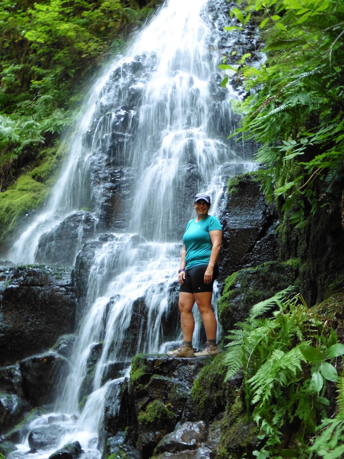
About halfway to the ridge, you find Fairy Falls. This is a pleasant little cascade that is the final destination of most of the intrepid tourists. We still have a ways to go though, so we push on.
At the top of the switchbacks you run into fir forest and a more flat terrain. This is the lower ridge. We are going to hike along it and then eventually ascend up to the upper ridge where we will find Devil’s Rest. The usual way to do that is to follow the signs east toward Multnomah river and take the offshoot trail up to the upper ridge. We are going to go the longer way around by first hiking over toward Angel’s Rest and then picking up the foxglove trail. So we take the right hand trail. 100 feet down this way we hit Wakeenah Springs. This is where the entire Wakeenah stream comes bubbling right out of the rocks at this nice little shaded area.

Wakeenah Spring. 


This is a great spot for have lunch and relax. Today, we are going to stop here for just long enough to top off our water bladders. I have brought my little filter and we quickly fill up. The water here is very cold, even at this time of the summer, and the flow is also strong and clear. I probably don’t need to filter, but I don’t see a reason to risk it. Something I realized about Wakeenah, though we are in the midst of a dry hot spell and at the end of the summer, when all of the other creeks and streams are really low (Multnomah falls, for instance, is a shade of its normal glory) Wakeenah is flowing along just fine. In fact, it seems to be pretty much the same as it looks during the winter rains. The source of the underground spring must mitigate the high and low water levels. I wonder how that works. Is there some great huge underwater lake up in the higher hills with a little out flow near the bottom that feeds underground to the springs? So the flow will be just about constant no matter what unless the secret reservoir runs out of water?  I am going to say it is unless Wikipedia wants to contradict me. (An internet search finds nothing except other people saying how nice it is to hike this loop. I will interpret their posts as reverse time derivatives of my work).


The springs area is a nice shade place. One of the areas flat enough to put up a tent (though you are not supposed to camp within 100 feet of water) and home to a nice stand of cypress (which are called something else on this coast but I forget what). There is also a curious little side stream that is all pebbled with red stones. You don’t see that color stones anywhere else in the area. 

The trail is now heading West down the Gorge with the occasional switchback to gain altitude. We are slowly working our way up the ridge and over toward Angel’s Rest. There's good tree cover from the hot sun here. On one of the switchbacks, we cross a scree of old basalt. The falling rock has knocked down the local trees (a few hundred years ago) and opens up a very nice view of the Columbia River facing East.  At the top of the scree we level out again and now it is just a few little bends around the tops of little valleys and small streams before we get to the left turn that is the side trail up to Devil’s Rest.

The Scree with a View
This side trail is called “The Foxglove Trail”.  This is not an “official” trail. It is marked and semi-maintained by unknown persons. It goes up the hill, connects with an old lumber trail, intersects the trail to Devil’s Rest and then loops back down to the Angel’s Rest trail (the one we are currently standing on). Today, this trail would be better named “The Salmonberry Trail” or perhaps “The Bramble Trail”. It is fairly overgrown for the first half mile we are on it and my partner and I got torn up a bit as we went. So bring a stick or a hiking pole or something to fight off the brambles.  Editor's Note: And the cobwebs, lots of spiders scrambling around trying to get out of my hair.

Remember all of those people we saw down by the trailhead on the Historic Highway? They haven’t made it up here. We have only seen one person since we left the springs. Now we are turning to make our way up on the Devil’s Rest trail. Be on the look out for the signs on the trees here as it can be easy to miss your way and get turned around.

I came this way once in the winter in the snow and damned near got myself lost and benighted before I turned around. It was a strange thing. I had seen the signs that said things like “Devil’s Rest” and “Angel’s Rest” but I was convinced that they were all pointing the wrong way. This turns out to be a sure sign your are lost. I was trying to get to Devil’s rest, and I thought I was going the right way. I was following the foot prints in the snow of a couple of hikers and they surely must have known where they were going. I would either find Devil’s Rest, or I would run into them. So I followed and followed. The way kept getting harder and harder and looking less and less like a real path. Surely I would hit something I recognized soon? It started to snow again and it was getting on toward the afternoon. Sun goes down around 4:30 this time of year so I really needed to be getting someplace soon. That is when the footsteps stop. Both pairs just stopped. What? Did they fly off? Then it hit me. It wasn’t a couple of hikers. It was one hiker. He had just turned around and I didn’t realize one set of footprints was going in the other direction. CRAP. I turned back and decided just to retrace back to my car. Then I saw my shadow. It was long a tracing out in front of me. In Front of me? Crap, I had been hiking 180 degrees in the wrong direction. It was cold. I was low on water. I had very little emergency overnight stuff. Just a light bivy. Got to be more careful in the future when I am out alone in the snow. 

But today I am out with my Partner in the Hot sun. And I have a lot of water. And we are starting up the now fully trusted and signed trail to Devil’s Rest. The only problem with it is that this trail is very steep. So steep that we both get winded on the way up and need to stop several times. We pass another couple on their way down. They give us the usual hiker greeting “Don’t worry, not much further. It is worth it !!”. The man tells us that Devil’s Rest is pretty cool and we should look for the pitchfork shaped tree that gives the place its name. The woman tells us to be on the lookout for the hidden grotto down underneath the boulders. There is a little shrine there. Okay. That sounds like fun.

The Grotto at Devil's Rest

Devil's Rest Boulders

Still some climbing to do before we get to the place, perhaps another 30 minutes. We are up on the top of the plateau by now and things are leveling out. You can see Devil’s Rest pretty clearly on a topographical map. It is the highest little circle in the area. But looking at it when you are there is a little less exciting. It is a nice jumble of big moss covered boulders. But the only view you have is of the towering trees that are all around you. We didn’t see the pitchfork tree (and I really don’t believe that is the source of the name) but we did find the little grotto. I get the feeling that this used to be a little place for gnomes to visit, but now it was sort of a place that people left little trinkets. Almost trash. Perhaps it is a geocacheing site.

So. A lot of hard climbing to get to a poor view. But take heart, if you continue on the same trail past Devil’s rest, you soon come to the Columbia Gorge cliff face. There is a side trail to a very nice overlook. A place where we could even see Mt. Rainer just peeking over the top of the hills across on the Washington side (or was that Adam’s? must check the pictures).


I guess that must be Mount Adams.

The trail winds it’s way down to a very nice plateau that is pretty much straight up from Wakeena springs. There is a lot of local water up here. Just little seeps and a couple of very small streams. But the entire area is a little wet. Perhaps this is the top of that underwater lake that supplies the springs. This is another great place to camp. There are a lot of flat areas that you could put up tents or hammocks and just enough water to filter even this time of year. And I have never seen anyone camping up here.  The funny thing is that just a 100 feet south from this area. Hidden right over there in the woods. Is a road. Strangest thing to think you are out in the boonies and then come across this road. This is a dirt road that goes down and across Multnomah creek to get to the lodge owned by the Portland Club. I hike up that way to Devil’s Rest on occasion.


Okay. So I got you up to the plateau up by Devil’s Rest. But what I really wanted to do was show you a map of the area that has the trails marked and is better than those terrible maps they hand out at the ranger's station. I am going to see if I can create one with Google's new map editor (even though I hate that thing).  OK. I changed my mind. I decided to do a different post that is just about the map. I will link it here when it is done.

see ya.


Tuesday, August 11, 2015

Roadtrip East: On to Pendleton

On to Pendleton


I have had this little dream, call it a mini-bucket list item. I want to go to Pendleton. I want to see the wild west part of Oregon. I want to go to the historic factory that makes the cool woolen materials for my blankets and spiffy handmade Jacket. I want to see the stage for the famous Pendleton Roundup and be awed by the mysterious Pendleton Underground.


And here I am, driving to Ontario, the perfect chance for an overnight pitstop in Pendleton.

You have to drive a lot. Just saying.

If you remember from my last post, my partner and I had just spent a rather parched couple of hours hiking the Deschutes river in 100 degree scorching sun light. We then took a quick shower (nice camp ground there at the confluence of the Deschutes and the Columbia), cranked up the AC in the Subaru and went on our way up river (Columbia). You leave the Gorge right about then and head out into the plains of Oregon. In fact, just up river from the Deschutes is the place where the Oregon Trail pioneers would have come down off of the plateau (that part above the river cliffs) down to the river. They came down to the Columbia where they would decide whether to float down the mighty Columbia (not a good idea with the dams not yet in place and Ciello Falls just around the bend) or take the nascent private railway down the river bank (pricey) or turn south and go around Mt Hood and down the route 26 highway (lots of graves that way).

The question you should be asking right now is, “How the hell does he know all this?”

The obvious answer would be that he was born and raised in Oregon and so had been taught the whole Oregon Trail and Pioneers thing ever year of his school boy life. Hell, he played the original “Oregon Trail” game every day for a year and only died of dysentery 37 times. He played the helpful Indian in the pioneer day play and lead the way across the Deschutes river, saving the intrepid pioneers nearly $10 !!. That would be the obvious answer.

Learning Stuff

These things are everywhere. Made from real trees.
But it would be the wrong answer. He was born in Beruit when his dad and mom were stationed there for a Navy assignment and only moved to Oregon when the job market went bad in Southern California. The right answer is: Kiosks.

There is an Oregon Trail Kiosk at ever park, trail head, rest stop, and byway all the way up the Columbia and through the passes to Idaho. They all look alike (here are a couple of samples) and inside of them are placards stuffed full of interesting tales and pertinent data. It is there that I read about the trail across the plateau coming down to the river at Biggs Junction. I also read about the helpful Indian that would lead the wagons through the shallow fords of the Deschuttes for $2 saving the settlers the $10 they would have spent on the ferry.

It is also where I learned about the terrible scar that the influx of settlers put upon the land they were moving through. Imagine it, thousands of wagons of settlers moving through and camping off the land. They would be following the instructions given them and the wheel ruts of the people before them. They would camp near water (where other people had camped). In a short period of time the arrid plains of the high desert were stripped of their game and their firewood. Every tree would have been cut down and burned. Every edible plant eaten (hell, many unedible plants eaten. Deadly Hemlock looks a lot like wild carrot, you know). They put a scar across the land that can still be seen in some places, if only as a narrow swale winding up the plain toward the next water. Still, you can easily see how it got to a point where the newcomers were not welcome and the locals were getting a bit angry about things.

But let's ask the meta-question. Why all of the hullaballoo? Why all of the Kiosks? After driving through the area I can pretty much tell you that the great Oregon Immigration is the last interesting thing that happened in the plains of Oregon. The thing before that was the retreat of the glaciers at the end of the last ice age. Wow. I just lost all of my Pendleton readers.

Perhaps they will come back if I tell you some about Pendleton.
View from our Hotel room of the Blue Mountains. 

First of all, the Red Lion Inn in Pendleton is a great hotel. It has great rooms with great air conditioning and a beautiful view of the Blue Mountains across those exciting plains. The restaurant is OK and they have a swinging karaoke. Though it is a sad Karaoke Night when the single woman gets up and can't convince any man to do a duet with her. She was relegated to “Stand by your Man”. Did I mention it was Country Karaoke? The Nipponese have insidious influence throughout America.

Oh. The Red Lion also has a great pool. And it is Dog Friendly. The building is on a hill, so you enter on the second floor. On the back side of the building (down the hill and facing the view of the Blue Mountains) is a wonderful little green lawn. All of the rooms that open onto that lawn, essentially in the daylight basement of the hotel, have their doors opening onto the lawn and the back of the building. These are “dog friendly” (and I suspect smoker friendly) rooms. You park out back, walk along the grass to your room and bring your cannine companion with you right to your room without ever going through the hotel. And you can play catch right there !! What a great idea. Not sure I would want to lay in the grass and sun, however.
Editor's note: People in Pendleton must love their dogs more than people in Portland.  How do I know this? I was so excited to see what Pupcakes were, until we got close enough to read the signs.  Check out the cupcake store we found:


I had mentioned the “Pendleton Underground” earlier. I have heard about this on NPR and that it was a “thing to see” in Pendleton. So I wanted to see it. That and the Pendleton Mill. Well, I got me some free WIFI so I looked it up. I could find a reference to a paid tour of the Pendleton Underground. That is nice, but I would rather wander around and do a self tour of whatever it is. But I couldn't find one. As far as I can tell, the entire endeavour is sort of like an ad hoc Ripley Believe it Or Not show. You know, like the ones you find at the boardwalk on the beach. Some sort of commercial affair through the basements of downtown Pendleton where you hear about the bad things that happened to the Chinese laborers that were housed there and moon shining and other stuff. OK. Might be fun. But it isn't open on Sunday. What? A tourist attraction that isn't open on Sunday? How does that work. OK. Plan B.

We want to go boot shopping. We are in the Wild West of Oregon (which, you may note, is in the East) and we want to find a place that sells real cowboy boots. Well, not too real. I don't want to ride horses, but I don't want to be walking around in Ostrich Skin line dancing boots either. The nice restaurant lady recommended we go to Hamley's. Looks interesting. Gotta find it first.

So we head downtown. I see signs all over the place pointing to “Pendleton Underground”. Sort of pisses me off, it being closed and actually a commercial enterprise and perhaps not still existing at all. But I missed the turn anyway and ended up on the other side of town and, Hey, lookee there. The Pendleton Mill !! The Mill is sitting where it has always been, right next to the railroad tracks running through town.

I borrowed the following link from Pendleton Woolen Mills:


Notice anything similar about these pictures?
Note that these pictures are referenced links from the Pendleton site. 

I fell in love with Pendleton Woolen Mill blankets when I first moved to Oregon. At first, all I had was a simple camp blanket which I used in the winter to keep warm while watching some evening TV. But later I found their beautiful Jaccard patterns and ended up getting Chief Joseph blankets for my bed and for pretty much everyone in my family. Then I had a winter coat made from my favorite black Chief Joseph. I love wearing this coat to go walking in downtown Portland on a cold winters day (or night). I always get comments. Most of them positive ones.

The current Pendleton Mill is also a museum and factory outlet. It is a pretty good factory outlet, they have damaged blankets and unwanted runs (like leftovers from some University Logo run) on sale for about half price. Something to think about.

But we were actually on a trip to find Cowboy Boots. At Hamley's. Well, that is only a few blocks away down the main drag. Big old historic building with a cool 50's electric sign out front. We parked in the already blistering heat and went inside to check things out. They certainly had a lot of saddles and art of naked indian princes, but their supply of boats was pretty negligible.


We walked around and looked at lariets and Winchesters and such for a while. My kayak partner used to jump horses as a teenager (she won some big local awards) so she could explain what the various strange looking dookers were. 
I love old American Town Buildings


My Dad used to drive one of these

Afterward we walked around the main blocks some. It was very, very hot. And very deserted. Nothing much was open beside Hamley's. Even the bakeries and such were closed on Sundays. There were a lot of brass statues and Western themes and closed or under construction buildings. Pendleton very much has the feel of a town that had a renewal and rebirth.... about 20 years ago. Perhaps if we were to come back during the Roundup. There is this HUGE rodeo collesium (closed on Sunday) that we drove by on our way out. If they can fill that sucker up for a couple of weekends, that might make the town more jumping. Probably on Friday.

Coming up Next:
Back on the Oregon Trail to Ontario.


Wednesday, August 5, 2015

Traveling East: Road Trip up the Columbia Gorge

Traveling East: Road Trip up the Columbia Gorge

The sign says this is an old church. It is out on "the Slabs" behind our Hotel.


The road east from Portland has been built and redefined many times in the last few thousand years. The first big change was caused by the receding glaciers at the end of the last ice age. The melting waters built up behind an ice dam in Idaho and Montana creating a temporary lake the size of one of the great lakes. Eventually, the water pressure built up and the ice dam melted to such a point that there was a catastrophic failure of the structure. Over the course of a few days, the lake drained and flooded western Washington. The Washington house of representatives was powerless to stop it. The waters swirled around looking for an exit past the mountains to the ocean and eventually carved one through the Columbia river canyon. Carrying the remains of the ice dam and the huge rocks attached to them, the waters scoured through the area cutting the wide and steep valley that we now call the Columbia Gorge. When this torrent hit Portland, it backed up against the local coast range and flooded south into the Willamette Valley. For a time the large valley was under 200 feet of water, with icebergs carrying Idaho boulders bobbing around on the murky muddy surface. As the waters receded, all was left changed. The icebergs in the Willamette Valley left their attached boulders sitting out on the plains as Glacial Erratics; The mud and debris left deep all around. The Columbia, up around the gorge, was scoured clean to bedrock. Large monoliths, like Beacon Rock, the core of and old Volcano, were stripped of their surrounding materials and left bare and wonderful rising out of the river. And that was how the humans found it.

The first local inhabitants used the Columbia River for transportation through the area, but they also made great use of it for industry. Fishing communities thrived in the places where the spawning salmon would be forced into tight, predictable areas. Ceililo Falls and the Cascade Rapids were two of these areas. The fish would have to fight their way up to the most easily jumped section of the falls and the local humans would catch them with ingenious nets and spears. Other mamals also took advantage of the salmon migrations. Many seals and sea lions would swim far up the river to gorge on the plenty of highly congregated fish. The humans would harvest them as well.

Then these two really pale guys and a bunch of their drinking buddies came floating down the river. Bill and Merry (almost Hobbit names) and their band of cronies were not something that the local humans had ever had to deal with. The more insightful of the locals wanted to immediately kill the strangers and take their stuff, but they were dissuaded by other factions and the rather impressive weapons of the pale guys. Why, one of the guys pulled a strange hollow pole out of their stack of stuff and proceeded to use it to throw rocks (very fast rocks) at any number of targets. The damage to the targets was very suggestive of the damage it might do to the locals. Perhaps trading was a good idea.

It is unclear exactly what would have happened if the Lewis and Clark Expedition of Discovery had just disappeared at this point. Probably wouldn't have slowed down things too much. It wasn't long before the next set of humans came wandering on down the newly named Oregon Trail. Down the Snake river they came, and then, where the Snake heads into Washington, they took their wagons across the short cut west to the Columbia and so downstream by boat to the Ceililo Falls. At this point a decision needed to be made. Ceililo Falls are really not that big. In fact, during high water (which happens most years in the spring) the river would rise so much that the falls would be covered and navigable by raft or boat. However, the reason the water rose is that just down river from there is a mighty narrowing of the canyon. The narrowing would cause the river to backup and flood the falls. But that narrowing was deadly during high water. Many of the pale ones drowned trying to take their families through that death trap. Presumably the local humans looked on, wondering what was up with these guys. The other route from these rapids (named by the previous French trappers in their own language “Dalles”) was to head south for bit around Mt Hood and then down route 26 eventually arriving in Oregon City. Many took this southern around route. There as a road that was built and the skiing up at Timberline Lodge is pretty wonderful all year around. Many of the original pioneers were very taken by the stunning views and Friday night Prime Rib in the Cascade room.

A common sight by the early pioneers, first glimpse of Mt Mood.
The route down the river was a bit more daunting. Not a good place to build a road. Various “portages” were built using railroad technology. The rails could be built up on log causeways and (what is a log bridge called?) the cars could be pulled by oxen until someone managed to get a steam engine up the river from the ocean. The steam engines were also put into paddle wheel boats which could bring entire loads of pioneers and their wagons and teams down river. Could they navigate up the Snake all the way to Ontario? Must check.

Still, the railway portages were not very efficient and couldn't carry as much traffic as the steam boats could carry. A water route was needed. At the Cascades rapids (near Beacon Rock) a side passage of locks were built right through the town of Cascades Locks. The town people were not happy about it, but if you go and name your town something suggestive like that you have to expect something bad to happen. This is why you don't find many towns named “Meteor Strike” or “Forest Fire”. The people that live in Tsunami, Oregon, for instance, must be fraking crazy. Back on the Columbia, more locks were needed, and a set were built around Cielilo falls.

About this same time a couple of interesting technologies were introduced that demanded change to the Columbia Gorge area. The first was the invention of the internal combustion engine. This little machine was light enough to put into a wagon and powerful enough to make that wagon move at speeds heretofore unheard of. (you like that? “heretofore unheard of”). These “automobiles” were great transportation and even greater at impressing girls and so they were suddenly all over the place. The rulers of Oregon got together to discuss this issue. They were not sure what they should do with all of these cars. They were clogging up the few streets in Portland. The cars needed someplace to be and the drivers needed someplace to take the passengers they were trying to impress. Something sweeping and romantic was needed. And they needed to find this something quickly or they wouldn't be able to make millions on the sale of fuel for the vehicles. And so the Columbia River Highway project was born. The idea was that this new road would be built that would wind it's way up the majestic cliffs and waterfalls of the Columbia gorge. Right now, there was just this old steam train railroad running through, and though train traffic could be romantic, the railroad was much too close to the cliffs to actually SEE them at the speeds that trains traveled. But the dang train tracks were sort of in the way and they had priority over the roadway. So the road had to be.... innovative. It had to cling to the side of the cliffs, burrow its way though the cliffs, leap about the base of the cliffs. In short, it had to be fun.

You can still see quite a bit of the old historic roadway. Hell, you can drive on it from the outskirts of Portland to Bonneville Damn. Take a day. Go slow. Stop at each of the many waterfalls. Don't go on a holiday unless you live for traffic jams.

I think it was the holiday traffic jams that finally pissed off the rulers of Oregon again. “Well”, they must have said, “that was great while it lasted. But now I believe it is time that we took advantage of all of that post war highway money and build a bloody great interstate. Something that will make it easier to get to Idaho in case there is a potato shortage.”

In the background, however, another technological revolution was biting into the gorge. The growing number of houses and industry were requiring more and more electricity. The corp of engineers decided that a number of places along the Columbia would be ideal for the building of damns for electricity, better flood control, and better river cargo transportation. The electricity could also be used for the war effort. What do you use electricity for, at home, during a foreign war? You use it to make the lightest, strongest metal in the world. A metal that is so rare when it was used to cap the Washington Monument it was the most of that metal ever assembled, and yet so common that it can be found in almost any state in great supply. Aluminum. Aluminum is not found in nature as anything except the oxidate mineral Bauxite. Bauxite is very common but cannot be refined into the metal aluminum through any process except high voltage electrolysis. So the Ancient Romans didn't have much of this stuff. Because of this, Aluminum smelting plants like to be close to hydroelectric power plants. Just like google computer server installations, both take in huge amounts of electricity and expel important societal needs, like Coke Cans.

Oh yeah, I promised two critical war needs for electricity. The other was making plutonium. Perhaps sometime I will do a blog about [name and location erased by NSA].

Anyway, we needed electricity, so the dams went up. The rapids at Cascade and Dalles were flooded. Even the old locks were flooded in many areas. Barge traffic could now travel from Astoria pretty much to Canada. In fact, these days you can catch a luxury stern wheeler from Astoria to the middle of Washington.

And that is where we have it now. Old Historic and constantly used railroad, Old Historic and eternally used roadway, Aging but still viable lock and lake waterway, New huge and fast interstate. Take your pick. Well, as long as you pick interstate.

On this particular hot summer day my partner and I are traveling east by car to do some sightseeing whilst en route to Ontario (Oregon, not one of the other ones). She is signed up to do some training on infant mental health for the county of Malhuer and I am along to hang out in hotel rooms and look pretty. We plan to stop at the Dalles, Pendleton, and Ontario. We haven't decided how to get home yet.


The Slabs
Our first night we spent at the Shilo Inn in the Dalles. Out the back of the place was a few (preserved?) old wooden buildings and the Dam. The Dam at the Dalles is a strange one. Most dams just go across an opening in the canyon (think Hoover Dam) but this one is more like two low dams that come out from the curving canyon and meet at a corner. So the walls form a bit of a 90 degree 'V' pointed right at the city of the Dalles. And why “The Dalles” by the way? Well, Dalles is French for 'slabs' or 'flagstones'. Dang, I thought it was rapids. Anyway... slabs.... I guess that would be all of the flat rocks that are out on the river. The ones that are now presumably flooded by the dam. Damn. I sure hope Deschutes is more interesting when we translate that. And why are all of these locations getting French names? The main reason was to drive up housing prices when the Pioneers came through because the french sounds so much more cosmopolitan. I mean, what would you spend more money for, a shack in “the slabs” or a dwelling in “The Dalles”? Ok ok. The real reason was that the first white people in the area were the french trappers and they named the rivers for the features they saw. There are currently pushes in many areas to try and put the names back to the local peoples original names. I mean, Mt Hood was named by a British junior naval officer trying to make points with his commanding officer. Wouldn't it be better if we thumbed our nose at the brits and named the mountain back to Wy'East?

Random Piece of Advice: When traveling in rural America and staying at quaint little hotels. Never get the cheapest room. Always spring for the king size bed upgrade. Just saying.

Deschutes River Park


Saturday Morning my partner and I wheeled out of the slabs and headed east. Our plan was to stop at the mouth of the Deschutes river at a park there and do a hike up the river. Get some exercise, break up the drive, provide rich and new blogging fodder. That sort of thing. One central flaw in our plan turned out to be the heat. It was already 90 degrees when we got into the car and by the time we had drove the 20 miles up to the Deschutes river recreational area, it was like 95. 95 and hot hot hot sun. If you got into the shade, it was OK, but there turns out not to be much shade out on this hike.
We were loading up our packs (we had gotten a lot of bottled water at the Fred Meyer in the Dalles) when a local ranger came up to us. He just wanted to say hello and make sure were weren't trying to camp where we were standing. We told him that we were going to hike the river trail and then head up the hill to Ferry Springs.

“Wow.” he said, “That is quite the Hike. Be careful of rattlesnakes. They have been all over the place this season. Even coming down into the park, which they never used to do. Oh, and ticks. The ticks are EVERYWHERE. Stay out of the high grass.”


Great.

Turns out it is easy to stay out of the high grass. Just stay down by the river where it is cool and completely overgrown with Blackberry brambles and Poison Oak.

So. Here we start off. 100 degrees now in the scorching Noon sun. A little bit of shade down by the river but I REALLY hate poison oak (and it was ubiquitous). But it turns out we had a mild selection of trails to consider:
  1. The River Trail, which I will call “The Poison Oak and Dead Fish” trail. This summer's ghastly heat and lack of rain has heated the river to a point where the salmon are dying. They are dying and floating to shore and you can smell them up and down the rivers. I was wearing long pants and a long shirt for sun protection, but this would also work ok for poison oak protection. But my parnter was in cute shorts and low socks and I could see her ankles swinging through that trecherous green stuff. She isn't particularly afraid of exposure to the stuff but it was driving me crazy. I really wanted to pick another trail.


  2. The Middle Trail. (The Snake and Tick Trail). This one went through what would have to be the definition of “high grass”. Once again. I was wearing appropriate protective clothing. My partner, it turns out, is much more afraid of ticks than she is of Poison Oak. Our conversation on the way showed the problem. She has had a lot of experience with ticks on her person and those of her children. For me, it has been all about encounters with Poison Oak (and it's evil sister, Poison Ivy).


  3. The Trail. (The Hit By Bike Trail). This is a converted railroad right of way. Wide, rocky, easy to talk. Easy to zoom down much too fast on a trail bike. Very hot with the reflection of sun off of the gravel.

  4. The high Trail (the much too hot to actually consider trail) Perhaps that was where the snakes were.


    We opted (well, I led down) the middle trail. The trail book I had consulted for this hike assured me that this trail was lovely with wild flowers and cool breezes during the spring. It didn't recommend hiking it in the summer. I think the author could have been a little more clear. Don't Fucking Hike it in the Summer! There. It was very hot. Very dusty. It did afford some lovely views of the Deschutes River but, did I mention it was hot and dusty?

Rattle Snake Rapids

By the time we had reached the half way mark (where the Middle trail climbs up and intersects the Trail) my partner was VERY hot and very dry. I think she was border line heat exhaustion. Did I mention that I was wearing a long shirt and pants? Usually in a situation like this, I would be just dripping sweat. Water would running down me in streams. But today, I was essentially dry. I had consumed almost 2 liters of water and yet I wasn't all sweaty. Evaporation. It was so hot and dry that the water of my body was evaporating as fast as I cold sweat it out. My theory is that my long clothing was distributing the water and helping me to cool more efficiently and so I wasn't in trouble with the heat. Or perhaps it is just my families tendency to sweat like horses that was protecting me. Anyway, my partner wasn't looking so good, but I knew that it wasn't in her to cancel our planned adventure. So I did it. I nixed the High Trail to Ferry Springs and started us back down the Trail to the car (the Air Conditioned Car). The views of the river were still lovely. And we did see some wild sun flowers that were an exciting counter point to the brown of the dead high grass and sage. At one point, the old railway trail crossed the little trickle of stream downhill from the presumed Ferry Springs. My partner soaked up the stream in her bandana and dowsed herself good. It made her feel a lot better. It was so hot that the water I was carrying in the side pockets of my day pack were almost too hot to drink. Not very refreshing to pour on your head.


And we saw this thing:
What the hell is it? A Cow Washer?


I will say this about this hike: I am going back in the spring to see the flowers and not bake my sorry ass.

Coming up next: The exciting Drive To Pendleton !!