The Narrows
Yes, Yes, I know, I have already taken
you to the narrows, but this was an emergency “The Sun Is Out And I
Have To Go Kayaking” trip and my kayaking partner insisted on
something a little more challenging than a water jog around Ross
Island. Besides, she had never been to the Narrows.
So we put in, right around 6:00pm, at
the public boat landing in West Linn. This is on the North shore of
the Willamette about a half mile up stream from the falls in Oregon
City. The sun was out, but it would be down by the time we got back,
and the water is still cold this time of year, so we were both
wearing farmer john (jane) wetsuits and had jackets in our hatches in
case we took a tumble.
It turns out that different people
prefer to launch in different ways. I like to launch from the shore.
I like the water to be about a 6 to 10 inches deep. Then I can
straddle the boat and easily lower my but onto the top of my seat,
swing one leg in, and then balance with the paddle on the bottom
while I swing in the other leg and lower myself into the boat.
My partner likes to enter from a dock.
I think this is tricker and requires better balance and stronger
knees, but you don't have to get your feet wet.
West Linn has a boat ramp AND a dock,
so you can enter and exit anyway you choose. Luxury. We headed up
the river. The Willamette is maybe a quarter mile wide at this point
and the current is very slow; perhaps a knot. We headed up the west
shore only slightly harassed by the 3 or 4 super big expensive ski
boats that were jockeying for open water out in the center of the
river. I don't know if this is a really good place to ski or if it is
just close to the big expensive houses where all of the super big
expensive ski boats like to live.
At any rate, we paddled without
incident or subsequent loss of life to the start of the narrows and
started up the west side of the little islands there. At the Narrows,
the Willamette creates 3 channels. The central channel has by far the
most of the water and current and is where the main boating channel
is (when the lock at Oregon City was open you could probably see some
pretty big barges through there) the East channel (where we are
headed eventually) is very low current and shallow, but has some fun
rock formations and places to play. The West channel, where we are
right now, has some faster moving current, but no big deal. It mainly
has a place where the rocks come up and the water gets shallow and
you have to paddle a little faster to get around the bend.


In this area you will see some Madras
trees. Also called Manzanita. I guess they don't grow in very many
places inland (you see them a lot on the coast). You may also see a
few Eagle, Osprey, or Heron. The actual lay of the land here is very
dependent on the height of the river. But it is mainly made of rocks
somewhat scoured clean by the river at flood. Today we are at medium
flood. We paddled up to a cute little cut between the islands where a
2-3 knot current pulled us through a 15 foot wide slough over to the
central main channel. I was a little hesitant about crossing the main
channel. The current was running pretty hard through there because
the Narrows are... well... narrow. The big lazy river is suddenly a
much smaller much less lazy thing. Lots of up swirls and eddylines
and whirlpools. I also suspected sea monsters. So my partner and I
stopped on the little rock of a central island and looked at the
flowers.
 |
| Some sort of wild Onion |
 |
| Yarrow? |
 |
| Scoured Rocks and Moving Water. There be Monsters. |
It turns out that paddling with an
experienced kayaker and therapist can be a good thing. She explained
the eddylines and currents to me, talked me through my fears, and
convinced me that we could go out on the river and she could defend
me from the sea monsters.
An
Eddyline (besides being the kind of
kayak I have) is the cross over between two opposite or different
currents. It is a place you can definitely see on the water, and when
you cross it, you fell it, and things happen. The moving water will
hit your boat and do 2 things: 1) push the bow of your boat quickly
along in the direction of the current (as one would expect) and 2)
Grab the bottom of your boat and try to throw your right over in a
direction that would be toward the current (which I certainly didn't
expect). You counteract this by leaning away from the current, doing
a brace turn on the low side and turning your boat to be going WITH
the current. “You can't fight a real eddy current. They are just
too strong. You have to enter the current, become one with it, and
then cross it”. And as I understand it, it is better to become one
with the current while still right-side up in your kayak.
Today it was sort of a joke. The
current really wasn't that strong and the sea monsters don't come out
on sunny days, so we just went into the current, got gently spun
around a little and then edged over to the east side of the river
and entered the east channel.
Here we paddled upstream to a favorite
little place of mine where there is a mini-whitewater of current from
the main to the east channel. I paddled up that and waited for my
partner to follow. The secret to this is to get into the center of
the flow an GO STRAIGHT and hard. Just paddle up it. If you drift to
the side, you risk getting turned side-on to the current and rolled.
In which case, you might smack your head on a rock. So don't do that.
When my partner caught up with me she pointed out that she found
that much more challenging that crossing the big river. Well good, I
feel less like a wuss. Later we found another little
restricted-space-current area did some more fake white water. I sort
of liked it.
 |
| A little circle Eddy. You can just see the little "white water" current ahead of us. |
But now it was starting to get cool and
the sun was starting to go down. Must be after 8:00pm. Time to head
home. We just exited the narrows on the east side, and crossed with
the current over to the west. I was only scared shitless one time.
This was when my partner, who was behind me, said “See Jon, the
current isn't that bad. Oh oh.” (turns out she was having trouble
with my camera that she had borrowed, not with the current. Still,
avoid saying “oh oh” when you are behind someone and they cannot
turn around to see you without being gobbled up by sea monsters).
Back at the dock once again time to
answer that perennial question, “do we do rolling practice?”.
Since we were not wearing our skits, a roll really meant a half roll
and wet exit. I decided no, but I wanted to test my new electric
bilge pump setup, so I went shallow to get out and flood the boat by
hand whilst standing. My partner was made of sterner stuff and when I
looked up, she was upside down 30 feet off shore. And back in the
boat in less than 2 minutes. A boat full of water.
Now the funny part. The watching
citizens of West Linn came flooding down onto the dock to make sure
she was OK. Why did she flip over? Was it on purpose? I was taking
your picture and you flipped over? Why didn't your partner help you?
Wow your really rescued yourself fast? What kind of boat is that? Why
didn't that guy help you? Are you really with him?
Oops, look at the time. Better get out
of here........
 |
| Sun Set on Kayak |
 |
| Sunset on Tualtin River |
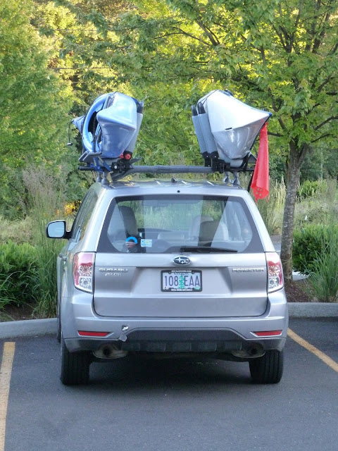 |
| Got to Love A Subaru with Yakima Racks |


