Sunday, May 26, 2013

Nehalem River to Aldervale

Nehalem River to Aldervale


This is actually a kayak of the North Fork of the Nehalem River. This isn't the one that my train line follows. Which means I have another paddle to do in the future !!


View Nehalem River to Alderdale in a larger map


This was a dual Meetup trip. Half the group went up river to explore, half went down river to find the ocean and play in the surf (or as I call it “die”). I elected to take the up river jaunt. We up-river-ers met at the public boat dock in the little town of Nehalem (pop. 371). I like this town because of the amount of schtick per square foot. It is very close to Nehalem Bay State beach, a big summer camping destination, so it has a lot of things to cater to people passing through. There is a nice little mom and pop grocery where you can get a sandwhich, beer, and aluminum foil. There is a antique's store that more resembles a yard sale. A drive-up coffe place. A store that seems to specialize in “Tarps, Ropes, and Tie Downs” (I bet they do a brisk buisness out there on the rainy coast or Oregon). There is also a public bathroom and a little public dock. No ramp. Just a tie up or a place to launch boats that you can carry down the foot ramp. Hey, I just happen to have a boat like that on the top of my car!! Let's try it out.


We pushed out from the dock around 10:45. The water was glassy. The wind was still. The tide was on the make. We had a perfectly lovely pre-noon paddle just floating in land and enjoying the quiet of the day. These kind of trips make it easy to move around the pod and meet and greet other kayakers and hear their stories. This section of the Nehalem is tidal. Lots of old dead trees have floated downstream and the water just sort of winds lazily around. The banks are high and we didn't have much of a view except of the grass and mud.

At one point some of the local cheese makers (AKA: Cows) came over to give us a stare. They were very inquisitive as long as no one made a sudden move and freak them out. I was expecting to see a lot of birds, but we really didn't see many. A few Osprey. A Kingfisher. Some little tweeter birds.

Everyone has a red Tsunami except me.


Cow prowling the Veldt


We passed several little “by the water” communities. One was built up of these little camp trailers. They appear to be travel trailers or 1-wide's that have been framed over by a carpenter to look like little cabins. Very pretty little things. And sort of funny to see lined up 20 at a time.

Little pre-fab community

This was a longish paddle and our arms and legs were getting strained by the time we found the boat ramp at Aldervale. Not much of a ramp, just a road going into the water. At the top there is what might be a parking lot. At least the brass was mowed. While we ate lunch the owner of the nearby house came over. I thought he was going to chase us off, but no, he was just coming over to introduce himself (Dave), say hi and tell us the history of the area. Turns out that the location is called “Aldervale” not because of the Alder trees (my guess) but because of the old barn on the property that used to the “Aldervale Cheese Factory”, one of the original Tillamook cheese making locations. Personally I still think that the Alder trees in the area might have had something to do with it. He also warned us that the wind was going to be picking up soon and would be blowing on our nose all he way back to Nehalem. (He was right. I suspect witchcraft).

The Bustling Boat Ramp at Aldervale


So with that in mind we got back in our kayak's and took off. I was having a particularly bad time of my entries and exits today. I like to enter and exit in shallow flat water close to the shore. But I didn't get those today. Even at the boat ramp, the lay of the ground was rather steep, which means if you boat is floating, you are standing in knee deep water, which makes my usual sit down entry harder and tipier than usual. Fortunately one of my kayaking buddies was there to help me out. We always help each other out. Well, unless you are the last to get into your boat. I wonder what ever happened to that guy.....

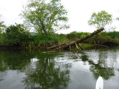
Back down the river we go. The tide was super high by now, with many live tree branches showing green leaves under the water on the sides of the river. Our Pod lead wanted to go exploring one of the side canals and so I followed down a tree overgrown area and we paddled back a few hundred yards till it bottomed out at a little manicured lawn. I am thinking beaver.


The Secret Way

There be Elves about, I am thinking. And Skunk Cabbage.


Back to the main channel, and we started getting that wind that the weather witch of Aldervale had predicted using his eldritch spells and special links to the spirits of Nehalem. The river kicked up a bit and we had some swell to play with. I may have taken a few small waves over my bow. When you have to paddle into the wind the work gets a lot harder. I don't think you go much slower, but you have to push more to got he same speed and you can't glide and relax anymore. So we pushed over to the north side of the river, tried to stay out of the wind, and paddled harder.

So we were glad to get back to the dock. I had brought my little bilge pump I have been trying to design and had worn my dry suit, so I flipped over and activated the pump. I have a little film I made from the bow. Not sure I will attach it. The main thing you see is the absolute look of horror on my face when something grabs my leg (turned out to be my paddle). Bilge pump is still not reliable enough to be able to use in a non-test situation. I need to think more. I may have to bite the bullet and drill some holes in poor Journey.

Can I stick a video here? Will Google charge me extra?


Afterwards we met up with the surf group and went to a very nice little restaurant called the Big Wave Cafe in Little Apple (oh, sorry, I think the town goes by the Spanish name: Manzanita). I had a delicious plate of Salmon Fajitas and some Marion-berry pie with Tillamook Vanilla Bean ice-cream. YUM.

Sunday, May 12, 2013

North Fork Reservoir, Clackamas River.


North Fork Reservoir, Clackamas River.

I have never been on the Clackamas river before. I have seen it from the road and even boated past the mouth while on the Willamette, but never actually been on the river. Come to find out, it is a great river for swimming, boating, and fishing. Amongst other things, it is much cleaner than the Columbia or the Willamette. It is also very cold.


View North Fork Lake Kayak in a larger map
On this particular perfect Sunny Saturday afternoon I set out with two new kayaking friends to have some fun in the North Fork Reservoir. This is a lake made by a small hydro-electric dam, The North Fork facility, which generates enough electricity to power more than 4,500 homes, went into operation in 1958. The project created a 331-acre lake, with which PGE controls river flows at North Fork, Faraday and River Mill” (From PGE page)


There are a couple of public places to put in and one private launch area. The private place was closed, so we went to a little side road right up at near where the river dumps into the lake, emptied our cars there and then parked along the road. Not a lot of parking there, I am betting it is hard to find a legal place during the summer. But it was only a 100 foot portage down a paved road to the water and it was easy to launch from there.

We first headed up stream. The South side of the lake is sheer too and I found a pretty little lily that looks like an avalanche lily, but the location and time of year is a little wrong for that. Take a look at the picture and let me know what you think. Plenty of beaver sign over in that part of the lake also.


Next we headed up the steadily strengthening current till we got to the actual flow of the river. A few little white rapids were present. When we just didn't feel like fighting the current anymore, we turned and ran quickly down stream. Back past our put-in and down to the very slow moving and deeper waters. Lot's of fish to be seen. And many aquatic foul. We saw quite a few Canada Geese and Common Merganser ducks.

A mile or so down the lake and there is a place where the road bridges a side finger of the lake and there is this cool large culvert that you can easily paddle a kayak through. Hell, you could motor a small fishing boat through. On the other side is a shallow protected area of the lake. Perfect for swimming and fishing and practicing rolling our kayaks.


The two lovely ladies I was with are much better kayakers than I (another good reason to hang around with them) and they changed into wet suits and practiced doing rolls. I have to learn how to do that. If you can't roll, you have to do a wet exit and self rescue. I was in a dry suit and I was practicing that. I had also brought along this little battery powered bilge pump I have rigged up. I am trying to figure out a good way to connect it up to my kayak without having to drill any holes in my poor Journey.


Now if I can just get my feet in.


I am glad I wore the Drysuit. The water was much too cold to be spending any extended time in it. My partners were very cold after a couple of rolls and we soon were all sitting up on the banks taking in some sun and having a little meal. One of the nice things about a kayak trip is that it is pretty easy to bring a lot of supplies with you. Fortunately for the cold ladies, this was an incredibly beautiful spring day. Temperature was over 80 and not a cloud in the sky. This is the type of weather where people die in Oregon because they dive from the hot bank into the cold water and pretty much die from shock. There are signs to that effect posted in many swim holes.

We left our little Thistle and Blackberry encrusted beach just as the sun dipped down below the far tree line. A very hot wind was picking up but the other side of the tunnel was not churned up (as it often is in the early evening). We had a very pleasant paddle back. On the way we passed a 10 foot or so deep area where we could see to the bottom, there were a lot of fish down there. I am thinking trout. (PGE says they stock the lake with Rainbow). Most over a foot long. If I had had a reel I could have caught us dinner.
Still at the close of the day


As it was, we loaded our stuff back on the cars and drove into Estacada for a pleasant dinner with a view of the river. All of the specials for the evening were mexican dishes, which seemed strange to me until my paddle friends reminded me that it was Cinco De Mayo.  

Sunday, April 28, 2013

Bachelor Island


Bachelor Island


Yes. Kayaking again. But my arms are getting buff.
Good thing too, because this paddle had a bit of weather that made for some challenge.

But First: Bachelor Island.


View Bachelor Island in a larger map

This is one of the low lying essentially old sandbar islands that litter the tidal confluence of the Columbia and Willamette rivers. I am sure Lewis and Clark and something interesting and misspelled to say about them. In more recent times, Bachelor was put to agricultural use, but today it is a “Natural Preserve”. I am beginning to think that a Natural Preserve is any piece of land that has had all of the tree's cut down and the ground ruined by over farming. But perhaps I am jaundiced. Perhaps these farm lands were abandoned because the clean water act made them stop using pesticides on land that could only run off into the river. Shall I look it up?

OK, Lewis and Clark called it “Green Bryor Isd” on their way west. They probably meant Green Briar Island. On their way back east they changed the name to Quathlahpotle Island. (This is clearly a misspelling of Quathlahpotel). Either they didn't like the name Green Bryor anymore, they had forgotten they named it, or they were completely aware that everything they were naming had already had a name for centuries and so re-naming something every time you passed it was just a part of the natural course of events.

In any regard, we started our journey today at the public landing of Ridgefield, Washington. This is a nice little town right down on the banks of the columbia floodplain. The Amtrak line from Portland to Seattle goes right past the town and the landing. I saw 3 trains go by (2 Amtrak, 1 Freight) just in the little time that we were loading and unloading. One of the trains may have been local commuter, I guess I need to look into this, because riding the train up to Bellingham for the weekend would be a blast. Did I get distracted again?

Ok. So. We are launching at the ramp on Lake River. Curiously named Lake River because it is a tidal slough that flows out (and in) to Vancouver lake. So you can paddle all of the way from Vancouver lake to Richfield if you have that kind of time.


But today we are headed to the mighty Columbia.

A few fishing boats power by us. The shallow water seems to be on the south side (river side) of the channel, so we stayed over there to keep away from the wake makers. About a quarter of a mile along we took a left turn down a side channel called “Bachelor Island Slough”. Lewis and Clark called it something like Pigeon creek, which I like more.

Entrance to the Slough

What are all of these piling for?


My Kayak partner (who was leading this trip) told me that the last time she had been on this paddle, the slough was very narrow and difficult to navigate. The water was only around 18 inches deep for the entire length. Today we have a 50 foot wide channel and plenty deep enough in the center for some kayak dump and rescue practice (which we did).

I have been wanting to try out a Tempest, which my partner just happens to have, and so we did a deep water boat switch. Now that was interesting. It gave me a good chance to see the difference in stability in a boat with soft chines and hard chines. Not sure which I like best. I was having a hard time keeping the Tempest going in a straight line, but that may have been because I didn't have the skeg down. Will have to try again sometime.

When we finally viewed the Columbia, there were breakers coming down the slough at us. I was worried that the wind that had sprung up on our backs could be churning that up, but it was just a few waves so we figured it must be the wake of some passing giant.

Then a pair of eagles flew over our heads. Cool. These guys come back later in the story, so keep an eye on them while we paddle. Right at the entrance to the Columbia river, we pulled over on a handy sandy beach to switch back into our own kayaks and have a snack. (And to stretch and see what the wind was doing!). Some dark clouds are blowing in form the North, but they don't really look like storm clouds. Just sun blocking. It quickly got a few degrees colder as the sun winked out for the day.

Journey on the Beach


I looked up river and there was a very large commercial freighter headed down river with a substantial bow wave.


The boat is maybe half a mile away and I know the wake is going to be interesting when it gets to us. So I watched (but I forgot to have my camera ready). With no particular sign of the waves coming, the river lapping at the stern of our beached boats suddenly disappeared. It.... sucked back. And I thought, “oh Shit, just like a tsunami”. And then the wave came up and I had to walk briskly to one boat and pull it up the beach a couple more feet. That was really cool. I could see the waves breaking to our left up the slough. That is exactly what we saw when we were arriving. Must have been 2 freighters.

Before we started down the main river my partner gave me a safety talk. She warned me to stay outside (in the deep water) away from the lines of pilings that we would be passing. The currents can be wicked running between them and you can get flipped over and sucked under. Well, OK, scare the crap out of me why don't you. It can be hard to feel manly when your female kayaking buddy has to keep asking you if you are doing ok. Good thing I rate safety over manly. I must be mature.

Even though we were going down river, the tide was coming in and the wind was picking up right in our faces, so it felt like we were paddling up hill the entire way. There was a little current down stream, but I don't think it was nearly what it would have been if the tide was fully on the ebb. So watch for that. Even with this light current, the 50 years downstream of each of those pilling lines was salted with upflow eddies and whirlpools. Not a big deal, though it did push me around a bit and made me wander what it would have been like with a real current running.

We tried to stay over close to the shore of Bachelor Island when we were not dodging (what I now knew were) death trap pilling lines. But still the wind pushed waves were getting larger and the paddling was a slow slugging.

We did get rewarded with an Osprey making a fish dive right in front of us. Dammit Osprey, give me a 10 second warning to deploy my camera, will ya? I also learned the number one rule of instablity. What is the first thing you do when you feel that you are loosing your balance? Sit up straight? Arms under you? Low Brace? No, take a forward paddle stroke. Get moving. You are more stable when you are moving. Forward Paddle. Forward Paddle.

And so we Forward Paddle all the way down the length of Bachelor Island (named for 3 bachelors that moved there in the 1800's. What would we call an island today if a bunch of unmarried guys went out to live there?)(Not that there is anything wrong with that).

Just at the tip of the island, we come back to Lake River, and the beach that we intend to use as our picnic location. As we approach, there is this large aluminum sport's fishing boat coming in from the river. He is several hundred yards out and we should have time to cross the little Lake River channel and he can pass behind us. But as we paddle, he doesn't turn. In fact, if anything he is aiming more and more right at us. And he isn't slowing down either. Does he not see us? Hell, I am wearing a bright red PFD, Dry Suit, and Spay Skirt. He is blind or a fraking asshole. Finally, not 50 feet from the shore, I yell “He isn't turning, backwater.”

And we stop. And he wasn't turning. Or slowing. And he goes zipping past us about 20 feet away. What an ASSHOLE. Or as NPR would say it , “What an ASS<bleep>”. (You can't say “hole” on the radio, you know). So, some bigger wake over my bow and then the last 30 feet up onto our beach for lunch and some follow up cursing.


So, at least in these weather conditions, this was a sheltered beach. And there is a large tree log to hid behind if the wind whips up. It was getting ever cooler, however, and we both put on fleeces and had some hot tea. After lunch we quickly packed up and headed east for the last little push back to Ridgefield.

But, time for one more little show. Up ahead I saw an Osprey doing something strange. I thought he was hovering and fishing, but he seems to be dive bombing a tree. Over and over again. We get closer and I see that in the tree is a bald eagle. The osprey is very upset with this eagle and spends a lot of time and energy making passes at the much larger bird. The eagle is nonplussed on his branch.
I have pictures.

Though not great pictures....... sigh......


We continue on, and after a bit the osprey comes winging over our head. Then the Osprey heals and dives and plummets into the creek ahead, to come up with a fish !! so cool. Then the Osprey flies away from you us and now, close over our heads, comes the Eagle. “He is chasing him” says my partner. Oh, she is so right. That eagle just powers after that Osprey, and catches him, and (now things a far away, so what I think happens), the eagle takes the fish from the Osprey. Now the osprey is chasing the eagle, but I don't get to see what happens. Well, that certainly explains why the osprey was so upset with the eagle earlier. What is up here? Is the eagle not capable of fishing? Are they fighting each other for territory? Are Bald Eagles just big bullies? Hmm.

We ended up back at the landing. Easy pull-out here either on the actual concrete landing or the mud too the side.

Animal life seen: Bald Eagle, Osprey, Kingfisher, Great Blue Heron, sea gull. Some trees.

Some Adventure !!

We got off the river around 7:00. So we were paddling for....... 6 hours? That sounds a bit long somehow.


Sunday, April 14, 2013

Willamette River (Boone's Ferry Landing to Willamette Park West Linn)


Willamette River (Boone's Ferry Landing to Willamette Park West Linn)


If you want to do a down river run on the Willamette, there are scores of choices for put-in and take-out points. On this particular day we chose our take out as being as close to Oregon City as we could get without actually going over the falls (or breaking other laws). There are a few “Willamette Park”s, this one is off exit 6 right in West Linn at the confluence of the Willamette and the Tualitin rivers.
View Boone's Ferry to West Linn in a larger map
We wanted around 3 hours of River time. The river was listed at flowing at 2 mph (which is moderate fast) and a person can do an extended paddle pace of around 3 mph (which means going upstream would be damn slow). So our combined forward progress would be around 5mph. What with wanting fun and explore time and all we chose a handy put-in location pretty much right at the 405 crossing of the Willamette near Charboneau.

I got 3 Kayaks on my Subaru!!


There are a lot of places around the Portland area that are called something ferry. Scholl's Ferry, Taylor's Ferry, Boone's Ferry. Boone's Ferry was a big one south of Portland near Wilsonville. It was originaly built and operated by a grandson of Daniel Boone and continued in service until a bridge was built across the Willamette near the ferry site in the 1950s. (I think we may have passed the remains of that bridge).
Boone's Ferry Landing

We put in at the Boone's Ferry landing, on the South East side of the river. Even at the launch dock, the speed of the current was apparent. You had to point you kayak a little up stream to avoid getting pushed into the downstream dock.


The first part of our trip was a sunny river holiday getaway float. Lots of beautiful expensive houses on the high banks, each with a smaller but often equally beautiful expensive dock thing down by the water. Hard to just call the docks. They were more like party houses. Some were 2 stories tall, with nice windows and teak and special housing for boat storage. All were floating and moored to VERY tall steam posts the size of telephone poles. Gives you a good idea how high the river can rise.


LOOK AT THAT ONE !!


On this particular day, the water was up, but no where near flood stage. Still, we had a few places where the current was moving faster than we had expected and this limited our exploring somewhat. For instance, about 3 miles down for the start we came to the confluence of the Moala river. Bill (one of our more experienced paddlers) had gone up this stream before and we all thought that would be fun, but after pushing up stream for a few hundred yards we realized that this was just going to wear us out, so, we turned and shot out back into the Willamette.

After this we shot into a spot where the river got really wide. Now, I sort of expect the river to be more challenging when narrow (and fast). And it is. But in this location, when it got wide it got (relatively) shallow and there were lots of upwelling areas. Places where the river current was bouncing off of something on the bottom (I am thinking rocky protrusions) and skittering to the surface to make whirls and eddies and random currents. Usually they don't mean anything, but they will, on occasion, push your boat around in unexpected ways. So I am wary of them.

In truth, there are a few things on the river to be wary of. The water is dark and cold, there are snags and logs and fishing lines under the water. Things could surprise you or tip you over. And the water, even in the spring, is cold enough to kill you if you can't get out of it efficiently. Which is why you should travel safe and prepared. All of the 5 people on this outing, for instance, were wearing emersion gear (dry suits). You wear these over a warm layer of normal clothes and they will keep most of you completely dry for an extended dunking. Plenty of time for one or two of your buddies to come by and make a rescue or for you to get yourself together and perform a self rescue. Didn't need to do that today, but there was this one time.....

About 6 or 7 miles down the way we came to “the narrows” (see map). This is a place where the local basalt rock upwelling (ha!, 2 uses of upwelling in the same post !!) has been cut through by the river. A pull-back on a topo map shows the rock ledge pretty clearly. It also shows the river make a big elbow around the rock before cutting through. The place where the river makes its break is rocky cliff on both sides (as you would expect) and has rocky island still remaining in the narrow center. Lots of current, lots of pretty rocks, plenty of swirls and such to play in.


We found a little rapid water and went in circles for a while practicing entering and exiting the swift water. I am still learning how the current will push your bow around on entry. You have to expect it and lead it and them paddle hard to maintain your control while going upstream.

At the end of the narrows, we crossed over the main current. This was another education for me. We did something called “Ferrying”. Which essentially means aiming up current quite a bit from where you want to go. This was working find until I hit a little whirlpool that jogged me around to the wrong direction and made me worry about going into the drink. It seems like I am worrying a lot more than I am actually flipping. I probably need to flip over and be rescued a few times just so I will stop worrying about it.

A little about wildlife. On this trip we saw: Bald Eagle, King Fisher, Canada Goose, Blue Heron (just one off in the sky). On the little islands in the narrows we saw the red barked Madrone trees along with Oregon Grape and the ever invasive Scotch Broom, Himalayan Blackberry, and Poison Oak. (OK, Poison oak may be native, but I still want to eradicate it).

As we left the shelter of the Narrow's islands and headed back into the combined strength and width of the Willamette river things got a little dicey again. The wind had picked up and it was pretty much right at our backs blowing us downstream. This was fun at first, but the farther away from the islands we got, the more the wind had room to blow up the river, and the large the following swells got. They were coming over my bow and pushing my stern around and I really wasn't in the mood to get rescued. (and no, the “FALLS 10 MINUTES DOWNSTREAM ARE NOT SURVIVABLE” signs had nothing to do with it).

OH COME ON!! Looks survivable to me.


I ended up coming ashore right at the Willamette Park landing with around 1 foot waves breaking on the boat launch. Doesn't sound like much, does it? I took a picture and you can't even see the waves. But when you are sitting about 2 inches below the water, then they at least feel bigger. Sigh. I need more practice.

So, study up before you do this trip. At the height of the summer, the rapids and whirlpools and whitecaps will all be gone, and the water will be warm enough that you won't need a dry suit. But, you won't have the 2 knot current pushing you down that 10 miles either !!.

Oh, by the way, right where that last picture of the falls was taken is a great Scottish Pub.


Cheers