Thursday, April 4, 2013

Devil's Rest (The Back Way)


Devil's Rest (The Back Way)


This is a special hike that is not on any of the maps I have found. A fellow hiker told me about it one day and after a little searching I found it and now try to do it a couple times a year.


Devil's Rest: The Back Way at EveryTrail


You start out at Multnomah Fall. Yes, the place where all of the tourists go. If you are going on a nice day like today was (And Easter Sunday to boot) you may have a parking problem unless you get there good and early. I have a somewhat secret parking place I like to use (or at least try). Instead of parking in the big main highway lot on 84, I enter onto the old historic highway at the turn off right after Rooster Rock, then drive down toward Multnomah. I look for parking at Wakeenah and Multnomah lots, but I never find any, but right after the bridge over Multnomah creek, there is a large secondary lot and much of it is unpaved and there is usually some parking there. That is what worked for me today.


Lots of people out today. Lots of families coming out after church. Lots of young women who have been waiting all winter to go out in public wearing as little as they can get away with. Lots of young men waiting all winter to see them do that. Sigh.

I had packed a medium heavy pack, with my stove and mixings for Easter Dinner, and I set out to make my way to Devil's rest (or at least close to it).

The first mile of this hike is the hardest. It is also the mile filled with tourists. So if you are slugging it a bit, at least you get to people watch. I also take satisfaction in that I can now climb this damn hill with a loaded pack and be doing pretty good (of course, the youngsters in flip flops carrying children are doing better....).

Never been to Multnomah Falls? Oh, you gotta go. It is like 30 minutes east of Portland on I84 and it is one of the most beautiful (and high) falls you will see. And the surrounding cliffs (and the Gorge of the Columbia River) are nothing to sneeze at either. So even if you don't want a big hike, head on there one day. Bring a camera. Bring the family. Park in the I84 lot and take the walkway under the highway and enjoy the view. On a hot summer day, hanging out at the bridge over the lower falls would be pretty sweet.


So, the first mile. 9 (or perhaps 10) switch backs. Around 1.4 miles, 800 feet. This is a very well maintained and paved trail. Plenty of places to rest. Lots of good views. Lots of people. Lots of dogs. And during the summer, lots of poison Oak (so stay on the sidewalk). When I was first starting into this hiking thing, I did a lot of resting. Now I do 10 or 20 seconds at each switch back and just power my way up.

I remember the first time I did this ascent. I am not sure why, but I thought that when I got to the top there would be this big flat plane with the river running toward (and then over) the cliff. But that isn't how it is at all, when you get to the top (at switchback 9) you enter into a secluded river valley. A miniature gorge. With very tall and steep sides of its own and with lots of waterfalls and rapids of its own. This is a very wonderful area. There is a kodak picture moment about every hundred yards and you really need to spend some time JUST LOOKING.

You also need to spend some time watching your step. This trail was blasted out of the canyon wall (like Eagle Creek) and there are lots of sheer drops and some very rough and ankle threatening sections. Also, there is a lot of water dripping across the trails, so things can get slippery. (Oh, in the winter there is ICE that has turned me back a couple of times). Most people just runs right across it, laughing as they go. Show offs. If you have one bad knee and a sprained ankle (like me) then use your trekking poles and go careful. And stop and take a lot of photographs!


At about the 2 mile mark, the trail splits. To the right takes you on the my normal Multnomah, Wakenah loop. To the left is the trail to Larch Mountain (and, the Majestic Larch). Today, we go left.

Right away we hit this section that had some storm damage about 2 years ago. Lots of HUGE trees are down. The have fallen from above the trail and down across the trail and then splintered as they hit THEY OTHER SIDE of the canyon. Pretty cool. The trail has been cleared, but the trees remain. (do I have pictures?). Pretty quick we hit a metal foot bridge across the river. It too was hit by one of these falling trees and got a big bend. It was closed for a while, but now it is open with a warning to only have one person on the bridge at a time. See, this way when it collapses only one person gets killed.

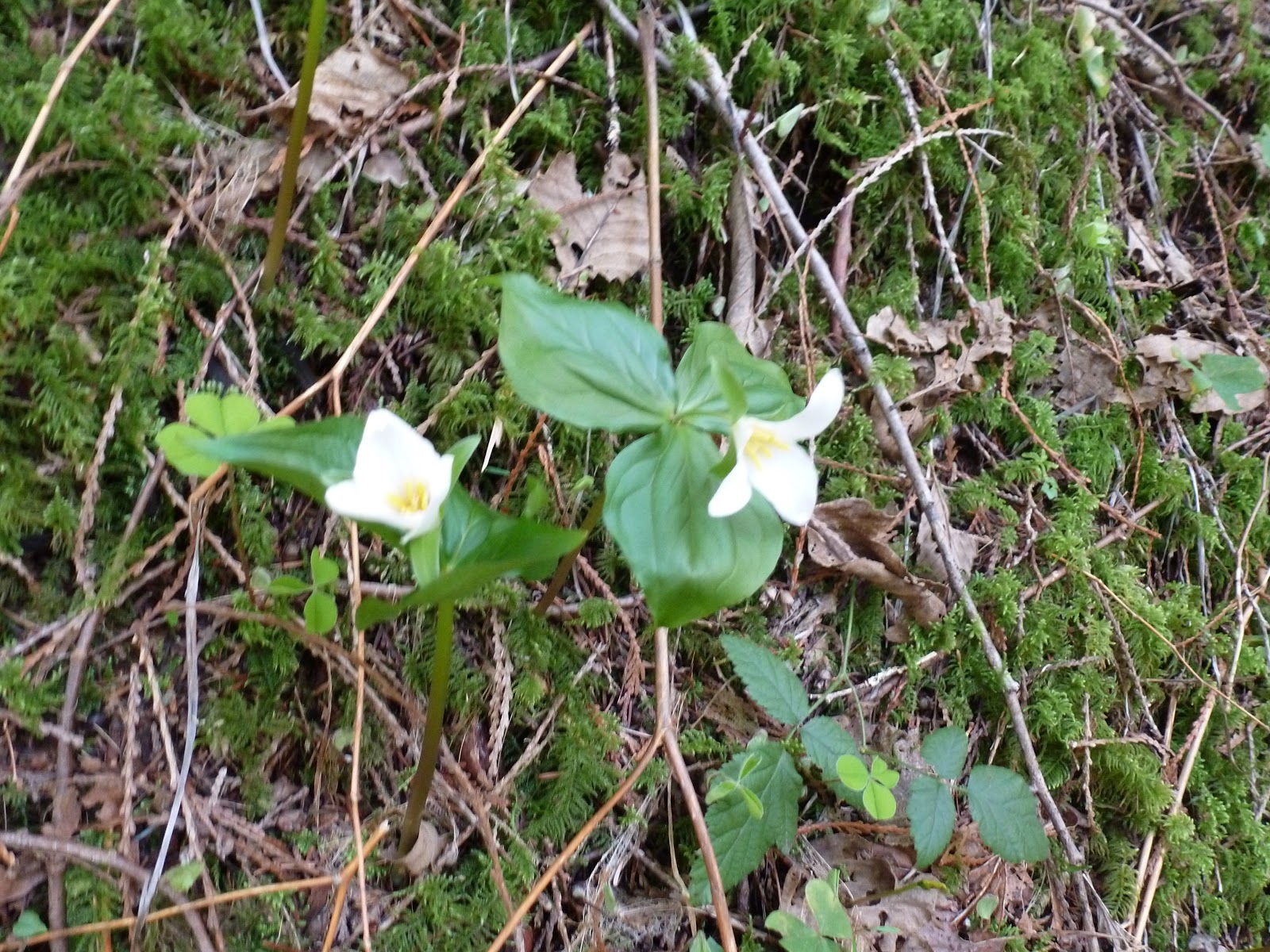
This section of the trail is just so redundant. Just one more incredible fall or rapid after another. Yawn. On this trip, though, there was some Trillium lighting up the day. A gift on Easter! Better than searching for Easter Eggs.


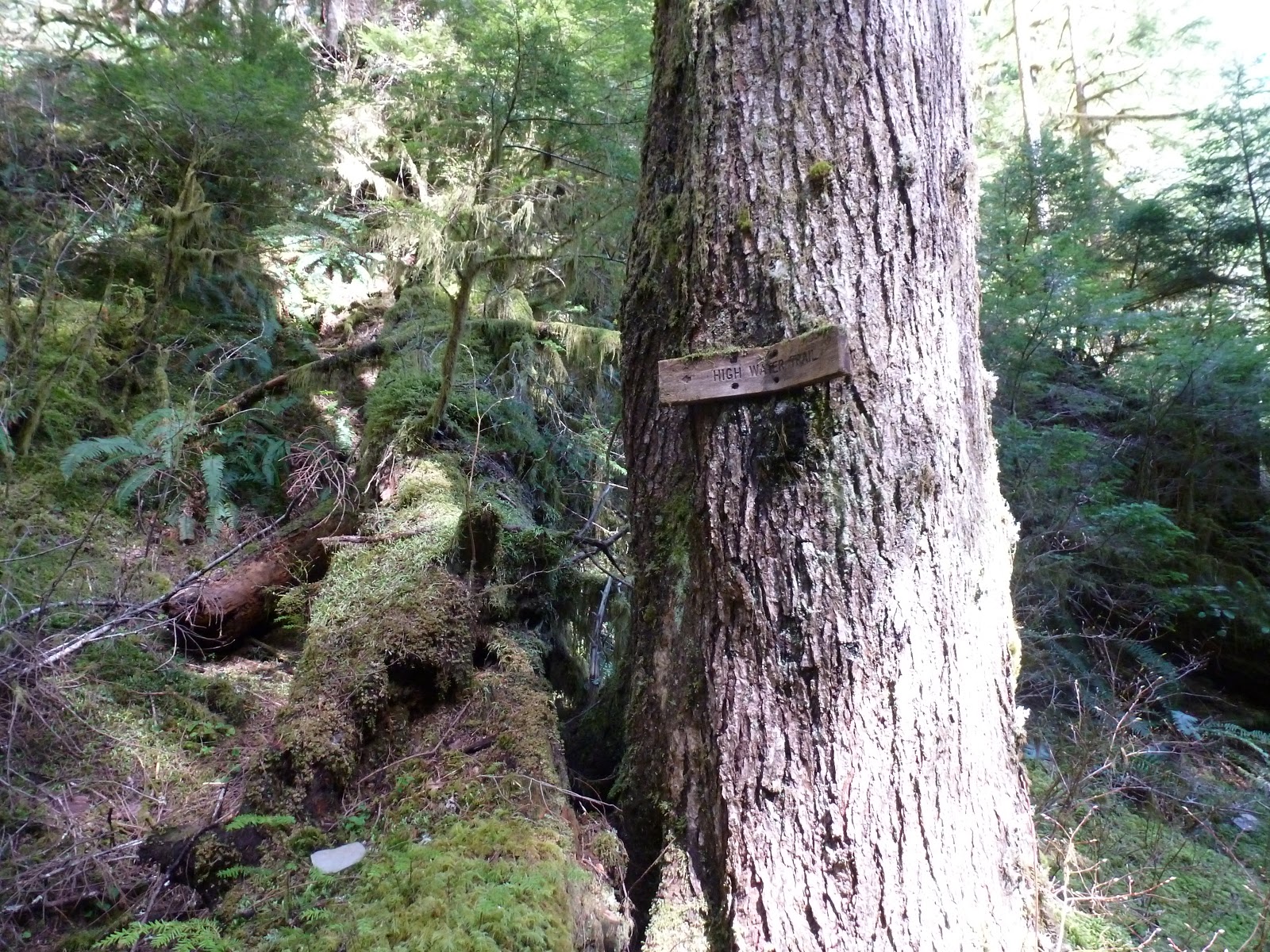
At one point on the trail you will hit a sign that says “High Water Trail”. That is the way you go if the river is so high that the “low water trail” is.... welll... underwater. Today (and every other time I have tried this) the low water way was fine. It is also only about 100 yards, so taking the high road isn't that big of a deal.


Just a bit after this section you will it a dirt road. Bunches of signs telling you things. But none of them tell you what the road is. That road is sort of a secret (I think). It is called the Multnomah Basin road and it runs from someplace I haven't found yet up to the Skamania Lodge. This is a private lodge of the Portland Hiking Club (or perhaps the Portland Adventurers Society). I will look it up and forget to post it later. Anyway, Thanks guys for maintaining that bridge! (though they need to do more maintaining because I don' think they can get a car across right now. Perhaps they need to charge more dues).

Anyway, we are turning right at the road and we are going to follow that road all the way to Devil's Rest (sort of). First we cross the suspiciously broken looking bridge (it has footpath stuff set up but has warnings for vehicles), then we start to climb up out of the canyon. This isn't a steep ascent, but it does go on for at least a mile. Still, it is a car road and easy to follow. We eventually come to a locked control gate, there is a little path around it and then we are up on the top of the Plateau. Half a mile and we will come to a little “parking” area and a sign on the tree indicating park lands and a hiking trail. Turn Right and in a 100 yards you will intersect with the Devil's rest trail.


This is the spot I like to stop and make camp for lunch. It is a protected area, there are good spots for setting up a shelter (don't need one today) and it is on the trail so you can say high to fellow hikers on their way to Devil's rest. (oh, and every other group will ask you how far it is, so make sure and have some witty answers ready).

I like to call this spot Devil's rest. It isn't really, but the real devil's rest is just a bunch of rocks about ¾ of a mile further on. Yeah, it is a little higher up, but it is completely surrounded by trees and there just isn't any view there.

So stop here. Take a load off. Make some Tea. Eat your lunch. There is a nice view of the columbia and the sun is shining. There is even the sound of a little waterfall just over that cliff in front of you. I like it.

After lunch you have some choices. You can go straight down and back to the car. About 2 hours from here. Or you can continue on to Devil's Rest and then on West on a non-official trail called the Foxglove Trail which will take you around to Wahkeena springs, down Wahkeena valley, and so back to the car. We are a little short on time today (I have some homework) so we are going to go home the short way, but what the hell, lets go some of the way toward Devil's rest and visit this one really great view point. It isn't hard to find. Just head toward devil's rest and there is this one point where the trail will turn and start doing some switchbacks upward. Just before that, there is a survey marker and just after the survey marker there is a point where the trail branches (though the right branch isn't real visible). That right brach goes through some trees and in 100feet hits a cliff and some nice rocks and great view of the Columbia and Mt. Saint Helens and Mt. Adams (both with a lot of snow this time of year). Nice.


Ok, enough. Grab my trekking poles and head for the car. It is all down hill from here. I follow the devil's rest trail down to the Multnomah trail and follow the ridge back around to the crossroads we have already seen one this morning. Now we are back on Multnomah creek and retracing our steps.

A little different this time, however, because the sun is going down and it is setting in such a way that it is really lighting up the canyon. So Green !! And so many people out today. So many Tatoos ! (oh, I like that one!)


I don't know what it is about me. The close I wear? My Age? My general appearance of stunning competence? Or perhaps the big backpack, but I have LOTs of people stop me and ask for information or directions. I had one guy say, “Excuse me but I have a question”. It is like I am a ranger or something. Of course, the really funny thing is that I always know the answer. Perhaps it is my mutant ability.

Hey, it was a great hike today. 10.1 miles !! Thanks for coming along.

Cheers !!

Sunday, March 24, 2013

Smith and Bybee Wetlands


Smith and Bybee Wetlands


This is a strange little area. It is a couple of lakes in the middle of the industrial part of Portland and completely surrounded by train yards and boatyards, and an old trash dump. But given all of that, it was an interesting place to paddle. Beaver sign ALL OVER the place. We may even have seen a beaver (it may have been a nutria).

View Larger Map

You enter the area on the north side down a road that goes right by the Columbia river and the Portland Expo center. I guess you could ride the Max out here if they had a kayak rack (damn bike riders have a bike rack on the max....). There is a fair amount of parking, but you may want to be ready to carry your boat a few hundred yards (bring some wheels). This time of year, the lake is way high and the path down to the water ended 50 feet sooner than it does in the summer. So the water is high all around, up in the trees, and the trees do not yet have leaves. Give it a sort of bleak kind of feel. That and the clouds and cold wind......


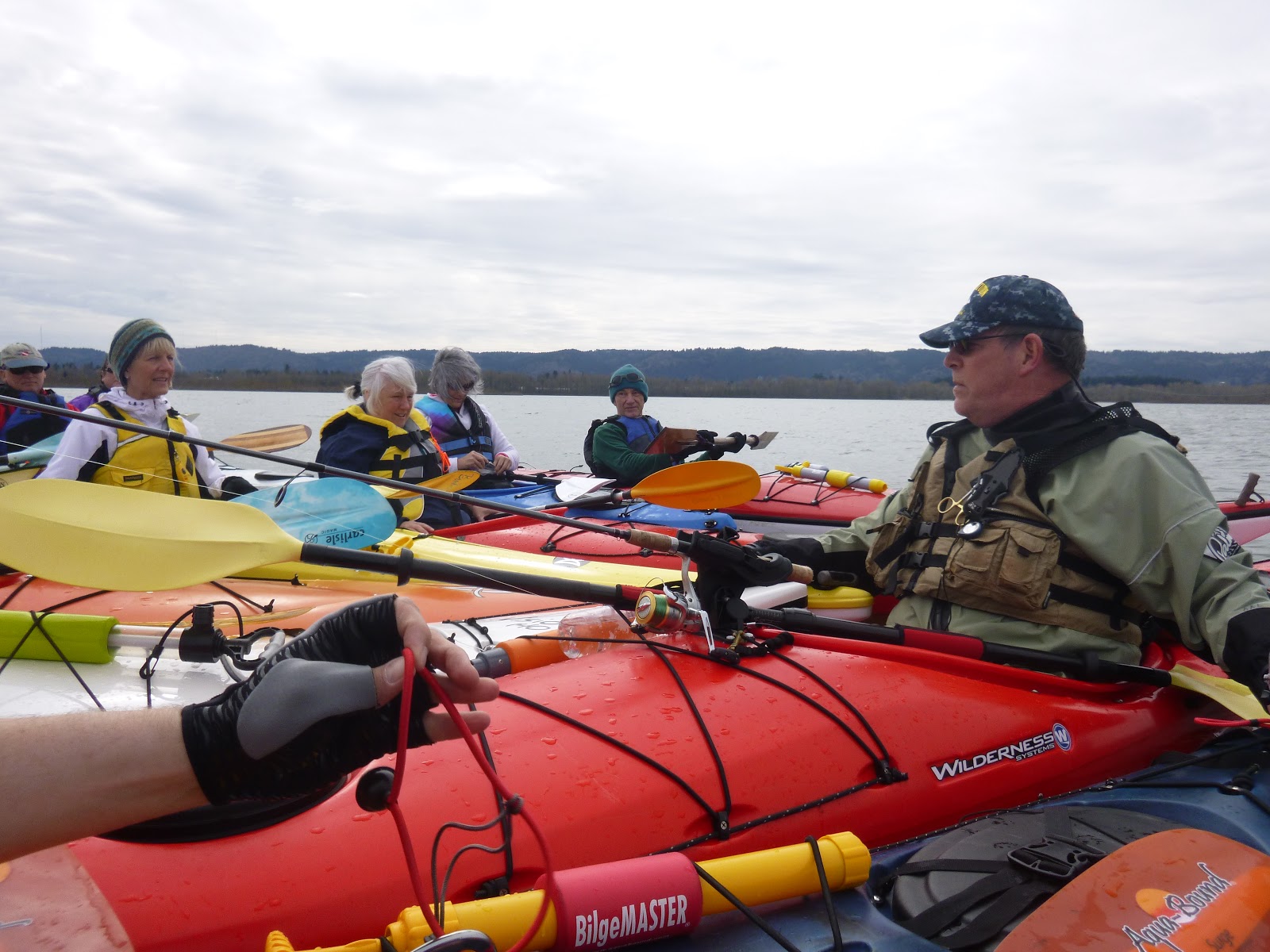
Rafting up for safety lecture


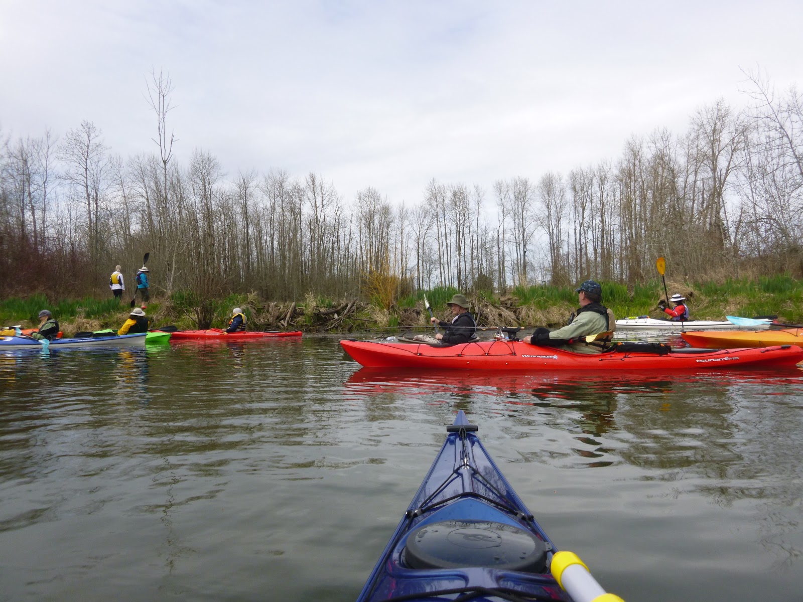
A lot of kayaks out today, I think we had 17 in our group. Would have made me feel safe except we had a number of new comers that were not in quite the kind of gear I would have liked for them. (But they made it just fine and had a good time, so perhaps I am a worry wort).

We did a quick down wind traverse of Smith lake and took the more sheltered little water-way that goes over to Bybee. We quickly ran into a nice Beaver Lodge. With Beaver !! (I think). We also saw a Bald Eagle. Another group of Kayaks said the Eagle had just scooped a fish out of the pond right in front of them. Cool.

He is pointing at a beaver. Now where is that sucker?


Just a cool old tree. Right next to the floating beaver carcass. Look for it !!


At the other end of Bybee lake is a rather large rookery for Great Blue Heron. There seemed to be upward of 50 nests in the trees and a lot of Heron heads. Saw one of the big birds (we call them Pterodactyls) come in with a branch for the nest. He coasted majestically through the trees and than managed to hover, wings flapping, for several moments before he landed on his nest. Pretty cool.

Great Blue Heron Rookery
You can see some birds standing up there


Snow on the mountains. Behind the ah....... factories.


Just a few hundred yards further West is a huge old beaver dam. This thing is about 5 foot high and perhaps 60 foot long and closes off another separate pond. At great risk to my dignity, I got out of my kayak and took some pictures for you fine folk. Notice how the water in the pond side is a couple of feet higher than the water in the lake. What a great dam!!. Jenifer said she saw 6 painted turtles on a log in the pond before I got up there. These turtles are on their way to being a protected species.


On our way back we started going into the wind, it was pretty much uphill for the return. We passed several flood control gates as we went. Evidently Ducks Unlimited put some money into the area a few years back and added flood gates that allow the lake to be kept higher than the surrounding river level during the wet months. This makes a better habitat for the birds and other wildlife and also stunts the growth of the exotic invasive reed canary grass. During the summer, the gates are all open and the lake water is low and “tidal”.

On our return, when we got back to the entrance to Smith Lake, the wind had blown up quite a bit and there was white caps on the lake. But our take out was pretty much diretly up wind, so we took off across the lake directly into the waves. Doing that is actually a lot easier than going sideways to the wind and waves. I only had a couple of waves break over my bow. Gave me a little think about. I was a little wary, a little tired, and had to push hard. And this wasn't even a big wind or a big lake or a big deal. Just a little taste. Just a little warning to keep my eyes open (and maybe get that Drysuit with my REI rebate).


I think Smith and Bybee on in a sort of rebound time, evidently last year the lake was closed because of a avian disease that was killing all of the birds. I am sure that the abandoned trash dump and toxic dump site to the south had nothing to do with it.

Sunday, March 3, 2013

Salmon River Estuary


Salmon River Estuary


View Larger Map


According to my extensive research (mainly on Wikipedia) there is “absolutely nothing interesting about the Salmon river” except that it runs past some place called Van Duzer corridor. Named after some guy that was in office when they needed to name stuff. There are some old trees in the Van Duzer.

Luckily, the beauty of the actual Estuary and Cascade Crest do not depend on any of the historic significance (or insignificance) of the river or it drainage. Oh, and if you go checking up on me, don't get too excited about reading how the Salmon river starts at mount hood and is the only river whose entire run is protected as wild and scenic river..... that is a different Salmon River (there are 3 in the area).

So, this is what I get for trying to throw in a little local color. Perhaps more later.

For now, lets go Kayaking.

Dammit. OK. First, lets get there.

From Portland, it is about a 2 hour drive to Lincoln City (which is a good target if you are looking at a map). You can spend a little more time and have more coast viewing if you go to Tillamook and head south down the coast, but we went through Mcminville (past the 747 on top of the waterpark) and then took route 18 past the Indian Casino and on down to 101.

Highway 18 is pretty much following the Salmon River for most of the way. The river was high today. The whole area was pretty dark and bleak looking. But the Skunk Cabbage is peaking up yellow through the gloom and I can just taste spring there in the running waters.
A little north jog on 101 and then down 3 rocks road to the little county park and boat ramp.

The Kayak Portland meetup organized this trip (Thanks Julie !!) and we had 10 kayakers on this trip. I have fun just watching everyone suit up, put their gear together, and get into the water. I think that Kayakers (and I attempt to include myself) are all gear heads at heart. There is so much stuff you need just to enter the water safely (at least in the winter).
The big thing you worry about is flipping over. Kayaks are pretty stable, but if you do something silly (like look behind you) or you bump into someone or you run up on a stump or you hit a wave or you miss your paddle pull or you break to quickly into a turn or.... you have trouble getting in and out on a high dock.... you might take a swim. In the summer, this is funny and embarassing. In the winter, it can be deadly. Unless you have all of the toys and training.

I have the first part of the training and most of the toys. For the training, you need to learn how to do a “wet exit” and then how to get back into your kayak. If you are alone, this means you need to roll out of your kayak while upside down, deploy a paddle float (blow it up and put it on your paddle) and then use your paddle as a outrigger to right and balance your (flooded) kayak and spin your fat ass back into the boat. Ok, I can do that. Though I am not looking forward to the 15 minutes it is going to take to hand pump the cockpit dry (why does that read funny?). The real trick is the water temperature. In the winter the water can be like 45 degrees or less and in water that cold, it can hard to think or breath, a lot less save your ass.
And so we introduce the 2 most important pieces of safety gear.

The first is a drysuit. A waterproof onesy that protects you from the elements and gives you superpowers against the cold (ok, Julie wrote that line). In one of these things you can fall into the coldest waters (at least around here) and not even die for like an hour. Of course, if you loose the use of your hands, you could still be in trouble. I don't have a drysuit, but I do have a wet suit and a good top and I have every reason to believe that I could live in the water for 20 minutes which is long enough to deploy the second safety piece of safety gear.

Dry Suits


The second is your kayaking partners.
They are all trained in assisted rescue and they should be able to come up to me, flip my boat over on top of their boat to drain it, and then brace the kayak while I crawl back into it. And with any luck they can have me back in the boat in less than 10 minutes.
I would still be cold as all hell, but should be relatively out of danger.

Wow. Ok. So. Drysuit or Wetsuit, PFD, boots, gloves, Paddle Float, Cockpit Pump, Emergency whistle.

Check, check and check.

Oh..... CAMERA !!

Lets go kayaking!

We entered the estuary at the very end of the low going tide and rode the current the half mile down to the beach and the entry of the Salmon into the Pacific Ocean. The river is flowing just about North West as it approaches the short, with a sandbank off to the left. Then the river hits the Cascade headland and takes a sharp hard fast left turn into the waves.


Right at this turn, the river narrows down and the currents get strange. Lots of eddies going on, not only with the river currents bouncing off the rocks on the bottom, but with the wave surges coming in from the Ocean. A little exciting, especially considering the water temperature and the afore mentioned dying when tipped over thingee. But we weathered this storm (mainly through enlightened self interest) and pulled our kayaks up on the sand for a stroll on the beach. We had been warned that the tide comes in fast and to pull our boats well up on the sand if we were going to go exploring. So we all pulled up a good 10 feet from the water.


And we pull out our cameras. The headlands are just sitting there all gorgeous and such and the beach is just begging to be photographed. So I do some of each. And then I notice some bigger than normal waves have come over the bar and are traveling up the river. As I watch, I realize that this wave is going to go right past my kayak. Hell, it is going to hit my kayak. My 10 feet form the river kayak. And those of my friends too, I should add. So I walk toward the boats, at about the same speed as the wave (not fast at all) and between the few of us we keep the boats from getting away. But that wave just keeps going. And I realize..... that was the tide change. The tide is now coming in and the level of the water is NOT going back down. Just like that. “What, haven't you ever seen a tidal bore?” I was asked.
No. No I haven't. I used to spend my summers running a boat dock on a tidal estuary in South Carolina. Never saw anything like this. It was SO COOL.

Tidal Bore
Normal Bore (LOL)


So, we pulled our boats up another 10 feet and then took a VERY short walk.

Lets go look upriver. Once we got a half mile up the river we were magically paddle against the current again. Places like this you can really go up hill both ways if you plan it right. You have to be a little careful, you can find yourself in 3 inch water pretty fast. But that isn't all that scary. Hell, it is even a good place to fall out. I would have, as a joke, but my camera isn't waterproof (must fix that). One of my rules for reading a river is that the bottom next to the bank probably looks like the bank. So if the bank is steep too, so is the river. Look for deep water there. If the bank is a flat mudbank..... so is the river.

We traveled up the river far enough and then beach on the bank of a little side creek and sat in the mud and ate our lunch. Once again the cool Drysuit kids had nothing to worry about and just sat there in the mud and told “how warm and dry I am” stories to their not so cool cousins. I really do find this sort of funny. Look at some of the pictures. See all of the blue and yellow outfits? Those are drysuits. They run like $1K a piece. They cost on par with the kayaks. I MUST get one. I can hardly wait for my REI rebate. At least then I will be empowered to make a choice.


After lunch, it start to rain, so we all went back to the coast to play in the waves. Well, I went to watch people play in the waves. The surge up the river and around the bend was enough excitement for me. But I did get to see the other guys do some wave practice on the little waves that come up the river.

It was raining harder now, so we head back to the landing.

Now, a couple of things about landings and cameras. I have this general, until now untested, theory that it is better to carry just a good point and shoot camera, than a less capable but waterproof camera. So I have a nice Lumix ZS8 tucked into my vest pocket on my PFD. If I go over, the camera is destroyed. But, I figure I not going over unless I plan to. And when is the most likely time to flip over? In my experience... when you get out of the kayak at the shore.

Here is how you get out. You run up onto the mud a little, unhitch your spray skirt, use your hands to lift your butt up to about deck level, bend your knees and lift one foot out and put it down in the mud. Now you can do the other foot, and then stand up. The trick is the “lift up your butt”. At that point your center of gravity is high and you don't have your paddle handy for balance. A great time to flip over. Which is what I did today at the landing. It wasn't a big deal. Except for my camera. So instead of doing what I should have done, which was just roll out and stand up, I caught myself on my right hand and said, “Hey, Chip, can you come over here and rescue my camera”. I think everyone else thought I was in trouble, which was embarrassing, but I just needed someone to reach into my vest and grab my camera. Then I rolled out. Water cold. Wetsuit, pretty damn good.

And no, there are no pictures, because Chip had to rescue my camera instead of unlimbering his own. Bad Choice Chip !!

Afterwards we went to the only building in the area and had a nice dinner. Buffalo burger. Hmmm good. Or perhaps mine was regular, the waiter wasn't sure.


Ok, enough, I need to go spend 15 minutes and hand pump the cockpit dry.