
Just about two years ago, between Christmas and New Years, my partner and I set out to hike the Salmon River Trail, up near Welches on Mount Hood. It was a lovely winter day, not too cold, no snow or ice on the trail by the river. The sun was peaking out on occasion. We had a lovely little hike but I just didn’t feel like making the last big push up to the promised viewpoint at the end of the 3.5 miles out. We turned back about a half mile short. A good thing too. About a mile from the car my bad knee just went out. I didn’t fall or twist it or anything. I was just walking along and the knee just went. I came down on it and it screamed like a further mucker. Oh my God it hurt. And it continued to hurt. Every inch of the way back to the car it screamed and yelled and complained. It was so loud that my wonderful wife could hear it. (yes, that is a joke thing).
My knee took like 5 months to recover from that trauma but that didn’t matter because I didn’t trust it anymore. If that had happened when I was 3 miles out, Paige would have had to go for help and a stretcher. No Thanks. I had the knee replaced.
So Today. Today, we embark on the same trail for the first time since that injury. I admit to having a little PTSD whist sitting in the parking lot at the trailhead tying the laces on my boots. Once more we have lucked out with the weather. It had been raining for the last 24 hours, and had been raining the entire drive up the mountain, but it stopped as we took the little side road over to the trailhead and now, in the parking lot, the sun is out. Oh Boy.
It is a wet Saturday at the end of October. The parking lot at the trailhead is pretty full. You need a Forest Pass to park here from May to October 1. We shoulder our packs and head off down the trail.
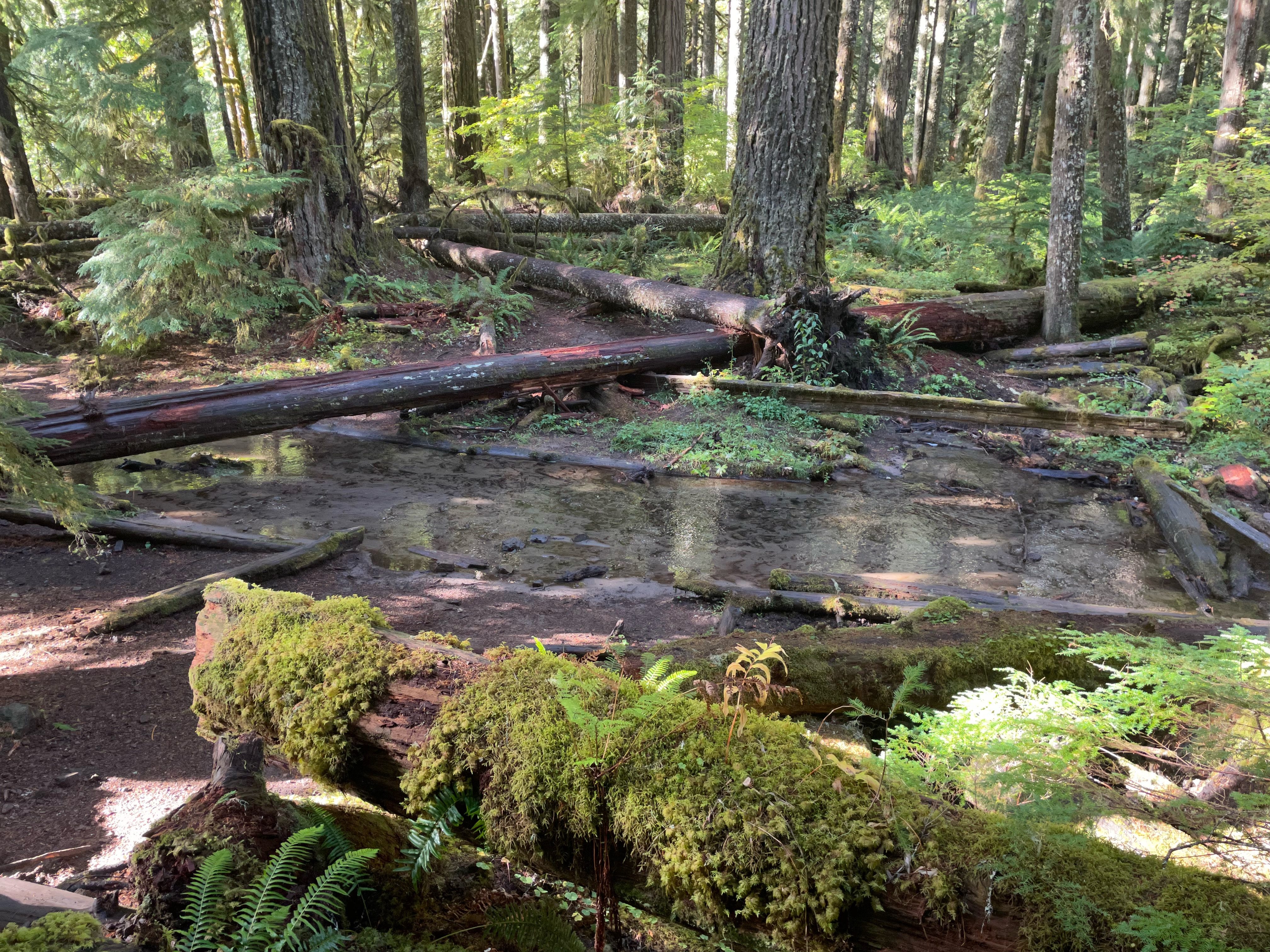
The trail starts right at a road bridge over the Salmon, it goes up a little embankment to get away from the road and then descends quickly to the river. This first part by the river is gorgeous. The river has hit a little wide flat bottom land and sent a small finger as a mountain stream through the forest there. The Doug Firs are tall and majestic and the understory is filled with ancient downed logs and the ferns and moss that love to grow on them. Stop and enjoy the view. Also be careful where you walk, the trail is still cut out of the mountain side and is full of slippery rocks and awkward carved terraces.
When you leave this little bottom land you follow a space where the river is hard up against a rock facing and the trail is cut from the facing just about the water. This is a great place to get a long view of the river. We had the sun breaking through to light us up and the sparkles off the water were a lift to the soul.


This is another natural forest that hasn’t been logged… perhaps never been logged. I didn’t see any old sawed-off stumps and all of the tree fall seemed to be very old and natural. There were a lot of places that saws had been used, but only to remove big logs from the trail. The sawed sections were still sitting over on the side.
The Pacific North West, West of the Cascades, is Green Green Green. My partner and I found ourselves remarking on the similarities of this trail to other trails we have hiked the past year. Oh, this section reminds me of that hike up the Ho river rain forest in Olympic National Park. The soaring rocking mountains on one side and the fast moving river on the other, with the huge moss covered trees surrounding the trail. Oh this reminds me of our hike up to Fall Creek Falls. The steep-to of the trail winding above the river. It made me think of how many lovely places there are all around the PNW. So many places to go that are just hard enough to get to that they have not been ruined. Each unique but all sharing so many common elements. The profusion of Cedar and Doug Fir, the Nurse logs and Sword Fern. The running water and volcanic stone. Can a person become immune to this beauty and stop appreaciating the wonder of it all? Oh, I hope not.


At around 2.0 miles you enter into National Forest Wilderness area. There is a sign and a place to fill out a permit during the high season. We are moving pretty fast (for us) and have taken off all of our layers except our medium outer shirts. It is a nice day with occasional sun breaks through the clouds. Welches is just low enough that it doesn’t usually get snow this time of year and sometimes not even in high winter. People stay there in cabins and then take the short drive up the mountain to the snow to take the kids sledding or whatever.
At 2.5 miles, there is another wide spot and a camping area has been made over close to the river. Camping is legal and common along this stretch of the river, though we don’t see anyone wanting to try it at this time of year. From looking at the flat spots where people have put tents I am thinking that a hard deluge might put a half inch of standing water in that spot.
Now the trail heads up and it does it pretty determinedly. We quickly come to the spot where I made us turn around 2 years ago but we are determined to get to the viewpoint. People that pass us coming back down say the view is clear and lovely today. So up we go. I am guessing that it really isn’t all that steep or high or far, but it sort of felt like it today. I need to come back here when I am 30 years younger and see how it feels. I will report back.
At the top of all of this whining we come to a place where the smooth tall rocks stick out from the side of the forest and crowd the trail up against a sheer wall. Across a canyon we can see more of these rock outcroppings. Down below you can hear and occasionally see the river as it carves its way ever deeper into the stone. Up here, we have a great view of the blue and white sky against the dark green of the surrounding tree strewn mountains. Off in the distance to the East, I catch a glimpse of some white in the trees on the highest summit. Perhaps a little snow from the precipitation we have been getting this week.


 |
| The 'Meadow' on the top |
Paige knows a side trail to get up on the very top of the ridge and a nice flat spot. There is a sign there that says “Camp in the Trees, not in the Meadow”. A strange sign. We presume it is some warning about the danger of on-coming weather out in the open. Like Lightening and wind. We sit in the ‘meadow’, which is really just a slightly grassy spot out on the rocky prominence, and enjoy our little lunch and the view. This is a great destination.

But now, the horses want to get back to the barn. The downhill 3.5 miles is much easier and faster than the uphill part had been. But do try and stop yourself every once in a while to enjoy the view. The sights on the way back down a trail are often different from the ones you saw on the way up.
We get back to the car around 4:30 and decide to grab an early dinner at the Zig Zag Inn before we head back to the city. I would just like to say that this is one of my favorite little places to get food. It is very quaint and a little weird, the service is good and friendly, and the house made Pizza is excellent. In fact, it is my new best pizza in the world. I also like their coffee mugs, so I got myself one. I also recommend the Ice Pick beer, but you can only have one of those if you drove up the mountain and your partner has signed up to drive back down.


No comments:
Post a Comment