Paddle Oregon 2018: Paddle, Food, and Education
 |
| Clothes Maketh the Man |
Paddle Oregon launched off right in the middle of the "new normal" super hot and wildfire smokey season in Portland. The trip was moved North around 15 miles this year (about one day's paddle) perhaps to avoid the rather dangerous first day we had last year (see
HERE ) from the many swift water sections and numerous snag hazards. Or maybe it was moved so that we could take advantage of a much nicer spot to camp on the last night and add some additional and beautiful river sections to the paddle. I guess I could ask...


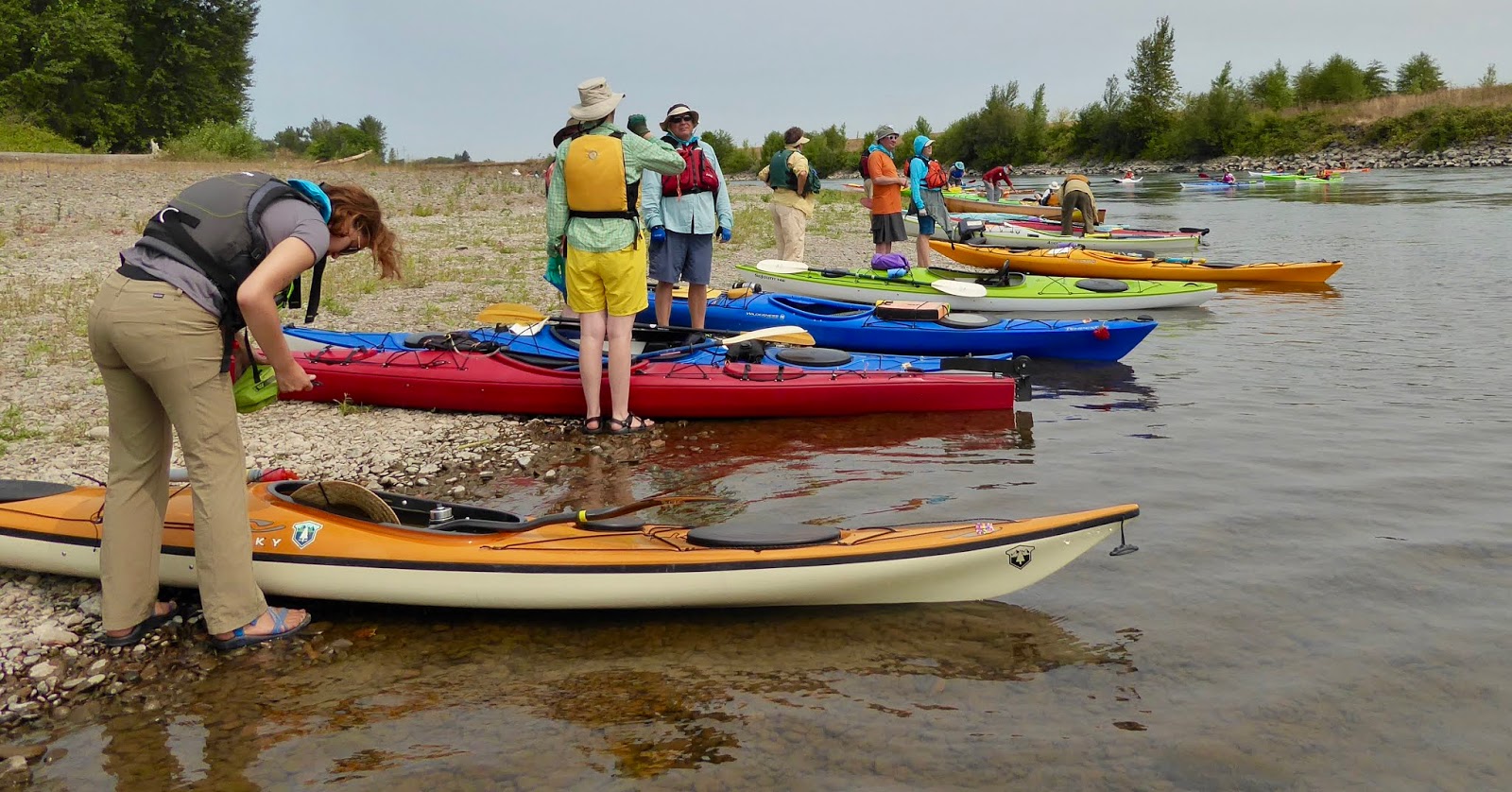
The trip this year starts and ends at the historic Saint Paul 4th of July Rodeo Grounds in beautiful Saint Paul Oregon. My Partner and I drive through this little town (450 residents) on a semi-regular basis because we like to launch (or retrieve) from the San Salvador park boat ramp, which is a little county park at the end of a long road through the hops fields. This year, Paddle Oregon is going to end the week at the same boat ramp. Now, this is a little tiny park. Room for maybe 15 cars. Certainly not enough space to have a hundred cars lined up waiting to pick up people and boats. So what they did was have us drive our cars and boats to the Rodeo Parking area (lots of space there, and semi-secured). There we were met by a number of vans pulling boat hauling trailers (something like 20 boats per trailer) and two sight seeing busses. We put our gear into the storage below the bus and climbed aboard. The staff (along with many workers from local Kayak shops) loaded all of the boats, sweet. And then we all drove off south to the boat launch at a little park just south of Peoria. At the end of the paddle, they had the vans with trailers meeting us at San Salvador and shuttling us the 10 minutes to the rodeo grounds to meet up with our vehicles. A well thought out and excellent way of doing things.
 |
| Our Twin Tempest 170s ready to go |
Last year, my partner and I arrived a night early at the put-in and camped overnight so as to be sure to be there in the morning. This was because we were (I was) worried about the traffic that was predicted in conjunction with the 2017 Total Eclipse of the Sun by The Moon (TETSBM). We didn't have that worry this year as the 2018 TETSBM was cancelled due to all of the Wild Fire Smoke (WFS). I must say that catching the shuttle, even at 7:00 in the morning, is much preferable to spending an additional night out camping in a straw field. The bus was actually pretty luxurious. How those drivers make those turns in that small park was pretty impressive.
At check-in at the
McCartney Park and boat ramp, we sign our legal agreements (promise not to sue when we drown, etc.) and get a t-shirt and a lunch box and are assigned to a pod. The pods are the safety and social groupings of the paddle. There are around 12 paddlers and 3 leaders in each pod. Our pod was called "Luckiamute". No, this isn't some funny phrase made up on whim, it is actually the name of one of the tributaries of the Willamette. It comes into the Willamette just north of the Santiam confluence. Turns out that all of the pods are named after tributaries of the Willamette.
 |
| Luckiamute Pod at a break |
The pods also have different personalities, based somewhat on the pod leaders (the safety trained volunteers) but also on the specific function of the pod. For instance, there is a fast pod and a slow pod (the pokey pod). There is also a Nature Pod (they spend more effort getting Eco talks and paddling to interesting objects). Our pod was a "didn't specify but everyone claims to know how to paddle" pod. We had a pretty good cross section of people including a "guy from Chicago" and most of the retired lawyers from Roseburg.
No matter how hard they try to get us on the water quickly, it always takes longer than planned. I think we hit the river around 11:00. We didn't have a very long paddle for the first day, but we didn't have all that much time, either, so we were going to have to paddle hard and fast to get to the campsite in time. In time for what? Well, there you have the mystery of the event. In time to get a good camping spot (there are plenty). In time for Happy Hour (that lasts like 4 hours and doesn't start until pretty late). In time for Dinner? (well, that is like at 7:00). In time for someone to get a frigging massage? Perhaps part of it is that you want to be done because you are going to be so Tired. Of course, you might not have been so tired if you had taken it easy. Many pods do take it easy. They would get into camp an hour after we had our tents set up. But they spent that time On The River. So. Something to think about. I am also willing to admit that if I was the guys coming in last I might be wishing that my tent had been up for an hour and I had been relaxing in some dry place for a bit.
 |
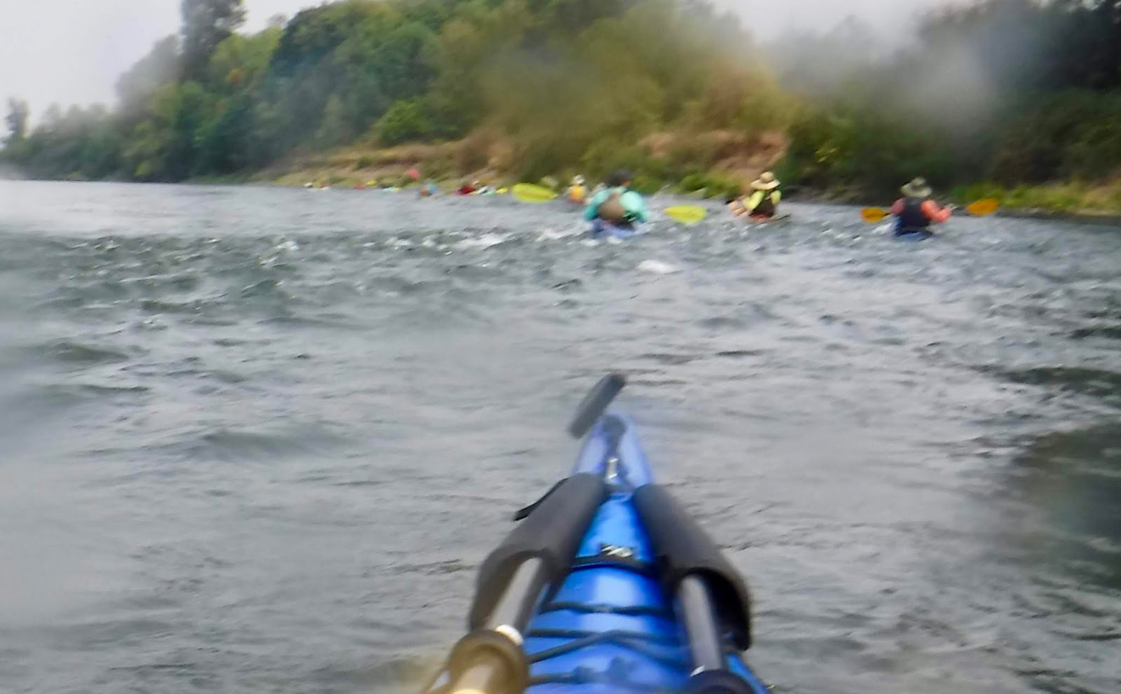
| Somebody lost it on a submerged log. This is the end of the quick recovery. |
 |
| hmmmm, blackberries are ripe all along the river |
 |
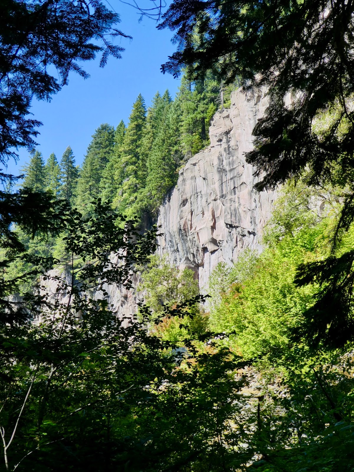
| Many parts of the bank are very steep. No landing. But... there may be agates |
Our first night camping was at the public softball fields in Corvallis. The second night was at the park in Albany. I have written about those sections of the river last year. I refer you
there if you are interested. I would like to talk about some of the new things that occurred during that time.
 |
| Where we put our boats. Note the Volunteer tent who stayed to keep watch |
 |
| Camping on the ball fields in Corvallis |
 |
| A typical Breakfast |
At some points along the river, there were places marked out for educational eco talks. Just downstream from the Corvallis bridges is a stretch of river where Fresh Water Muscles are making a come back. Travis (Head Honcho of Willamette River Keeper) had pulled in and was giving a talk to paddlers about river keeper efforts to study, document, and improve the fresh water muscles eco system.
Just to show you that I was paying attention, I will give you a fact. These Muscles need to move upstream at some time (because if they only breed and move downstream, they end up not being fresh water muscles anymore) and they do this by attaching themselves to fish when they are little babies in their free floating form. Also, these muscles live a long time. A hundred years. Wow.
More Details Here and don't let the T-shirt ad up front throw you, there is good stuff on that page.
 |
| Travis Teaches us about Muscles. |
At Albany, we had a guest speaker. My partner and I happened to sit next to him and his wife during
hors d'oeuvres. He is an author (self published, which I find intriguing) of books concerning the ice age Missoula floods and how these floods shaped Washington, Oregon and, more specifically, the Willamette Valley. He explained to us the years of research he had done compiling his book (It is a very educational read. I want to go find all of the locations he mentions). Later he gave a slide presentation about his research. I found it fascinating. One of the things he pointed out was that the "flood" that occurred when the Glacial Dam broke up in Montana wasn't a big wall of water, it was a big wall of dirt, sand, rocks, and boulders mixed with maybe 30% water. Just enough water, that when under high powered agitation, would form a liquified solid and go roaring down the gorge. Wow. He had videos of similar phenomena in modern times, I believe they were during volcanic eruption events. Anyway, during these flood events, the Willamette Valley would fill up to 400 feet with flood water, and the dirt and debris that washed down is why the Willamette valley has such deep fertile soil and why Eastern Washington is scraped clean Scab Land. Here is the author's site:
Rick Thompson.
 |
| Sunrise in Albany. Note the Smoke Colored Sun. |
Some nice river on the third day. We ate lunch at the confluence of the Santiam and Willamette rivers. The Santiam is going right down from the mountains and has very cold water. There is a good rock bar right at the confluence, but it hasn't been washed over in a few years so the pickens are slim for Agates. There is a good deep slow stretch after that, a great place to practice rescues. So my partner and did that. One of pod people took a video that I will share. You get to see my partner do a great heal hook entry back into her boat whist I stabilize. Unfortunately, you don't get to see me empty her boat or water or hear her curse when I tip over and she wasn't ready...
On the third night, we were on a farmer's land just south of Independence. This farmer graciously permits people to stay on his river bottom property for free, as long as they indemnify him (which makes sense to me). He comes out and gives talks about the history of the farm and what he is currently growing. His father bought the land the year he was born (1940?) and he and his children and grand children are still farming. Right now he is saying that filberts (hazelnuts) are a good crop, though difficult to grow. He also mentioned that he uses a lot of technology. Specifically, he uses computer controlled herbicide spreaders that will recognize and target a weed such that it limits the amount of herbicide used.
 |
| Add caption |
Though I appreciate his letting us stay on his property, I will say that his rocks are very hard and don't make very comfy bedding. I am glad I got a new (cheap) Coleman sleeping pad from Bi-Mart.
 |
| Our rocky Camp Ground. And No Agates !! |
 |
This Bald Faced Hornets nest was right
next to the little trail up the hill for food |
 |
| Right next to. |

That night at dinner we had a guy come in to talk about Fossils. He was from Woodburn High School where he is (amongst other things) a history teacher. It seems that 10 years or so ago they were digging on the school grounds for some new building and, at about 12 feet down, ran into a layer of sediment dirt that had a lot of fossils in it. Well, the U of O came out and did a dig and wrote some papers and such like that and then left. The teacher got to thinking, there surely is a lot more school property that we can dig down 10 feet. Perhaps we should do that. The city of Woodburn thought that was a good idea also, so every year they come out with a backhoe and dig a 12 foot hole and the kids go down and find fossils and do projects. One of the things they found was a complete Bison skeleton. Mostly they find frog bones. This is because this area was a marsh at the time it was on the surface, which turns out to be just after the end of the big floods. The upshot is that this local high school has a paleontology program that their students can access that has led to things such as high school seniors doing research papers with local college professors and presenting them at real scientific venues.

 |
| Agate Hunting on the Sly. |
And now, as we paddle down the Willamette on the 4th day, we get to new river that I have never written about in Paddle Oregon context. My partner and I would like to be doing more Agate hunting. However, it is sort of hard to get good agate hunting time when everyone else in your pod can't figure out why you want to walk around looking at rocks. Luckily, one of our pod leaders found a HUGE and beautiful agate during her first half hour of searching with us. This pretty much hooked her and made it easier for my partner and I to steal away and hunt rocks. I want to say that this is a stretch of the river that is good for that, but it is probably true that EVERY stretch of the river is good for rock hunting and you just have to know where to look. The places change. This year the pod agreed to stop on this one little island that my partner and I had hunted a few years ago. It is a rock bar that is just up river from Mission State Park on the west bank. She and I had paddled from the Wheatland Ferry launch up-river and we had found a large expanse of open rocks to explore. But I guess we haven't had a good high river winter since then because that empty rock bar is now a grown over island of brush and sticks and such. Not nearly as easy or as fun to hunt. Dang. The same thing happened to the DSL island that we used to like to camp and (agate) hunt on further down river. We need either new hunting grounds or a good wet flooding-river winter.

 |
| We saw many GBH |
 |
| AHHHH RAPIDS |
 |
| One of the 3 Ferries on the Willamette |
 |
| Killdeer. |
One of the river hazards that our pod leaders were concerned about on this trip is the old Boat house that is just upriver from downtown Salem. I think it used to be a boat house for launching skulls for the college rowing team. It was situated at a turn in the river and was floating out in the eddy created by the turn. Some years, the river would shift a bit and the current would flow right into (and under) the floating dock. One year, evidently, a paddler got swept up into the side of the dock and then her boat got rolled and pulled right under the dock. Fortunately, she knew what the dock was and that it was open on the inside, so she just went with the boat and then popped up inside the building. Still, something to be avoided. Last year, I remember, there was an extra safety boater just hanging out at the boat house to keep people away from it. This year we went around the corner and saw no safety boater. Hell, I thought the boat house was right there. Our leader was out front and was going to be leading us away from the boathouse, but it is easier to stay away from something when you can see it. And then I did see it, it was 20 feet up on shore upside down. Did it get washed there by high water or just pulled up there by machinery to get a hazard our of the river? Oh, I see, there was a fire
earlier this year and the boathouse burned up! Like I said, things change on the river.
 |
| This is our Pod |

 |
| Get Hot? Take a swim. |
 |
| Hey. Another Ferry. This is the Wheatland Ferry. |
Last year, the trip ended in downtown Salem. This year, we paddled right through because we are going to be camping tonight down near the Wheaton Ferry for our last night on the river. This was a good long day of paddling, but you know what, we have all been working so hard and getting so much better at paddling that we are not having such a hard go of it. Hell, I am really feeling great. I think that night on the rocky river bank did good things for my back. My partner things it may be that I haven't had the stress of being at work for a week.
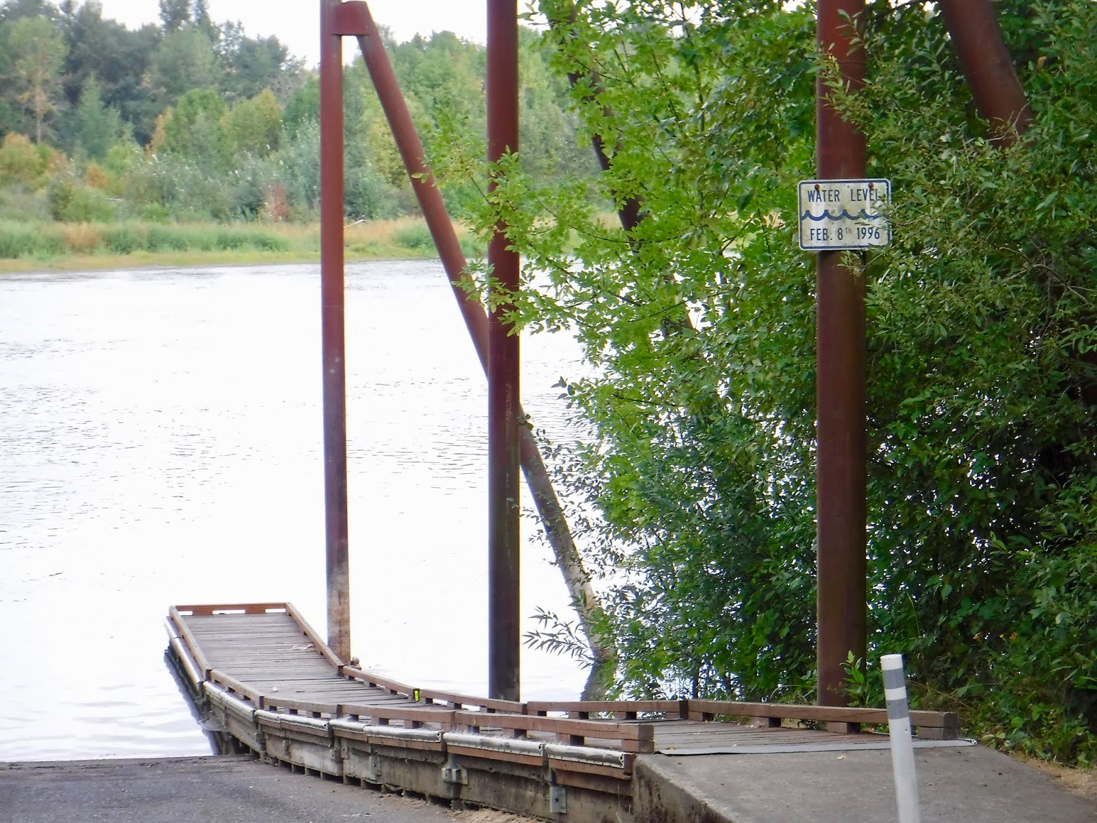
Some more fun water to play with today. There is the Keiser Rapids. Also called the Keiser ripple or the Kieser shallows. Not much going on here today, but when the river is high it goes over the large basalt formation that is at the foot of the Keiser turn and that may make it more interesting. This was one of the more difficult places for Steamboats to navigate 200 years ago when the Willamette was the main road for farm goods and trade products up the valley. Boats would come across the Columbia Bar at Astoria. From there, steam boats would carry goods and people up river to Vancouver, Portland, and Oregon City. There was a short overland wagon ride around the Falls of the Willamette and then different (and smaller) Steamboats running on the upper Willamette. These boats would stop in places where Farmers had set up storage areas or people were trying to start small communities. Many of these places ended up not being viable because of the frequent large scale flooding of the Willamette. So places like Butteville and Champoeg were just wiped out by flooding. And this wasn't some big loss of life or anything. The river would just keep rising day by day and eventually you had to leave before everything just started floating away. These days, we have dams pretty much everywhere Dams can go and there are a LOT of artificial river banks and controls, so the flooding doesn't happen as often or as badly. But you can still see high river markers that are way above the roofs of the structures (mostly temporary) that are down near the water. Need a picture of one, don't I?
 |
| This is the boat launch next to Wheatland Ferry. Would our campground have been underwater? |
To get to our winery campground, we have to take a left turn at the Wheatland bar and go down the little back channel behind the bar. There is a sweet little rapid to negotiate to get into the back channel and then you just coast on down to the bank where sits the Wheatland Vineyard and Arcane Winery and tasting room. This place is officially part of the Willamette river trail and evidently you can camp here any time, just let them know you are coming. we had like 100 tents set up, so there is plenty of room. My partner and I set up in the little orchard right out in front of the main house. We had apples clumping down to the ground around us all night (though we didn't hear them). This is another spot with a shower truck. I love the shower trucks. It feels so good to be clean after a day on the river and the shower trucks have plenty of hot water.
 |
| The Landing at the Wheatland Winery |
 |
| We camped in the Orchard. |
 |
| Shower Truck !! |
Tonight we have a local ranger talking about Steamboat history and all of the little towns up and down the river that used to depend on Steamboat traffic. He said a couple of things I want to comment on.
One, he said that the Indigenous peoples were in the valley long before white settlers and they did a lot of land management and river control. Mainly they would do burns to open up space for farming and such. He also said that Champoeg was the first gather together of peoples to make a government in Oregon. Now, I have a problem with that, it seems to me if the indigenous peoples were managing their land and doing burns and such, they surely were working together and so they surely had some sort of government in place.
The other thing the Ranger said was that for a while, the river was the center of all trade and it got a lot of attention. But once the railroads and roads were put in, the river lost its value and people stopped paying attention to it and turned to using it to dump their waste, sewage, and industrial poisons. So the river was really bad off for quite a while. Then more recently, people have begun to make laws and enforce them and the river is making a come back. Not sure it can ever get back to what it used to be, but people like the Riverkeepers organization are working hard on a number of projects to get the river to be a little more clean, a little more wild, and to preserve it for recreational use and for the sure beauty into the future.
 |
| That is a Big Agate |
 |
| An Osprey and a Sea Hawk |
 |
| I got this |
 |
| Some Pilots like to land on the river rock banks. This guy was being a bit rude. |
This year, the Willamette Riverkeepers received a gift of a hunk of river bottom land off down near the DSL island where my partner and I used to camp. It is
Here. Travis, the executive director of Riverkeeper is very excited about this piece of property. His goal is to try and remove all of the exotic invasive plants (Himalayan Blackberry, Ivy, Scotch Broom) and plant more indigenous species and get the area back to a more historic flora. I think I would like to sign up to volunteer for some of that work. It is a place I paddle past a lot and would enjoy helping to restore it.
The last day on the river was not a long one. We took our time and had some fun. We went down a few of the back channels of some of the islands and took a nice lunch break to hunt agates and go swimming. There are some nice swimming holes down behind some of the DSL islands. Here is a fun thing. We all have river maps that we use when paddling. They were given to us during registration and are printed by a consortium of groups but is instigated by Willamette Riverkeepers (I say this because I notice that the executive Director of Riverkeepers took all of the pictures). As part of my on going theme of "The river keeps changing" I would like to mention a few things. First there are human things that change. I have already mentioned the removal of the boat house hazard just upriver of Salem, there is also at least one set of Power Line crossing that are shown on the maps but are no longer present. Not a big deal really, unless you get confused as to where you are because you were looking for those lines. The most interesting differences tend to be on the little rock bars and islands. Since I paddle the Wheatland to San Salvador let me point out something there. At river mile 64, there are some DSL islands listed. In the map it shows 2 islands very close together (see map). Currently those 2 islands have formed into one and additional islands and channels have developed just downstream of the objects shown in the map (see google map entry). In addition, at RM 65, there is an area called Lambert Bar. No islands are shown at this spot, yet today there is a little chain of islands there, one of them with trees growing that appear to be on the order of 10 years old. (I am checking the age of the data shown in the maps). Any winter now, we could have another big wet season and these islands could radically change or wash away completely. One thing I wonder is whether or not these islands that appear (like at the Lambert bar) are automatically considered to be DSL islands (Department of State Lands).
By the way, I think the islands at Lambert bar may be big enough for camping now, though good look finding anything other than a rocky place to pitch a tent.
The take out for this trip is San Salvador park. This is a very little park with a small boat launch and some narrow beach. The park is out at the very end of a long farm road. It is sometimes a very nice place and other times it fills up with trash and illegal campers. For the last month or so there has been family living there in an old camper trailer. There are no hookups or bathrooms out there, so this is a very sustainable situation. I think the river keepers must have requested the family to move their trailer over out the way so the kayak recovery vehicles could come through and load up. I think that the park is owned by the state, they need to spend a little effort to keep people from trying to live there, since all that does is ruin the park for everyone. For a take out for 100 people, it was OK. This is mainly due to the fact that people were sort of dribbling in by pod and that gave the shuttle vehicles time to load up people and boats and transfer them the 10 minutes out to the Rodeo where we had left our cars.
Once back at the rodeo, there was lots of room and time (and ice-cream) to get our boats loaded. Luckily we had brought the impreza. It has a low roof which makes getting the boats on the roof with tired muscles much easier.