Saturday, February 18, 2023

Barlow Pass in Fresh Snow

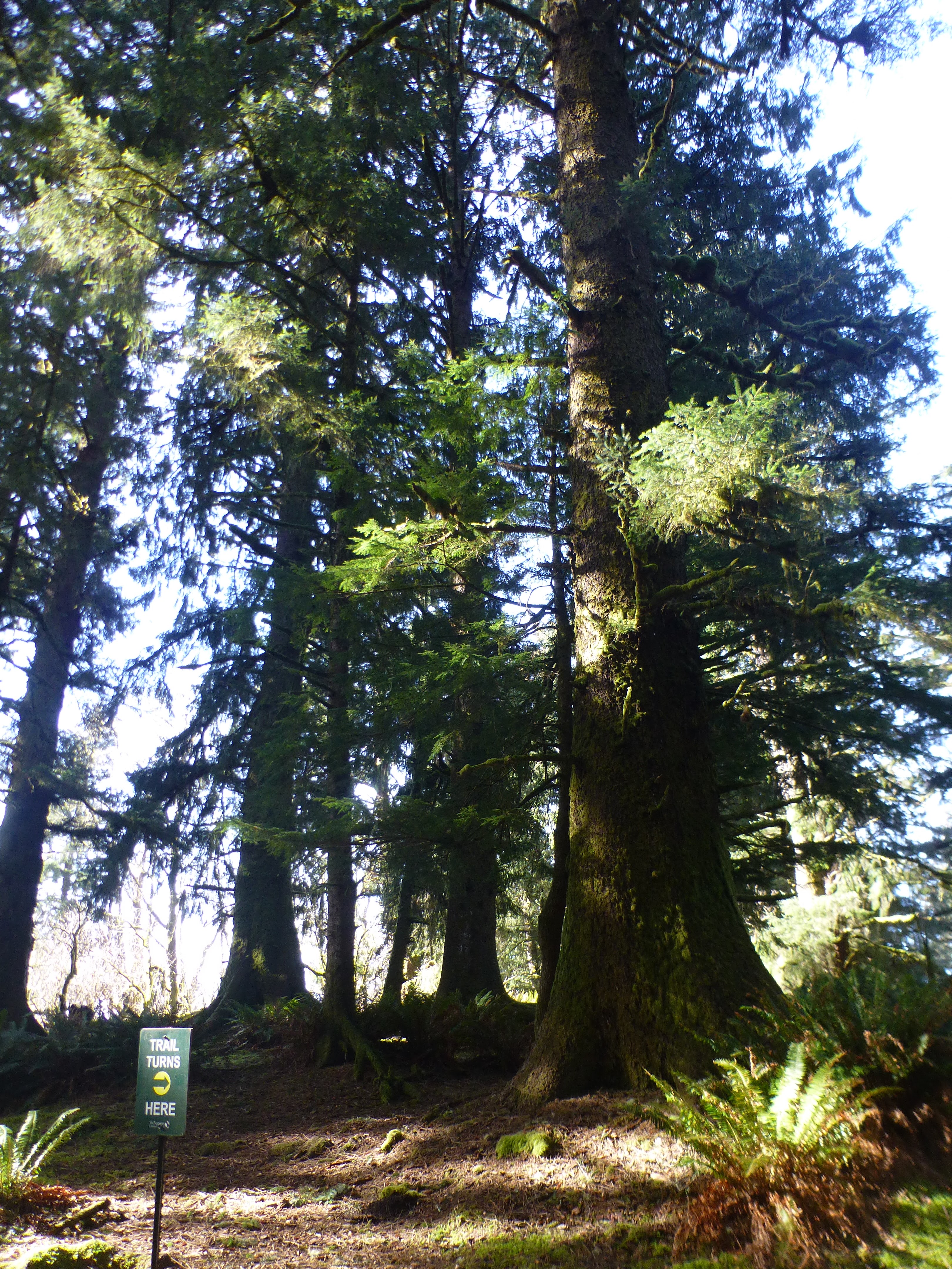
Barlow pass is one of the main passes through the Cascade mountains used by settlers coming over on the Oregon Trail. Parts of the original trail are preserved and you could see them if they were covered in 10 feet of snow and 2 feet of teenagers that died of dysentery.  This pass goes clockwise around Mount Hood from Hood River and so avoids the worst sections of the Columbia Gorge and the Columbia River which in those days was full of trecherous rapids and salmon. Why they didn't just take I84 is unknown to historians (at least I could find no reference). 

With the Barlow Pass, you get fewer salmon, but you do have to deal with the trees and the cold. Probably limited them to non-winter travel. Still, you have little marked sites like "Pioneer Womans Grave" as actual tourist destination spots. Today we are parking our snow ready Subaru Forestor (with AWD and Snow Tires. We have the chains but didn't need them today) in the plowed snow-park at Barlow Trailhead. You need to have a $5 Snowpark pass to use the lot. It is plowed but the road is still packed ice, so be careful. 

We timed it well on this expediction. I picked a day that was 2 days after a good snow dump on the mountain (got a foot on monday night). Today was Wednesday and there wasn't a cloud in the sky. So Blue and Sunny!! And since it was a day or 2 after the storm, the main roads were all well plowed.

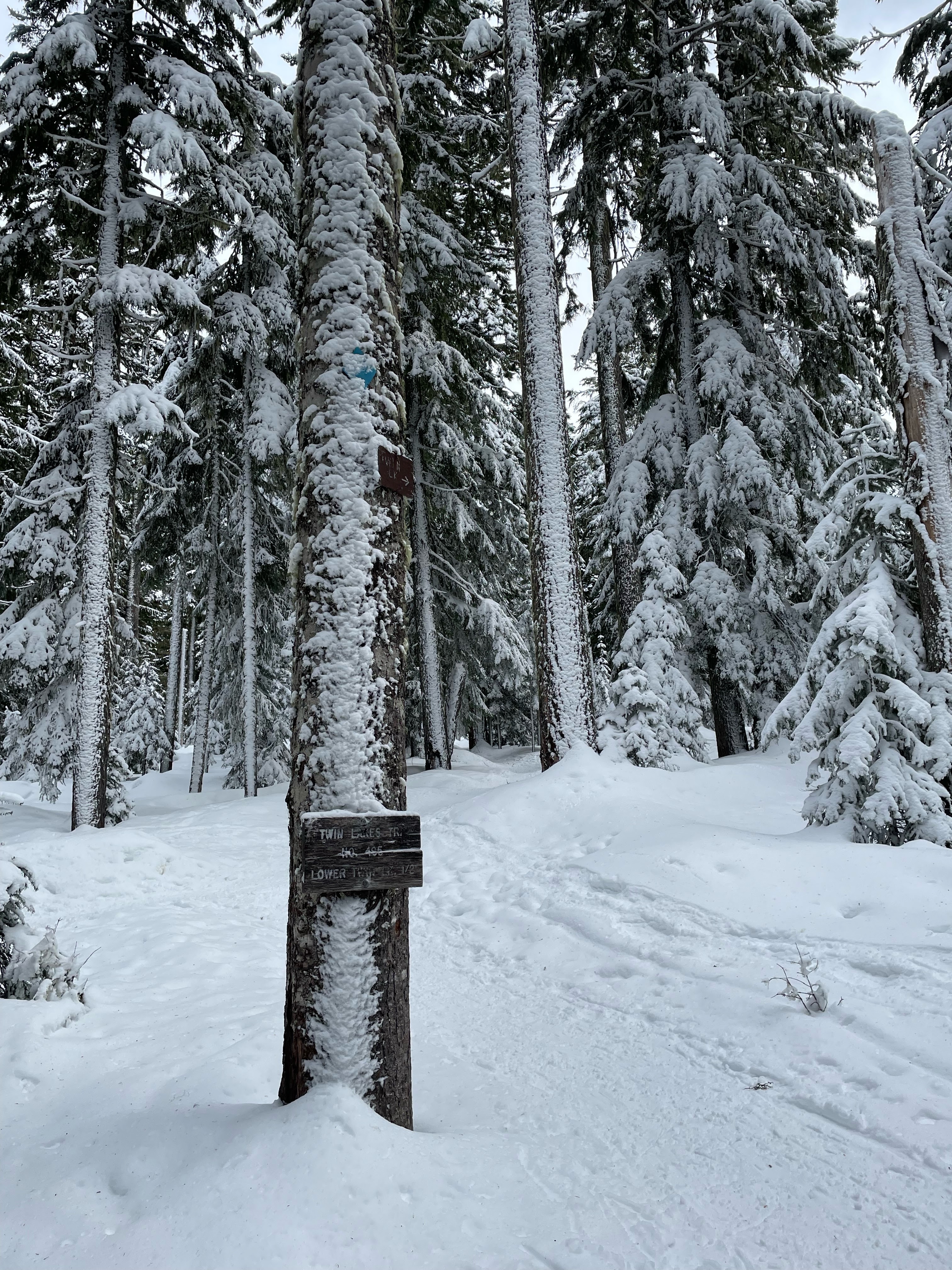
The temperature was just at freezing when we got out of the car. The parking lot this time of year is 5 or 6 feet below the snow level that we are going to be snow shoeing on. Gives you a good idea of the general depth of snow. We walk down to a place that people have sort of smashed some steps into and climb up onto the surface. We are going to be hiking a section of the Pacific Crest Trail. We are going South toward Frog Lake SnowPark but only plan to go as far as Twin Lakes. We did some of this terrain a few weeks ago walking North from Frog Lake TH. 

The PCT is marked for winter travel with a few PCT logos and a lot of blue diamonds nailed to trees at winter snow head level (call it 14 feet or so). I was thinking that we would have to be following these diamonds except that someone (perhaps 2 to 4 people) were out ahead of us and had made initial tracks through the snow. This was NOT a day that we could have skipped the snowshoes and gone on using our ice cleats. Even in the shoes we had (our new shorty MSR) we were sinking into the slightly trod track more than normal. Not a big deal but you can really tell the little extra effort that is needed to walk a trek that isn't hard packed.  You have that little sinking that happens. 


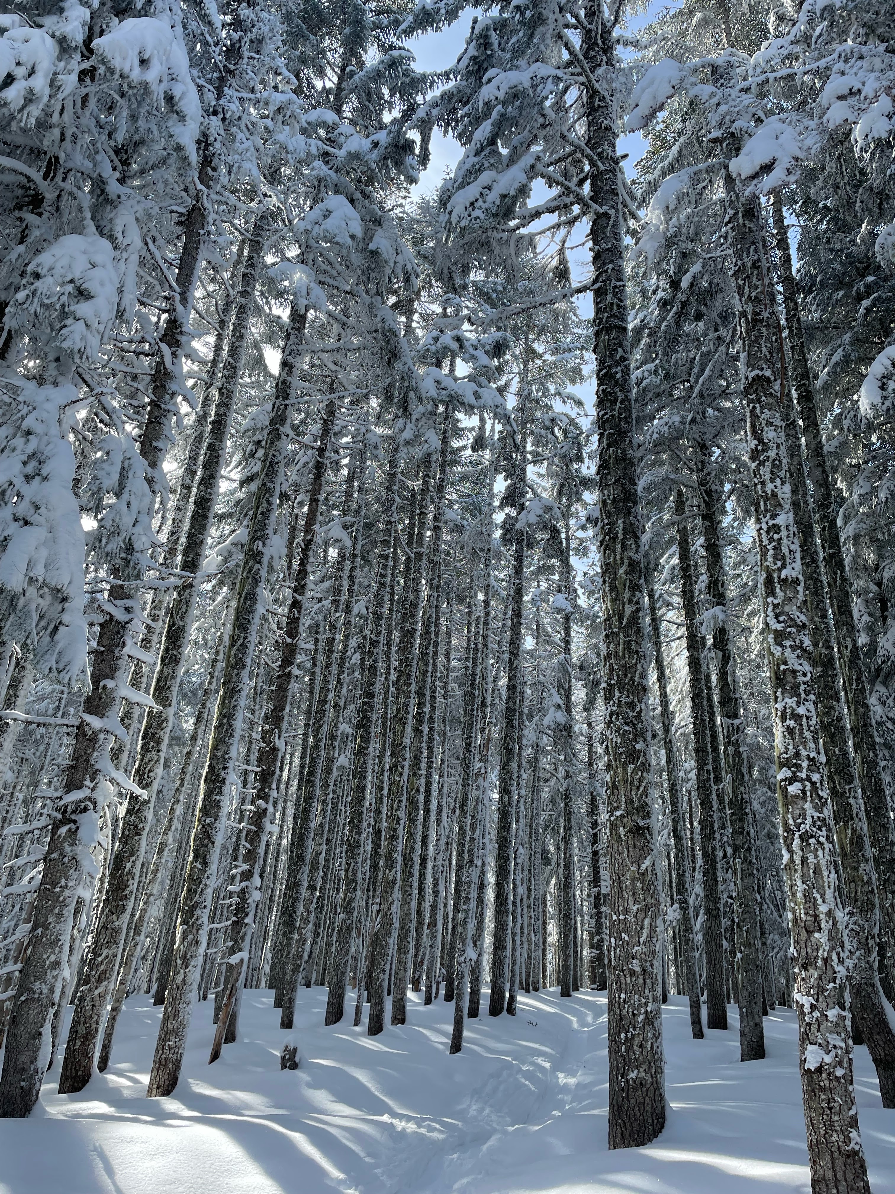
The Sun was shining and everywhere except the trail was pristine untrammeled snow. Ice sparkles and snow flocked trees abound. The snow is blown and stacked by nature so there are mounds and features everywhere. There were also places along the trail where you could see holes in the snow. Places where there was some natural hole that had be topped somehow by the snow. A great place to fall into if you were just wandering around off trail through the woods. I usually go stomping off through the woods at some point, just for fun, but didn't feel the need today. 


Why are the trees so small in girth. I suspect because of the short
season and that the big boys get knocked down.


There are a number of side trails off of the PCT going up from Barlow Pass. The first one was a right turn onto what we thought from our map was a trail up the ridge called Ghost Ridge Trail. Closer inspection of the map, however, revealed that this was really just some dotted border (county?) that happened to go right down the center of Ghost Ridge. Half the people ahead of us either thought this was a real trail or just wanted to go exploring because their tracks left the trail and headed up the ridge following that dotted line. I know this because I could see where we were and where the dotted line was using my new whiz-bang Gaia mapping Ap. I will review that after a few more hikes. 


This the route map from Gaia

We are still on the trail, but now the trail is Half as trampled as it had been, and the walking gets slightly but noticeably harder. So interesting. Another quarter mile and we come the Palmateer trail. It goes off to the left to some view point and eventually loops around to Frog Lake. The remainder of the people that were in front of us turned down this trail. This leaves us with the choice of either following them (not our plan) or going down the currently untrammeled PCT. 

Untrammeled (not trampled?)

Trampled By One.

Trampled By Many

The First Trampler.
Note that snowshoes are invisible

The PCT is going downhill at this point, which means we were not as tired as we had been going UP. We decided it would be fun to trail blaze for a while.  We are not going in a completely new area. People have been going down this trail all winter, so there is a definite visible dent in the snow running along ahead of us as well as the occassoinal blue diamond. Paige leads the way and we immediately find out what it means to be the leader going through virgin deep snow. It is hard. You sink down into the snow and then have to push harder to bring your feet up plus a few inches of snow covers you snowshoe and you have to lift this weight out. That show is all powder and spills of as you make your step just to be refilled on the next step. I am the second person through and it is even harder back there. I didn't get to appreciate how much EASIER it was in the number  slot until Paige needed a break and let me take the lead. Wow. Big difference. 

I found that the secret was to slow down and take smaller steps and just sort of keep lugging ahead. The little trail sign on a tree at the turn to Palmateer said that it was quarter of a mile to the intersection with Twin Lake trail. That was one of the longest quarter miles of my life. Hell, that is less that once around the block. Why was it taking so damn long? 

mouse?

Rabbit? 


Velociraptor?

However, since I am going slow and breathing hard and taking a lot of little rest stops, this is a a good time to look around and see all of the stuff going on in the snow. Lots of critter tracks. I think I see mouse and rabbit. And the ones that end right at a tree are probably squirrel. Didn't see any actual animals, but they must have been out and about in the last day since the storm. 

At the trail intersection Paige and I have a discussion. She wants to continue on at least until we have been hiking for 2 hours. She wants a 4 hour workout. I have been thinking how hard I am working breaking trail and the fact that going back (though stomped by 2 people) is going to be uphill.  But it is only a mile and a half to Twin Lake and it sure would be great to be able to get out of the trees and sit in the sun for our lunch. OK. Paige takes over trail breaking and down Twin Lakes Trail we go.  After about 100 yards she remembers how hard trail breaking is and reconsiders my comments about the going back uphill. We decide that I will trail break until I need a rest or until we find some sunny break in the trees for lunch and then we will call it halfway.

I am now reminded of my droll helpfullness. When out hiking in the summer in heavily touristed parts I am often stopped by people and asked for directions or advice. Not sure if I looked experienced or perhaps I dress like a Ranger. Perhaps I am the only person going slow enough that they could catch me and ask a question. Anyway, the most common question I get is "How much further is it?". I usually tell them that the trail goes on for miles and miles but the important thing to remember is that they know they are halfway when they turn around and head back toward their car.  I am not (completely) making fun, either. It is something I think about. Been walking for 2 hours? You got another 2 hours in you?  When is sundown? Do I have enough water? What time does the hot tub at the gym close? Important questions. 

But I digress.

I made it a few more hundred yards and then ran into a stretch of trail that was flat and exposed to the sky, that is, no trees crowded overhead. All of a sudden the snow was much deeper and thus much harder to snowshoe through.  I made it like 50 feet and then just said screw it and asked if we could stop. We were 5 minutes short of our 2 hour stop and about a mile from Upper Twin Lake. This means we had come maybe 2.3 miles in 2 hours. Holy cow that is slow. How can I be so tired for going so slow?

We tromped over to a semi-sunny spot and made a sitting spot by stomping all over in a circle. Then I put down my red tarp and we sat on our snow mats, ate lunch, and discussed our slowness.

our lunch spot


There is a hierarchy of stressors that build up to wear one out. There are the usual things, like are you going up hill? And then there are the Snow related things. These are mainly: How many people have trompled down the trail before you? if your are the first person in the virgin snow, that is pretty hard. If you are second, that is easier but still hard. You can even tell the difference in difficulty for 3,4 and perhaps 5. Once you get up to around 8 or 10, things are properly squashed and the only difficulty is that you are walking in Snoeshoes. OK, so the last thing is that you have snowshoes on and what type are you wearing. The short light MSR shoes, like Paige and I are now using? Those are least stressing of all snow shoes on packed or paritally packed sonw. On Virgin deep snow, I think we may have been better of with larger shoes with more floatation. (yes, the size of the shoe is refered to as flotation).  The MSR Evo's that we have are short (especially in the back) but you can get 5 or 6 inch extenders that sort of clip on. Those may have come in handy when we were trail breaking. 

So there you have it. We ate our peanut butter and jelly sandwhiches and thought about going back up the hill (as an aside, one of the great things about going on a hard hike is that you get a peanut butter and jelly sandwich).  We are going to be going 1) Uphill and 2) on a trail that has been walked by  persons (us). That is going to be.... medium hard? Also we have to go back over the longest quarter mile in the universe. Will it be shorter uphill but semi-tramped?

Lets go (we are getting chilly).

We have 2 miles and change to go. The first mile was uphill. It was somewhat of a killer. We were going really slowly and stopping a lot to "admire the view". The twice trampled trail was still pretty soggy and rough to slog through, though much easier than the virgin snow (though that was downhill. See how these thiings intermix?). 

After than long (fucking) quarter mile, we got back to the intersection with the Palmateer trail. Here we hit the part where other people had already walked and things started to get easier. This trail was 4-6 smashed already. Though we were still going up. Another quarter of a mile and we hit where the people had vered off to go up to Ghost Ridge. Now we were on a 10 to 12 smashed trail. AND it was going down hill. It was like a highway to heaven. It was SO EASY. We were just flying down that last mile to the car. 


Big Lesson. I still want to make it all the way to Upper Twin Lake. Perhaps in a couple of weeks we can try again. Everything will certainly be well trampled by then.


Tuesday, February 14, 2023

Cascade Head - A little higher


Portland and the northern Willamette valley were socked in with fog. That and the rain and general cloudiness we have been having for the last week or so had my lovely partner itching for some sunshine. She was considering a snowshoe up on the mountain, but things weren’t looking very clear up there either. The shore however….. The shore was saying that it was going to be sunny for most of the day. In particular, Lincoln City was looking good. We like Lincoln city. A great place to spend some time on the coast. And right north of Lincoln city is one of those places where an old lava flow had made its way into the sea and is still sticking out with a 1500 foot wall of stone. This is Cascade Head. 

It is almost a 2 hour drive from Portland to Cascade Head and most of that time, until we got through the mountain pass and the Van Duzer corridor, we were in fog. Once we started down the Salmon River however, which runs in the valley to the south of the mountain ridge that forms Cascade Head, all was blue sky and sunny. This is still winter, so I am not saying it was warm, but I think it was going to peak 50 later in the day.

You access the trail to Cascade head from a county park that is down 3 Rock road. This is the same park that we use when we Kayak the Salmon river. Our old Kayak club used to go hear a lot to paddle out to the beach to enjoy the sand and try our  hand hat surfing some waves in our sea kayaks. I have a couple of good ‘My Girlfriend had to rescue me’ stories that happened out there 10 years ago. And yes, I was smart enough to say yes when she asked me to marry her. Not going out there without her to pull my ass out of the surf, that is for sure. 

Anyway, no boats today. Today we don’t really need any of our cold weather gear, neither for sea nor for land. I brought my raincoat, but mainly as a wind breaker in case the wind was howling when we got out on the point. Cascade Head is owned by the Nature Conservatory. Do you know them? They are a private non-profit that tries to get its hands on nice pieces of land and then hold it and keep it safe. The one other time I ran into them they had acquired Santa Cruz Island in the Channel Islands off the coast of Southern California. This was back in the 80s. Since that time they have managed to transfer their ownership to the National Park service thus forming Channel Islands National Park.  I think that is so neat. Now the area is officially and legally protected, hopefully for all time. 

The trail out to Cascade Head is a bit of a mish mash. The first part is along the side of the road, just dipping down into a sort of swampy area but keeping pedestrians safe and off the road. After about a half mile you come to the real start of the trail. This is a few hundred yards of very steep tree root and wooden step trail that takes you up and up into a flatter area filled with old coastal Sitka.  The trail is well marked. Lots of signs telling you to stay off the road and point you in the right direction. Part of the trail at this point is on National Forest land and part is through private property. But the trail is a good trail with a number (6?) of nice metal bridges taking you across the various little streams that come bouncing down from the top of the head. 


Start of the real trail going up.


Breaking out of the trees onto the head

After about another mile you break out of the tree line and now your are at around 600 feet of elevation and in a steep to grassy field area. You suddenly have a wonderful view south. Down below you is the Salmon River and the beach at the mouth. Out in the (usually heaving) Ocean are a number of sharp rocks rising up. In the distance, down the beach, you can see Lincoln City.  If you look North, and up, you can see where we are going. Way. Up. There.

Elk

Up

Down


I paddled through those rocks once

The trail goes out to a nice viewpoint that is on the crest of the Head. From here you can see over the head North and South. Down the steep cliffs to the ocean and out West to the end of Cascade Head. If you are not interesting in slugging up the last 600 feet to the top of the hill, this is a good place to eat lunch and enjoy the view. We have certainly done just that a few times in the past. But our goal for today was to go higher than either of us had been before. So we tilted our heads back and looked up and made out the orange of another backpack way the hell up there.

Ok. It isn’t really all that far. A mile or so and 600 feet. But it sure looks far from down on that viewpoint. I think it may have something to do with the fact that we could see so far. Usually you can’t see the trail that far ahead of you so you don’t know what you are in for. In this case, we could see it as it stretched up and that seemed to make it all that much further away. 

The trail also gets a bit more funky at this point. It is steep and the main trail is eroded deeply into the grassy turf of the hillside. In some places the sort or narrow trail is sunk a foot or more into the ground and that makes it hard to place one foot in front of the other. There are also a couple of places where wooden stairs had been built, probably to slow erosion, but they have lots that battle and now just give the hiker and really big step to go up. Or you can go around and start a new erosion path. There are a few alternate paths once you get higher up. 


way down on the beach


The great thing about this steep climb is that it encourages you to stop ever 5 or 10 minutes to catch your breath, evaluate the importance of continuing upwards, and turn around to appreciate the incredible view. There are 4 people down there on that beach. I can see their kayaks that they arrived in. This is a glorious little beach with a lot of sand and those people have it all to themselves. Wonderful.

More people up here on the mountain. Probably because you don’t need a boat to get up here, just legs and a will.

We slug our way up until we are only a few hundred yards from the official ‘top’. But we were tired and we found a great place with green grass to sit down and enjoy the sun, the view, and our lunch. Besides, we want to save a little of the mountain to conquer next time. 

Just as we sat down, the wind that had been blowing and cooling us down cut out for a  few minutes and left us to luxuriate in the warmth of the sun. It was very pleasant. I spread out my red tarp and we sat and had lunch and watched the world happen way down there. 


The Cliffs North


Just as we were watching, the tide was changing down in the mouth of the Salmon River. At that moment, right as the tide changes, a big wave will come in and suddenly the tide is going in. We had the luck to see that wave and watch it travel (over 10 minutes of time, mind you) right up the river and into some sand banks. You could see the wave go over the banks and cover them and then…. Well, they were underwater until the next low tide. 

Ok. The wind has picked up and we are getting a bit chilly. Time to start back down. We pull out our trekking poles and put on our packs and down the hill we go. Our poor old knees do pretty good and going down is just about always easier than going up. My what a glorious day.


Sunday, February 5, 2023

Twin Lakes Snowshoe

Mt. Hood over Upper Twin Lake

The Action Adventure Team has not had an outing in a while. So it was good to get the core team together, load up in the Action Adventure Mobile, and head up to the mountain. Today we are trying out some new MSR Evo snowshoes (we have 2 models, the newer ones have an interesting change to the bindings...). 


On this hike we will start at the Frog Lake snowpark, hike up the hill on the PCT and then down to Lower Twin Lake. Depending on how we feel at this 2 mile point, we will either eat lunch or continue on to Upper Twin lake (another mile up a steep switch back). Before you go saying things like "Oh, Big Deal, a 6 mile hike". This is not a hike, this is a snowshoe. It uses different muscles. Trust me. 


PCT and Loop trail crossroads


Frog Lake is a large (icy in winter) parking lot that is very close to the "Frog Lake". This lake is evidently small and very shallow and seems to be the place that people drive their snow mobiles to. We are actually going in the opposite direction (we hike East) up the hill along the PCT going generally toward Mt Hood. If you continue on this trail, you will come to the Barlow Pass snow-park in about 6 miles. I want to do that as a point to point some time. I have snowshoed down from Barlow Pass a couple of times but have always got stopped on the ridge before the turns to the Twin Lakes by bad weather or a bad knee. 

The snow depth this year is not nearly as much as my previous snowshoe. Last time there was a 2 foot deep track all of the way that occasionally got very narrow and difficult to manage in big snowshoes. In fact, those tracks and the problems we had walking through them were the main motivation of getting smaller, lighter, and more expensive snowshoes (e.g. The MSR Evo).

Today, the snow is not nearly as deep as last time and has more crunch to it (I think it may have had a little rain at some time or at least a little thaw). The new snow shoes, however are still great. The last storm, which must have been in the last few days) blew hard from the south and left a splattering of snow encased on the southern edge of all of the trees on this side of the ridge. It made for lovely views as we followed the rising trail up to the intersection of the Twin Lakes Loop trail. I find that when I am hiking or snow shoeing these days, I spend a lot of time watching the trail and my feet. Although I think that this is important, it is also important to stop and look around the enjoy the damn view. The snow is beautiful and the trees are majestic. Off in the untrammeled snow you can see glistening ice flakes and also the little foot prints of mice or bunnies.  We come over the ridge and head down toward Lower Twin lake, as we go down the sun comes out from behind a cloud and it gets noticeably warmer. The trees start dropping ice and snow on us in these little puffs of release. I got nailed a couple of times by a pretty large ice chunk. Big enough to let me know it was there. 

We decided not to stop at Lower but continue on the trail up the steep switchbacks to Upper Twin Lake. I have never been to upper twin. Hmmm.... it looks just like lower twin. Only higher. We were lucky enough to be some of the first people that had made it too the lake after the most recent snow and we got to try our Evos out on the virgin deep snow of the lake surface. I could tell that these shoes were not giving me as much flotation as my older larger and more traditional shoes (Costco Specials) but I still was happy to have the small and lighter snowshoes. 


We hiked across the lake over the Northeast side so we could get into the sun. There we tromped down a patch and put down our red tarp and sat down in the snow to have our lunch. What red tarp? you may be asking? Well, this is the little utility tarp that I have been using for over a decade. I take it along on pretty much any adventure. It is red on one side and silver on the other and has grommets in it so you can put it up as a rain fly or just sit on it to keep your butt dry. Mine has a few burn holes in it from getting too close to a fire (or probably a hiking stove) at one time or another. They only cost like $20 bucks and they last forever. These days you can even get them in Blue or Yellow or Camo. Why you would want a Camo one I am not sure. I don't want an emergency blanket that lets me hide from the rescue teams. 

One difference between the lakes, From Upper Twin, on the Southside, where the trail comes in from Lower Twin, you can just see the top quarter of Mt Hood.  We didn't hike the loop but just retraced our steps back to the car. The return trip is mostly downhill, so we had an easy time of it. 6 or 7 miles roundtrip.


We stopped at Zig Zag Inn for pizza on the ride home because that is what one does.