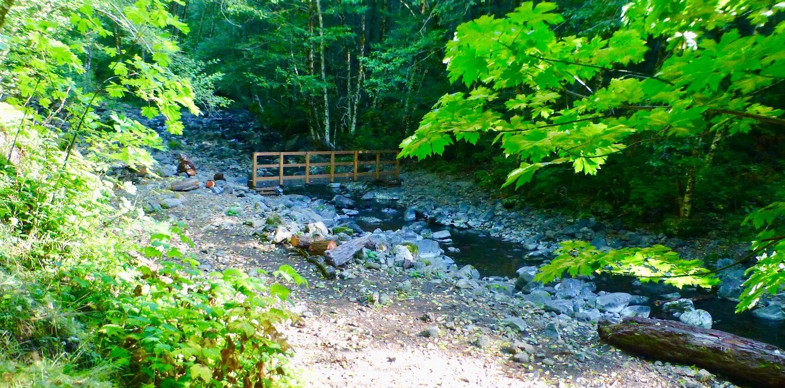
The Newest section of the Wilson River trail (well, that I know about) is the section from Elk Creek up over the hill to Idiot Creek Loop Road Trailhead. When they had originally put the trail in (just a few years ago) they had these plans for this big elaborate bridge. It would go across the main part of Elk Creek just below where the two main branches of Elk Creek join. There is a section of the bank there that has high rock on both sides and the bridge was going to be put in up on those rocks. This was going to be an expensive nice bridge, suitable for horse traffic. I think the forestry department lost funding before the bridge could go in. This all means that if you want to hike the part of the trail up to Idiot Creek you need to ford Elk Creek.

Fording Elk Creek isn't too much of a problem (except when the creek is in flood) but you are probably going to get your feet wet. In fact, the safe way is to get you feet wet. I got stuck in the middle once on some slippery rocks, I should have just taken my shoes off and gotten my feet frozen. I have been up this trail one time a few years ago, but I was blocked from getting too far by a big slide. My partner and I were hiking up Elk Creek trail last week when we got to the ford and found (to our surprise) that a little bridge had been put in. Cool. We could cross with dry feet and go explore this new trail. (update on the
Bridge)

Idiot Creek is a funny name for a trail. This is actually the Wilson River trail but it is the section going to Idiot Creek Loop Rood Trailhead. Now Idiot Creek Road is an old lumbering road (a dirt road) that is on the other side of the mountains from Elk Creek and winds around Idiot Creek. Idiot Creek dumps into the Wilson River right where the town of Idiotville used to be. Don't believe me? Try a google on
Idiotville.
I had run into a ranger up the trail several years ago. He had told me about the plans to build the bridge across Elk Creek but also about the long range plan to extend the Wilson River trail pretty much from the town of Tillamook all the way over to Gale's Creek. The only section that I don't think is done yet is the part from the Idiotville Creek Road Trailhead over to where you can latch in to the Gale's creek trail complex. Right about where Route 6 first Crosses the Wilson River on that one big bridge. There is actually a trail under that bridge that loops around to University Falls and Gale's Creek campground.

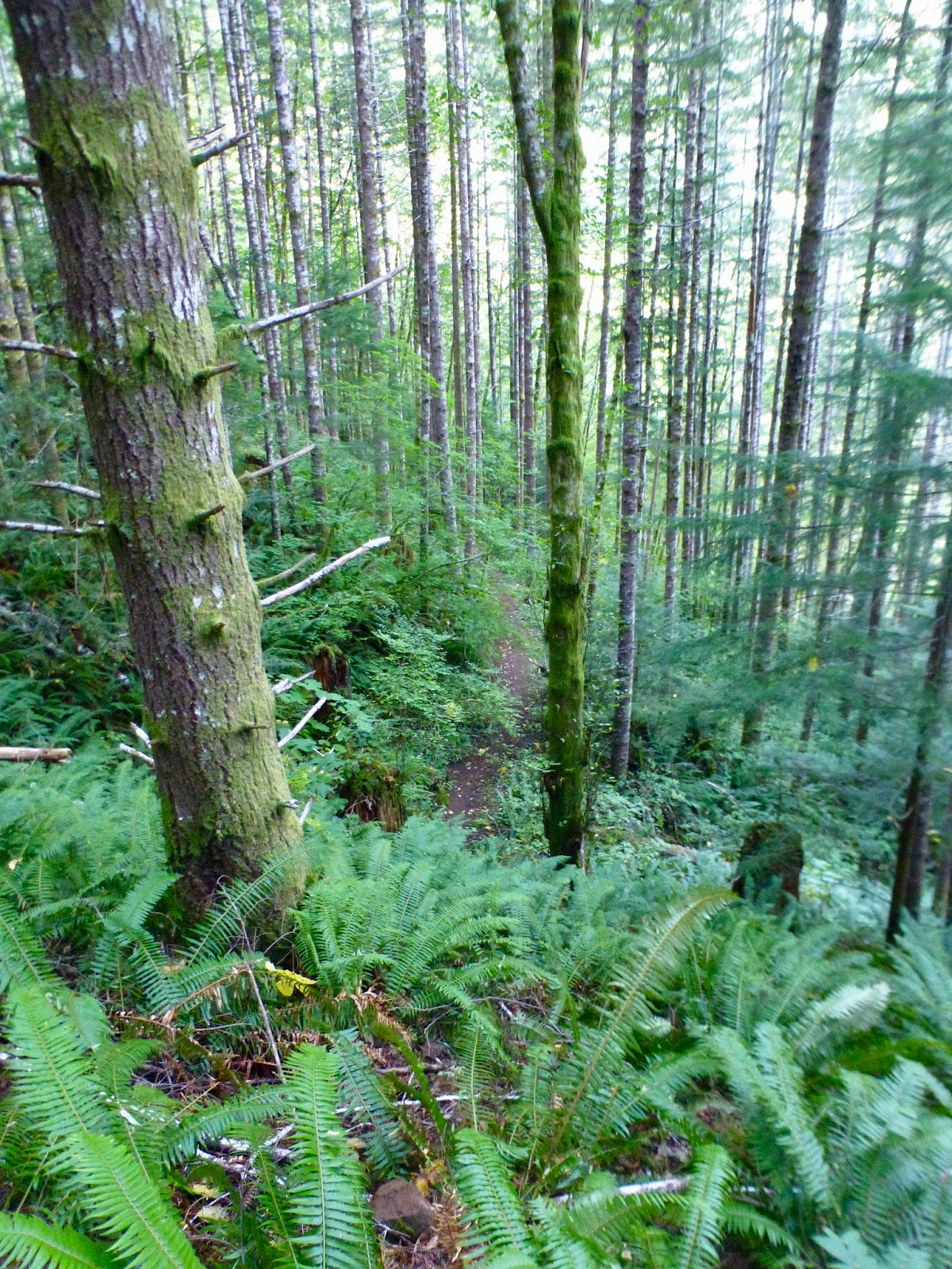
Today is going to be Sunny, but sort of chilly. We parked at the lot out by the road (the road into Elk Creek Camp is closed this time of year) so we had already done about a mile by the time we saw the bridge and decided to explore Idiot Creek Loop. The trail starts out pretty level. It is a newly made trail, not a part of an old logging trail, so it is more narrow than Elk Creek Trail, but also has its switchbacks better planned so things are not as steep. You start by following the right branch of Elk Creek (the Left Branch is what we usually follow going up Elk Creek Trail). But we quickly climbed away from the river. Down below, it seems like there could be a number of flat places covered in fern and fallen branches that might be good places to camp. But it is really steep down from the trail and I wouldn't want to try to climb down (or back up). After about half a mile we came across a large old remains of a washout. Ten or twenty years ago a bunch of mud came pouring down off the mountain, bring a lot of old stumps and new trees with it.
The trail cuts through it and then begins a set of switch backs up the mountain. The trail doesn't really go too far up the valley. Just back and forth as you wind your way up. Looking at a map, I see that all we are doing is going up this side of the hill to get ourselves over a little saddle and then down to the Idiot Creek Loop Road Trailhead. Well, as we go up, there is some interesting scenery.
 |
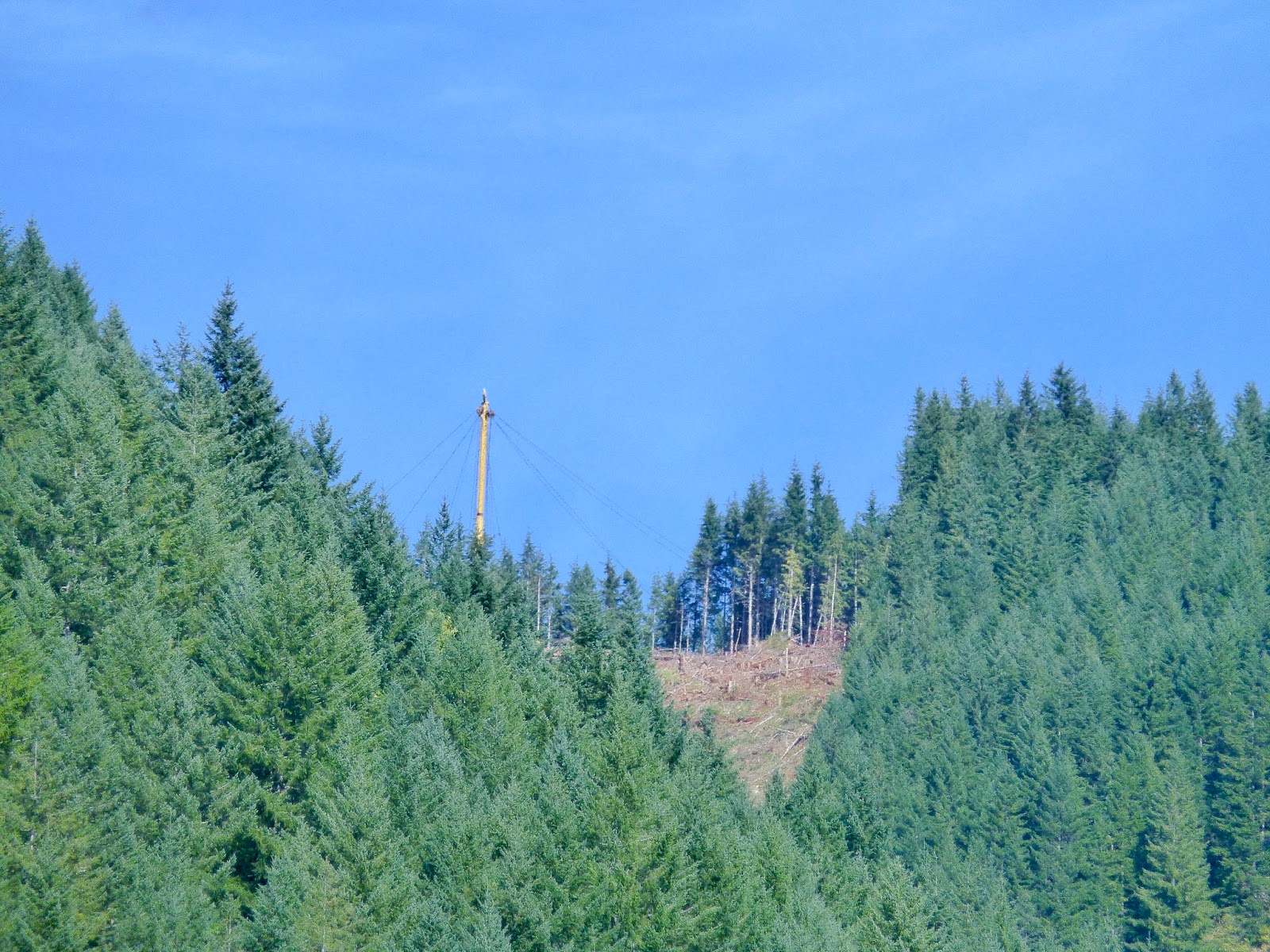
| What is that sticking up in the air? |
We can hear some machinery whining and when we pass over another part of that big wash (further up the hill) we have a clearance where we can see across the valley onto the sun lit Northern side. Up on the top of the hill we can see a periscope like thing sticking up with a bunch of ropes coming down from it. This is a lumberjack's piece of equipment. It is used to move logs around on a hill side. (after lunch we are up high enough that we get a better view).
 |
| There is that out of place Maple |
 |
| Up on the Lunch Time Ridge |
 |
| Looking at the view across the Wilson River Valley |
Now the switchbacks are taking us back West, so that we are pretty much straight up the hill from where we first crossed over that bridge. We hit the ridge and enter into a sort of strange eco-zone. More sun or something. There are different tree's and plants up here. There is a huge Maple, for instance, instead of the usual Doug Fir. We top out in a sunny area and stop there for lunch. There was a good open place to sit down and we had a bit of a view looking out across the Wilson River valley.
We had already been hiking for a couple of hours, but we figured we only had a mile or so left before the ending trailhead, so we decided to push on. I was thinking we were up on the ridge and we just needed to wind along it for a bit until we came to the parking lot. My partner was thinking that she wasn't going to be going out hiking with me anymore unless she had a map so that she didn't have to trust my thinking on ridges and mountains. There was another set of switchbacks. And Another. Then we came around the corner and had a really good view looking up the Elk Creek Valley to the hills on the other side where a little lumber crew was hard at work completely denuding the backside of the hill of Trees. There was that Periscope thingee (Ok, turns out it is a Cable Yarding Carriage), and a loader or two and a truck. Maybe 4 or 5 guys tearing down a forest. Here is a good page about lumber
equipment.
 |
| The standing plank hole |
 |
| Another stump |
I'm not sure how I feel about that. I mean, over where we were, there were tall Douglas Fir and Alder with a good healthy ground cover of Sword Fern and Oregon Grape. Very green and wet and beautiful. Of course, the really big giants are not here. No, they were cut down a hundred years ago the old fashioned way. In fact, a lot of the giant stumps are still around. You can tell they were cut down by hand because you can see the holes cut in the stumps for the boards to be inserted that the hand saw team would stand on so they could saw down the tree above the bother of the roots and elbows.
 |
| Sure looks like clear cutting to me |
There is a long history of logging in the Tillamook forest. The tree's have all been cleared out from most areas at least once. You can find a lot of the history still hiding around in the forest. Elk Creek Trail, for instance, is an old abandoned logging road. Running up that road, for much of the length, you can find remnants of the wire road roadway they may have used to swing logs down the valley. There are also machinery bits here and there. In other places in the forest you can find water tanks (presumably for steam engines). The biggest piece of logging history is the Banks to Tillamook train line that runs from Banks through Timber and then down the Salmonberry river eventually hitting the coast at Wheeler (
see a story here). Though this railroad was built to provide access to the coast from Portland, it also served as an alternate route to haul the timber of Tillamook out of the forest, probably to Tillamook for shipment to California via Log Barges, but also to Portland for more local usage. The railroad was washed out a about ten years ago, by flooding caused by the very logging that it had originally encouraged. As you drive on 26 toward the coast, you can see many places where logging stripped the mountains down to dirt and sticks. The lumber companies make a big deal about re-planting and putting in little signs that say "Planted in 2016". I can't help but think that it would be a much better practice to take the trees out a little more carefully. A little less cataclysmically. I am sure such a thinning costs more and that would mean that our 2x4's plywood and firewood would cost more, but I still think that would be better. I guess one could argue that more expensive domestic timber would just increase the demand for stripping foreign forests (poor Canada!) One problem at a time.
By the way, if you want to know more about the history the Tillamook forest, you can try the
Forestry Center. It is a very nice facility, paid for using the dollars earned with the clear cutting of the local area, and it has a few nice hikes that originate from there. A good place to go yourself or an interesting learning experience for some kid type friends.
When we started this hike, our plan was to hike two hours uphill and then stop, eat lunch, and hike the two hours back down. But we have already had lunch and continued up the hill for another 45 minutes. I swear I have seen the top at least three times now but there keeps being a big piece of stone soaring out of the forest floor and rising above our heads that we have to follow the switchbacks around and over. My partner was game to continue on, but I called it on account of time. We have a few things to do back home (like take a hot tub) and need to get back to the car.
 |
| You are hiking the side of the hill almost all of the way |
I find hiking in the wilderness to be one of the stranger experiences in modern life. Here you are, out for a nice walk. Having a wonderful time. But you don't stay out walking until the end. You stay out walking to halfway. You can't just instantly teleport back to your car. You can't get off the treadmill and go to the shower. You have to plan ahead to darkness and get your ass off that hill before you get benighted. So. Back down we go. The views going down are just as lovely as those coming up. But we don't get quite as out of breath.
We examined the map on the sign post at the parking lot and decided that we had been very close to where the trail would even out, wrap around the summit and then head downhill to the Idiot Creek Loop trail head. We will hike that final part another day. We saw no one else the entire time we were out hiking, and that is just too wonderful to not seek out again.