Candiani Bar

My Kayak Partner and I have been
exploring new places on the Willamette River to go rock hounding.
(well, Agate hunting). Earlier in the summer she found a place that
is about a mile up river from a cute little local boat ramp called
San Salvador county park. It is a dirt road affair down at the end of
everything in the town of St. Paul, Oregon (Home of the St. Paul Fourth
of July Rodeo!!). There isn't much room or much parking at the ramp
but that is usually OK because there are rarely many people there. And
even on a crowded day, you can park on the side of the road for a few
hundred yards at the entry. The main problem with the place is litter
and trash (or, as the old gentleman we met there last time informed
us, Vandalism). I don't understand why people would go out to a nice
place in the country for a picnic (or a 12 pack of beer) and have a
great time but leave all of their trash just sitting there on the
ground. Don't they think they may want to return some day? Do they
just go and trash a different place each time assuming that they will
never run out of places? Do they assume that no one else acts as they
do or that everyone else acts as they do?
 |
| Spring 2015 |
 |
| San Salvador County Park Boat Ramp, Spring 2015 |
St Paul is also, seemingly, the home of
the heart of many a brewer because the country road leading up to the
park is surrounded by hops fields. Hops is a mighty interesting plant.
It grows fast and wild on vines, sort of like green beans. The
farmers have set up acre upon acre of wire hangers some 20 feet in
the air. A beam every 30 feet or so holding up the wires and around
the edges of the fields are stays into anchors holding the hole thing
up. Then every 10 feet or so a string hangs down to a nacent hops
plant. As the summer grows, the hops goes climbing up those strings
until by mid summer the entire field is 20 feet high in vines. Then
when they flower, along come these upright harvesters that cut the
strings and bring the entire vines, still stretched out, into the
local processing plant. Not sure what happens then but my
understanding is that many a local IPA is counting on getting those
hops flowers before they are more than a day or so old.


 |
| Hops |
But today we are not drinking beer or
even seeing the plants. Harvest is long done and we are trying to
sneak one more day of sunshine out of our beautiful summer/fall. One
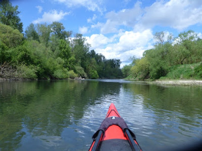
more day. We hit the ramp around 1:00 and started our paddle at 1:23.
I remember because we noted the time so we could try and figure out
how fast the current was running. The current does run here. At low
water, it is not so hard to paddle up, but on our first attempt, back
in the spring, the water was moving so fast that paddling as hard as
we could we could not make forward progress in some places. We had to
ferry across the river and see if we could find slower water on the
other side. If we had to, we could have gotten out and walked the
shore in some places, but not all. In some places there was just
steep bank on the side and fast moving water. As the river rises, I
am sure that there will be more fast water and less places to walk.
Of course, it is that high, fast water that turns the stones and
brings in the new rocks and lets rock hunters find great agates year
after year. Decade after Decade.
Remember that old gentleman back at the
Boat Ramp? He was a bit of a talker. A very friendly, pleasant sort of
talker. When we first arrived he looked our boats and said, “Oh, I
don't think you want to be going out on the river today. The water is
very wet today.” It took me a moment to realize he was having me on. I
like that.


Later he came down to where we were
loading our kayaks. “you know,” he said, staring out over the
river, “My ancestors used to own this land here. They were farmers
and this here was a steam boat landing and they would ship their
produce into the city from here. When the steamboats stopped, they
donated the land to the county. Used to be real pretty. Back then the
river was deep and narrow, not shallow and wide like it is now. Used
to be dredged for the river boats. But the ecologists complained that
the dredging was killing the carp or some other trash fish and they
had to stop it.” I suspect that they stopped dredging because of
the interstates taking away the commerce, but I shouldn't interrupt.
We told him that we were going rock hunting. “I used to go rock
hunting every spring right after the river came down off the bars.
There is a rock bar about a mile up river from here, on this side,
that I used to love to go to. You could get there by road and I would
hunt agates and such. One time I found this big rock, perhaps the
size of a grapefruit. I didn't know what it was but I took it to the
scientists at OMSI and they told me it was a mastodon tooth. One of
the nicest ones they had ever seen from this area. And you know, you
find these rocks or fossils out there, and you don't know where they
came from. They may have been tumbling down the river for hundreds of
miles and thousands of years, or perhaps they just got dug out from
some bank last weekend. You just don't know”.


No, you don't know. But we were going to
be on our way up the river to find his rock hunting place. We have
gone to this gravel bar a few times this summer, but this time I
wanted to do a little more exploring on the interior and see what was
there. We paddled up the left bank (our left) until the current got a
little strong, then we ferried over to the right bank where the water
was shallow up on a (less than prime) gravel bar. Do you know what
ferrying is? This is where you point your boat mainly up current, but
a little cross and then paddle hard in that direction trying to cross
the river without going shooting down current. It is a little
deceptive but once you get the feel for it, it's not a hard manuveer.
Usually we make this crossing, then paddle until the current gets too
strong again and then try to shoot across and redevous with the top
of the Cadiani Bar. Lots of current right out there at the tip. The
water is around 4 foot deep and moving fast. Fast, like 3-4 mph. Which
is about as fast as you can paddle a kayak for any sustained effort.
Today, however, we stayed on the right bank for awhile. We had to
paddle pretty hard against the current, but when we got tired, we
just got out and rock hunted a little. When we finally crossed, we
were already a couple hundred feet up the Candiani bar and the
crossing was very easy. Seems like the secret is to cross where the
river is more narrow, though that seems counter intuitive to me.
Perhaps something else was going on there. But cross we did, and
then we paddled along the bar until we can to end of the first gravel
bar.


The secret to agate hunting is sun
light. If the sun is out, and bright, and at an angle to the earth,
then you can see the agates glowing on the ground. During the summer,
this means later in the day or early in the morning. But by this
time of the year, the sun is far enough down in the south all day that we
had good hunting light even at 2:00. We beached our boats, ate some lunch,
grabbed our rock sacks, and hunted our way back into the island. That
is what Candiani bar really is most of the year. An island in the
Willamette river. When the river is high, every place we are
searching is underwater. Right now, it is 4-8 feet above the river.
Think about that for a moment. Not sure I would like to be on a kayak
on the river when it is 8 feet higher and running through these low
trees.


But today, the river is peaceful and so
is the rest of the world. Well, it was until this plane came and
landed on our beach. In fact, 2 planes. The one was some sort of
light single passenger job with the engine over the pilot and a
combination push and pull set of propellors. Big balloon wheels. He
came down, landed. Turned around the other way, gunned his engine,
and was back in the air in like 50 feet of run. Pretty cool. He and
his friend (in a more conventional looking little plane) just flew
around our area for half an hour making occasional set downs on
whatever little piece of beach they could find. My partner and I like
to hunt for rocks in their tire tracks as they turn up the rocks and
expose the agates.


To get off the beach, you have to find
an opening through the little brush that grows on the embankment that
leads up to other rock beds on the interior of the island. If you
look from the air (or from google maps) you can see how the river
must flow over the island in different channels as the water rises
each winter. We had previously only hunted the outermost bank, which
turns out to be made up of smaller stones, but once we got up the
embankment and into the interior, we came across a wide expanse of
much larger stone. All of it river rounded over thousands of years.
And Agates Everywhere.


We were hunting and hunting. Filling
our sacks. Enjoying the solitude once the planes had flown away. No
one else around, maybe a fisherman up around the bend. Down in that
river flood plane you can sort of think that you are out alone in the
wilderness, but if you zoom out a little on google maps, you will see
that right over the trees on either side of the river, there is farm land marching right up to the river's edge. Farms and
fields everywhere. We can see one big house about a half mile away up
on the bluff at the turn in the river. But right now we were all
alone.
 |
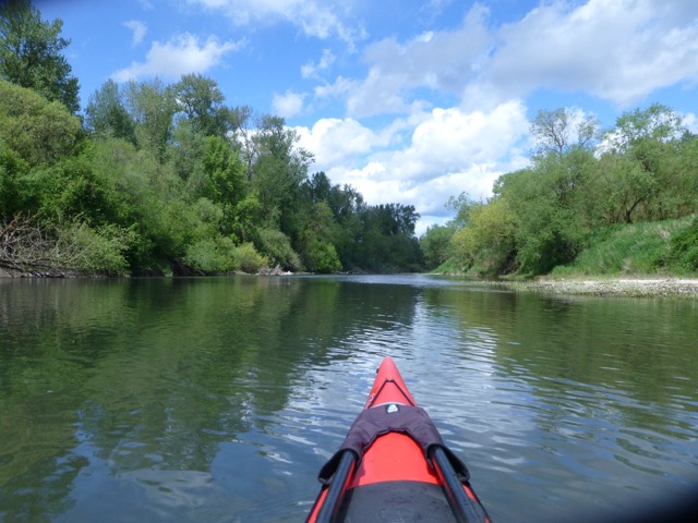
| During our first trip out, in the spring. |
And that is when we started to see the
little signs of others. Now, you may think I am talking about the
bottles of beer and other trash at some idiot's picnic spot, but I am
not. I am talking about a more subtle and artistic leaving. As you
walk across the stones, you come to a collection of rocks that just
can't quite be natural. You do a double take. Is that how the river
left those rounds stones? No. Could be. Someone did that. Someone
stacked those stones just so for someone else to find. For me to
find. I took some pictures. Then I walk some more, head down looking
for agates, and I run smack into this little log. And I laughed out
loud. Lined up on the log is a fine little collection of red and
orange agates and a very pretty little striped stone. I went and got
my partner and showed her. “Should we take the stones?” I asked.
“No,” she said, “We didn't find them”. I agreed. In fact, I
later added a few of my own findings to the collection on the log.


On the ride home my partner said that
the stones had been left by people who already had their fill of
collecting and now were just enjoying the searching.
And that is most of it. The searching.
The pattern recognition. The admiring of your friend's finds. Maybe
one day when I am as old as that old gentleman we met at the launch, that is what I will do
with my rocks. The rocks you find are thousands of years old. In
the grand scheme of things you can't keep them long anyway. 50
minutes or 50 years, all the same to the rocks.
 |
| And Always stop to Admire the Sunset |


