Saturday, July 22, 2023

John Dellenback Oregon Dunes Hike


There are a number of similar hikes on the Oregon coast that lead one through a wide array of terrain and hiking and visual experiences. These hikes feature some big walks across majestic shifting sand dunes as well as interludes through Sitka forests and low coastal scrub oaks and brush. You ultimate reward is coming over a dune a deserted ocean beach. 


John Dellenback Trail is a great example of this class of hike. It starts out near Eel Creek Campground in the Siuslaw National Forest and comes over a low forested rise to suddenly hit the encroaching dunes. This hike has almost 2 miles of dunes, which is longer than other dune hikes I have done. The sand is always shifting so there isn't a trail, per se, but you do need to be looking ahead to find the blue stripe topped wooden poles that rise out of the Dunes. They are usually placed in a local prominence where some grass or earth is present, but sometimes they are just out in the sand. 


Trail Marker

We started out across the sand on a cool slightly overcast day. There was some tendrils of fog blowing in from the Ocean. Be a little careful on days like this because if the fog blows in you won't be able to see the trail markers. In our case, there were lot of footprints roaming around in the sand and in general we agreed with them and followed them. We were trying to find the easy way to go, however, and sometimes these footprints were clearly looking for fun. We were trying to avoid going up and down every dune by following a imaginary topo line around the sides of the dunes. 

The sand out on the dunes is not very predictable. A lot of is was soft, letting you sink up to your ankles in the stuff. Not easy to walk through. Other times the sand would be firm enough to support our weight and we could make much better time. But the surface ahead of us, in both cases, looked the same and you never knew when you were going to sink or be held up. 


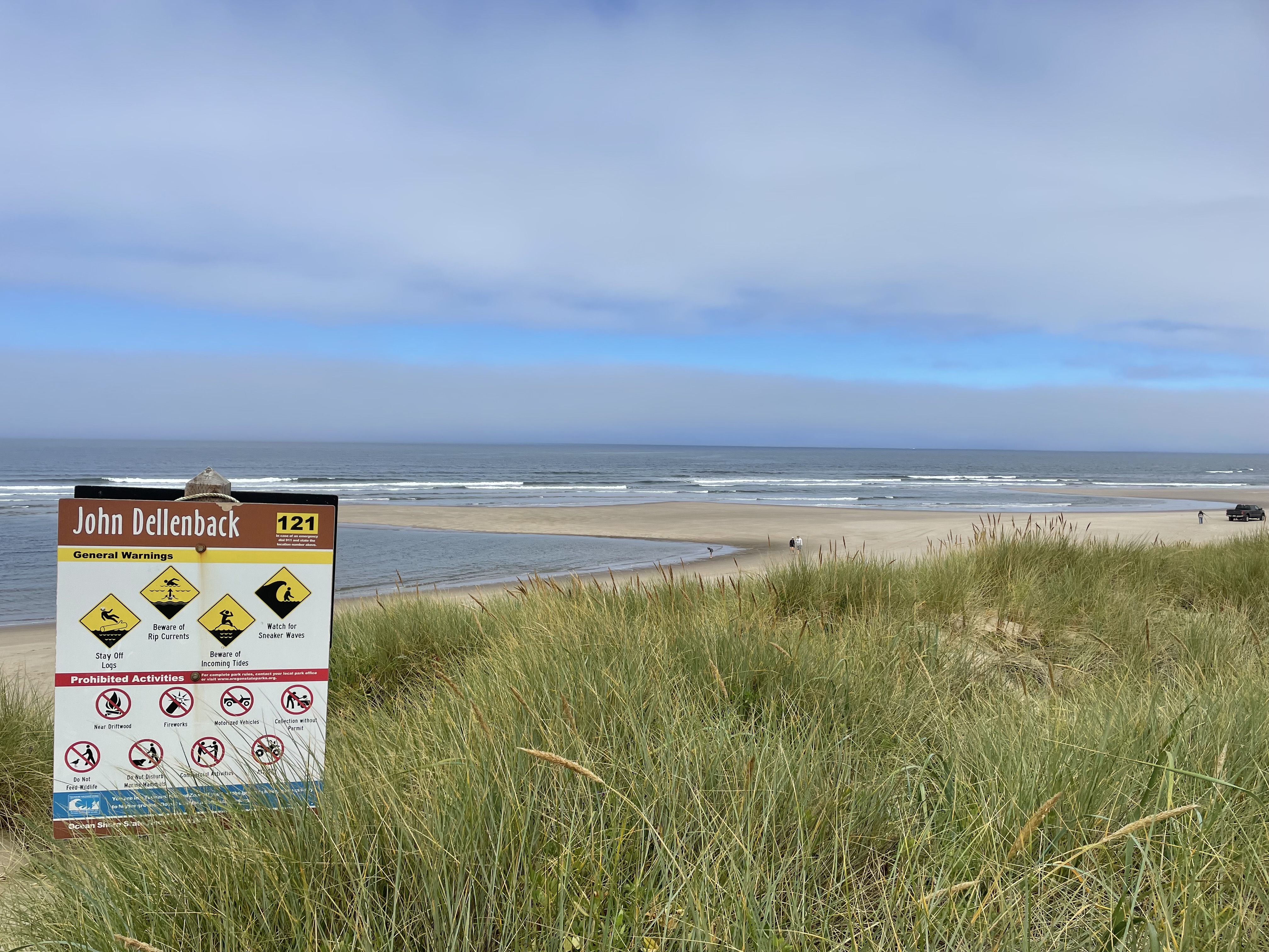
The poles were presumably all planted at the same height, with the blue stripe sticking out of the ground around 6 feet. But with the constantly shifting sand, we found a couple of poles with only a foot showing and there could easily be some that were buried completely. It took us around an hour to get across the sand and then we came to a wide tree island that seperated the dunes from the ocean. Here the trail got firmer and was easier to walk. The trail runs parallel with the ocean for a quarter mile or some and then turns and leads you to the coast. The trail through the tree island is pretty cool. You go through a bush covered tunnel for a bit, something that was clearly cut through the dense foliage.  Then you come to an area that must be marsh or shallow lake during the wet season. This area has a very strongly built boardwalk that extends for nearly a quarter of a mile. That is some boardwalk! Thick pilons placed every 10 feet or so and bit think boards spanning them. Must have had some big equipment in to build it. 

This one was hard to find


Tunnel of Trees


The boardwalk ends at the grass covered dunes near the beach and it is just short walk to your view of the ocean.  The ocean along here is all sand (as one might expect for the Oregon Dunes) so don't expect to be able to do much rock hunting.  We just sat in the sand and watched the waves, always a peaceful activity. We did find the creators of the footprints that we were occasionally following. It was a family of 6 (Mom and Dad and 4 kids). There was a truck on the beach when we got there and we thought at first that the family had cheated and drove out along the shore (which is evidently a thing), but no, they walked out from the same parking lot as us. 

We had a little snack and then headed back, at the same time as the family headed back. We ended up walking part of the way with them. They could go faster through the woods but it turns out that trying to gets kids to walk steadily through sand is like herding cats. 

Now we come to the cautionary part of this trail (or trail). Conditions change at the coast. The wind had come up a little bit and it had blown away our fog cover. The sun was out and it was much hotter and drier out on the dunes. If it had been this way in both directions I would not have been carrying enough water (I only had 800ml)(That is right, I drink in metric).  The other thing we found is that we could not easily retrace our steps because many of our steps had already been erased by the wind and moving sand. 

Centary Plant. Perhaps "Stomach Bitter"
Either way, evidently exotic


If you can keep going in a straight line, or just head generally in the right direction, you will probably be OK, but you need to hit the edges of the dunes close to the place where you came in or you won't find the trails that have been cut through the woods back to the parking lot. I would not want to bushwack through those woods, they are very dense and difficult.  We did have Cell Phone access the entire time, so mapping on our phones works just fine and that can keep you on the trail pretty well. 


The start and stop of this footprint path was covered by moving sand
while we were on this hike. 


This is a great hike. A little over 5 miles and it took us around 3 hours of walking time. It is a great deal harder than a hard trail hike what with dealing with the sand and all. We were certainly ready to stop walking when we got back to the car.


Friday, July 21, 2023

From The Falls of Willamette to the Cliffs of Insanity


This weekend myself, my wife, and my youngest son participated in a Level 2 kayak training put on by Alder Creek Paddling shop. This is a 2 day class that  introduces a paddler to some advanced paddling techniques as well as some more challenging water and wind conditions and group management.  No one else signed up for the class so it turned into a 2 day family guided adventure session. We went to two locations (one I have never paddled) and did a bunch of new things.

Willamette Falls

The Falls of the Willamette are the second largest falls (by volume) in the USA. Think of that, only Niagra has more water going over it. These falls have the potential to be a destination spot but right now they are surrounded by abandoned factories. They are somewhat the victim of being too close to Portland. The deal is that Portland is just a couple of miles down the river North (yes, this is also the second largest North Flowing river in America) and that proximity made the falls extremely valuable... for electricity production.  There was a time where there were commuter train lines all over the Portland area, running as far south as Salem, that were all powered by the hydro generators at the falls. Think on that, in the early 1900s there was great commuter rail in Portland. That hasn't quite recovered from the invention of the car but they are working on it. These days the Electricity comes from the falls that were drowned by the dams on the Columbia. 

But if you are in a boat, the falls of the Willamette are still pretty and you can get up pretty close to them especially this time of year when the water flow is low. 

And that is what we did. We paddled from the confluence of the Willamette and the Clackamette. This is called Clackamette park and there is an old boat launch there. It isn't used anymore because the Clackamas river flow changed and there isn't deep enough water to safely launch a fishing boat anymore. But it is still a great place to park your car and launch a kayak.  We paddled up the Willamette talking about different safety and paddling issues and "eddyline jumping". When there is moving water on a river there is usually protrusions into that water flow, either rocks or trees or bridges.... something. These protrusions create water current diversions that often make a swirling back current that is called an 'eddy'. You can sit in an eddy behind a little rocky outcrop and be in water that is relatively still with a slight current the opposite direction of the main. The main current can be only a few feet away racing down the main channel. This means that in front of you is a place where the current direction changes rather suddenly from upchannel to down channel. This change in water direction makes a very visible line in the river and that line is called the eddyline.  


Crossing a eddyline line can be challenging especially if the current differentials are large. The trick is to rock your kayak up on its side to prevent the fast moving 'other current' (the current you are not in) from building up water on the side of your boat and rolling you over. You do this by lifting one of your knees such that it engages with the hip pads on your boat and lifts that side of the boat.  But which side do you lift? This was always confusing to me because it seemed like you alway get different advice on this depending on whom you ask. Well, it turned out I was getting identical advice just in situations that were different.  The first time I was told about when to do this 'don't flip over' edging was when I was trying to learn how to surf small waves in the ocean. The advice was to 'moon the beach'. In other words, lift the knee that causes the bottom of your boat to face the beach. This puts your torso facing the wave and also lets you put your paddle in the water to help keep you up right while the wave tries to roll you over toward the beach.  Works great.  When you cross an eddyline in a river the advice is 'moon the current'. This means pointing the bottom of your boat toward the current. So if you are crossing from a slow moving eddy into the main river you would point your bottom up stream. This seemed to me like the opposite of pointing my bottom at the beach when surfing. An instructor pointed out to me that I was thinking about it wrong. He said that when surfing, the dominant current isn't the wave, it is your boat slipping across the top of the water toward the beach. So, effectively, the current your are mooning is coming from shore. So mooning the beach is mooning the current. Ain't physics grand?

Sorry, that was a lot of reading just to get across one damn eddyline. Today, that wasn't even the hard part. Our job was to 'ferry' all the way across the river (about 50 feet) from the eddy on one side of the river to the eddy on the other side of the river. Eddy hopping. This meant that no only did we have to cross the eddy, but then we had to deal with the fast moving, bumpy, swirly, scary water of the river and then cross back into the eddy on the other side.  Which is what we did. The 'ferry' part was trying to keep yourself pointed enough up river to cross the moving water without losing too much distance downriver before you made it across. Important to not be pushed backward into things you can't see. 


We did this ferrying a couple of times back and forth. Our instructor was giving us hints and directions along the way, but mainly he was getting us used to the lumpy water and more confident of our abilities to stay upright in the adverse conditions. Then he demonstrated a crossing to us and I noticed he was using a stroke I had not seen before to go in the opposite direction than I expected. I asked about it and he showed us how to do it and said it was a good stroke to use in these bumpy conditions. Well that may be true it turns out it is very hard to try and learn a  new stroke  when you are doing everything you can to stay upright and freaking out a little in the process. The first time I tried it I almost flipped and ended up abandoning the crossing and being swept downstream a ways into calmer water. Before I could work my way back upstream Nick tried the same thing and he did go over. So now we have someone in the water and our instructor took off after him. 

I think the essence of these advanced classes is that Someone has to go swimming. It helps the people in their boats practice rescues (or just staying out of the way) and it gives the person in the water the chance to realize that flipping over isn't that big a deal. It is just going for a swim. Note: If you are in a situation where 'going for a swim' is dangerous, you probably should not be out boating.  At least not at our skill level and physical abilities.  Nick has been practicing his self rescue lately and he got back in his boat pretty fast unassisted. Then we pumped him out and decided it was lunch time. 

We stopped on a local beach for lunch. After lunch it was getting pretty hot (we were having a scorcher in Portland that weekend) so we all did some rescue practice in the calm water near shore. Just flip over and get someone else to pull your boat up on there boat, dump out the water, and then help you get back in by holding you boat for you. It is a bit of a  chore but something that I have decided that I need to do at least once a year just to prove to myself that I can still do it. Once again, if I can't get back into my boat, I probably should go anyplace where I can't just swim to shore. 

For our next trick we went back to the confluence of the two rivers and were going to see how far up the Clackamas we could paddle. Maybe find some fun water. Well, it turned out that we had launched at high tide (yes, below the falls the Willamette has a tide) and the falling water level had made a great little standing wave in the Clackamas right at the old boat launch. Our instructor didn't think we could get further upstream so he taught us how to cross a fast small current like this. It is essentially a very quick and hard eddyline cross. He said it was called an "S" turn. You moon the current hard as you enter, it pushes you bow down river and tries to swamp you, then you enter the reverse current on the other side and you have to reverse you moon and you bow swings the other way. Your boat makes a nice S shape in the water. I went first (after the demo) and made it through the rough water but switched my moon to early and went right over in the water.  It is sort of funny how this works. I am a little apprehensive about going over but once I flip and find myself upside down in the fast moving water with my boat on top of me, I am really OK. I am not afraid of swimming, just of flipping over.  I got of my boat and thought I could just stand up, but the current was having none of that. I had to pull my feet back up because of was hitting some rocks. The instructor was there with me but I think he wanted to see what I would do. I ended up leaving him my boat and just swimming to shallow water on the opposite shore. I took my paddle with me and the instructor (Andrew) brought my boat over so I could empty it out and get back in. Paige and Nick were waiting back up by the fast water and we went back up there and tried it again. This time all of us made it across with  different approximations of the S curve. We sort of wanted to play more in the standing waves that were there, but the water was a little shallow for people that didn't have their kayaking helmets.  So we called it a day. 


Rooster Rock and the Cliffs Of Insanity

On Sunday, we went to Rooster Rock state park on the Columbia. The plan was to launch at the boat ramp there and head up the Oregon side of the Columbia. When we got to a relatively narrow section we would cross the river to the Washington side and then paddle more upstream to the "Cliffs of Insanity".  Andrew told us that all of the local paddlers called them that, evidently a reference to the movie "Princess Bride". We told him that we thought their actual name was Cape Horn, which is just a different copied name, but this one is on the maps. 


This Mama Merganzer had somehow adopted 20 babies
perhaps they adopted her.


Today we are practicing pretty much the same skills as yesterday but on a bigger river. We also did a lot of talking (whilst paddling) about the importance of weather monitoring and how things can quickly change when you are out on the water.  Andrew had used an app called 'winds' to check on the weather forecast for the area. He said this app pays a lot more attention to wind variations than other weather sites. The forecast was for 3-5MPH in the morning and then building to 10 to 15 this afternoon. He said he wanted us back on this side of the river and in a safe area by 3:00 to avoid any trouble. Sounded good to me, one thing I have especially hard problems with is padding with the wind. That is, a following sea. Paige likes to ride the wind waves but they freak me out a bit.  We crossed the river right below the cliffs. Cape Horn sticks out a bit into the water and it make a larger eddy there.  This means you can ride this back current right up the sides of the cliffs and enjoy the view. It is quite a view too, the cliffs are stunning and the rock is beautifully textured. We road some wind waves into the calm of the eddy and then got to take some great pictures. 


There is a train track line that runs up both coasts of the Columbia. The one on the Washington side carries Amtrak travel from Chicago (The Empire Builder) and we saw it run by going West when we were taking a break before the cliffs. The line is actually drilled right through the Cliffs of Insanity and a train went Eastbound through the tunnel right above us while we were floating there taking pictures. Such fun.

As we were floating up river in this back eddy, further and further East, we were also getting to a place where the river was more constricted by the cliffs on both shores. This was causing the wind to funnel and build and the water to funnel and build and outside of our little eddy things were starting to look pretty bumpy and challenging. Andrew was planning this. Now we were going to enter the rough water and be paddling with the current but against the wind. He said if we had trouble we could just dump back into the calm eddy to recover. If someone flipped, they needed to hold on to their boat so the wind wouldn't blow it away from them, but the river current would soon take us to a calmer spot. A complete rescue in that bumpy conditions would have been difficult, but I guess it wouldn't be impossible. When two boats are pulled up side to side, they are pretty stable.  We paddled in this rocking and rolling water for 20 minutes are so. It was a little scary and very exciting. I was getting a bit tired when we finally pulled out of the rough water and back into the eddy along the side of the river. At this point, we had rounded the turn in the river about were we had crossed over the first time and things were settling back down.  Please forgive me for not really having any pictures of things when they were "rough". I guess I need a go pro.


Across the way we could see a nice sand beach with people sitting in the sun, we decided to head over there for lunch. That side of the river is funny this time of year, it is a foot or so deep for a few hundred yards into the river. We were running aground before we got very close to the little island. I was wondering how all of those people got out to the island, turns out they walked from Rooster rock.  We finally got to land and sat down to have our lunch and we found another surprise; this is a clothing optional beach. Wow. Did you know that the original name for Rooster Rock was Cock Rock? Because of its shape. But the map makers changed the name when they made the public maps. Who cares what Lewis and Clark called it !! Not sure what made me think of that. 

The afternoon wind never did show up so we didn't get to do even more practice in bumpy water. Instead we found a shallow place and did brace practice. This is where you tip yourself until you are no longer stable and definitely going over unless you do something and then you slap the water with your paddle and try to save yourself. If you don't flip over, your probably aren't trying hard enough. 


Paige does a great self rescue


Anyway, a great weekend of lumpy water and new learnings. Now I want to go back to both the falls of the Willamette and the Cliffs of Insanity and practice. Need to make sure and bring along people that can pull me out of the water when I fall in. 


Tuesday, July 4, 2023

Jasper National Park - Part 2


Glaciers – 

Everything around here is about the ancient and current glaciers; where they were, what they did, how they impacted the land. We are talking about rivers of ice that are thousands of feet thick and hundreds of miles long. They compress the ground underneath them into huge flat sand covered plains. They plow the mountain valleys picking up errant rocks and boulders, breaking them down and pushing them to the sands creating long tall moraine that run the length of the ancient glacier valleys. They slowly move and grind against the remaining side and bottom stone, sanding the stone smooth but also creating a fine glacial silt that turns the rivers and lakes a beautiful blue green or a muddy grey.  When they retreat they leave large stands, terminal moraine, of carried rock where their toes rested a century or so. All of the glaciers in the Canadian Rockies are in rapid retreat in these days of global warming. The lodge and park center at the ancient terminal moraine of the Athabasca Glacier was built were the toe of the glacier was in the late 1800s. The new highway if 100 feet closer to the glacier. The road leading to the parking lot near the glacier goes on for a quarter of a mile. Then there is another quarter of a mile hike up over a rock ledge to get as close as you can walk to the glacier without a guide. The parking lot was covered by glaciers in the 1930’s. The ridge you scale was covered in the 1950’s. As close as you are allowed to get was covered in the 1990s. They need to redo the park and move the signs and the barriers because they are not up to date and don’t let you get as close as the park would allow. Hell, they were set up over 20 years ago when the Glacier was right there on this side of the rise !!

Intersecting Glaciers created the overlapping Moraines seen here
Behind them is a nice triangle of forest.

I wish I had a pocket geologist along with me to explain the many glacial and rock features that we encountered over the last few days. Might need a limnologists and a glaciologist. See, this is what AI would be really good for, answering my little questions on the fly. I point my pocket AI (today, called, for some reason, a phone) at the feature, say a giant straight pile of rock, and the AI would say, “Why Jon, clearly that is a lateral moraine that was built up by the Athabasca Glacier when it extended down through this valley 20,000 years ago. Dr. Steward from the University of Vancouver BC has some fascinating papers on this particular flow that I will queue for your nightly light reading”. Goddamn smartass pocket AI’s. 

Deep Canyon Dug
Under glacier by Melt
Another cool glacier creating is some of the deep canyons that are in the area. We visited two of them: one at Athabasca falls, and one at Maligne Canyon. Both were created in similar ways, not  so much by the growing glacier but by the river of melt water that would flow under the retreating glacier. This cascade of water would be, well, river sized, during the summer and could be pushed into a narrow area by different flows of lava rock, especially rock of different hardnesses. This quick flowing stream would be forced to dig down instead of sideways making very deep and narrow defiles that carried (and still carry) the water. I must write more about each feature separately. 

Lastly is the lakes. As the glaciers advance and retreat they leave nicely rounded holes in the stone that make lovely little (or large) shallow water lakes, blue-green with glacial silt and sparkling in the summer sun. In some places, the glacier was kind enough to leave a terminal moraine at the foot of the depression creating a lovely little natural dam to make the lake even larger and deeper. Check out this satellite image of the lake at Wallawa in Oregon. 


The Glacier is South up the Mountains.
The Dam Moraine is at the Top


Driving South down the Icefields Parkway. 

Heading south from our campground we are driving on highway 93A, which runs parallel to the main drag, 93, which is east on the other side of the Athabasca river. We can’t see it. We are on the very edge of the large flat plane that was made by the gigantic ice age glacier of Athabasca as it smashed the local terrain flat up to the encroaching mountain sides. We drive down past a number of little round mountain lakes, some that are advertising boat (canoe) launches. These are the same shallow water glacial lakes that like those we hiked on the trail of 5 lakes. In the early morning, there is no wind and they make wonderful mirrors for the backdrop of snow covered Canadian rockies. 

After a bit we come to the Athabasca river, turn a corner and immediately go over a bridge that is much to small to actually cross that big river. What happened? We just went over the gorge that contains Athabasca falls. This is a gorge created in a similar fashion as the Maligne gorge when the melting glacier forced the river that was forming under it to find its way through the harder rock of this small area. The result is a set of wonderful water channels (current used and long ago abandoned) with Athabasca falls at the head of the canyon. 


This is a great place to get out and explore. There were a number of tour busses there when we arrived, but don’t let that slow you down. The visitation paths of this area and the viewing angles provided for the falls and the canyon are amongst the best designed I have ever seen. We had a great time viewing the falls and walking around. There is an ancient, long abandoned, water channel that is now a walkway and as you walk it you can imagine how the etching of the stone would have occurred on how this channel would have eventually lost its flow as the current channel grew deeper and so dragged the water away. Perhaps in a few hundred years the current channels will change again. I can certainly visualize how that would happen, looking at the twin flows up at the top.  

By the way, this isn’t one of those rivers that you go through in a raft or otherwise. A sign at the top says that people die quite often by going for a picture and slipping on the glacier polished stone and going into the cataracts. It recommends not doing that.


Now we continue South again, joining up with the main highway 93 which is the Icefields parkway. 

What are Icefields? They are sort of the birthplace of glaciers. Up behind and between the tallest mountains in the area are high and huge depressions with no river escapes. They fill up with  snow and ice until the compressed masses coming spilling slowly over the mountain sides as a glacier. There isn’t any place you can go (by car) to get a good view of the icefields, but you can see a number of the glaciers that spill down from the Columbia Icefield, that is right here above the Athabasca Glacier.

As we get closer to the Athabasca Glacier, we are effectively getting to newer and newer remains of the retreating ice. The surrounding landscape has had fewer years (or centuries) to recover and there are vast areas where there are flat fields strewn with different sizes of rock and silt mud and very few trees or plants that need good earth to grow in.  We come over a rise and we get to the Columbia Icefield Lodge, which is a hotel, park visitor center, and Disneyland ride start. The Disneyland thing is only partially a joke. At this center you can buy tickets for this glacier tour experience. You get on a tour bus that takes you about 5 minutes up this private road to a place on top of the lateral moraine of Athabasca Glacier. There you transfer into a special ice crawling bus that takes you out onto the rapidly receding glacier. Not sure if you get to walk on the ice or not. After that, you reboard the tour bus and it takes you down the Icefields parkway about 20 minutes, driving through that flat field of post glacier debris. It ends up at a special viewing platform that only the tour busses are allowed to stop at. In fact, this viewing platform is a big semi-circular walkway that goes out over a canyon in a place where the highway is hugging the shear cliff wall. There you walk out over the glass walkway and view the canyon.  Such excitement.

The morning that we stopped at the lodge, we got there too early and everything was still closed. Oh well.


Glacier Smoothed


Toe of Athabasca Glacier. 

Ice Busses on Glacier


However, we did drive out to the Toe of the Glacier trail. There you park and walk a quarter mile across glacier smoothed basalt to get to the Toe (foot?) of the glacier. Actually, they don't let you get all that close to it these days. The very base is on the other side of the rise. I am sure the Toe was right here on the other side of the rope barrier when they put up the barrier 10 years ago. Time to put up another "The Glacier was here in 2020" sign and advance the trail. 

Maligne Canyon

This is a Glacier carved valley and canyon that is East of the town of Jasper and another sort of Disneyland attraction. You drive down a small road for a couple of miles, thinking you are the only cars on the road, then you cross a little bridge over the Maligne river and make a turn and you are at a 5 star restaurants sitting in front of a huge (and essentially filled) parking lot.  Yeah!!

Note lock on outside

We parked. One thing I will say for these Canadian National Parks is that they have lots of well maintained bathrooms (outhouses). Also strong bear proof trash cans. These are great because they help you keep the crap generated by massive amounts of humans in place. If you don't give the people a place to throw stuff, they will throw it on the ground. In some places I noticed that the Outhouses had throw bar locks on the Outside of the doors. Such that if you were me and your younger brother was inside the outhouse, you could lock him in. Why? I realized later that it was to keep the door closed in the wind. Perhaps to keep animals out, but I think probably the wind. They had little signs that said "please lock the door", which only would have made the locking your little brother in more funny. "But Dad, the sign says to lock the door!!"

The Canyon walk had a lot of people on it and we were planning on doing a big (6 mile) loop so we decided to do the ridge part of the hike first and save the canyon views for the return trip. In retrospect, not sure this was the right thing. We were a little tired coming back and that makes it harder to spend the time and energy to seek out all of the little hidden best views when you get to the main attraction. 


It was a lovely day for the most part. We were hiking in lodgepole pine and spring was trying to re-assert itself (a few weeks late) by putting blossoms on some wildflowers for us. There are 6 bridges that you want to see and they are named Bridge 1 through Bridge 6. Sort of like the Trail of 5 lakes. Why aren't these bridge named after old dead white guys? Very confusing. 

Our hike dumped us back on the river right at the end of the canyon (bridge 5, I believe) and then we continued on another mile along flat river terrain (almost swamp in some places) to bridge 6, where we stopped and sat by the quickly running river to eat our lunch. In the North West, out over the mountains above Jasper, we could see dark clouds and hear the occasional thunder, but we never got any rain.  Unlike most of the tourists out for the day, we did have rain gear.

After lunch we hiked back up to bridge 5 and then started our journey up the canyon. I think gorge would be a better word. This thing is the deepest canyon in ... canada? The Canadian Rockies? It was dug by the melt water stream that was running underneath the retreating glacier. You know how most modern glaciers have these ice caves under them that you can go into that are dug by the melt water in the summer and you only go into them in like winter? Well, this is the same thing except the river dug down into the rock. And it dug down hundreds of feet deep and only 30 or 50 feet wide (in some places). 


In addition to the river flowing down the middle, the hillside to the south west is full of still covered canyons (caves?) that flow down from a seasonal lake up the mountain and become springs dumping water into the canyon all along the way. Some are just seeps of water from the hillside and others are big flows coming out of holes in the rock. There is one large beautiful Cascade falls. It looks like something designed to be on the inside of some huge luxury hotel. 

And this is all Melt water. In the winter, the flow goes down so much that you can take tours to hike the canyon floor and explore up into some of the side channel caves. That sounds like a fun thing to do. I wonder how you get out to the area, are the roads plowed or is it a big adventure just to get here?

It is hard to take pictures of a deep canyon. The lighting is not good for that sort of thing but I have put some pictures here. Let me say that the trip out is really worth it and this is a singular place on the planet. You just have to ignore the hundreds of people trying to have the same experience that you are. Damn them.


One last added treat. When we got back to the parking lot we found an Elk grazing in the median. Lots of people gathering (too close) for pictures, but the Elk didn't seem to care and she went on grazing happily in the wonderful grass. 


We finished our vacation by driving South down all the way down the Icefield Parkway through the park of Banf. Lots more mountains and waterfalls and glaciers to see. A beautiful drive. There were some very nice wildlife overpasses built. These are highway overpasses except done for Deer and Elk and other animals to safely crossover.  We crossed into US at the Idaho border in a secluded little area going down to Cour dulaine. There was no line. 

wildlife overpass


my cool new ride