

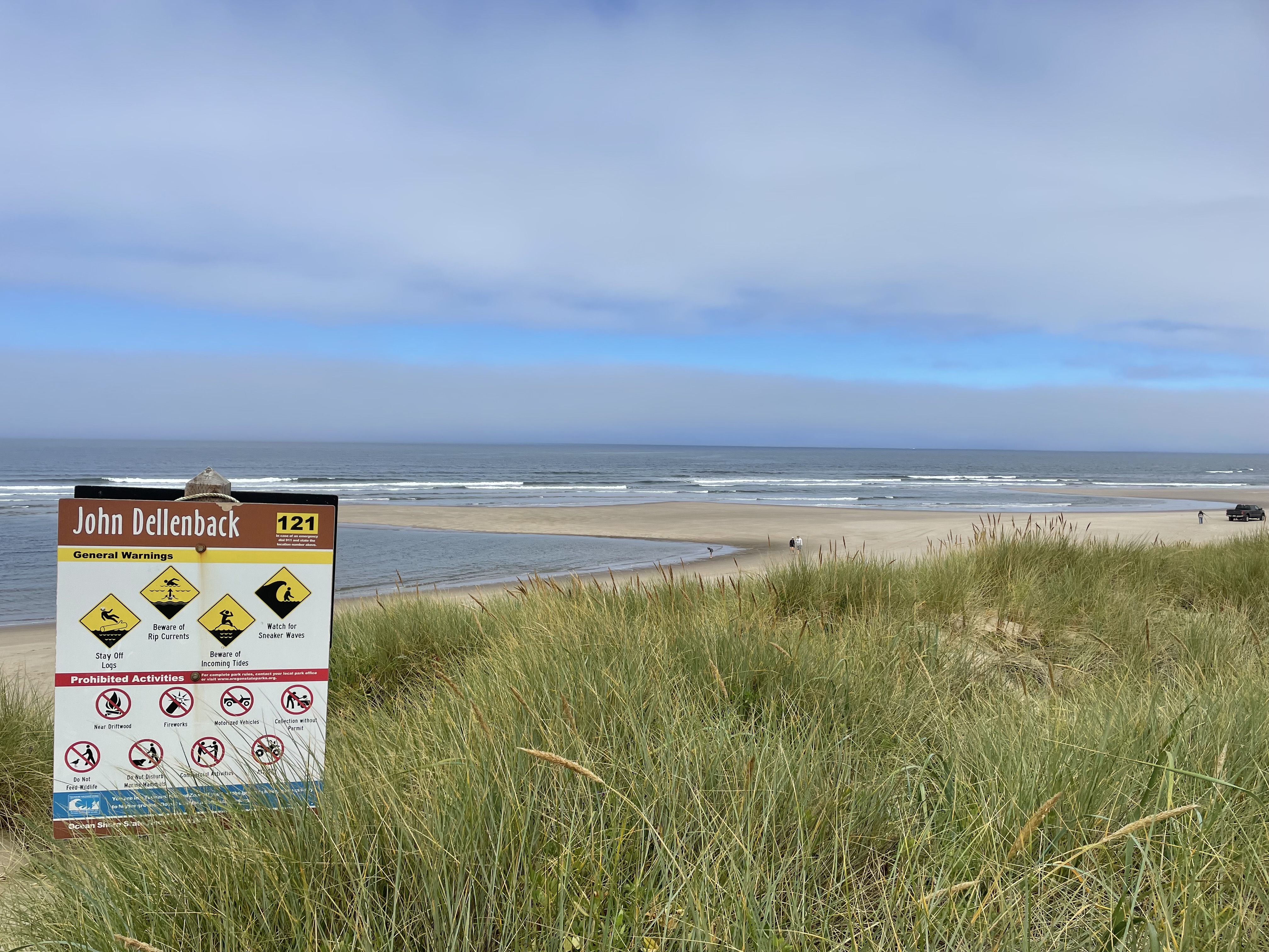
John Dellenback Trail is a great example of this class of hike. It starts out near Eel Creek Campground in the Siuslaw National Forest and comes over a low forested rise to suddenly hit the encroaching dunes. This hike has almost 2 miles of dunes, which is longer than other dune hikes I have done. The sand is always shifting so there isn't a trail, per se, but you do need to be looking ahead to find the blue stripe topped wooden poles that rise out of the Dunes. They are usually placed in a local prominence where some grass or earth is present, but sometimes they are just out in the sand.


 |
| Trail Marker |
We started out across the sand on a cool slightly overcast day. There was some tendrils of fog blowing in from the Ocean. Be a little careful on days like this because if the fog blows in you won't be able to see the trail markers. In our case, there were lot of footprints roaming around in the sand and in general we agreed with them and followed them. We were trying to find the easy way to go, however, and sometimes these footprints were clearly looking for fun. We were trying to avoid going up and down every dune by following a imaginary topo line around the sides of the dunes.
The sand out on the dunes is not very predictable. A lot of is was soft, letting you sink up to your ankles in the stuff. Not easy to walk through. Other times the sand would be firm enough to support our weight and we could make much better time. But the surface ahead of us, in both cases, looked the same and you never knew when you were going to sink or be held up.


 The poles were presumably all planted at the same height, with the blue stripe sticking out of the ground around 6 feet. But with the constantly shifting sand, we found a couple of poles with only a foot showing and there could easily be some that were buried completely. It took us around an hour to get across the sand and then we came to a wide tree island that seperated the dunes from the ocean. Here the trail got firmer and was easier to walk. The trail runs parallel with the ocean for a quarter mile or some and then turns and leads you to the coast. The trail through the tree island is pretty cool. You go through a bush covered tunnel for a bit, something that was clearly cut through the dense foliage. Then you come to an area that must be marsh or shallow lake during the wet season. This area has a very strongly built boardwalk that extends for nearly a quarter of a mile. That is some boardwalk! Thick pilons placed every 10 feet or so and bit think boards spanning them. Must have had some big equipment in to build it.
 |
| This one was hard to find |

 |
| Tunnel of Trees |


The boardwalk ends at the grass covered dunes near the beach and it is just short walk to your view of the ocean. The ocean along here is all sand (as one might expect for the Oregon Dunes) so don't expect to be able to do much rock hunting. We just sat in the sand and watched the waves, always a peaceful activity. We did find the creators of the footprints that we were occasionally following. It was a family of 6 (Mom and Dad and 4 kids). There was a truck on the beach when we got there and we thought at first that the family had cheated and drove out along the shore (which is evidently a thing), but no, they walked out from the same parking lot as us.
We had a little snack and then headed back, at the same time as the family headed back. We ended up walking part of the way with them. They could go faster through the woods but it turns out that trying to gets kids to walk steadily through sand is like herding cats.
Now we come to the cautionary part of this trail (or trail). Conditions change at the coast. The wind had come up a little bit and it had blown away our fog cover. The sun was out and it was much hotter and drier out on the dunes. If it had been this way in both directions I would not have been carrying enough water (I only had 800ml)(That is right, I drink in metric). The other thing we found is that we could not easily retrace our steps because many of our steps had already been erased by the wind and moving sand.
 |
| Centary Plant. Perhaps "Stomach Bitter" Either way, evidently exotic |


If you can keep going in a straight line, or just head generally in the right direction, you will probably be OK, but you need to hit the edges of the dunes close to the place where you came in or you won't find the trails that have been cut through the woods back to the parking lot. I would not want to bushwack through those woods, they are very dense and difficult. We did have Cell Phone access the entire time, so mapping on our phones works just fine and that can keep you on the trail pretty well.
 |
| The start and stop of this footprint path was covered by moving sand while we were on this hike. |
This is a great hike. A little over 5 miles and it took us around 3 hours of walking time. It is a great deal harder than a hard trail hike what with dealing with the sand and all. We were certainly ready to stop walking when we got back to the car.
No comments:
Post a Comment