Feel The Burn
It has been a little over a year since the big fireworks-started fire on the Oregon side of the Columbia Gorge burned up huge tracks of prime forest and hiking trails. This fire was started (accidentally) by a teenager playing with smoke bombs along the Eagle Creek trail. That started a fire in that deep hard to reach canyon that quickly spread throughout the area and finally burned itself out just as it got past the Multnomah falls area. Parts of the trail, like sections of Eagle Creek, may be lost for a generation. Some other more lightly hit sections were re-opened last month.
My partner and I have re-started our semi-weekly jaunt to do the trail starting at the Multnomah Falls parking lot and looping around Wahkeenah Falls and Multnomah Falls. This 5 mile loop is blessed with huge and wonderful water features and many huge trees and rocky precipices. We usually like to climb up the gorge at Wahkeenah and come back down at Multnomah (the next valley over), mainly because the Wahkeenah side is often muddy and slippery and easier to go up than down.
 |
| The connector trail |
 |
| Note lack of large undergrowth. Everything you see is 1 year old or less |
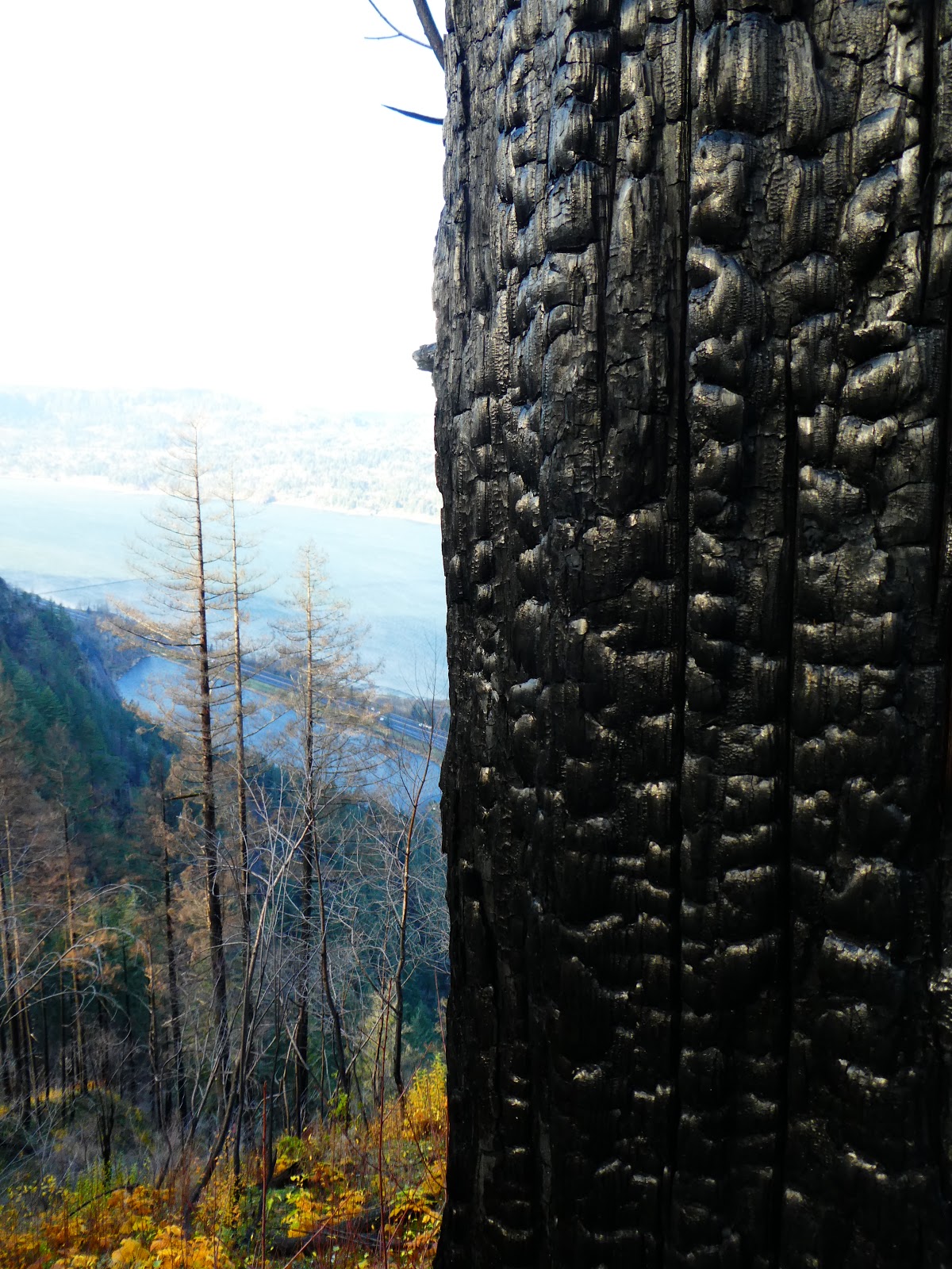
The fire impact can be seen from the parking lot (which is in between the lanes of I-84 right at the falls). The steep cliffs immediately East of the Multnomah Falls Lodge have been cleared of many trees and those trees still standing are all marked with black burn marks going 30 feet up the trunks. Since we are doing a counter-clockwise loop, we starting hiking away from these obvious scars along the little connector trail that goes from Multnomah to Wahkeenah.
The first thing you notice is how visible everything is. With all of the bushy growth and low hanging branches burned away, there isn't anything (except the burned tree trunks) blocking your view. You can see a long way and geographic features that had been invisible a few years ago are now exposed and prominent. This means more views of the cliff face walls, falling rock, and the Columbia river. Then you start to notice the specifics of the undergrowth that have been burned away. All of the bushy stuff is gone, but so is most of the ubiquitous sword fern. The sword fern in many places is burned down to little black stumps. Some are trying to grow again, but others appear to be just dead.
 |
| Burned Sword Fern Stumps |
The burned off undergrowth does appear to be being exploited by some species. There is a lot of thimble berry growing all around. It must grow quickly and is taking over everyplace it can find sunlight (which is a lot of places with the small broadleaf trees all burned out). There were also many new shoots of Mahonia (Oregon Grape) growing. Many of these shoots were coming up right in the trail. This is because
Mahonia spreads through root growth. Because of this I believe the plant was more able to "hide" from the fire and then come back with a vengeance when some of its competition had been burned out.
 |
| Mahonia in the trail |
One thing I was keeping an eye out for was Poison Oak. I was sort of hoping that plant was less successful against fire and had been wiped out. Hard to say. I didn't see any Poison Oak plants with leaves on them and it was certainly true that a couple of remembered Poison Oak infestation areas seemed to be burned clean. But this time of year it isn't completely unreasonable for the plants to be dormant, so maybe they are somewhat reduced but still present in the area. Dang.


We climbed up the Wahkeenah creek basin. The other thing the fire did was set the area up for a lot of rock slides and flash floods. Lots of evidence of that. Some parts of the trail look to have been completely rebuilt over top of a new slide. There was a new foot bridge across the river right at this place where the Wahkeenah cuts through a close sided ravine. As we arrived there were several people standing on the bridge and looking around. They were all wearing hard hats. Turns out they were the designer of the bridge and the people that built it. I guess just checking it out. It is a good bridge with strong stacked rock footings and steal crossbeams.
 |
The new Bridge. My Partner. Bridge Creators.
|
Above Fairy Falls is a split in the trail where you can either head further up the Wahkeena creek to Wahkeenah Springs (where the Wahkeenah creek comes pouring out of the mountain rock) or you can go up to a "View Point". I have looked for this so called viewpoint many a time in the past and never found or saw anything. But with the undergrowth burned away, my partner thought it might be worth a look see. So we went that away.
 |
| Two Singed Giants |
 |
| The Author being Artsy |


 |
| The New View |
And she was right. Instead of being surrounded by close-in green, we now were afforded a view of the river and of the gorge that was new to us. It was stark and visible. And with this view came something else, a bitter cold wind blowing unfettered down the gorge and into our faces. We weren't expecting that. We had to quickly don a couple more layers and then huff it away from the view and off to a more sheltered spot.
There is this place that I call the Multnomah Wahkeenah Crossroads (it is now a
facebook place. Make sure to checkin if you are there). There are a few trails that end up there (including the trails to Devil's Rest, Multnomah River, Viewpoint, and Wahkeenah Trail). I like to eat my lunch there. Today it was cold and that area was also more exposed to the wind with the undergrowth gone. So we didn't rest long. You can see way up the mountain from there.
 |
| This is a good picture of how high the fire must have burned through this area. |
After the crossroads you hike along the ridge for a bit. I always like that part of the hike. I think it is because you have to do a lot of work to get up there (so you feel a bit virtuous) and now you get to enjoy the fruits of your labor and sort of coast along the top for awhile. It is also very pretty up there. One of my favorite spots, however, where the trail winds through a relative wide flat area amongst a relatively young stand of Douglas Fir, was really hit hard by the fire. The smaller Doug Firs may have burned too much to survive and they are missing all of their needles and appear to be dead. That isn't a good thing. That entire part of the forest will have to fall down. Probably to be replaced by the quick growing Alder until another generation of the fir giants can take hold.
 |
| Not Dead |
 |
| Probably Dead |
 |
| Never could see the river from here before. |
Going down into the Multnomah river gorge you see a lot more burnt trees and a lot more evidence of rock slides and flooding. I included pictures. But this area, though burned and battered, appears to have survived. Things will grow back and in another 30 years it will look like it did 50 years ago.
This makes me think about that Viewpoint I was talking about earlier. Strange to have a trail that is called viewpoint that doesn't have one. But now, after the burn, there is a great view. I am supposing that the trail was built and named not long after some previous burn had opened up the understory and provided that wonderful view of the Columbia. So... therein lies hope.
 |
| Multnomah River Valley |

 |
| Note: This fire marks are much higher here. |
 |
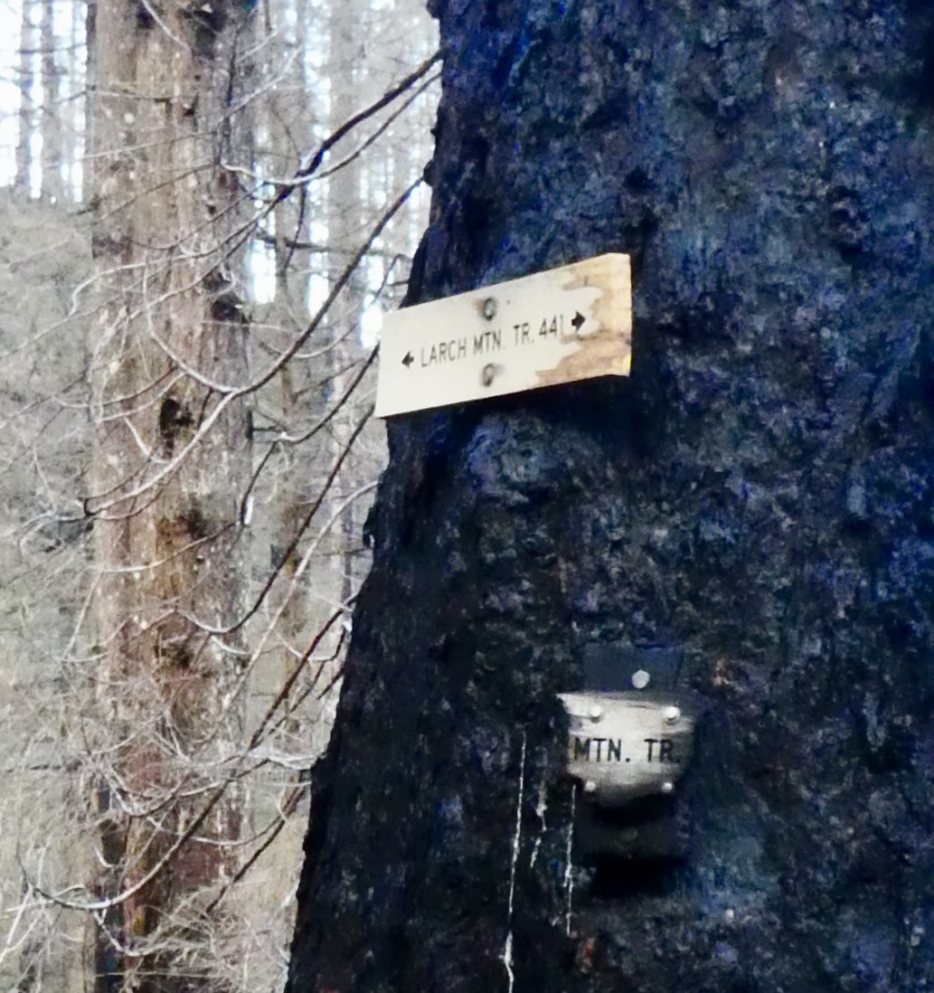
| Old and new Trail Signs for Larch Mountain Trail |
 |
| How often do you have to make these signs? |
 |
| Slide |
The last part of the hike is a paved switch back trail down the gorge wall to the Multnomah Lodge and the parking lot. This area of the loop was also badly hit by the fire. Down at one of the big falls view areas (about a quarter of the way up the cliff wall) most of the big trees had been cut down and left where they fell, and the area is just bald. Not sure what happened here. The trees in the area don't appear to be any worse burned than they are other places, so why are they all cut down? I am thinking that they were sacrificed in order to slow the fire down so that the firefighters could protect/save the historic lodge and bridge that are at the base of the falls. There are a LOT of tourists that visit those falls every year. Can't have the lodge burn down, that is where the bathrooms are!!
 |
| Falls Viewpoint above the Lodge. |
 |
| Why the Tourists Come. |
After the loop and partner and I were cold and a bit tired. The wind had been very cold up there. During the summer, we have a tradition of rewarding ourselves for making this hike with an ice-cream cone from the little snack bar at the old lodge. We like to say, "Do the Loop, Get a Scoop". But it was a little cold for that. So I took her into the lodge itself for some lunch. They have a nice sized restaurant inside the stone building. High sweeping ceilings and big stone hearth with a fire. And a pretty good menu too. Our new motto is "Hike the Loop, Have some Soup".
 |
| Hike the Loop. Have Some Soup. |


_at_Dayton%2C_OR_ca_1885.jpg)


