Friday, November 24, 2017

The Bend River Trail

Hiking The Bend River Trail


Bend, Oregon straddles the Deschutes river just where the river comes shooting down out of the Cascade mountains to plow its way through the old deep lava plain that is the High Desert of central Oregon.  On this unexpectedly nice day in early November, my Partner and I are spending a much deserved long weekend on a mini-vacation. We are staying at Mt. Batchelor Village in one of their rentable condos that sits on the bluff up over the Deshutes a couple of miles south of downtown Bend.

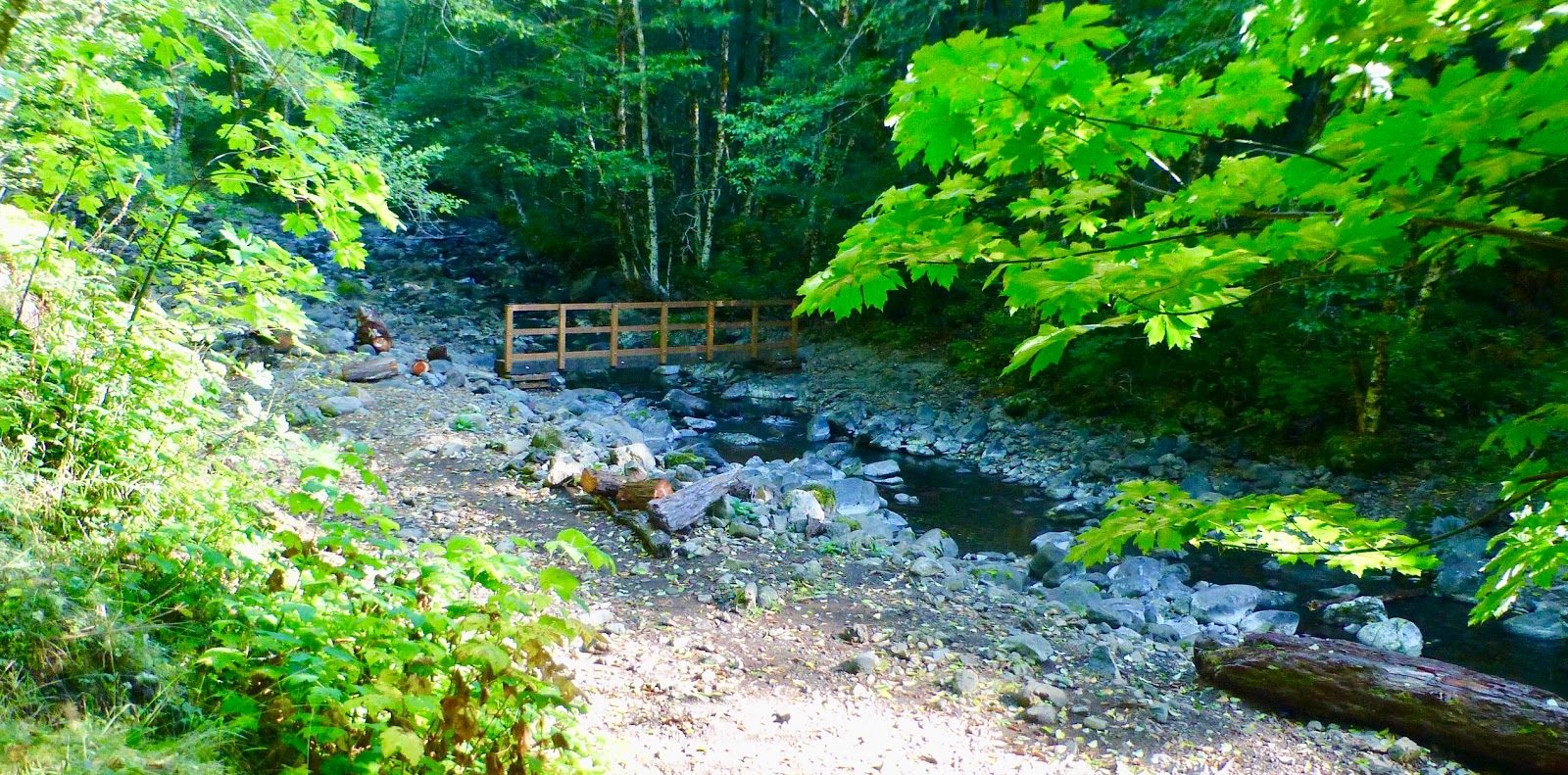
Originally, we were going to drive up to nearby Mt. Bachelor and do a snowshoe, but we decided to stay around town and scrapbook instead. That doesn't get us off the hook from hiking, however. Our Fitbits would be driving us crazy if we didn't get out and get our steps. We did this by going out in the morning and hiking the Deschutes river trail. This trail is a lovely forest and urban trail that winds from the Old Mill shopping district up both sides of the river into the gorge south of town and then up the river another mile or so, terminating at a little bridge that closes the loop. We entered the trail from a little connector about a third of a mile from the bridge on the west side of the trail. Today we decided to walk to the bridge and then into town on the East side of the river.


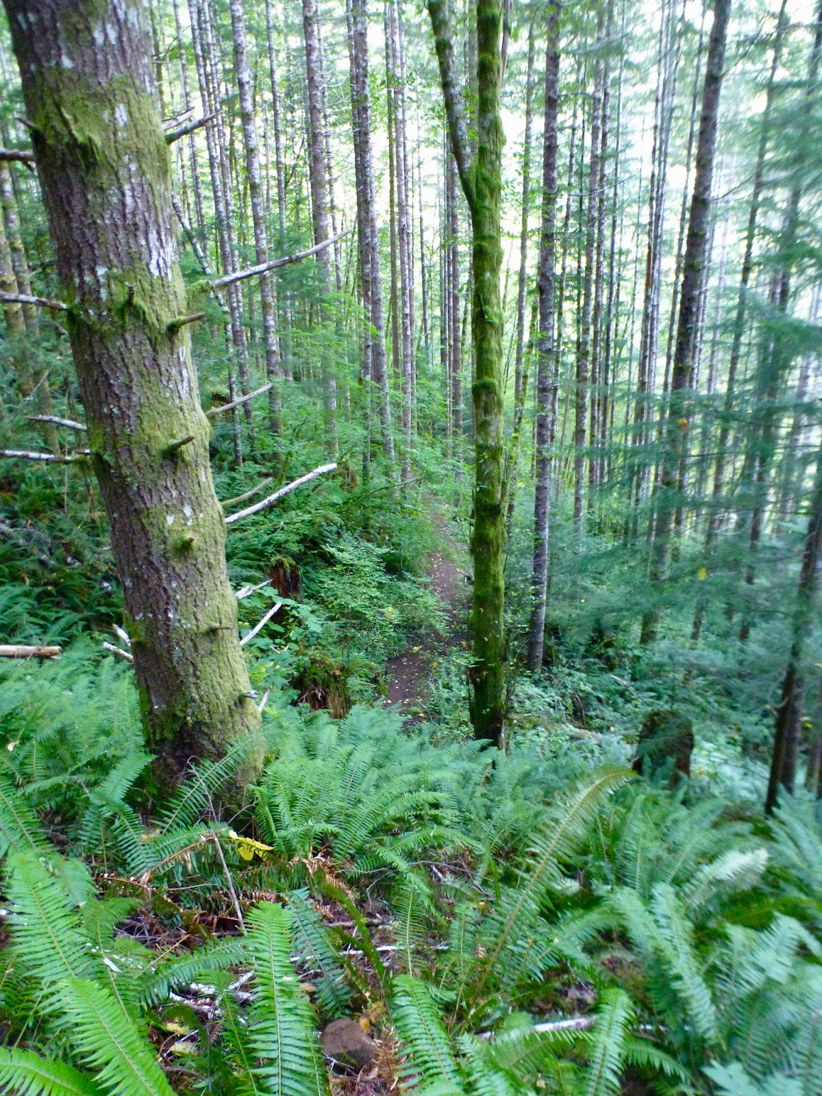
This trail is well maintained by the city of Bend. It is well marked and has a lot of nature and local interest signage (did you know that mistletoe can make a pine tree look like a witches broom stick?) as well as a few memorial benches and foot bridges. The trail is well used by the locals and visitors alike. Lots of joggers and walkers and dog walkers and families out for a stroll (though the teenagers don't look so happy). We are out early, and it is a bit chilly with a chance of rain in the air, but still we saw and passed many people on the trail. Since it is a loop, we passed many people twice. The second time you wave hello, it is almost like you are waving to an old friend.

This end of the trail is down in the gully of the straight and fast moving river. Sometimes you see white water kayakers out on the river, but not too often. It is a challenging stretch of the river and you can't get easy boat access in this part (you have to go up stream and try to find a place to launch where you don't have to run the rapids that kill you).  Though there is always water in the river, this is the desert, and the flora here shows it. There is lodgepole pine and its beautiful giant cousin, Ponderosa pine.  I like the ponderosa. The slightly orange color and the well formed bulk of the trees is very majestic. There is also manzanita and sage and other low lying plants. No ferns though, this isn't Portland. Lots of deer in this area too, though you don't usually see them when you are out hiking during the day. We see them a lot in town just at dusk.

As you walk the trail you can look up and see the big rock cliffs and all of the condos and houses seated up above them. A little bit of a let down, but hey, this is basically a urban walk, so having the uniqueness of this river valley so close to one of the larger cities in Oregon is quite cool.

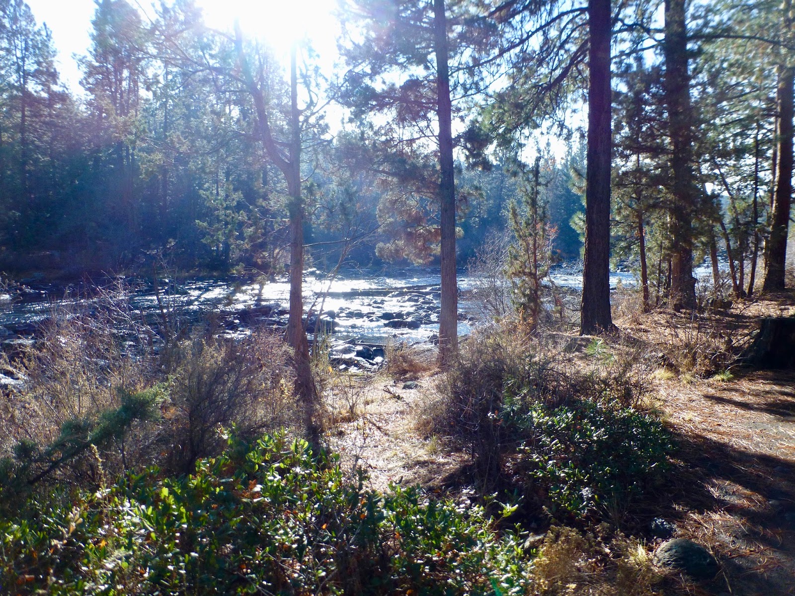
A mile or so of walking and we are at the part of the river just across from our condo. There it is up on that cliff. This part of the river has some really large rocks and cliffs right up against the river and is a great place for a view and some picture taking.

I took like 10 of these shots. Could not get the water and hills to light correctly.
There must be a button for that on my phone someplace


Soon we come to a place where you go out along a little bridge and boardwalk around a public water works. There is a couple of big cement pipes at river level with a very strong current coming out. What is this? Well, a few miles up river is a little diversion dam that sends a good part of the river down an aqueduct at the top of the canyon. A this point in the river, some of that water falls down through a hydro-power generator and then returns to the river. The rest of it goes into a open canal and flows across east Bend for irrigation out to who-knows-where.

Further down the trail and you come to the place where the river dumps out of the canyon onto the desert. There is a car bridge to go under and then you are in the little plain where the Old Mill district is built. The river immediately becomes wider and slower and is a pretty and sluggish thing as it winds its way leasurely through the town. During the summer, thousands of people plop themselves into inner-tubes and on rafts to float down the river on a hot lazy day. Lots of fun and pretty much free. Too cold for that today. But we do enjoy the ducks and Canada Geese out swimming and feeding.


Hey Daddy, Can I play on the Saw Blade?


That is a bridge across the river there.

Bend was originally a lumber town and the parks show that in their names and decorations. Statues of horses pulling logs, saw mill themed children play structures, that sort of thing. Why, the old Mill itself has been largely preserved, including the 3 tall chimneys, an houses the local REI store. My partner and I are walking that way. I like REI. They don't mind if you walk in wearing hiking boots and carrying a pack. They even take care of it for me whilst I shop.

See the 3 Chimneys around the Bend?


It used to be that you could go into REI every year and find that one new piece of equipment that you really needed to have. I must be getting old because it is getting harder and harder to find something new. Or perhaps the new things are still there but I can't convince myself that I need them. Part of the problem is that, yeah, a LED head light on an elastic band is cool. But I have 3 of them and I don't need one with 5% more light and a cool red light too !! And I have the 5 tents I need and not sure I could use one that sets up in a tree (if you can find 3 trees just the right distance apart). The stick stove that also generates power to charge you phone is nice, but not something that I think is worth the cost either in money or in weight.

What to do then? There are these new things coming out that I think would be nice. They are what are essentially digital walki-talkis. They communicate with other ones of their kind and build up a local network. You talk to them over bluetooth from your phone and run an app that lets you send text or voice messages to other people, either in your group or more globally. So, imagine you have one. And another friend has one and he is one mile away. Then another friend is a mile beyond that. The second friend is too far away for your device to reach, so the middle friend's device will automatically act as a repeater. I could see this as being a great safety thing if there were some of these things sprinkled around, like, by the rangers. Or even if you left one hanging from a tree when you were halfway out. Anyway, the other cool thing is that they don't have to communicate at speed. If the connection gets bad, they can lower the baud rate and resend and keep trying until they can get the message through (just like a text from your phone).  I like the idea, but for it to be useful, you need to have a lot of people out there using them. Not just me and my partner. Still, Christmas is coming soon...

Enough rank commercialism. We still have a few miles to go back to the condo and lunch time is looming. We cross the river on the nice foot bridge right by the Old Mill. To our right is the Les Schwab amphitheater. Les is the guy to go to for tires in Oregon. And he is the guy to go to for music in Bend. Big concerts outdoors right on the river. I guess a lot of people get the "cheap seats" and just drop an anchor off their inner tubes and listen from the river. I understand that this summer is a 50 year Jethro Tull concert. Can Ian Anderson possible still be the front man?

That rock says "Les Schwab Amphitheate"r. Take my word for it


No concert today, however, so we walk south down the west shore of the Deschutes. Our next site is the big park that is the main put-in for the down river floats. Last time I was here (around July 4th) there were hundreds of people inflating rafts and slathering on sun screen for the float down the river. You sort of need a good float because even in the height of summer, the river is brutal cold. Oh my freezing bum. Over on the side is the giant sculpture made from Eddyline kayaks. A unique piece. Ahead of us is another bend in the river (is it THE BEND? maybe) and above on the cliffs are some very nice office buildings. How did office buildings get to be up there on that prime real estate? Some place up there is the Deschutes Brewery main building. Not that that is saying much, seems like you can't swing a dead cat in Bend without hitting a brewery. And some of the best beers are starting to come out in Cans!! I love cans. So much lighter and easier to recycle than glass. Here are my two current picks for beers: Buoy IPA (from Astoria, so a little off theme) and Mosaic, from just down the road from our Condo at Cascade Lakes Brewery (the Lodge has Prime Rib on Saturday and Sunday nights. It is GOOD, as is the Elk Burger).


The trail now turns from pavement back to gravel and pulls in close to the cliffs. The river is getting more narrow, we are about to go back under the highway bridge and enter into the little gorge again.  Just before though is one last thing.  A strange concrete structure low on the river bank. An old ferry landing? Some place for dumping logs into there river for the mill? A rock beaver dam? I don't know. I wish someone would put up one of those nice little explanatory signs.

And so we come back to the side trail that leads up the bluff to our condo property. What a pleasant hike. And we get to do it again tomorrow morning.

Tesla Charging Stations OF THE FUTURE.

One last thing. Back at our condo I notice a bunch of electric car charging stations. These are new. They have just been put in by Tesla and are just for charging the Tesla cars. These things are popping up all over the place. Now, I know that there is a good chance you are reading this from the future and are thinking. "Car charging stations? How quaint. This must be before  all of the tree's were cleared so that the sun could shine directly on cars and charge them." Of course, if you are from the very distance future, then you probably ARE a smart car. How are things? Please read the rest of my blog entries and send my AI personality copy a note.


Monday, October 30, 2017

Idiot Creek Bridge Update

Idiot Creek Bridge Update


It has been two weeks since my partner and I hiked the Idiot Creek Loop Road section of the Wilson river trail in Tillamook forest. If you recall, a big part of that was because there was a new bridge across Elk Creek that gave us dry shoe (and probably dry butt) access to the main part of the trail. At the time we wondered what would happen to that little bridge when it rained. Well, last week it rained big time (6-10 inches on the coast range). This week when we got to the trail, the Bridge Was Gone !!

Without Bridge
With Bridge


But a little too completely gone.
Turns out it is stored for the winter over there on the other side.
So..... no bridge for crossing and doing the Idiot Creek Loop Road hike probably until late Spring.


See the bridge hiding up there?


Tuesday, October 17, 2017

Idiot Creek

The Newest section of the Wilson River trail (well, that I know about) is the section from Elk Creek up over the hill to Idiot Creek Loop Road Trailhead. When they had originally put the trail in (just a few years ago) they had these plans for this big elaborate bridge. It would go across the main part of Elk Creek just below where the two main branches of Elk Creek join. There is a section of the bank there that has high rock on both sides and the bridge was going to be put in up on those rocks. This was going to be an expensive nice bridge, suitable for horse traffic. I think the forestry department lost funding before the bridge could go in. This all means that if you want to hike the part of the trail up to Idiot Creek you need to ford Elk Creek.


Fording Elk Creek isn't too much of a problem (except when the creek is in flood) but you are probably going to get your feet wet. In fact, the safe way is to get you feet wet. I got stuck in the middle once on some slippery rocks, I should have just taken my shoes off and gotten my feet frozen. I have been up this trail one time a few years ago, but I was blocked from getting too far by a big slide. My partner and I were hiking up Elk Creek trail last week when we got to the ford and found (to our surprise) that a little bridge had been put in. Cool. We could cross with dry feet and go explore this new trail. (update on the Bridge)


Idiot Creek is a funny name for a trail. This is actually the Wilson River trail but it is the section going to Idiot Creek Loop Rood Trailhead. Now Idiot Creek Road is an old lumbering road (a dirt road) that is on the other side of the mountains from Elk Creek and winds around Idiot Creek. Idiot Creek dumps into the Wilson River right where the town of Idiotville used to be. Don't believe me? Try a google on Idiotville.


I had run into a ranger up the trail several years ago. He had told me about the plans to build the bridge across Elk Creek but also about the long range plan to extend the Wilson River trail pretty much from the town of Tillamook all the way over to Gale's Creek. The only section that I don't think is done yet is the part from the Idiotville Creek Road Trailhead over to where you can latch in to the Gale's creek trail complex. Right about where Route 6 first Crosses the Wilson River on that one big bridge. There is actually a trail under that bridge that loops around to University Falls and Gale's Creek campground.


Today is going to be Sunny, but sort of chilly. We parked at the lot out by the road (the road into Elk Creek Camp is closed this time of year) so we had already done about a mile by the time we saw the bridge and decided to explore Idiot Creek Loop. The trail starts out pretty level. It is a newly made trail, not a part of an old logging trail, so it is more narrow than Elk Creek Trail, but also has its switchbacks better planned so things are not as steep. You start by following the right branch of Elk Creek (the Left Branch is what we usually follow going up Elk Creek Trail). But we quickly climbed away from the river. Down below, it seems like there could be a number of flat places covered in fern and fallen branches that might be good places to camp. But it is really steep down from the trail and I wouldn't want to try to climb down (or back up). After about half a mile we came across a large old remains of a washout. Ten or twenty years ago a bunch of mud came pouring down off the mountain, bring a lot of old stumps and new trees with it.

The trail cuts through it and then begins a set of switch backs up the mountain. The trail doesn't really go too far up the valley. Just back and forth as you wind your way up. Looking at a map, I see that all we are doing is going up this side of the hill to get ourselves over a little saddle and then down to the Idiot Creek Loop Road Trailhead. Well, as we go up, there is some interesting scenery.

What is that sticking up in the air?

We can hear some machinery whining and when we pass over another part of that big wash (further up the hill) we have a clearance where we can see across the valley onto the sun lit Northern side. Up on the top of the hill we can see a periscope like thing sticking up with a bunch of ropes coming down from it. This is a lumberjack's piece of equipment. It is used to move logs around on a hill side. (after lunch we are up high enough that we get a better view).

There is that out of place Maple
Up on the Lunch Time Ridge


Looking at the view across the Wilson River Valley

Now the switchbacks are taking us back West, so that we are pretty much straight up the hill from where we first crossed over that bridge. We hit the ridge and enter into a sort of strange eco-zone. More sun or something. There are different tree's and plants up here. There is a huge Maple, for instance, instead of the usual Doug Fir. We top out in a sunny area and stop there for lunch. There was a good open place to sit down and we had a bit of a view looking out across the Wilson River valley.

We had already been hiking for a couple of hours, but we figured we only had a mile or so left before the ending trailhead, so we decided to push on. I was thinking we were up on the ridge and we just needed to wind along it for a bit until we came to the parking lot. My partner was thinking that she wasn't going to be going out hiking with me anymore unless she had a map so that she didn't have to trust my thinking on ridges and mountains.  There was another set of switchbacks. And Another. Then we came around the corner and had a really good view looking up the Elk Creek Valley to the hills on the other side where a little lumber crew was hard at work completely denuding the backside of the hill of Trees. There was that Periscope thingee (Ok, turns out it is a Cable Yarding Carriage), and a loader or two and a truck. Maybe 4 or 5 guys tearing down a forest.  Here is a good page about lumber equipment.

The standing plank hole
Another stump

I'm not sure how I feel about that. I mean, over where we were, there were tall Douglas Fir and Alder with a good healthy ground cover of Sword Fern and Oregon Grape. Very green and wet and beautiful. Of course, the really big giants are not here. No, they were cut down a hundred years ago the old fashioned way. In fact, a lot of the giant stumps are still around. You can tell they were cut down by hand because you can see the holes cut in the stumps for the boards to be inserted that the hand saw team would stand on so they could saw down the tree above the bother of the roots and elbows.

Sure looks like clear cutting to me

There is a long history of logging in the Tillamook forest. The tree's have all been cleared out from most areas at least once. You can find a lot of the history still hiding around in the forest. Elk Creek Trail, for instance, is an old abandoned logging road. Running up that road, for much of the length, you can find remnants of the wire road roadway they may have used to swing logs down the valley. There are also machinery bits here and there. In other places in the forest you can find water tanks (presumably for steam engines). The biggest piece of logging history is the Banks to Tillamook train line that runs from Banks through Timber and then down the Salmonberry river eventually hitting the coast at Wheeler (see a story here). Though this railroad was built to provide access to the coast from Portland, it also served as an alternate route to haul the timber of Tillamook out of the forest, probably to Tillamook for shipment to California via Log Barges, but also to Portland for more local usage. The railroad was washed out a about ten years ago, by flooding caused by the very logging that it had originally encouraged. As you drive on 26 toward the coast, you can see many places where logging stripped the mountains down to dirt and sticks. The lumber companies make a big deal about re-planting and putting in little signs that say "Planted in 2016".  I can't help but think that it would be a much better practice to take the trees out a little more carefully. A little less cataclysmically. I am sure such a thinning costs more and that would mean that our 2x4's plywood and firewood would cost more, but I still think that would be better. I guess one could argue that more expensive domestic timber would just increase the demand for stripping foreign forests (poor Canada!) One problem at a time.

By the way, if you want to know more about the history the Tillamook forest, you can try the Forestry Center. It is a very nice facility, paid for using the dollars earned with the clear cutting of the local area, and it has a few nice hikes that originate from there. A good place to go yourself or an interesting learning experience for some kid type friends.

When we started this hike, our plan was to hike two hours uphill and then stop, eat lunch, and hike the two hours back down. But we have already had lunch and continued up the hill for another 45 minutes. I swear I have seen the top at least three times now but there keeps being a big piece of stone soaring out of the forest floor and rising above our heads that we have to follow the switchbacks around and over. My partner was game to continue on, but I called it on account of time. We have a few things to do back home (like take a hot tub) and need to get back to the car.

You are hiking the side of the hill almost all of the way
I find hiking in the wilderness to be one of the stranger experiences in modern life. Here you are, out for a nice walk. Having a wonderful time. But you don't stay out walking until the end. You stay out walking to halfway. You can't just instantly teleport back to your car. You can't get off the treadmill and go to the shower. You have to plan ahead to darkness and get your ass off that hill before you get benighted. So. Back down we go. The views going down are just as lovely as those coming up. But we don't get quite as out of breath.

We examined the map on the sign post at the parking lot and decided that we had been very close to where the trail would even out, wrap around the summit and then head downhill to the Idiot Creek Loop trail head. We will hike that final part another day. We saw no one else the entire time we were out hiking, and that is just too wonderful to not seek out again.


Saturday, September 30, 2017

Paddle Oregon 2017: Part 3 of N

Day 4


Jasper Pod prepares for the day

We had an easy and fun launch in the morning. No big escarpments to cross. No swift waters. Launch our boats, ferry across to the other side and wait for the pod to form up. Then we can start on down the river. It was a little cold this morning. Where is that sun? We grouped up at one point (where there just wasn't a good place to land) to steady each other boats and let some people put on warmer layers. Nice to travel with people who know how to help out like that.


I Ferry across. Don't I look like I know what I am doing? That is good Photography


The big excitement for today is going to be navigating the confluence of the Willamette and Santiam rivers. The Santiam (at this point) is just about as big as the Willamette and will be coming in from the East (River Right). Anytime two medium sized currents come together you can get some jumble and mishmash and our pod leaders don’t have any news on how rough the confluence is today. Might be a big rock bed there also. We have a long paddle today (21 miles) and have been working hard at it for a while when we round the bend and can tell that something is happening up ahead. Our lead boat is a one man canoe, today, and she tells us to string out and follow her so she can guide us through the upcoming turbulence. We start over on the left side of the Willamette and then head across the river intending to go through any little white water there is and right across the Santiam mouth. From the start of the crossing, we can see way across to a large sandbar. There are a lot of boats up on it, many pods have decided to take a break here. As it turns out, the crossing is pretty simple. In fact, some people crossed much faster than they wanted and ended way up the beach with the other pods instead of down river with us. No problem. My partner and I pulled up on the beach we went rock hunting. Lots of rocks. But no agates (today). It is hard to find agates when the sun is right overhead. Easier when the sun is low on the horizon and sort of lights up the little suckers.


We did walk up the Santiam a little ways. Cold Water. The Santiam river itself is not very long, perhaps 8 miles, but it starts from the North and South branches of the Santiam which themselves feed into big reservoirs (one being Detroit Lake, a popular ski play and camping lake).


Just down river from the Confluence we start to run into a lot more obvious human habitation. First we cross over the line of the Buena Vista ferry. There are three operational ferries on the Willamette river. This one, one at Wheatland and one at Canby. All three of them use the same ferry construction. They are small (perhaps 6-9 cars max) flat two sided boats. They are powered by an overhead electric wire that runs on a little trolley system on a cable overhead, and they are held in place on the river by an underwater cable that they pull themselves along on. I think they also have a backup generator on board as well as auxiliary propellers.  A little more of a history search shows that the Canby and Buena Vista crossing are using slightly older boats that carry six cars and use overhead power, while the Wheatland Ferry is newer and bigger, it can carry nine cars and supplies its own power using a generator. I am a little unconvinced as to the accuracy of these reports. We may have to drive out to the Ferries and get better details. You can ride one (in your car) for like $3 and they are certainly a fun little thing to do with your family. Hey, take the kids out to ride the ferry and for a picnic by the river. You could hunt for Agates!! I would probably recommend the Wheatland Ferry for that. Willamette Mission park is right there and provides a good place for a picnic and exploration. Of course, I have only seen the other two ferries from the river, so perhaps there are some good parks close to them also.


A lttle downstream from the Ferry is a medium sized wooded island. We went down the left channel and then stopped at the North tip for a bio break. My partner and I went agate hunting in the shallow water at the tip and we got several of our Pod mates following along with us. Pretty soon people were finding agates and getting all excited. Not sure why it feels so good to find a rock, but it does, and it appears to be contagious. And fun. And cheap. Well, until you start to bring them home and have to go out and buy the rock tumblers and grit and such.
Hops Production at Rogue
Down and around the corner, through another small set of fast water, and we are at a Rogue Brewery site. This site is an active Hops farm, we can see the harvest machinery going as we float by. In past years, this had been the location of Paddle Oregon’s 4th (and final) stop. But this year the camping area was all dug up and muddy and not suitable for as large a group that we had. So we are going to float down a bit further and stay at a friendly local farmers bottom land. (On a side note, this may be a good thing since people didn’t like all of the noise of the round-the-clock hops harvest trucks at Rogue last year).

Boats on Murphy's Bar

The place we ended up staying is called Murphy Bar. This is really just a rock bar that is underwater in the winter. As camping sites goes, it was probably my least favorite, mainly because the entire area was gravel and there were very few spots to put up a tent that you were not on rock. My partner and I arrived a little later than most so we didn’t get a prime camp site. We were pretty much camped out on the shoulder of a dirt road. If I do this trip again, I am going to have better bed technology. It may be that the best thing is just a big air mattress. There is certainly room in your luggage for such a thing. I hesitate to use an air mattress because if you get a hole in them you end up sleeping on the ground (which has happened) but… perhaps with a good patch kit and some caution… The other possibility is a foldable cot. I saw both things in use walking through the extended campground and I admit to being a little jealous. Of course, I couldn’t decide if I was more jealous of the cot or the mattress.


My Kayak Partner and I relax at Dinner
I think it is a Paddle Oregon tradition to have a really big, great dinner on the last night. I must say that I think it will be difficult to have something all that much more super than the previous evenings, but our caterer seems inclined to try. Thanks to one of my Pod mates, I have pictures of the menu and the heap of Crab that was there. I will also say that the Prime Rib was HUGE and sliced to order and delicious. There was also good beer from Rogue and some fun western singing from a local group. It was a fabulous dinner and evening, even if we didn’t win the raffle for the 2017 Paddle Oregon Eclipse Ukulele. (too bad, I would have played it for you. Do you like “Sloop John B.?).

The owner of the farm came out and talked to us and told us something about the history of his farm and family. I wish that I could remember the details, but he was a good story teller. One thing that I remember was him talking about technology and how farming is changing. He said that he invested a bunch of money for computer controlled mapping and plowing technology. Now, I wouldn’t think much of this, but he said (I am trying to remember numbers) that a field that had taken a person driving a tractor 13 hours to plow was now done in 3 hours. Not only that, the plowing was such that more crops could be planted in the same area. Wow. Translate the use of the tractor into money spent on equipment and you see that the computer control is something a third of the cost compared to a human driver. The other thing I think I remember was him saying that he had 1000 acres planted. He mentioned that he was making the land we were camping on available to many people to use. I guess anyone can camp on it during the year (not sure about that) but he has also had many other groups come out and use it for free. The only thing he asks is that the groups free him from legal responsibilities. What a nice thing for him to do.

Day 5

Our last day (really half a day) on the river.
Some Mergansers

We had only drifted down river about a mile when we passed Independence. This is a nice little town with a very handy park on the river. My paddle club (Kayak Portland) has used it as a put in for a Independence to Salem paddle before. This length of the river has lots of nice rock bars for Agate Hunting. Today is only 15 miles and we are now going past many more homes and small communities. There is one little place that is called “Social Security Hole”. It is just a little park along the river where people evidently like to go and fish. Lot’s of articles on it on the web saying what a pleasant park it is and how friendly the local people are. And evidently the fishing is good.

My Partner found a big Agate
Our sister paddled with us, doesn't she look great in our blue Journey?


But the river is running and the end of our journey is drawing close. We have time for one more lunch on the river and do a full pod picture. Just around the bend is the big bridge in Salem and under that is the pull-out and the inevitable cluster of people getting their boats and gear onto their cars and heading home. You can stall for a little while and enjoy the serenity of the river. You even get one more little exciting bit where you have to paddle to stay away from the slightly dangerous current going under a local college boat house (you can tell that it is slightly dangerous because of the big signs that say “DANGER (slightly)” and the presence of a Paddle Oregon staff safety boater hanging out under the sign.


But then were are paralleling the highway and the city surrounds us and we are at

The End


Ok, that was too abrupt. I mean, we have to give hugs and handshakes to our many new friends that we have spent the last 5 days paddling with. Interesting and fun people all. People that you have share strange confidences with over the last few days. People that you would Ride the River (add link to novel) with. People that you may even see again one day. Perhaps in another Jasper Pod. Hey, there is our son with the car. Time to go.


N=3