Wednesday, August 9, 2023

Adventure at Fort Stevens


We are spending a few days on the coast at Fort Stevens. This is our second trip to this nice state park and campground. It is high season in the mid summer and the camp is packed with people, cars, and bikes. I had no idea that so many people did group camping. There are many single campsites with multiple tents, but also a few adjacent campsites with groups that are obviously together. The people across the road from us, for instance, have 3 or 4 campsites and have 3 of these large shelters set up. They are like 10 foot high and have rigid structures and strong plastic weave outer, outer with doors and windows. They look a little like the temporary garage structures I have seen in front of people's homes to keep the sun off their new car. They are certainly big enough for a car. This group has 20 or so people and they have one of the structures set up with 2 picnic tables (they must have carried one over from the campsite next door) and a nice camp kitchen set up in back. Big prep tables and a big portable stove along with many identical plastic crates with food and cooking gear. They also have a HUGE pile of firewood. Can’t believe that drug that big a pile in here. I wonder how long they are staying.  They also have one of those big stainless steel fire pits that have shown up in the stores recently that are made by the same company that made my little wood burning solo stove. I guess the solo stove guys made it in the business world even though their products were too damn expensive. 

Lots of kids running around. Check that, lots of kids riding around. Paige says she has memories of going on family trips to camps like this and the kids were allowed to ‘ride the loop’ all by themselves. That is what is happening here. Gangs of kids riding around the loop (often in the wrong direction) pretty much ignoring the car and truck traffic. When you are driving you just have to come to a stop until they pass you because there is no telling what they are going to do. And they give you funny looks like “what are you doing driving in the road, mister?”. Paige says I am practicing my grumpy old man act. Who needs practice?

Lots of this octagonal net tents around

Is this really the only vehicle
picture that I took?


And what are they riding? There seems to be a profusion of new personal vehicles available of late. Especially new e-vehicles. Bikes, of course; all sizes. Many of them either electric assist or full electric. A few electric long skateboards, being ridden by two at a time. Seems like there are 5 identical little girls on tiny pink bikes with tiny pink training wheels. Maybe it is the same girl and she is just riding round and round the loop. There is a thing that looks like 2 scooters glued together with on upright handlebar. The bottom parts make a V and you put a foot on each of the legs and sort of skate back and forth to go forward. Seems to work just fine. Saw some adults in electric recumbent tricycles. They were blocking traffic because they were sort of the in the bike lane but they were really too wide to pass and they couldn’t decide which laws they were following, car or bike.  And it does seem like all of the adults are riding some kind of eBike. Some have the ones like I do, where you just get a little assist when you peddle (but you have to peddle). Others have the big huge heavy ones with the big wheels that you can just crank up the throttle and go. I saw one couple ride by on ones where they had given up the entire “this is a bike” thing and they had no pedals. I guess they were small electric motor scooters.  

All of these new electric vehicles, including one zooming down the street with bright lights that was the one wheel kind that you stand on and lean forward. The thing you don’t  see is the original vehicles of this ilk, the Segway. They just never caught on.  I suspect that they were too expensive and maybe just so ahead of their time that people didn’t believe they were useful. They were quite a bit larger and more expensive than any of the vehicles we see zooming around at the park. 

And this is all so new. I don’t think you would have seen so many different eVehicles at a state park even 5 years ago. The eBike makers must be making a bundle. 

The people in the campsite next to our just came over and introduced themselves and offered me a ice-cream bar. So nice of them. And it was delicious. Some sort of coconut and cream bar. They are Spanish speakers, so I wonder if it is some treat from Mexico (oh, they just stopped by again and I saw the box, from Mexico). There are also a lot of people speaking some Slavic language, perhaps Russian. There is a large Slavic Church group here (they have a huge passenger bus). Paige talked to some of the people in the group and they said that some of the larger churches will reserve an entire loop for a week for their family camps. Wow. We got in here on a last minute cancellation, so perhaps one of the churches had released a few sites. 


And what about us? What are we doing here? We are doing a complete load-out Scamp test. We have our kayaks. We have our bikes. We have our hiking gear. We have our wetsuits and boogie boards! We are going to do a day of each thing. 


There is a lot to do here at Fort Stephens. When we first arrived, we rode our bikes on one of the many bike trails over the beach access. There we saw the famous shipwreck on the beach and walked down the strand for a bit. There were a LOT of people on the beach, but a 15 minute walk will still get you to a piece of sand where you are all by yourself. Today (the next day) we got going a little late but we still took our boats out to the little lake that is in the park and paddled the length of it. It is less than a mile long and very skinny. It is one of the many long skinny lakes in this region that have been created by the many rolling sand dunes that define this part of the coast. There is a high part, then a low part, then a high part, then a low part. The low parts often flood making a marshy area or a lake. The lakes are pretty shallow and this one had a lot of weed growing in it. We also saw these large soft growths some the size of a football growing near the surface down in the south end of the lake (where people don’t go so much as there isn’t a road there). We ran into a ranger giving a kayak tour of the lake and asked him what they were. He said they were Brylians (ok, I will look it up when I have some Internet coverage). 


I spent the first part my afternoon riding my bike around on some of the bike paths that I have not traveled. I stopped at one of the historic gun emplacements that are scattered around the remains of the old army camp. The first one I stopped at was Battery Russel. It is a large Cement bunker with mounts for 2 or 3 big guns and lots of rooms for stationing troops and hiding from explosions and moving shells around. Though this structure was built in the late 1800s it had been upgraded and was in use during WWII. In fact, it has the ‘honor’ of being the only American Mainland target that was shelled by a foreign power since the war of 1812.

Wait, that can’t be true, I know that the oil rigs north of Santa Barbara were shelled. Something in Southern Oregon was also shelled, or maybe that was a fire balloon. Still, attacked. I need to research this. Once again, I will have to wait until I have internet. The area we are camping in is very nice but it doesn’t have enough cell phone signal to do anything. Not sure what good telling me I have 1 bar if you can’t actually do anything with 1 bar. Might as well be 0 bars, you know what I mean? Internet says that Fort Stevens was the First mainland military base to be attacked by the Japanese. They fired 17 shells and took out the camps baseball field backstop.  You know what else I found? There are 2 Forts named Fort Stevens. One is near Washington DC. They are both now National Parks and are both named after the same guy. 


I continued riding the bike trails and followed them to the main part of the historic Camp Stevens. There are a number of batteries there from various eras (starting just post civil war). I walked around some and took pictures. They were of different designs, presumably because the eras had different building materials and different requirements for the guns. There was also a structure that controlled the detonation of underwater mines that were place in the harbor and then exploded by remote control wires. I didn’t know mines were used that way. 

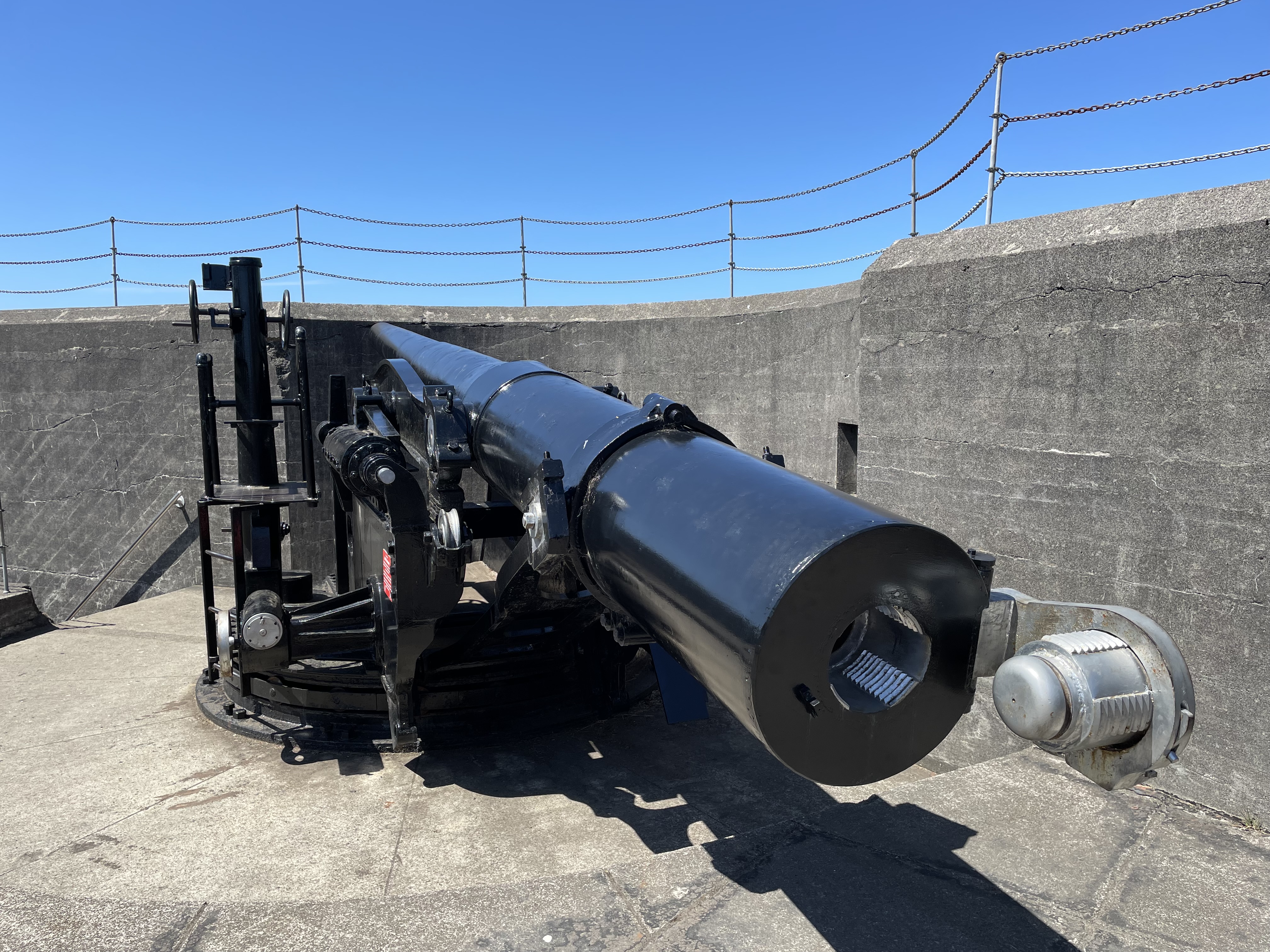
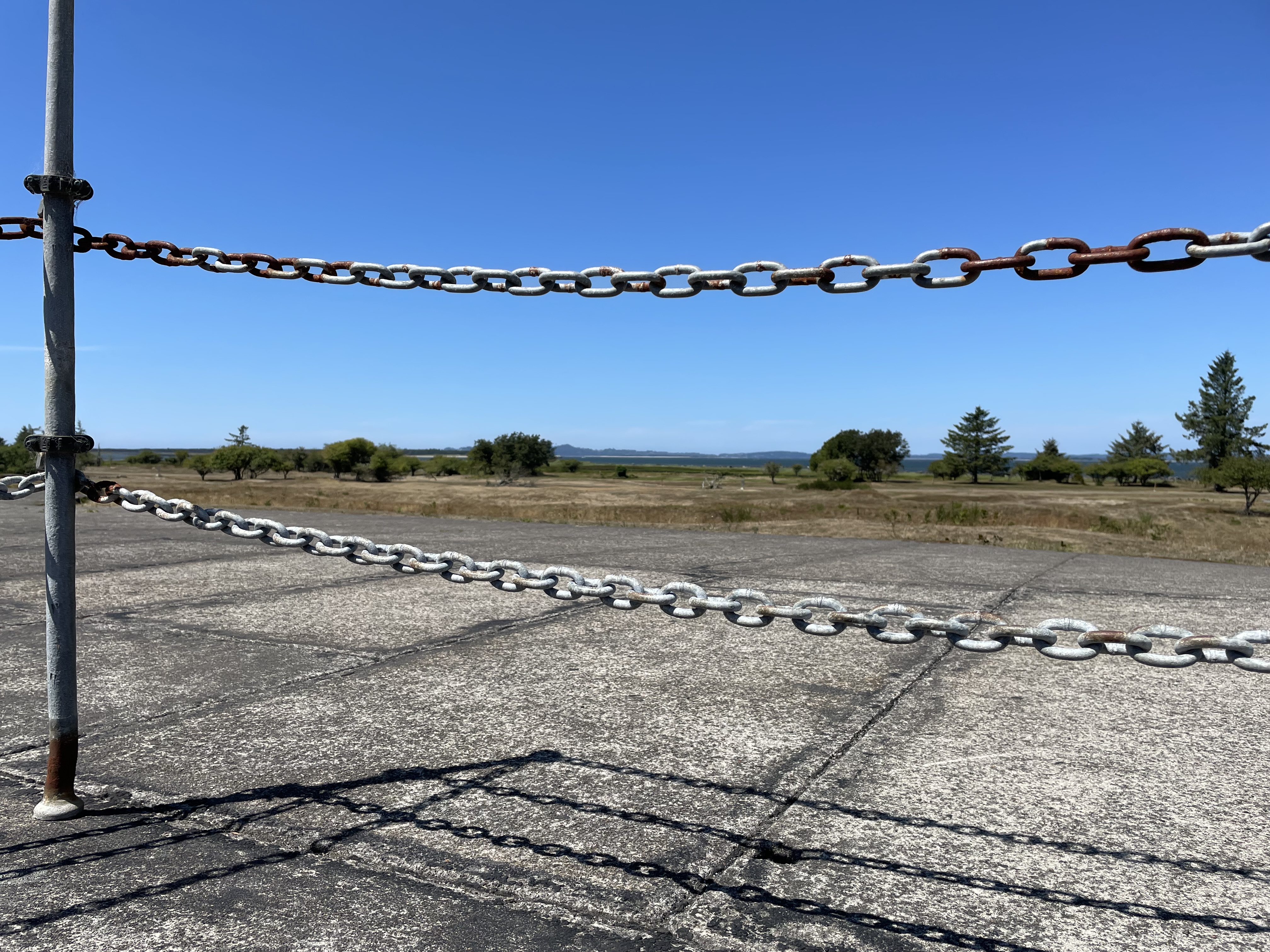
Old historic forts like this are kind of funny. I mean, they are not doing anything to restore or maintain most of the fortifications. They cut the grass and put up fences when things get too dangerous. I guess they are interesting to see, but they can’t last too long except as rusted out hulks unless they are repaired. And the most interesting things about them, the guns, are long gone. Well, there are a few left but most of the biggest ones (like from the late 1800’s) were scrapped a long time ago.  

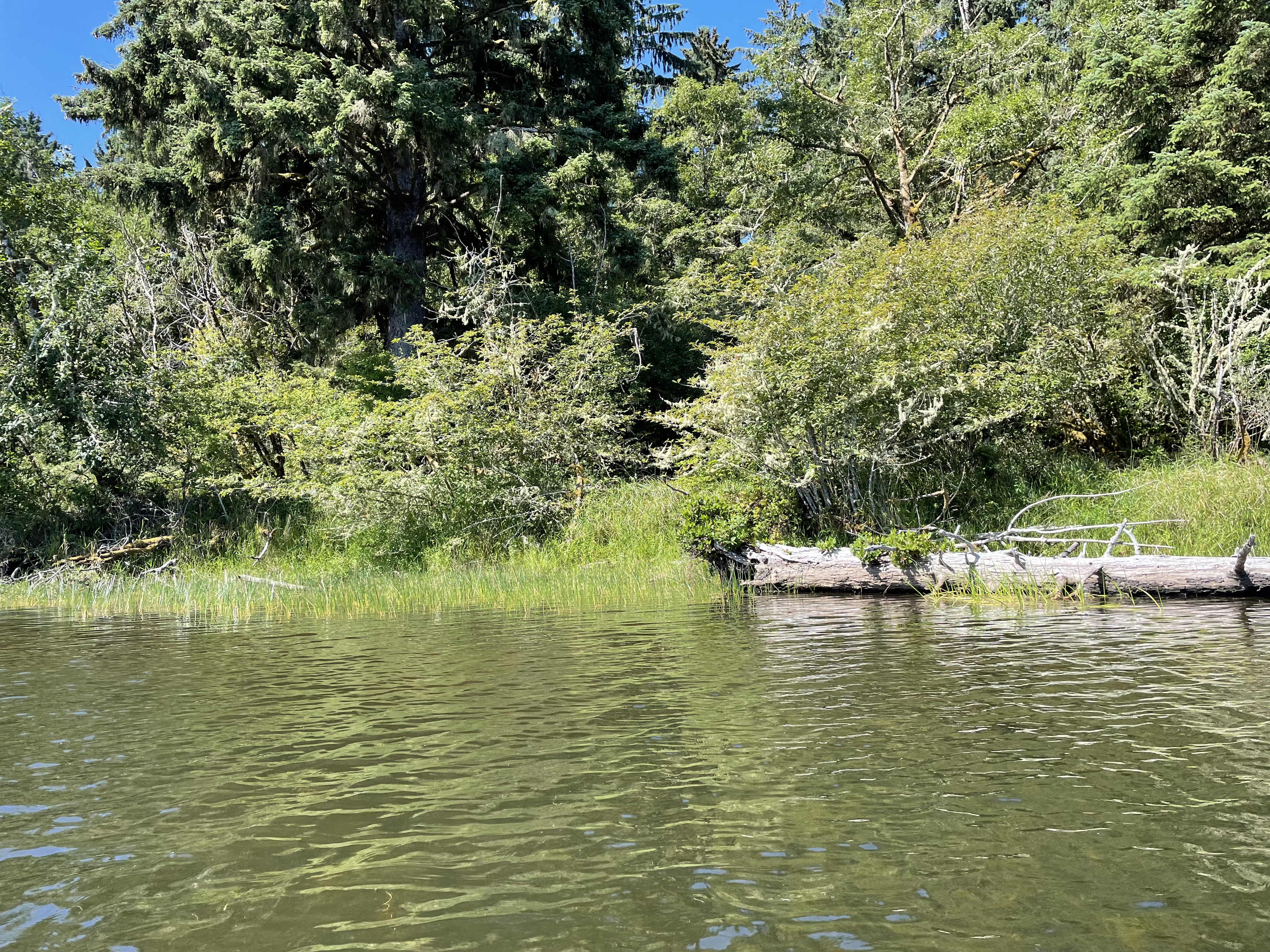
A great thing about the major bike paths in this park is that they do not follow the roads. They go to the same places (generally) that the roads go to, but they go through the woods, follow old canals, or go down the dune lines usually quite distant from the car traffic.  They are very scenic bike paths, lots of view of lowland marshes and big Sitka trees. Just be careful to stay on your side because when you round that corner ahead, one of those huge big wheel eBikes could be barreling your way and those puppies are too heavy to dodge well. (Good thing I was on a light 18 speed and I could do the dodging).

Every campground should probably get a bug report. Oregon is pretty blessed with a low bug population (at least on the west side of the Cascades). Here near the mouth of the Columbia I am happy to report very few mosquitos (say, you kill 2 a night), even fewer biting flies (1 in 2 days) and not that many red midges (3 or 4, and I don’t think they were the biting kind). One strange thing did happen to me. As I was riding my bike home from the old Military base my ankle suddenly hurt. It felt like I had twisted it. I was riding my bike quickly down the smooth paved path so hard to see how that possibly could have happened. So I ignored it. When I got back to camp, it still hurt. It hurt to touch and it hurt a little to walk. So I pulled off my shoe and sock and examined it. There was a suspicious red spot there, about the size of a Nickel. In addition, my ankle was starting to swell some. I don’t know what did it, but something either stung or bit me. Something that doesn’t feel like any traditional bee or wasp sting that I have had. Later on (after a couple of hours) the pain started to feel less like a sprain and more like a sting (or like a burn). This morning (12 hours later) it still hurts on occasion but it really itches. I wonder what tagged me? (Update, that puppy itched for nearly 2 weeks)

Last night I walked around our little loop area at camp. The family camps had all gathered together in groups of 10 to 15 around roaring campfires and were having social times. One group was telling stores (perhaps ghost stories). The group just a couple sites down from us had out a guitar and a couple were singing some what I imagine were folk songs. They were in some Slavic language and the people were singing harmony parts. In many parts of the songs most of the people in the circle would join in. It sounded pretty good but I did not recognize the tune or the words. 

The other big difference about the being over here amongst the large family (church?) groups is that there are no big RV’s. in the other loops there are all of the Mega RV’s parked next to each other, over hear it is all tents and pop-ups. Our little SCAMP is the largest RV in this section of the loop. 

Walkway out at the tip.

A freighter on the Columbia

The Jetty

The Observation Platform is closed. The stairs are broken. Lost of construction is going on 
on the Jetty itself. They have a road constructed to bring in rock from a temporary landing port
on the Columbia.


On our last day here we went out to the spit and Jetty that is at the mouth of the Columbia river. We had hoped to go up into the advertised observation platform but that was closed. There are a bunch of big parking lots and additional beach access areas out there (5 miles from the campsite). The parking lots are very large and were essentially empty. One or two cars in each. A huge empty beach. And this is on a wonderful day during the summer. Is this the height of occupancy? No wonder they haven't repair the observation platform, no one is using it.

One Day we hiked the Fort to the Sea Trail. See Here.

One day we went to the beach to go boogie boarding but we decided it was too cold so we just lounged by ourselves in the sand and sun on an empty beach.


Fort To The Sea Trail


A 15 minute drive from our campsite at historic Fort Stevens state park is the even more historic Fort Clatsop. Never heard of it? It is the place that Lewis and Clark spent their last winter after completing their epic journey from the Eastern baby United States to the pacific ocean, exploring the newly acquired lands of the Louisiana Purchase.  It makes sense that this place would be close to where we are staying since Lewis and Clark came down the largest West flowing river, The Columbia, and we are camped at the mouth of the Columbia. Clark and Lewis paddled their canoes up the little tidal creek that was just before the big turbulent mouth of the river. I need to check my history but what I remember is that they wintered near a settlement of indigenous peoples. They built a sort of lean-to structure that may have had a small perimeter fence. They called it Fort Clatsop sort of in the manner that I called my structures of sticks out in the woods a ‘Fort’ when I was 8 (Mine was called 'Fort Maple').

They spent the winter sitting in the gloomy rain of the Pacific Northwest, hunting Elk and Deer, Salting said Elk and Deer, and trading with the locals. I am sure the spreading of venereal diseases was one of the common pastimes.  The other big thing they did was to hike the 6 miles over the small mountain ridge to the ocean, where they kept a couple of guys stationed in some little shelter. These guys job was to keep a driftwood fire burning in order to boil seawater and make salt. The salt they needed to preserve the hunted elk meat that they needed for supplies to travel home. They shot over 130 Elk and hand stiched together over 300 pairs of elk skin moccasins. I am guessing you wear through those puppies quick on a long walk back to Virginia. Did they bring a big pot to boil the sea water? Or did they barter for a clay pot from the locals. There was a suspicious sign near the National Park that said “Clay Pit Trail”.  Evidently they used small pots they had brought along.

National Park? The area around where the Fort Clatsop is located is now a National historic area. It has a nice (currently under renovation but due to open next week) Visitor Center (where I am sure I could clear up my history questions) and a copy of the Original Fort (that I think was made from drawings and descriptions left behind in Lewis and Clarks notes). If I make something up, but then it turns out to be right, is that really making something up? 

Today we are going to hike the trail that the expedition people hiked to get from the Fort to the Sea. This was probably a trail used by the indigenous peoples at that time. Today it is a amalgam of different trails and roads and narrow rights of way that winds its way through a patchwork of different terrains. 

You start off near the Visitor center hiking through flat and pretty standard Sitka and Sword Fern. The trail is a standard woods trail and nice hiking. You cross the road the climb up a little hill. At the top of the hill is another trailhead, this one evidently for bikers. There is a bathroom there and a parking lot. There is a link here to other trails that head on up the Lewis river. We follow the main trail which is now a graveled path wide enough to be an old jeep track (which I suspect it is).  You follow this track for around a mile. There are side trails leading off that I may want to explore on some other day (the Kwis Kwis trail, in particular). The Gravel (bike designated) trail ends at the top of the hill and a nice overlook. There is a sign at the overlook that tells of the history of the North West facing view that you are enjoying. It mainly says that the lumber companies cut down all of the trees. The trees consisted of many varieties and species that are required to live together and make a healthy forest. In their place the lumber company planted only Doug Fir, which is relatively quick growing and good for the lumber industry. Then the Forest Service acquired the land and they are now in the process of naturalizing the area. In The Future the land will be all happy and natural again. Trust us. We won’t loan it  back to the lumber companies in 100 years for them to use for a few months or nothing.


Wow. Where did that come from? I don’t know, because just after this lookout, you enter the nicest part of the trail. Another 2 miles of wonderful descent through mature growth. Big nice trees. Shady walk. Lots of deer fern and sword fern and Huckleberry.  After a while you descend into a more flat area that has little fens areas with skunk cabbage and devils club. It is very pleasant and good hiking. There is some water flowing but not enough to filter for drinking at this time of year. 


a Nice bridge across one of those rolling dune lakes

A Maze of Cow stoppers

x


The coast in this area is built of cycles of sand deposits that create repeating lines of high dunes and low areas. The further you get from the ocean, the more the dunes have become covered in dirt and are growing trees and such. The low areas are usually meadows, marshes, or cute little finger lakes, like the one at our camp where we went kayaking the other day. 

We now descend into this area. There are a number of nice bridges on the trail that you use to get across some of the largest wetlands. Now you come to another big sign post. There is a dirt road there but it doesn’t look like it is used. There is also another nice Forest Service pit toilet there. So handy! Clearly a lot of money was spent on this trail. The signage is great. The upkeep is great. And there are toilets and bridges where you need them! So nice. 

There is also a sign that says it is 3 miles to Sunset Beach. Our Destination. You are halfway to the Sea. 

This is also where the wonderfulness of the trail ends. The rest of the hike sort of sucks. First you go through a stretch of unhealthy forest. It is all Doug Fir, maybe 30 years old, and the trees are crowded together and have, as such, shed all of their lower limbs, which have made a mass of dead fall on the ground. A great place for a fire. Not many ferns or other undergrowth life. We do see a couple which appear to be hunting mushrooms in the debris. Seeing people hunting mushrooms is not uncommon as charrels grow in this area and sell for a pretty penny. They are also one of the easiest edible mushrooms to identify without accidently poisoning yourself. 

Next you come to the first strip of private property. There is a cow pasture with electric fencing off to your left. The property is trash strewn and not exactly scenic. At the end of it you come to highway 101. There is a nice paved path here that leads down the road a bit and then through a tunnel with a very nice façade printed with “Fort To The Sea Trail”. Someone spent a lot of money putting nice stone work up and making the tunnel look very pretty. And then they let blackberry grow up all over it and obscure it. 

Out the other side and you go down off the pavement onto a sandy narrow path. The trail now winds for the remaining 2.5 miles through a narrow carved out right of way between privately owned cow pastures and the Oregon National Guard training facility of Camp Rilea. So you have barbwire on your left and chain link topped with barbed wire on your right. The Right of Way is about 10 foot wide and it is not signed very well. We lost the trail once where it started to go through very constrictive wooden corridors designed to stop cows but allow hikers. Skinny hikers. It is sort of strange, this mixture of nice trail, with lots of money trail, and shit trail. Since we are hiking on occasion through cow pasture, the shit trail thing is literal. You hike for a ways out in this sort of barren place and then you come to one of those big finger lakes in the undulating landscape and there is this really nice big expensive footbridge. The bridges are clearly just for the trail and they look so out of place. If you hike this trail you need either a detailed map or a good piece of mapping software on your phone. There were at least 2 places where the correct turn was NOT where the main foot traffic seemed to go and the signs that marked the turns were either obscured by plant growth or non existent.  So. 2 miles of walking. Some of it is strange non-trail walking along beside the military base fencing. The sound of automatic rifle fire in the distance so reassuring. Some of it is nicer trail through wooded beach area forests. 

We finally came out at the parking lot at the end of the trail. It is a nice parking lot with a nice bathroom and good signage. I will say that this last 2 miles of trail did not look well trodden. One area through a grass run was barley trampled at all. I am thinking that not many people hike the beach end of this trail. This makes me think that this parking lot is one of the least used beach parking lots in America. I mean, you could park here and do the last half mile to the beach, just  like Lewis and Clark, or you could drive to the beach and park there. Much less far to carry your beach chair and umbrella. Do you think that Lewis and Clark carried their beach chairs and umbrellas all the way from the Fort every day?

I may come back here someday, mainly to remember to bring my National Parks pass and go for a good tour of the historic site. If I do, I will hike the Kwis Kwis trail loop that includes the nicer parts of the hike we just did. That seems like it would be more fun as I really like hiking in the coastal Sitka.