Sunday, July 5, 2015

Low Water in the Cascade Lakes

Low Water in the Cascade Lakes


There's been lots of strange weather going on this year around the country. Tons of snow out east this winter. Back here in the Pacific Northwest, we were desperate for snow. My partner and I did a snowshoe up by Mount Bachelor to Todd Lake in January and even then you could see how low the snow pack was. Trail signs in the trees that should have been at head height (because of the deep snow) were 30 feet over our heads. It was really bad. But even though I had been prepared, I still wasn't ready for how low the Cascade Lakes were when we did our yearly Kayak Portland meet up vacation trip up there in the middle of June 2016.

My partner and I have a special tie to this particular half week long event. First, 2 years ago it was our first real commitment to each other (that is, she invited me to go off on vacation with her in 2 months when we had been dating for about 1 month) and second, 1 year ago at the event was our wedding (that is, she asked me to marry her and I said yes and we found this waterfall in Bend...). This year, I decided to really splurge for our anniversary and got us a nice campsite at Tumalo State Park. Talk about ritzy, this place had room for 3 tents and the water spigot was (almost) IN OUR CAMPSITE!!. But the Clincher: Single Stall lockable (and therefor co-ed) showers !!! Yes, that is right, 3 exclamation points.(2 of them were mine). (Editor's note:  I actually found the campsite and made all the travel arrangements, as Jon was busy working 60 hours a week with meetings at all hours of the night.  We were in danger of a dingy motel 6 as things were filling up fast in Bend)

So. Anyway. The club usually has this 4 part trip (and I encourage you to go follow the link above and join us some time, if not on this trip, than on any other, there are like 5 a week). We start off with a quick little paddle us the Deschutes river through the city of Bend. Bend Oregon was a thriving little summer vacation home community before the housing bubble. It took a pretty hard hit then but it is now rebounding and as far as I can tell, because of the craft beer industry. Cascade, 10 Barrel, Deschutes, to name just a few. Deschutes has Mirror Pond Ale, which is fabulous, but any of their many selections are wonderful. And 10 Barrel just got bought by Anhiseur Busch, so you know that they must be even better than Budwieser; hell, probably better than Bud Light.

But I digress.

We met over by Tumalo Creek Kayak and launched with around 20 boats to paddle up the Deschutes. This is a lazy paddle. The river is wide and 3-4 feet deep as it winds its way from the highlands, through the old mill district of the city. Off to our left, as we paddle up stream, is the old mill itself. The building is now the local flagship REI, but it still boasts the old architechture and the 4 towering smoke stacks of the old mill. Around REI is a nice little outdoors shopping mall. Today there is a local beer fest going on at the waterfront, but I take it that a beer fest is not an uncommon occurrence for this area. As we paddle up the river we are passing many a bikini or shorts clad youngsters floating down stream on innertubes, floats, or air mattresses. Bend has a little business of lauching people in tubes at the local park. You float downstream for maybe an hour and then get out and catch the city shuttle back up to the top. Great fun.

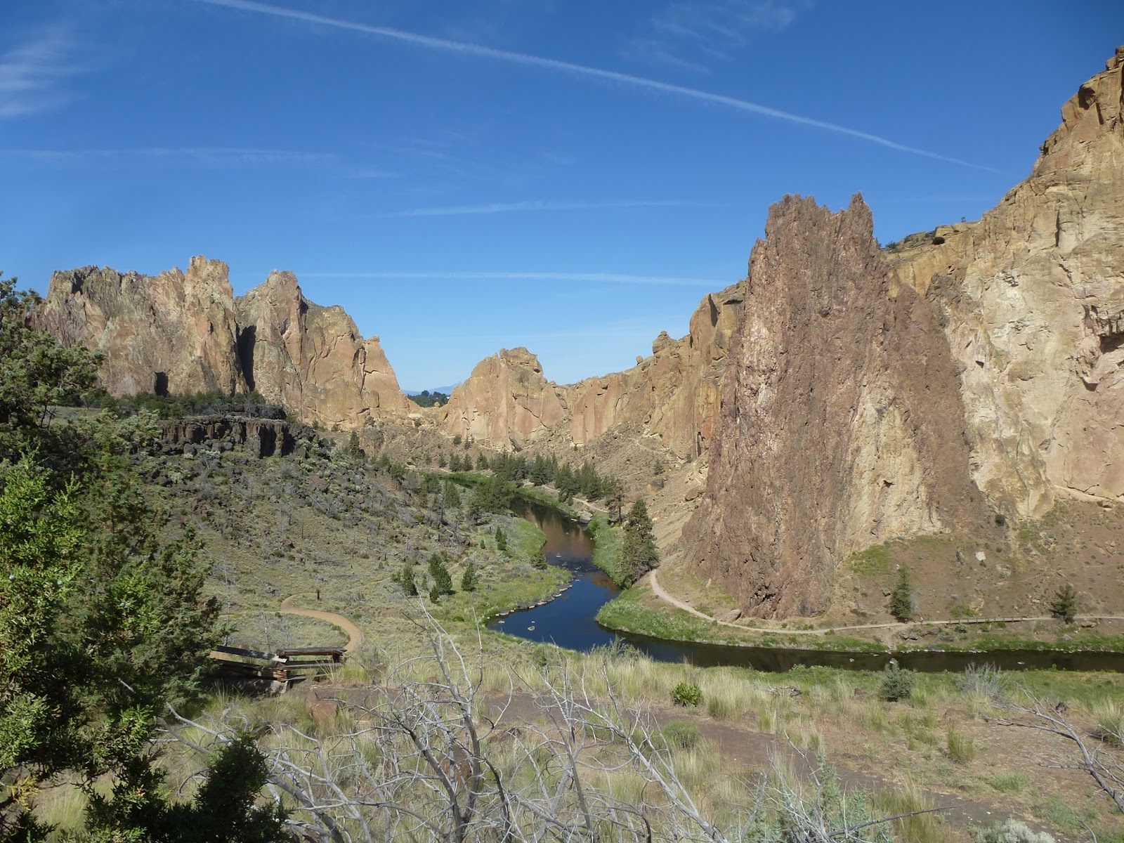
At the end of this lazy river is a canyon where a much more lively Deschutes hits bottom after a couple of miles run down from the top of the local lava flows. We paddled up to the rapids and played around for a bit, entering the eddylines and bucking the currents. The river is pretty low for this time of year but it was still great eddy play and we all had a good time. Afterward we shot back down the river to have some dinner at the pub/brew house that is right next to the Kayak shop. I forget the name of the brewery, but I do know that isn't the same name as it was last year when we went there. A whole different menu and schtick. This year, it was all genuine Kansas food. Perhaps Missouri.... But we had great Corn Bread. I wonder how often these little brew houses and restaurants turn over? It seems like such an easy thing to go into a place and eat their burgers and think “Hey, I could do this. But mine would be better because I would have {Enter what you would have here}”. (My thing would be Buffalo Burgers).


After a wonderful night in our campsite, Perhaps a shower, it was time to go up to the Cascade Lakes for our first real paddle. We always start at Hosmer Lake. These mountain lakes all have definite inflow and outflow areas. The inflow is usually a crystal clear little mountain stream. The outflows are usually some interesting hole in the lava where the water bubbles back down through the ground. The lakes all feed each other. Water from the top lakes feeding down to the bottom lakes. All of them fed by snow melt. Hosmer is down below Sparks and Elk and so I expected it to still be doing well no matter what the condition of the other lakes was. But Hosmer was down 1 to 2 feet below what it usually is this time of year. Don't get me wrong, the lake was still enchanting and wonderful, full of ducklings and Osprey and water lilies. But this year the water lilies and other plants were on the ascendancy and open water was more restricted. We paddled around to the inflow area. Usually we can paddle up to the little creek, and in fact actually paddle UP the creek for several hundred yards to eat lunch at a pleasant little waterfall. This year, we couldn't even get to within 100 yards of the creek because the water was just too shallow and we were all getting stuck in the mud.

Got some good shots of a yellow headed blackbird feeding his/her rather large youngsters


Everything is fed by snow melt. To give you some idea of what this means, I am posting some pictures from Hosmer Lake of Mount Bachelor. Note the difference in snow cover.

June 19 2015
June 20th 2014
Ok, so study the lower right area of the mountain. And this isn't Bachelor, this is .... South Sister?

2015. His paddle is touching the bottom.
2014. Ok, so pretty shallow here, but this was meadow this year.

That night my partner and I celebrated our anniversary. We invited our action adventure team member, Chip, to join us. Chip claims that he is responsible for our relationship since I never would have learned to kayak or taken such an interest in joining the meet-up if it had not been for him. In fact, it was his idea and he drove to the first meet-up that I went to where I first my Kayak Partner. This anniversary we went to Cascade Brew house. It is much better than 10 Barrel as you can find parking and get a table. It also has great service and food. I had the Elk Burger. Not as tasty as my Buffalo Burger would be, but mighty damn fine.

That night we had an anniversary shower.  (after a trip to REI, in which we realized that buying each other what we wanted for ourselves was something we could do anytime from our computers at home)

Sparks Lake was the next morning. The water was REALLY low at Sparks. Places that I usually go paddling across were well developed meadows. The lake was down at least 2 feet. You had to be careful paddling near the boat ramp that you didn't hit lava rocks that were usually much too deep to care about. The up side was that the water was so low that there were beaches everywhere. Usually we have a hard time finding a beach where 20 people can eat lunch. This year we found lots of nice deserted ones. The water was also much warmer than it usually is. The sun was roasting, so we did some swimming and kayak safety practice.


This is near an outflow. The usual water level is that horizontal crack in the rocks.

Momma and Baby Mergansers.

lunch on the Beach.

This Goose family was out for a swim. They were acting very strangely. The Dad was very aggressive toward me and I couldn't figure out why, since I wasn't cornering them. Then Dad came toward me and passed me and went out in the water behind me. He sat there for a long while and then, up popped baby #5. It must have been hiding underwater for an awful long time.


So anyway. I don't know if this strangeness is global warming or just the republicans fraking with us, but it has definitely been a very strange winter, spring, and summer here in the Pacific Northwest. As I type to you now, it is 86 degrees at 8:00 pm. Hit 93 earlier today and that was average for the last 2 weeks. Crazy. Let's check back in a year and see what is up. The main thing I know is that, because of the heat and such, next year for our Bend trip, we are getting a hotel.


Friday, July 3, 2015

Hiking Smith Rock

Smith Rock, From the Parking lot


I have been exploring Oregon now for over 10 years and, evidently, I still haven't managed to do much more than touch on the cool things to find in my corner of the state. Kayak Portland had their annual Cascade Lakes trip centered around Bend this week. It is also my Kayaking Partner's wedding anniversary (hey, mine too!!) and so we blew out of Portland on Wednesday night heading for central Oregon and fun adventure. We stayed the night at a cheap (but nice) little hotel in Madras (The Econo Lodge). We had arrived pretty late on account of the blasting they are doing on 26 near Government Camp to widen the road, so we slept in a bit. Ok, we were also exhausted from trying to get a weeks worth of work done in 3 days. Anyway, we got going and decided to stop at Smith Rock and do a little day hike before we headed over to Bend to start the group events.

I have never been to Smith Rock State Park so I was not completely sure what to expect. I know that a lot of climbers head out here. In fact, I know that it is something of a climbing Mecca. But what does that mean exactly? Are there a lot of climbing walls set up with a lot of specialized gyms in the area that people go to? Is there one particularly nice wall, perhaps along a river, where a lot of people can climb at the same time? I had no idea. I certainly didn't expect to find such a glorious geographical wonder sitting in the middle of nowhere.

I'm not sure why I was so surprised. I have certainly been to other things like this. Driving along, minding your own business, turn the corner, and Bam!, there is Yosemite. Or drive out to Pinnacles. Just a little leftover half of a volcano sitting in the middle of rolling hills. Beautiful huge rock formations that are sitting in an island of camouflage.

You can actually see Smith Rock from pretty far away. But you can't really tell what it IS until you get right up on it. After you leave Madras and are driving toward Terrabonne on highway 95 you pass over this bridge. Now, there isn't much in the way of water out here on the high desert. We have not been passing over any rivers or streams or even dry gulches. So it is a pretty big surprise when the rolling lava encrusted plane suddenly drops out from under you and there is this hundred foot deep sheer rock wall canyon. With a bridge. There is a path there and I encourage you to stop and get out and walk over to the foot bridge and look around. Keep your dog on a leash. I think I have some pictures.

Anyway, I was pretty sure that this gorge leads up TO Smith Rock. So I was expecting something like that. But there is also this rock.

Asterisk Pass

You can see the rock (yes, Smith Rock) as you are approaching it down the little side road. You have to zig around on different roads as you weave your way through the different farm plots. Always getting a little closer to that rock. You do finally get to the sign for the park and you walk up to the information desk and get a map. You are told to take a lot of water. Out there across the way is that rock. The trail map says you can do a mile hike. Sounds like fun. But as you walk away from the long parking lot you quickly see that between you and that rock is that same sudden canyon that you had seen back on the highway. Not quite as deep. Not quite as sheer. You can hike down into it. But this is certainly the head waters of that canyon.

We stopped and read about the creation of Smith Rock.

It seems like long ago there was this volcano. It spewed a lot of ash which built up in mounds thousands of feet deep. Over time that ash got compacted and hard and formed the bases of the Smith Rock area. Then, more recently, this lava flow came through the area. It put a layer of lava (basalt) a couple of hundred feet deep and flowed until it hit against local obstacles, like the compacted ash nacent Smith Rock. In this area the lava flow pushed the local river up against the Smith Rock barrier and the river then started cutting through the two of them. So here at the park you can see the river with the basalt cliffs on one side and smooth rocks of the ash flow on the other. Climbers come for the Hardened Ash.

That is the end of the basalt flow, breaking off into the river valley

To start any of the hikes, you have to descend down to the river. This is a broad steep trail. You could take a wheel chair down it, though you might wish you had brakes on the first part. At the bottom, by the river, is a drinking fountain and a large green area. The green area was being watered and may have been the only lawn for a few miles around (until you got to the billionaire homes down the river). It would be very easy to see from the air, which is good since it is the helipad for emergency air evac. This is the first national park I have been to with a planned and watered evac pad.

See the nice round green Heliport and Evac pad? This is from the Smith Rock side on our way up Misery Ridge

At the river you have a few choices. Stay on this side and go up and down the river. Nice and flat and green. Or cross the river and then start the loop over Misery Ridge. Everyone was heading up misery ridge, and since half of them were wearing shorts and flip flops and the other half were carrying climbing ropes we thought we might try that way. We had looked at the map, it was only a mile, how hard could it be?

A couple of factors. First, a small park trail map doesn't do a good job of showing the topography or the majesty of the area. That peak up there is pretty high and you have to climb to it pretty fast. Second, light colored rock, devoid of most vegetation, makes a great heat reflector. So climbing up the steep side of the slope to “See what is up there” turned out to be a hard, hot slug. But not an incredibly long one. And we had all of this scenery that was opening up with each step, which gave us plenty of excuses to stop and enjoy the sights and catch our breath. We brought 1 liter of water and half a bottle of diet coke between us. I didn't get offered any diet coke. We probably should have had at least 2 liters, probably 3 to feel really hydrated. Since my partner was the only one with a backpack, I guess we could have carried as much water as we needed if we had spent the time to dig the other water bottles out of our kayak gear (which was in the roof box on the top of the action adventure mobile in between our two boats).


Walking on the Summit

We climbed up the Misery Ridge trail. This trail has a lot of cut steps and switch backs and goes up the east side of the rock formations. Along the way, every hundred yards or so, we would run into climbers that were either mid way up their climb, or setting up for a climb. They had their helmets and their ropes and they were lashed in to piton points that seemed to be previously placed all over the place on the scenery. The climbers were all young and healthy, of course, and (at least on this side of the rock) about half and half, men and women.

The trail was pretty crowded for a trail marked “Most Difficult”. The usual mishmash of passing or being passed. But people were all in a good mood and, as mentioned, the scenery was fantastic. On this side, the main thing to look at was the river valley opening up beneath us and heading east into the mountains. The parks info person had said there were river otter down there and we could see some (Golden?) eagles soaring up around the cliffs. Do Golden Eagles soar in flocks? Perhaps they were vultures, though they didn't really look like it. Since we were on the hot mountain trail we discussed how nice it would be to be down there in the flat cool green river valley. No doubt the people we saw down there were looking up and talking about how wonderful the view would be for those people up there on the rocks.

That switch back is Misery Ridge Trail going up from the River.


We got to the summit and had a good look around. Posted a quick picture to facebook, you know, the important stuff. Now. Which way down? The way we came was very steep going down on sore knees. The other way was longer and so probably less steep. Certainly unknown. But some people coming the other way told us that we had to keep going so we could see “Monkey Face”. Well..... how could we resist that?

I didn't know what Monkey face might be, but evidently everyone else on the planet knows about it so I am sure that my ignorance must astound my readers. I mean, Recycled Hiker is such a well known, well traveled, and well read gentleman, how would it be possible that he has never heard of nor yet seen “Monkey Face”?

So we walk along the ridge. I like walking along ridges. You don't have to go much up or down and you get to see cool things. The only problems with ridges are 1) you have to climb up to them, 2) you have to climb down from them and 3) they are usually pretty short. In this case, we walk a hundred meters, turned a corner and their was this cool rock out ahead of us. This turns out to be the actual Smith Rock. A different color than what we are on (Jones Rock?) with Asterick Pass in between here and there. I looked out trying to figure out which of those pinnacles must be Monkey Face. Nothing leapt out at me. A few did look like bananas. I didn't see what the hubbub was all about. Then we turned the next corner.


Oh.

Here was a spire of rock sticking up into the sky like a baby's arm holding an apple. Ok, perhaps like Arnold Schwarzenegger’s arm holding a mellon. The thing was huge and majestic and had two people just on the summit looking like some ants up on that mellon. I didn't see no Monkey, however. We turned the corner and started down the switchbacks. At one point we had this nice couple take our picture with the rock in the back ground and that is when my partner saw it. Right there on the top of the rock. A huge Face. A huge Monkey face. This one had some green snot climbing line coming out of one nostril. Ah. Monkey Face!!! Now I have seen it.


The trail wended around the spire and finally brought us to the base, where we could see the road of pitons hammered into the face going up and up and up. Also at the base was a little storage shed containing a emergency stretcher, a pair of crutches, and a little memorial. I take it there were little sheds like this all over the place at the base of all of the many climbing start points. I wondered, were there memorials all over the place also?


See the Piton road, going straight up the side?

I only got about half way up.
See, the interesting thing is that this park has been set up as a place for people to come climb. The rock faces have been mapped, the climb points marked, the pitons placed and presumably maintained. The climbing is sanctioned and the stretchers and helicopter evac pad is bought and paid for. No wonder this is a climbing mecca. It is like a gigantic beautiful skateboard park for adrenaline junkies just a little to old for their skateboards.


By the way, coming down that way was easier than it would have been retracing our steps. And the west side of the mountain has more views of the river valley and the entire Deschutes River valley. It also let us see the billionaire homes that had popped up on the ridge over the Crooked River. What a great place to build. No one can block your view and you have this big cliff to protect one side of your property from Zombie attack. Here are some pictures of some of the nice homes, which one would you like?


When you come off the West side of the hike, you are down by the river. A lot cooler down there in the green and such. We hiked along, on the far bank is the basalt topped with expensive houses, on our left is Smith Rock with lots of little places where people were doing their climbs. We did hear a couple of screams as people fell and then got jerked up on their safety lines. Actually, I think all of the screams came from the same guy. He may have needed a better belay guy. Or maybe he was trying to attract the attention of the girl a couple of rocks down. For some reason it seems the fashion to climb in as little clothing as possible. The weight, that has got to be it.


Between Smith Rock and Misery Ridge is Asterisk Pass. I didn't get the joke until I took this picture of the pass from below.


At one point my partner spotted some mammal up in the rocks above us, about the size of a raccoon. We didn't get a real good look at it. I would have said it was an opossum but it didn't really quite look like that. We met another couple that told us it was a rock-chuck. “They are such cute animals. They live in the rocks. In Bend they are everywhere. The sheriff says they will eat your dogs, but we don't believe it, they are so cute.”

Picture of rock-chuck to prove cuteness.

Picture borrowed from here
I guess I mentioned our 1 liter of water. And how it was a hot day. And given as how we drank it, we were pretty thirsty that last mile or so. And pretty hot. And there was this river. So my kayak partner scampered down a dusty little slope to the water to dunked her hat and I followed her (why do I keep doing this? Surely not just because she has a nice personality)


We didn't drink the water though. No no no. There are too many people and dogs around to trust the water to drink. I read this article recently on the dangers of drinking river water and getting Giardia. The article said a few interesting things. First, it said that if you bring water to a boil, everything in it is dead. Forget about that 5 minutes stuff. Second, it said that most streams out in nature don't have enough Giardia to worry about. You know where most people get Giardia? Public swimming pools that allow children with diapers to swim. Think about that for a bit. That said, anyplace where people and dogs can be, I would rather not be drinking unless I have a good filter along. The other place you don't want to be drinking is places with agro run-off. Don't need the pesticides and fertilizer, thank you very much. (And filters and boiling won't get rid of dissolved chemicals).

But I digress.

We finished our loop. There was a glorious water fountain back at the helicopter pad and once I had drunk a liter or so I no longer felt like I needed emergency evac. Perhaps I could even make it back to the car. That would be good, because we need to be getting on, we have a group paddle starting in Bend in just 1 hour.....