Lookout Mountain
Here is a hike with truly unique views.
This is the second tallest mountain in the Mt Hood Wilderness area
(the first being, Mt Hood) and it lies to the south east of Hood
giving spectacular views of the east side of the mountain, along with
views of Adams, Jefferson, Sisters, and the dry-lands of East Oregon.
View Larger Map
The trailhead for this place takes a
while to get to (2 hours from Portland) and it is harder to find than
other hikes. I recommend you have a map of the Mt. Hood Wilderness
area. With that, the Google Maps directions will make more sense and
you should be OK. It is paved road all the way to the trailhead at
Fret Creek.
This trail is a bit steep. Perhaps
comparable to Saddle Mountain. 3.5 miles one way with about 2000 feet
of altitude gain. Of course, we start at 4K feet. So perhaps the air
is thinner? Or was that just me because I was up late last night
watching “Lie to Me” episodes on Amazon.com?
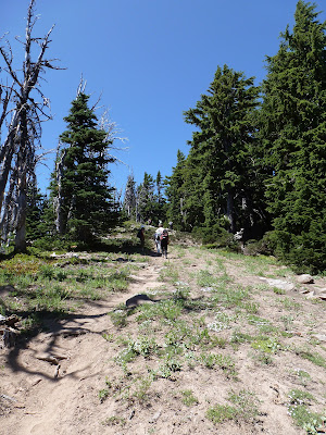
The trail starts steep right off the
road. I hate that. I want a mile to warmup. Shut up and hike. A very
nice pine forest, with lots of lupine and other flowers. Seems like
everything up here was running way late in the season, I think the snow is just
recently gone up here and we are seeing spring flowers. So strange.
A couple of little creeks (one is Fret. The other is probably Badger or Fifteen Mile)
run through this area and the trail crosses them several times. At
one rest stop our guide (Russ) pointed out the moss on the Trees. He
had been told by a Lichen expert that the moss level showed where the
snow usually was in the winter.

 |
| See the Moss/Snow line? |
 |
| And that is as high as the moss eating cave bears can reach |
A little more climbing and we get a
respite at Oval Lake. Oval lake is a quaint little spot. A lake the
size of a football field (only oval), only a couple of feet deep at
least on this side, but with a tall rock pinnacle looming over the
far side. We stayed for a couple of photos and then continued on back
up the trail.

5 minutes and we get to another trail
crossing, a right turn and we start a run along the mountain getting
ready for our climb up to the ridge.
A push to the ridge, and right away
there is a little side path that takes us out to our first view.
 |
| Bryan Sighting |

 |
| I am getting good at these shots |

 |
| a little Paint |
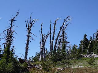
Now we start a more dedicated climb. We
trade the pin needle trail for dust and rock. Harder footing, but
some tantalizing views of looming rock formations, dead trees, and
small flowers. We reach the next section of the ridge. Somebody was having fun with rocks.


 |
| Just Hiking the Ridge |
Here we ran into some snow patches,
still hanging on here at the tail end of July. And there, perhaps
right at the edge of last weeks melt, is that my old friend the
Glacier Lilly? I thought they only bloomed in early spring, right
after the first melt. Perhaps that is what time it is up here at
6,000 feet.
Continue along the ridge and we exit a
stand of trees and there we see our destination. Yeah, that looks
like a lookout to me.


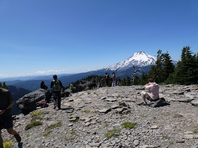
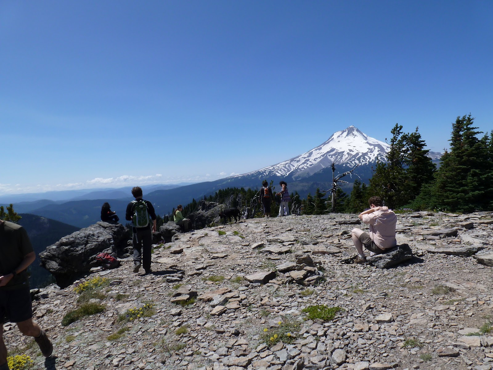
A few more minutes and we are on the
summit. Wow. What a view. Just like I promissed. There is Mt. Adams.
Mt. Jefferson. But where is Hood? (joke). We even have a little
glimpse of Rainier and The Sisters. St. Helens must be hidden behind
Hood.
I also didn't expect that large spread
of brown and …... desert? Spreading out to the east. Russ points
out that if we look to where the hills rise out of the gorge in the
north east, we can see clusters of many many giant windmills. The
power source of the future.
 |
| Oh, there is Mount Hood. |
 |
| Rainier on the left in the clouds. Adams on the Right |
 |
| Oh, isn't that big |

 |
| Is that Desert? |

What a wonderful singular place to be.
Where else are you going to get these particular views? You can see
where there had been a lookout tower built here at one time. Makes
sense. Explains the name too.


No comments:
Post a Comment