Tuesday, January 25, 2022

Cascade Head in January


What a glorious week on the Oregon Coast. Hard to believe it is the middle of the winter. We have had a LOT of rain in the last month, but it has let up for a few days and the sun has come out and it is like 60 degrees in the sand at Lincoln city. 

My partner and I like to stay a few days in January in Lincoln city at the Inn at Spanish Head. It has great views and great beach access and there are plenty of things to do around the area.

Yesterday, for instance, we went down to a local glass blowing establishment and did a little class where we each to to participate (close up) in the creation of a glass bauble of our own personal choice and design. It was great fun and they turned out great.

Today, we decided to get some exercise so we drove 20 minutes north to the Salmon River, parked our car at a nice county park and then hiked 2 miles up the hill to Cascade Head. This is a medium intensity hike through forests of giant Sitka and across creek beds filled with thimbleberry, constantly climbing until you get up to the grass and scrub covered headland. But I get ahead of myself.

The land we are hiking is mainly owned by the Nature Conservancy. They maintain the trail and the signage and invite people to come up and see the sights. Just stay on the trail.  

From the trail head parking lot, which is also the parking lot for the local boat ramp, the trail follows the road (but NOT on the road) going out along Cascade Head.  I have visited this park and Cascade head before, but not for a hike. I have paddled down the Salmon river from the boat launch to the ocean a few times. Cascade head is a big rise of land that extends a good quarter mile out into the ocean from the main shoreline. The river runs down its south side. You can read about a fun paddle trip here.

Today, we are walking. As I said, the trail follows the road for about a half mile, going along just below the road often on little wooden bridges that let you avoid the worst of the boggy area down here at the bottom of the headland. After a bit we come to where the trail leaves the road,  there is a big wooden sign there. Don't try to drive the road to the sign, there isn't any parking allowed out there, you really need to park back at the trailhead. It is very well signed.


Now the trail gets a bit challenging. It goes up very fast for a few hundred yards. Lots of wood plank steps and giant Sitka Spruce roots to climb up and over. Big steps. But after 10 or so minutes things settle down a bit and then you are just hiking through these beautiful old growth trees as you wind you way up the side of the headland. There are a lot of creeks running up there. A lot of water. The big trees don't grow in the creek ravines and these have instead filled up with thimbleberry (which is just bare sticks this time of year). The ravines are forded by very nice aluminum and composite bridges. They are around 40 foot long and there are 4 or 5 of them. Just another sign of how well maintained this trail is and how much personal money has been donated for care and maintenance of the trail. 

Sitka Grove


At around the mile mark we came out of the trees and are on the headland itself.  This part of the trail is facing south, so we have a great view of the Salmon River and the dunes at the river mouth, along with a clear run down the beach. I am pretty sure I can make out the rocks that stick out into the ocean where our hotel is built (perhaps 10 miles away). 


The Trail goes up there to the top. We did not.

Looking South


Three Rocks (it is called that)


There are a few other people on the trail, but not many on this Tuesday in late January. We don't make it all the way to the top, but call it quits at the Low Viewpoint. We are around 1200 feet up and have a lovely view. We sit down and bird watch for awhile. There is one bird, looks like a small hawk, that is doing this hunting method that involves flapping its wings quickly and hovering for 10 or so seconds before zooming down to attack something. I think it must be a sparrow hawk or perhaps a kestrel. We watch a couple of these guys off down below us on the still green hills and eat our snack. 

Probably a Red Tail Hawk


A young Kestrel


Some Old Bird

Up the trail come these 2 older gentlemen (like my age). The one in the lead has 2 sets of binoculars. I figure they are bird guys. So I ask, "Hey, are you guys out bird watching?"

The lead guys says "Well, sort of".

I describe the bird we are watching. He says "That is a small falcon called a Kestrel". Then he pulls up and says, "You want to know the rest of the story?"

well, sure we do.

Turns out these guys are retired Biologists that spent their carriers working to monitor and save the peregrine falcon. They are up here today, with permission from the conservancy, to hike out in a restricted area to do a count of the local peregrines. Evidently since DDT has been outlawed, the Peregrine Falcon has made a great comeback along the Pacific Coast and now maintains a nest in just about every available habitat along the coast.  My Partner and I saw a couple of them over the summer down south at Cape Arago!! (Let me find a picture). 

(I am still looking for the picture)

People are very communicative and friendly out on the trails. I wonder how much of that is the loneliness and lack of social interaction that has been caused by the Covid Pandemic?

While the bird biologists were there the local raptors decided to come out and do a show. We saw 2 adult bald eagles, a Juvenile bald eagle, a red tailed hawk, and 2 of the Kestrels. Oh, and a crow. This is a different kind of bird watching for me, because we are up above all of the birds and looking down on them, with the ocean often in the background.

Then we went back down the hill. I would like to report that my reconstructed knee, with the complete knee replacement, is doing really well going down the hill even with those huge step downs. I think the PT and the one legged squats must be doing me some good. 


Tuesday, January 11, 2022

Twin Lakes in Snow

Lower Twin Lake

If you want to go play in the snow on Mount Hood on a sunny Sunday, you had best get yourself up early and get out the door, because lots of other people have the same idea and the parking at the Trail Head is limited. And it doesn't matter much with trail head you are targeting.

My Partner and I wanted to visit a trail that she had done with her BFF last fall (before the snow). Last week there was like 2 feet of new snow up in that pass, so we expected things to be different. Our plan is to park at the Frog's Lake Sno-Park (don't know why they spell it that way) and then snow shoe (or hike) the 2.5 miles over the pass to the first of the twin lakes (let's call it lake 1)(Ok, it is really called Lower Twin Lake)(The other one is lake 1). 

A View from the Car

The main road (well...... only road) from Portland up to the Government Camp area, where most of the snow parks and ski areas are, is US 26. We got out of our house by 8:00, but didn't really get through the city and going up 26 until around 9:00. We stopped in Sandy to get a Joe's Donut (yum) and were going great until just around the Zig Zag ranger station. Then we were slow bumper to bumper until the steep uphill road changed to 2 uphill lanes. There was snow and ice in the passing lane, so people who tried that gave up pretty quickly, but still the traffic was moving nice up into Government Camp. At this point, just about everybody veered off to either visit ski bowl or head further up the mountain to ski at Timberline. We were one of very few cars to continue on down US26. Just 7 miles past Government Camp, on the way to Madras and Central Oregon, is the little turn-off for Frog Lake Sno-Park. The parking lot is right off the road and is just a bit of cleared and plowed space big enough for perhaps 50 cars. There are a couple of pit toilets there (which were very popular). When we arrived the parking lot was less than half full. We were a little surprised at that and so were the other snowshoers that we talked to.

Snowshoers. What a funny word. I feel uneasy using terms like "Go Snowshoeing" or "Go for a Snowshoe". They just don't sound right. They sound like made up words. But my spell checker seems to be happy with them so perhaps I should just let it be. 

When we were in Sunriver a couple of weeks ago, my partner and I both got blisters on our feet from walking in Snowshoes. We found it is often possible to walk on previously trod snow trails with our Boots (and wearing snow cleats). Walking is much easier than snowshoeing and avoids those blisters. 

Today we decided to start out just wearing our snow cleats but carry our snowshoes with us in case we needed them. 

This is how you take a picture

When I was buying Snowshoes, I was under the impression that I needed to get snowshoes that were big enough to support my weight. I also didn't want to buy the really expensive REI ones because we just don't go out in the snow all that often. So I got a couple of pairs of the ones that they have seasonally at Costco. These cost like $65 and the XL ones claim that they can support a weight of 250 pounds. When you talk about the weight limits of Snowshoes you are discussing how much "flotation" they have. I guess they are trying to float you up on top of that slightly compressed snow.  It can be pretty neat to walk around in big snowshoes like that. You really can walk across the top of deep snow only sinking down a few inches, instead of post-holing down to your thighs, which is what you would do if you only had hiking boots on. 

The Snow is all Glisteny


What a great smile


Lots of Snow Downed Trees

We started up the trail and had no problem at all in our snow cleats. The cleats are like snow-cable-chains for your shows. They are connected with rubber so they stretch over your boots and give you excellent traction on ice and compressed slippery snow. We found that we could walk easily down the compressed snow path and we didn't post-hole unless we wandered out of the middle of the track. Post Hole. Another funny word. It is what happens when you wander off the trail and break through the snow crust and sink up to you knee ( or thigh) in the white stuff. You make a hole just like the kind you would dig with a post hole digger !! It can hurt when you fall and it can be hard to get yourself back up out of the hole and onto the hard snow again. I went through once and it took a minute to get myself out. After that I was more careful to stay in the center of the path and to walk lightly in places that looked iffy. 

The Track
A good Post Hole


The weather is beautiful today. The temperature is just at freezing and there is a fresh coat of snow that fell just a couple of days ago. It was sort of heavy snow (maybe with some ice) in this area and the highway was closed for a day with trees down from the snow. There are a lot of trees down on the trail, too, but they have been covered over with more snow so you just have to tramp over them a bit. Lots of huge clumps of snow up in the branches. How did those clumps form? How do they stay up there? 

Big Clump up on top

At this early part of the trail we are actually hiking on the Pacific Crest Trail. My partner and I have hiked this section of the PCT a couple of other times, coming from the North trailhead over by Pioneer Woman's Grave.  At about the 2 mile mark, you break off from the PCT and get on the little loop trail that goes down the hill to the twin lakes. We had started out on the trail with nobody around us, but everyone else seems to be faster than us and we were passed by 10 or so people and by the time we got the lake there was a bit of a party going on. 

But it was well worth it. The Lake was Beautiful. A shinny flat white wonder of a circle with snow crowned pine around the edges. We pulled up a little snowbank, spread out our red tarp and sat down for a nice little lunch in the sun. It was actually a bit hot sitting in the snow in the sun. We could take off our hats and gloves and enjoy ourselves. Some people over next to us were feeding the local Jay population. The little guys would fly down from the trees and land right on your arm and take a nut out of your hand.  


Lunch in the Snow and Sun


After lunch we packed up and headed back up the hill. My partner assured me that all we had to do was climb the half mile back up the PCT and then we could just coast downhill to the car. This was a great plan except that it didn't take into account one thing: rising temperature. We got up on the sun exposed side of the hill and all of a sudden we both started to sink. I was leading and hear my partner sort of laugh. At that same moment I sunk down to my shins in the snow. Oh. I turn around to look at here and she is up to her thigh in a posthole. And right in the middle of the Trail!! She had a pretty hard time getting out, she was in so deep, and then she sunk right back in again. Crap.  The rising temperature of the day had made the snow just soft enough that we could no longer safely walk across it in our boots. We had to move over to a more stable area and take off our packs put on our snowshoes. 

And now we are really Snow Shoeing. Or perhaps Snowshoeing. Either way, we are not Postholing. (see what I did there?) 


See how perfect and deep that track is?


One feature of much of the trail we are shoeing is the shape of the beaten track. It is about 18 inches wide, just wide enough for you snowshoes, and 1-3 feet deep with nice neat square sides. It looks like it was dug with some kind of snow shoveling machine. Like the crisp sides that the snowplows make on the highway. And it has this shape just from people snowshoeing over it in line a few dozen times.  That is all great and everything unless you are wearing the biggest snowshoes that you can find. My partner and I found ourselves in place where we couldn't easily walk because the 2 foot deep trail just wasn't wide enough for us to easily move our snowshoes. We had to step very carefully.  I was really wanting something that was a cross between snow cleats and big snow shoes. I really wanted some small snowshoes..... like the expensive ones that REI sells. Hell, the very smallest ones that Costco sells probably would have been great (if they had fit my boots. I don't know about that). 

When we got back to the PCT intersection, we switched back to cleats.  And then it really was a coast downhill back to the car. 

As we were pulling out of the Sno-park I noticed a few groups of people that had set up tables and cooking stoves. Looked they were going to cook dinner and stay past dark (which is coming along in like an hour). But not us. We figure we can get over the busy part of the pass and on our way down toward Portland before the skiers have finished there last run on the hills. The lifts close at 4:00.

We were wrong. We zipped along until just a mile from Government Camp and then traffic just stopped. We were almost all the way to the Trillium Lake parking lot and we didn't go 100 yards in 2 hours. Not sure what was going on up the hill but I am pretty sure that the only reason we ever moved forward was because people ahead of us bailed and did a U-turn and headed some other direction. We didn't have any cell signal so we couldn't get any traffic reports. We did have enough for a text from our son. He said that trip check showed the traffic, but didn't mention a reason. So after two hours we bailed and went the other way around to go home. This was a major decision. It is 90 minutes to Portland (when the traffic is flowing) if we went west, but going east around was more like 4 hours. But at least we were moving again. Until we weren't. Turns out the traffic was bad both ways. I have posted some conversations on this and people who frequent the mountain say that that is just how things are. There is a choke point coming down from Government camp and things all backup for hours at a time. I think this may explain the people setting up to make dinner at the parking lot. If you are going to be sitting still anyway, might as well have a burger or some soup and sit back and enjoy the night. I am sure things are clear to head home around 8:00 or so.


This guy had just pulled from a sno-park on the left and was heading east until
He saw all of those red lights ahead. Then he did a skidding turn and headed back West.
What he didn't know as that the red lights were even worse in that direction. There is
Some sort of shared information Mesh Wifi App Product Idea in here somewhere.

Friday, December 31, 2021

Edison Butte Snow Shoe


Edison Butte is a snow park and trail head on Mount Bachelor right off NF-45 which is the main drag from Sunriver to Mt Bachelor.  The Butte itself is just across the road from the parking lot and trailhead. During the summer, this is a hiking trailhead and OHV area. During the winter, when the snow has coated everything with a layer of white fluff, it is an excellent destination for Cross Country Skiing, Snowshoeing, and other snow-based fun. 

We have been staying for a few days in a rental in Sunriver, a sort of up scale outdoor adventure oriented community. Lots of snow covered bike paths and such to walk or snowshoe on here, but we wanted to venture out some and so we headed a ways up the mountain to find some excitement. Forest Road 45 starts just outside of Sunriver (near the bridge across the Deshutes River) and goes in pretty much a straight line right up the mountain. On Google maps, the road is occasionally labeled "Edison Ice Caves Road", which is interesting. There is also a Edison Ice Caves labeled on some maps not far from the Edison Snow Park. An ice cave is a lava tube that has had a ceiling collapse leaving an entrance from the surface. They are called ice caves because ice and snow get into them in the winter and pretty much don't melt even late in the summer. So you can hike into them and find the ice (or at least find them very cold). The largest publicly known lava tube in this area is a national park site and you can go there and park and rent a lantern and hiking the 2 miles down the 50 foot diameter tube to the sand filled terminus. Why this digression? Because the presence of a lava tube is also indicative of other big surface rock formations. Some of which we will see whilst out Snowshoeing.

Cars at the Trailhead

We get to the Snow Park around 10:30, which is evidently pretty early to be arriving because the parking lot is only about a quarter full (when we left, it was at capacity).  The temperature is a balmy 28. Yesterday it was 12. We lucked out.

The map mounted on the trail complex entrance tells a great story.  First, note that there are 2 kinds of trails, those for Snowshoeing (or just walking) and those for Nordic Skiing. The Nordic Ski trails feature 2 tracks (one for each ski) and go around through the trees and stay away from rocky areas. The Snowshoeing trails have one well tramped 2 foot wide path going off through other interesting areas. 


The other thing you notice is the cute trail names. Since this is Edison Butte (which I am betting has nothing to do with the inventor) many of the trails have electricity based names, like "Direct Current" and "High Voltage". One of the snowshoe trails is named "Tesla". I find this funny because the stories of Edison and Tesla always imply that they didn't get on so well. 

Today, one of our party is going out to Cross Country skiing, so she is leaving us. My partner and I are going to do one of the descriptively named snow shoe trails "Long Loop" and "Short Loop".  They should have consulted with a few more electrical engineers on these names. I think they easily could have called "Short Loop" the more apt name of "Short Circuit".  

These two trails start off together, so we decided to put off making a decision as to which one we were actually on for as long as possible. Our main concern is that we are meeting our Nordic Ski friend back at the car in 2 hours. Short Loop claims to be 3 miles. Long claims to be 4.5 miles. 

We tramp along. Everything has had a recent 6 to 12 inches of new snow (like in the last 48 hours) but the trails are well marked (with blue squares with little yellow snow shoe people nailed up high in the trees or on posts) and well tramped (by previous shoers).  The trail starts to wend its way through  an area that must be a tumble of boulders or lava rock uprising. It is hard to tell because of all of the beautiful snow. But the trail goes up and down and in and out in a maze like fashion and the view of the snow covered rock piles is stunning. 


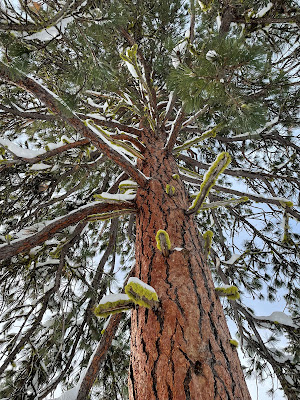
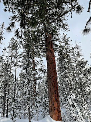
Our other stark vista is the red/orange giant of Ponderosa Pine soaring up through the snow and towering over the smaller lodge pole pine. I think I got a couple of good pictures. 


Ponderosa


Quite a few other hikers on the trail, many of these with dogs. Just about everyone is going much faster than we are. I could attribute this to my still recovering from knee surgery, but I think I will instead go with the fact that many people were wearing smaller and lighter snow shoes. More like wearing large tennis shoes. This has got to be cheating. I have to look into getting some of these things. My partner and I are wearing the $65 specials from Costco. They work fine. They get you up and down the hills and you can tromp off trail into the deep snow without sinking in over your head. But they are a lot bigger and heavier than what many of the fast movers around us are wearing. 


The weather was pretty variable for our short time on the mountain. It snowed pretty hard during the drive up, but just after we passed the sign to "Chain Up" the snow stopped and the sun came out and it was pretty nice there in the parking lot whilst we geared up.  We got a little snow before we got to the trail decision point but then the sun came back out again. Now we came to a big Ponderosa Pine with a trail map on it. We could go straight and be on the long and short loop, or go right and only be on the short loop. My partner pointed out that we had to pass this tree again to get back to the car. Nice to know. We realized we could go straight and once again avoid having to make a decision about going the short or long route. 


Back into some even more intense rock pile areas. These were a little challenging to get up and down (at least for a 65 year old with a new knee). After another quarter of a mile we came to our real decision point. Long loop was about 3 miles back to the car. Short loop was about 2 miles back to the car. We had come about half a mile and used up about 40 minutes and were already feeling the burn a bit. We decided that we needed to take the short loop to be back on time. This turned out to be a good decision.  We now hiked away from the bolder fields and through some lovely trees, crossing a Nordic trail track. We were heating up some and stopped to lose a layer. We usually carry small packs when we go snow shoeing. I liked to bring some extra layers (rain coat, fleece, dry socks, thick gloves) as well as water and some emergency gear. My usual thought is that I want to be able to spend a few hours (or a night) in the snow in case I fall and break a leg or something like that. Even if you don't want to carry the emergency gear, it is very nice to have a place to put your layers as you heat up or cool down. 


After about half an hour we got to the place where the long loop intersects with the short loop. We were a mile and a quarter from the parking lot, had been hiking for an hour, and were halfway around the loop. Wow. that is pretty slow. It turns out it is much harder to walk through snow in snow shoes than it is to just go out for a hike in the forest. We turned down the trail back toward the trailhead. We pretty much immediately hit a bit of a slug uphill and at the same time, that beautiful sun disappeared. It started snowing rather hard and the cold wind was blowing. We stopped at the top of a rise and got our outer layer rain coats back out and put them on to stop the wind and snow.  At this point I was glad that we had taken the short loop. Not only was it shorter, it was also labeled "More Difficult".  Why is that good? Because the long loop was labeled "Most Difficult" and I was having enough trouble with some of the steps up into the boulder groups on the "More Difficult" path.   I also find it amusing that the "More Difficult" route is the less difficult route.

The snow flurry did not last long. The sun came back out and we finished our hike with the sun shining. What a glorious day.