Larch mountain is the tallest prominence that is considered part of the Columbia Gorge. It is an extinct Volcano with what I am told is a pretty lava cap up at the summit. (Foreshadowing). It was originally named Larch Mountain because some people wanted to cut down all of the trees there and some of the local trees look a lot like larch (when cut up for lumber) and Larch was worth more. So, no Larch trees there. Just saying.

Today was supposed to be a warmish clear day in Portland, but as we drove up the 14 mile access road to Larch Mountain, it appeared that weather would be different up on the 4,000 foot "summit". We had total low hanging cloud cover, 45 degrees, and raining at the trailhead. There are a number of popular trails that start (or end) at this nice parking lot. The Larch Mountain trail starts at Multnomah falls and comes up through that gorge along Multnomah creek. The Oneonta trail comes up from Horsetail falls, bypasses the closed Oneonta Gorge, and then comes up Oneonta creek to Larch Mountain.
Today we are going to hike around part of the ancient caldera that was Larch Mountain Volcano once upon a time. We are going in a counter-clockwise direction so that we can do the part of the trail that is on the paved road first and not when we are tuckered out. We also had this thought that we could avoid going up the really steep parts if we went in this direction. Don't you believe it.
Accompanying Paige and I on this epic journey is our newly turned dog from puppy, Rory the Wonder Dog (And yes, I read a lot of Robert B. Parker). Rory is a very different creature from the 4 month hold pup that did this hike with Paige last October. And let me tell you, she is was in full hunt mode.

There is a sign at the beginning of the trail that says that animals going off trail would be considered as trespassing. Rory never went off the trail.
The first mile of our hike was an easy downhill walk in the light rain. Lots of gorgeous vegetation and big trees. This entire area was stripped of trees in the early 1900s. You can see the huge cut off trunks all over the place. But enough time has passed such that there are new quasi giants (still only half the size of the cut off trunks, but big trees). They were not Larch, so what were they? I thought that they were the usual Doug Fir but they had very strange pinecones. Lots of these pinecones were one the ground because of a very active Douglas Squirrel population.

Paige took a picture.
Looks to be that of the Pacific Silver Fir
 |
| Bunch Berry Berries |
The undergrowth in this area was also very fine. Along with the usual huckleberry and mahonia, there was lots of Bunch Berry that had the lovely little bunches of red berries. I really like bunchberry. The leaves look like dogwood tree leaves. In fact, the plant is a member of the dogwood family and in Alaska they just call it Dogwood. I have never seen so many of the plants that had berries. They were everywhere for a significant part of our hike. I also saw a lot of Deer Fern, which I don't think I usually see growing with bunch berry. Paige took pictures of lots of fungi which I include below.
About a mile in we came to the intersection of the Oneonta trail and the Multnomah Creek Way. Looking on the map, the Multnomah Creek way appears to be a cut across the center of the crater for the volcano. On the map it also makes it look like something of a shortcut. Don't fall for it. It may be slightly shorter than going all the way around but it has lots of bad parts of the trail that are steep and difficult for old knees to negotiate. Rory the Wonder Dog, on the other hand, was in absolute heaven. There were evidently THINGS just everywhere. She was bouncing all over the place, bounding in and out, but always returning to us when we called, just like a good dog should.


Oh, so we took the Willamette Creek Way which is a 2.3 mile cut through to the other side of the loop. Very nice terrain. Lots of big trees. No big views, however. It was pretty steep up on one side and pretty steep down on the other side, and the trail was wide enough that it could easily have been a logging access road at one time. There was one part where it cut through the rim (of the caldera?) so it was a sort of man made ravine for a hundred feet or so.

At the bottom of the descent there is a large open area. I believe this used to be a large meadow but now appears to be filled with young Alder. The Wiki article I read says there is a big meadow here someplace that was carved by glaciers in the last ice age and was a lake for a long time before becoming a meadow. I wonder if that is the same area. We stopped in the big trees next to the Alder growth and sat on a big log and had lunch. We were very tired at this point and happy to have a good rest before we started around the other side and so back up that mountain.


We crossed Multnomah creek and then just went up, up, and fraking up, I really prefer to do the UP the first part and the Down the second part, but there is no way to do that on this hike as you start at the top and have to down first no matter which way around the loop you go. But we haven't been doing much hiking lately and this was hard. Even Rory was getting tired. Of course, Paige and I had hiked around 5 miles and Rory must have run 20.

In the last mile or so, the terrain and vegetation change. There is no undergrowth, just the tall trees. I have seen this sort of thing in other places and not sure exactly what it indicates. Is this an area that had a recent fire or a recent clear cut? Or is it just a botany thing?
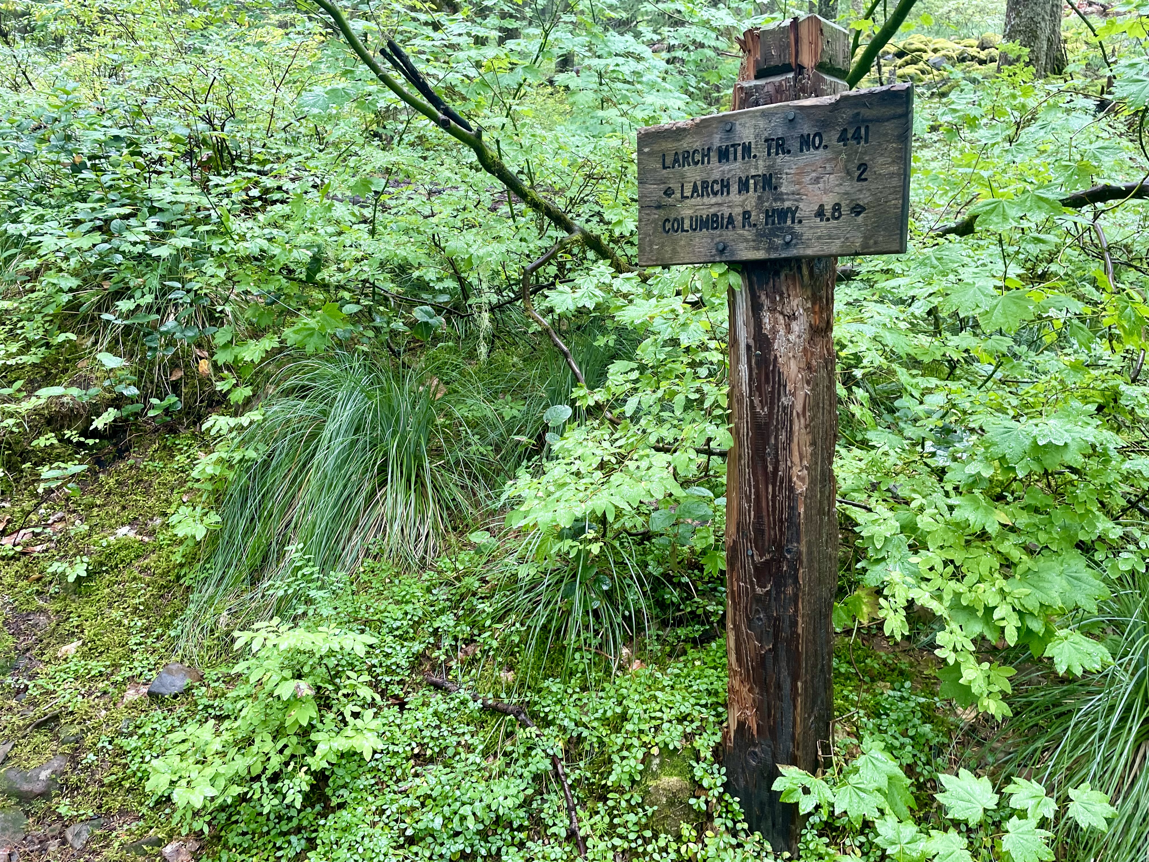 |
| Turn right here for Multnomah Falls Parking |
We just about crawled back to our car after going nearly 7 miles. But our tracker says that our moving speed was around 2 miles per hour (average) with almost 2 hours of rest. That was a long hike. Remind me to read this post before I do this again.
On the drive home I saw a animal cross the road a few hundred years ahead of us. I thought it was a deer. When we got closer it crossed back. It was a big Cat with a short tail. Either a Bobcat or a Lynx !!
As I type this, the day after the hike, Rory is asleep on her bed and still tuckered out.