Glaciers –
 |
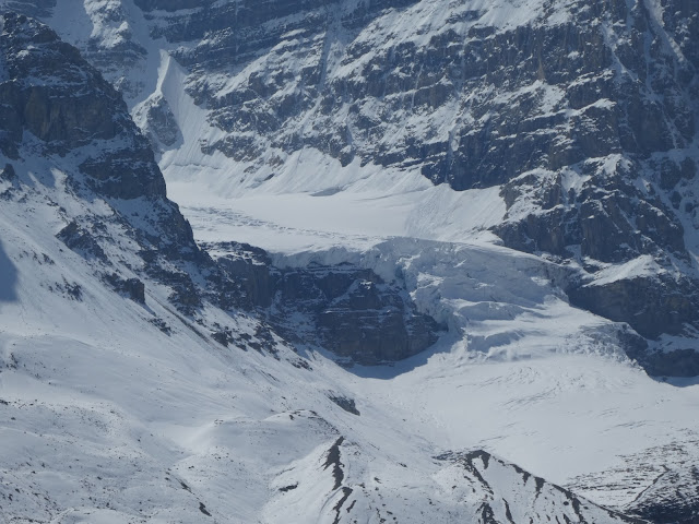
| Intersecting Glaciers created the overlapping Moraines seen here Behind them is a nice triangle of forest. |
 |
| Deep Canyon Dug Under glacier by Melt |
Lastly is the lakes. As the glaciers advance and retreat they leave nicely rounded holes in the stone that make lovely little (or large) shallow water lakes, blue-green with glacial silt and sparkling in the summer sun. In some places, the glacier was kind enough to leave a terminal moraine at the foot of the depression creating a lovely little natural dam to make the lake even larger and deeper. Check out this satellite image of the lake at Wallawa in Oregon.
 |
| The Glacier is South up the Mountains. The Dam Moraine is at the Top |
Driving South down the Icefields Parkway.
Heading south from our campground we are driving on highway 93A, which runs parallel to the main drag, 93, which is east on the other side of the Athabasca river. We can’t see it. We are on the very edge of the large flat plane that was made by the gigantic ice age glacier of Athabasca as it smashed the local terrain flat up to the encroaching mountain sides. We drive down past a number of little round mountain lakes, some that are advertising boat (canoe) launches. These are the same shallow water glacial lakes that like those we hiked on the trail of 5 lakes. In the early morning, there is no wind and they make wonderful mirrors for the backdrop of snow covered Canadian rockies.
After a bit we come to the Athabasca river, turn a corner and immediately go over a bridge that is much to small to actually cross that big river. What happened? We just went over the gorge that contains Athabasca falls. This is a gorge created in a similar fashion as the Maligne gorge when the melting glacier forced the river that was forming under it to find its way through the harder rock of this small area. The result is a set of wonderful water channels (current used and long ago abandoned) with Athabasca falls at the head of the canyon.

By the way, this isn’t one of those rivers that you go through in a raft or otherwise. A sign at the top says that people die quite often by going for a picture and slipping on the glacier polished stone and going into the cataracts. It recommends not doing that.
Now we continue South again, joining up with the main highway 93 which is the Icefields parkway.
What are Icefields? They are sort of the birthplace of glaciers. Up behind and between the tallest mountains in the area are high and huge depressions with no river escapes. They fill up with snow and ice until the compressed masses coming spilling slowly over the mountain sides as a glacier. There isn’t any place you can go (by car) to get a good view of the icefields, but you can see a number of the glaciers that spill down from the Columbia Icefield, that is right here above the Athabasca Glacier.
As we get closer to the Athabasca Glacier, we are effectively getting to newer and newer remains of the retreating ice. The surrounding landscape has had fewer years (or centuries) to recover and there are vast areas where there are flat fields strewn with different sizes of rock and silt mud and very few trees or plants that need good earth to grow in. We come over a rise and we get to the Columbia Icefield Lodge, which is a hotel, park visitor center, and Disneyland ride start. The Disneyland thing is only partially a joke. At this center you can buy tickets for this glacier tour experience. You get on a tour bus that takes you about 5 minutes up this private road to a place on top of the lateral moraine of Athabasca Glacier. There you transfer into a special ice crawling bus that takes you out onto the rapidly receding glacier. Not sure if you get to walk on the ice or not. After that, you reboard the tour bus and it takes you down the Icefields parkway about 20 minutes, driving through that flat field of post glacier debris. It ends up at a special viewing platform that only the tour busses are allowed to stop at. In fact, this viewing platform is a big semi-circular walkway that goes out over a canyon in a place where the highway is hugging the shear cliff wall. There you walk out over the glass walkway and view the canyon. Such excitement.
The morning that we stopped at the lodge, we got there too early and everything was still closed. Oh well.
 |
| Glacier Smoothed |
 |
| Toe of Athabasca Glacier. |
 |
| Ice Busses on Glacier |
However, we did drive out to the Toe of the Glacier trail. There you park and walk a quarter mile across glacier smoothed basalt to get to the Toe (foot?) of the glacier. Actually, they don't let you get all that close to it these days. The very base is on the other side of the rise. I am sure the Toe was right here on the other side of the rope barrier when they put up the barrier 10 years ago. Time to put up another "The Glacier was here in 2020" sign and advance the trail.
Maligne Canyon
This is a Glacier carved valley and canyon that is East of the town of Jasper and another sort of Disneyland attraction. You drive down a small road for a couple of miles, thinking you are the only cars on the road, then you cross a little bridge over the Maligne river and make a turn and you are at a 5 star restaurants sitting in front of a huge (and essentially filled) parking lot. Yeah!!
 |
| Note lock on outside |
The Canyon walk had a lot of people on it and we were planning on doing a big (6 mile) loop so we decided to do the ridge part of the hike first and save the canyon views for the return trip. In retrospect, not sure this was the right thing. We were a little tired coming back and that makes it harder to spend the time and energy to seek out all of the little hidden best views when you get to the main attraction.
It was a lovely day for the most part. We were hiking in lodgepole pine and spring was trying to re-assert itself (a few weeks late) by putting blossoms on some wildflowers for us. There are 6 bridges that you want to see and they are named Bridge 1 through Bridge 6. Sort of like the Trail of 5 lakes. Why aren't these bridge named after old dead white guys? Very confusing.
Our hike dumped us back on the river right at the end of the canyon (bridge 5, I believe) and then we continued on another mile along flat river terrain (almost swamp in some places) to bridge 6, where we stopped and sat by the quickly running river to eat our lunch. In the North West, out over the mountains above Jasper, we could see dark clouds and hear the occasional thunder, but we never got any rain. Unlike most of the tourists out for the day, we did have rain gear.
After lunch we hiked back up to bridge 5 and then started our journey up the canyon. I think gorge would be a better word. This thing is the deepest canyon in ... canada? The Canadian Rockies? It was dug by the melt water stream that was running underneath the retreating glacier. You know how most modern glaciers have these ice caves under them that you can go into that are dug by the melt water in the summer and you only go into them in like winter? Well, this is the same thing except the river dug down into the rock. And it dug down hundreds of feet deep and only 30 or 50 feet wide (in some places).
In addition to the river flowing down the middle, the hillside to the south west is full of still covered canyons (caves?) that flow down from a seasonal lake up the mountain and become springs dumping water into the canyon all along the way. Some are just seeps of water from the hillside and others are big flows coming out of holes in the rock. There is one large beautiful Cascade falls. It looks like something designed to be on the inside of some huge luxury hotel.
And this is all Melt water. In the winter, the flow goes down so much that you can take tours to hike the canyon floor and explore up into some of the side channel caves. That sounds like a fun thing to do. I wonder how you get out to the area, are the roads plowed or is it a big adventure just to get here?
It is hard to take pictures of a deep canyon. The lighting is not good for that sort of thing but I have put some pictures here. Let me say that the trip out is really worth it and this is a singular place on the planet. You just have to ignore the hundreds of people trying to have the same experience that you are. Damn them.


One last added treat. When we got back to the parking lot we found an Elk grazing in the median. Lots of people gathering (too close) for pictures, but the Elk didn't seem to care and she went on grazing happily in the wonderful grass.
We finished our vacation by driving South down all the way down the Icefield Parkway through the park of Banf. Lots more mountains and waterfalls and glaciers to see. A beautiful drive. There were some very nice wildlife overpasses built. These are highway overpasses except done for Deer and Elk and other animals to safely crossover. We crossed into US at the Idaho border in a secluded little area going down to Cour dulaine. There was no line.
 |
| wildlife overpass |
 |
| my cool new ride |


No comments:
Post a Comment