On the Kenai Peninsula, the thing that dominates the (hidden) landscape and feeds all of the large glaciers is the Harding Icefield. This is a thousands of feet pile of snow that is on top off and behind a big circle of mountains. This is a wet area and a lot of snow falls up there during the winter. The snow gets very very deep and eventually the pressure of the snow crushes the lower levels into dense crystal ice. This ice, under pressure and with time, begins to flow down hill very very slowly. It creates a huge river of ice that moves perhaps inches a day but still forms a well defined and visible flow that cascades down from the mountains into the fjords and is what we then call a glacier.
Today we are going to climb partway up a trail that lies on the side of Exit Glacier, which is a popular hike in the Kenai Peninsula national park. There is a visitor center at the trailhead and as you drive the access road there you begin to see little marker signs with years on them that represent where the glacier was at a certain time. They begin around 1870 several miles from the visitor center. When you get to the visitor center you are around 1940. You come to the conclusion that the glacier is retreating very quickly and has been doing so since the very start of the industrial age. To me this implies that the initial retreat of the glaciers was more a part of the end of the last little ice age than global warming brought on by man. Of course, in recent times, this retreat has greatly accelerated and now the difference of 10 years is huge. It is sort of sad to see these huge beauties die this thawing death. Perhaps they are somewhat cyclic and if we humans can get our act together we will see them return. Well, Not anyone alive today, but perhaps some human.
As you go up the hike, your are very close to the side of the glacier, though you can’t see it for the trees. These trees were not here 100 years ago because the entire area was under a hundred feet of ice. You can see the effects of the ice in the stone you scramble over as your wind you way up the steep hill. In many places the large bolders under your feet are etched flat and smooth by the sliding ice.
 |
| Hikers out on the glacier |
The trail is a bit difficult in places, much of the trails seems to be built an old watercourse that probably came down under the glacier. Lots of broken rocks and haphazard but natural steps going up the cliff side.
About halfway up the trail we come to a viewpoint called Marmot Meadows. We stopped there (along with many others) to enjoy the view of the glacier, eat our lunch, and to decide if we could do the next bit of the hike that featured a even steeper cliff climb. We decided that we didn’t have it in us this time and turned around and started by down the trail.
There had been reports of a she-bear and her cubs on the nearby hillside but we did not see any sign of them. We did have bear bells and bear spray in our party, however, and were rather stringent about making sure people hiked close to a person with deterrent. Many other hikers were carrying automatic pistols. Very strange to see a Colt 45 or a Glock strapped to someones chest as they hiked with their family. Though I have heard it said that you can’t stop a grizzly with a pistol, I am thinking that they sure make a lot of noise and perhaps just shooting it in the air would scare away most critters in most situations.
Still…. It is a little strange to be walking a trail with young men that are carrying pistols at the ready.
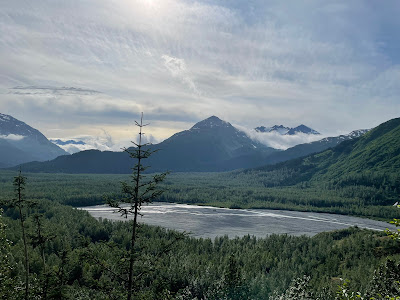
On the way back to town we stopped for a view of glacier from across the valley.


No comments:
Post a Comment