 |
| Hundred Year Old Log Jam |
January can be a great time to get away to Central Oregon. So quiet. So uncrowded. Well, perhaps being in the middle of a Covid Pandemic has something to do with it. And when do you know that you are NOT in the middle of the Pandemic? Seems like All of America has been thinking "Well, we must be halfway through this piece of shit" since last May.
But I digress.
We are staying in a cute little condo up on the ridge of the Deschutes River canyon, just south of the Old Mill area. We had a lovely sunrise over the ridge with blue sky and sun glinting off of the snow on the local roofs and landscape. Very cold. sub 10 degrees (F) when we got up and were having our coffee. We almost decided to just stay in and do crafts all day, but that sunshine was pretty inviting. So we put on our long underwear, jumped into our Subaru Forester and headed south on highway 97 toward Lava Lands, in the Newberry National Volcanic Monument.
We had hoped to drive up Lava Butte to get a view of the surrounding territory, but the visitor center and road up the butte were closed (for the season). So we just pushed onto our main objective which was to drive down the little road to the river where the hiking trail along the Deschutes River begins. There was about 5 inches of snow on the road and it had not been plowed, so we took it slow and stayed in the ruts in the center of the road. To either side were lodge pines and lava rocks and snow.
This is a geologically fascinating area. Around 7000 years ago, a rupture of lava (from nearby Newbury Volcano) exploded out of the ground forming Lava Butte. The lava flowed down hill in a tall wall (very visible today) until it interested with and changed the course of the Deschutes river. The river created a number of lakes in the area for a few hundred years and then formed a new course around the lava as what we see today.
 |
| At the Trailhead |
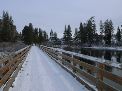
We parked at the Benham Falls Trailhead which is right on the river. During non-snow times (like, oh, summer) this is a boat launch and raft/tube take out area. It is a popular thing to launch a float at Sunriver (just upstream) and then float down to this location and take out. This time of year, you really can't float any further as there is a big manmade (and nature enhanced) log jam a hundred yards downstream. During the summer at high water, you might be able to float over the log jam, but if you do, you will probably die, because just around the corner (the corner cause by the huge Lava Wall) is the start of the rapids that turn into Benham Falls.
The reason that log jam was created was to protect the little bridge that was across the river. The bridge that was used to bring timber to the lumber mill that was sitting right near where the parking lot is now. As you cross the bridge and hike along the trail beside the river, you initially get a great view of the suspiciously slowly flowing river and the 30 foot high cliffs of lava just on the other side. Note that these lava cliffs were not carved by the river. This is just where the lava decided to stop flowing one day 8,000 years ago.
 |
| Note the Lava Flow just behind the trees |
 |
| Ponderosa Pine |
 |
| Once a train track? |
It was especially stunning views today, with the snow and sunshine. Ice on the river, snow on the lava rocks on the far side.
The sign at the parking lot says it is a half mile to Benham Falls, but we clocked it as a mile (never argue with fitbit). As you start to get near the falls, you can certainly hear them. I recall seeing signs out on the river something to the effect of "Get Off The River Now. Falls Ahead are not Survivable"

 |
| Benham Falls Scenic Overlook and Wedding Chapel |
Walking along the trail it is pretty obvious that this was once a Railway. It is flat and wide and built up from the surrounding terrain, probably with stone cut out of the hill from the area ahead near the falls where you suddenly have walls on both sides of you.
Once you get to the falls area you come on another parking lot and trailhead. You come at these roads from the other side of Bend on the road going up to Mount Batchelor. They are not plowed and are not very accessible during the winter. So, no cars there. There is a vault toilet and a signpost map. Follow the signs and the railed trail down to a perfect overlook of Benham Falls. Enjoy they view. My partner and I really like this place, though I admit we have a bit of a selfish reason for the enjoyment. See around seven years ago (during the summer) we got married here.
I realized this today, many people get married in a church or other building. You back to that site in a couple of thousand years and you probably won't find so much as a familiar window, but my partner and I can go back to this spot and still find the falls falling and the river shining.
 |
| I love the red of the Ponderosa against the White of snow |
 |
| The long straight road |


No comments:
Post a Comment