Monday, November 16, 2015

Willamette River Run: Wallace Marine Park to Wheatland Ferry

Willamette River Run: Wallace Marine Park to Wheatland Ferry


Had a chance to hook up with some other Kayakers and do a quick one way shuttle down a new section of the Willamette a couple of weekends ago. The Sun is still shining this freakishly long and warm summer and my partner and I decided to do yet one more Agate hunt down our favorite rock hunting river.


We met the other Kayak Portland Meetup members at Wallace Marine park in Salem. This is a big softball complex with a river running through it. I think a public park like this, something that doesn’t have to have very many permanent, expensive structures, is a great thing to put into a flood plane. Every 30 years or so everything gets swept away, but that is OK. You can build a new set of softball fields, and those bleachers needed replacing anyway. Much better than having a bunch of expensive houses that tax payers now get to pay the replacement costs on because of national flood insurance.

photo by my partner (and editor)

The launch at the river is a nice rock bar right above an old railroad bridge. I thought that the bridge was still in service, but then I saw a number of people walking or riding bikes across it, so it must be a rails to trails success story. Turns out this is the Union Street Rail Road bridge and it links together trail systems on either side of the river.

Our Kayak Portland Meetup is doing this excursion as a shuttle. So the first order of business is to get some of the vehicles prepositioned down at the take out at the Wheatland Ferry. Turns out there is a nice road on the West side of the river that runs pretty much straight from Wallace Park to the ferry landing. On the way out I noticed a number of signs advertising other river parks and boat ramps. We put our cars in the big gravel bed on the west side of the river and did the 15 minute commute back up to the boats. It was pretty fast and efficient. 

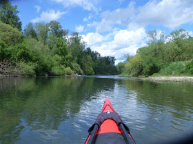
We did this trip in early October. There has been no significant rain all Summer so the river is very low. The sun was out and the air and water temperatures were such that we didn’t need to bother with emersion safety gear. Won’t be very many more of those days this fall. Rain and cold must be coming as this is the Pacific Northwest no matter the awesome summer we just had.

Or maybe 74
We are starting at River Mile 84. One of the curious things about the Willamette river is the work that has been done to make it into a real trail. Or perhaps a long linear park. There are signs facing the water that announce many of the miles (big signs that say “84” for instance) and also many of the parks and such that are boat access friendly. There are “islands” and such along the river that don’t appear to belong to anyone and are available for camping during some parts of the year. During other parts of the year, they are underwater, which is probably why they appear to not belong to anyone. We passed one of these islands during our first half hour down the river. This time of year, the islands are pretty overgrown with small plants and brush. If you get out in the spring, just after the yearly flooding recedes, you will see all empty stretches of scored sand and stone.  On the river trail maps, these islands are often listed as DSL islands. DSL is Department of State Lands. That makes sense to me.


We were seeing a lot of wildlife on this trip. We started off with water fowl. Mallard, Merganser, Heron, King Fisher, a Red Tail Hawk. A bit further down we saw a few deer and a curious little pack of wildly divergent goats. The goats must have been someone's pets (or livestock) but they were foraging down by the river bank. I called them divergent because they all looked so different from each other. A pack of mongrel goats.


The river has a very straight run for a couple of miles here and then runs into Keizer and hits the Keizer rapids. This time of year it is more like the “Keizer slightly less slow section” rather than rapids, but I get the feeling that when the river is up, this little S turn in the river is much more impressive. Even as it was, it was good to pay attention to the sea monsters and such and keep an eye on each other through the faster moving water. I am not too concerned about the fast moving water, but I am concerned with running into a much slower moving submerged tree branch should I accidentally go swimming. So, all in all, staying in the boat is a good idea.


Just before the rapids, however, on the west bend, is a little rock bar that one of our meet up members said was a great place to look for Agates. The sun was not perfect for this (a little behind some trees) but we spent half an hour looking through rocks there and I think everyone found at least one good size Agate (I found 2 plum sized ones).


After the rapids is a set of flat stone areas. I guess an old basalt flow now carved through by the river. More and More gravel beds also. We did not stop at the big gravel bed that is right below the rapids. This is part of the Keizer park and since there is ample access from easy parking, the beds are picked over by land based searchers early in the rock hunting season.

Beaver Slide


As we get further out from the city the wildlife has changed. We are now seeing signs of beaver. What are beaver sign? Well, fallen trees is one big sign. Those guys take down pretty big trees. 5 to 10 inches in diameter. A couple of these trees were fallen over the water and the bases were clearly beaver chewed. Then there are also the slides. I have never seen such well defined, and apparently constructed, beaver slides before. I wish I had scored pictures of the best one, but I don’t think I did. It was around 30 feet long and it came straight down the bank into the water. It looked like a mud slough, about a foot wide with very well defined, almost rolled, edges. Perhaps it was built just by repeated use, but it looked like it may be have been pushed around and slapped into shape some. My understanding is that the beaver use the slides for emergency egress from the shore. 

When we got down to Willamette Mission Park, just before our Wheatland ferry terminus, my partner and I left the company of the Meetup so we could spend some more time rock hunting. There was one big rock bed at River Mile 74 that is only exposed at low water. These sorts of places are nice to go to by boat since few other people get to stop there, but they are also a often covered with river scum and white mineral deposits (calcium?) which make it hard to find good rocks.


At Mission Park there are also more of the river facing road signs. One is a Mile Marker and another is a sign marking Mission park and stating that there is camping and picnicking. That later sign I only know about because I saw it from the shore once whilst exploring the park with my son. It must have been visible from the river at one time, and maybe it still is during the winter, but during the summer you can’t see it because of the undergrowth that has sprung up.


Here are some pictures of a good rock bar that is right across the river from Mission Park. My partner suggested I take a picture of the scum on the water at the landing because it wasn't just scum, it was thousands of pretty floating tiny flowers.


Beautiful flowered Pond Scum

We searched for rocks some and then floated on down to our car on the bar by the Wheatland Ferry. While we were loading up the car, a motorcycle club came through and road the ferry. Sort of interesting to see 20 or 30 motorcycles driving onto the ferry at one time.


Motor Cycle Club on Ferry
The ferry landing is another rock bar. This is where we had parked our car after the shuttle down and all we had to do was back it down to the water and load up our boats and head home. We should have taken the Ferry back across, it would have been the better way to go. Instead we drove out the river road on the West side of the Willamette picked up 99W and took that into town. But 99W backs up if someone sneezes so we would have been better off taking the ferry and going back out to I-5 north.

Here is how I would do a "smart shuttle" if I was doing this trip with people from Portland (or just my Partner). We would put the boats and gear in my car. Drive my car and her car to the ferry, cross the river and drop off her car. Then drive up the West side of the river to Wallace Marine park, unload, and paddle down the river. We get to her car, load it up and catch the ferry back and go to I5 and so home.

Wait..... did I just leave my car in Salem?

I hate it when I do that.


Tuesday, October 27, 2015

Agate Hunting: Candiani Bar

Candiani Bar


My Kayak Partner and I have been exploring new places on the Willamette River to go rock hounding. (well, Agate hunting). Earlier in the summer she found a place that is about a mile up river from a cute little local boat ramp called San Salvador county park. It is a dirt road affair down at the end of everything in the town of St. Paul, Oregon (Home of the St. Paul Fourth of July Rodeo!!). There isn't much room or much parking at the ramp but that is usually OK because there are rarely many people there. And even on a crowded day, you can park on the side of the road for a few hundred yards at the entry. The main problem with the place is litter and trash (or, as the old gentleman we met there last time informed us, Vandalism). I don't understand why people would go out to a nice place in the country for a picnic (or a 12 pack of beer) and have a great time but leave all of their trash just sitting there on the ground. Don't they think they may want to return some day? Do they just go and trash a different place each time assuming that they will never run out of places? Do they assume that no one else acts as they do or that everyone else acts as they do?

Spring 2015

San Salvador County Park Boat Ramp, Spring 2015

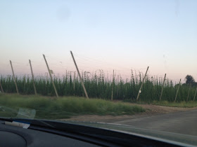
St Paul is also, seemingly, the home of the heart of many a brewer because the country road leading up to the park is surrounded by hops fields. Hops is a mighty interesting plant. It grows fast and wild on vines, sort of like green beans. The farmers have set up acre upon acre of wire hangers some 20 feet in the air. A beam every 30 feet or so holding up the wires and around the edges of the fields are stays into anchors holding the hole thing up. Then every 10 feet or so a string hangs down to a nacent hops plant. As the summer grows, the hops goes climbing up those strings until by mid summer the entire field is 20 feet high in vines. Then when they flower, along come these upright harvesters that cut the strings and bring the entire vines, still stretched out, into the local processing plant. Not sure what happens then but my understanding is that many a local IPA is counting on getting those hops flowers before they are more than a day or so old.

Hops


But today we are not drinking beer or even seeing the plants. Harvest is long done and we are trying to sneak one more day of sunshine out of our beautiful summer/fall. One more day. We hit the ramp around 1:00 and started our paddle at 1:23. I remember because we noted the time so we could try and figure out how fast the current was running. The current does run here. At low water, it is not so hard to paddle up, but on our first attempt, back in the spring, the water was moving so fast that paddling as hard as we could we could not make forward progress in some places. We had to ferry across the river and see if we could find slower water on the other side. If we had to, we could have gotten out and walked the shore in some places, but not all. In some places there was just steep bank on the side and fast moving water. As the river rises, I am sure that there will be more fast water and less places to walk. Of course, it is that high, fast water that turns the stones and brings in the new rocks and lets rock hunters find great agates year after year. Decade after Decade.


Remember that old gentleman back at the Boat Ramp? He was a bit of a talker. A very friendly, pleasant sort of talker. When we first arrived he looked our boats and said, “Oh, I don't think you want to be going out on the river today. The water is very wet today.” It took me a moment to realize he was having me on. I like that.


Later he came down to where we were loading our kayaks. “you know,” he said, staring out over the river, “My ancestors used to own this land here. They were farmers and this here was a steam boat landing and they would ship their produce into the city from here. When the steamboats stopped, they donated the land to the county. Used to be real pretty. Back then the river was deep and narrow, not shallow and wide like it is now. Used to be dredged for the river boats. But the ecologists complained that the dredging was killing the carp or some other trash fish and they had to stop it.” I suspect that they stopped dredging because of the interstates taking away the commerce, but I shouldn't interrupt. We told him that we were going rock hunting. “I used to go rock hunting every spring right after the river came down off the bars. There is a rock bar about a mile up river from here, on this side, that I used to love to go to. You could get there by road and I would hunt agates and such. One time I found this big rock, perhaps the size of a grapefruit. I didn't know what it was but I took it to the scientists at OMSI and they told me it was a mastodon tooth. One of the nicest ones they had ever seen from this area. And you know, you find these rocks or fossils out there, and you don't know where they came from. They may have been tumbling down the river for hundreds of miles and thousands of years, or perhaps they just got dug out from some bank last weekend. You just don't know”.


No, you don't know. But we were going to be on our way up the river to find his rock hunting place. We have gone to this gravel bar a few times this summer, but this time I wanted to do a little more exploring on the interior and see what was there. We paddled up the left bank (our left) until the current got a little strong, then we ferried over to the right bank where the water was shallow up on a (less than prime) gravel bar. Do you know what ferrying is? This is where you point your boat mainly up current, but a little cross and then paddle hard in that direction trying to cross the river without going shooting down current. It is a little deceptive but once you get the feel for it, it's not a hard manuveer. Usually we make this crossing, then paddle until the current gets too strong again and then try to shoot across and redevous with the top of the Cadiani Bar. Lots of current right out there at the tip. The water is around 4 foot deep and moving fast. Fast, like 3-4 mph. Which is about as fast as you can paddle a kayak for any sustained effort. Today, however, we stayed on the right bank for awhile. We had to paddle pretty hard against the current, but when we got tired, we just got out and rock hunted a little. When we finally crossed, we were already a couple hundred feet up the Candiani bar and the crossing was very easy. Seems like the secret is to cross where the river is more narrow, though that seems counter intuitive to me. Perhaps something else was going on there. But cross we did, and then we paddled along the bar until we can to end of the first gravel bar.


The secret to agate hunting is sun light. If the sun is out, and bright, and at an angle to the earth, then you can see the agates glowing on the ground. During the summer, this means later in the day or early in the morning. But by this time of the year, the sun is far enough down in the south all day that we had good hunting light even at 2:00. We beached our boats, ate some lunch, grabbed our rock sacks, and hunted our way back into the island. That is what Candiani bar really is most of the year. An island in the Willamette river. When the river is high, every place we are searching is underwater. Right now, it is 4-8 feet above the river. Think about that for a moment. Not sure I would like to be on a kayak on the river when it is 8 feet higher and running through these low trees.


But today, the river is peaceful and so is the rest of the world. Well, it was until this plane came and landed on our beach. In fact, 2 planes. The one was some sort of light single passenger job with the engine over the pilot and a combination push and pull set of propellors. Big balloon wheels. He came down, landed. Turned around the other way, gunned his engine, and was back in the air in like 50 feet of run. Pretty cool. He and his friend (in a more conventional looking little plane) just flew around our area for half an hour making occasional set downs on whatever little piece of beach they could find. My partner and I like to hunt for rocks in their tire tracks as they turn up the rocks and expose the agates.


To get off the beach, you have to find an opening through the little brush that grows on the embankment that leads up to other rock beds on the interior of the island. If you look from the air (or from google maps) you can see how the river must flow over the island in different channels as the water rises each winter. We had previously only hunted the outermost bank, which turns out to be made up of smaller stones, but once we got up the embankment and into the interior, we came across a wide expanse of much larger stone. All of it river rounded over thousands of years. And Agates Everywhere.


We were hunting and hunting. Filling our sacks. Enjoying the solitude once the planes had flown away. No one else around, maybe a fisherman up around the bend. Down in that river flood plane you can sort of think that you are out alone in the wilderness, but if you zoom out a little on google maps, you will see that right over the trees on either side of the river, there is farm land marching right up to the river's edge. Farms and fields everywhere. We can see one big house about a half mile away up on the bluff at the turn in the river. But right now we were all alone.

During our first trip out, in the spring.

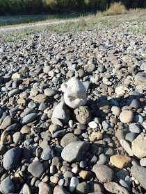
And that is when we started to see the little signs of others. Now, you may think I am talking about the bottles of beer and other trash at some idiot's picnic spot, but I am not. I am talking about a more subtle and artistic leaving. As you walk across the stones, you come to a collection of rocks that just can't quite be natural. You do a double take. Is that how the river left those rounds stones? No. Could be. Someone did that. Someone stacked those stones just so for someone else to find. For me to find. I took some pictures. Then I walk some more, head down looking for agates, and I run smack into this little log. And I laughed out loud. Lined up on the log is a fine little collection of red and orange agates and a very pretty little striped stone. I went and got my partner and showed her. “Should we take the stones?” I asked. “No,” she said, “We didn't find them”. I agreed. In fact, I later added a few of my own findings to the collection on the log.


On the ride home my partner said that the stones had been left by people who already had their fill of collecting and now were just enjoying the searching.

And that is most of it. The searching. The pattern recognition. The admiring of your friend's finds. Maybe one day when I am as old as that old gentleman we met at the launch, that is what I will do with my rocks. The rocks you find are thousands of years old. In the grand scheme of things you can't keep them long anyway. 50 minutes or 50 years, all the same to the rocks.

And Always stop to Admire the Sunset


Friday, October 2, 2015

Oregon Coast Adventures Newport: Beaver Creek by land and by sea.

Oregon Coast Adventures Newport: Beaver Creek by land and by sea.


The Oregon coast is home to a wide variety of parks, camp grounds, lighthouses, waysides, and natural Wonders. As you drive up along the coast you will hit one every 20 minutes or so and I am coming to believe that ALL of them are worth stopping at and spending the day. For one part of this particular trip to the coast my partner and I had managed to reserve a Yurt in South Beach State Park (Just South of Newport near the Oregon Aquarium) and since we had brought our kayaks, we were looking for a good place to splash in and Explore.


Have you ever stayed in a Yurt? Oregon has them in many of the state parks. They are circular one room buildings about 20 feet in diameter. The walls and ceiling are wood beams and lattice with a canvas cover. Inside is wood platform flooring with a fixed position full size bunk bed, a couch (that folds into a bed) and a card table with 2 chairs. There are internal lights and a little electric heater. Cozy. No pets or cooking in the yurt. Outside is a small rain shelter and a picnic table. The picnic table is almost never under the rain shelter, which makes little sense on the Oregon Coast. Anyway, these things are great little “almost camping” structures. In the very center, on the top, covering the 3 foot hole where, if we were Siberian Steppe dwellers, the smoke from our central fire would escape, we now have a clear plexiglass mini dome. You can raise and lower one side of the dome a little to vent the Yurt. You could sleep 4 or 5 friendly adults pretty easily in a yurt. As long as they didn’t snore.  Might have some problem with who has to sleep in the standard twin bunk over the full bed. Last time I drew that straw I just pulled the mattress off the bed and slept in the corner on the floor.  Wait, there aren’t any corners in a Yurt. That must have been in a cabin someplace. Ok, not sure that will work here.

This guy and 2 of his sibs came to visit our Yurt.
I had to borrow a couple of Yurt pictures for you.
lots of room inside !!
Anyway, we had asked the Ranger where we should go to use our kayaks and he said that his favorite place was Beaver Creek. Easy put in at the boat ramp and a few miles of paddling with ample wildlife to visit. He even had a brochure. Turns out the area is named “Brian Booth State Park”. It is just called Beaver Creek. Brian either had money or was a politician. Place your bets while I consult the spirit guides: Well, shut my mouth. Brian turns out to be a cool guy that made a lot of money, helped found the Oregon Coast Trust (for establishing state parks with Lottery money) and then settled on the coast in the town of Neskowin. There is this one too. It made me cry (seriously). 
So, when the state bought the property to set up parks like this, they just naturally named them after people like Brian. I think Stub Stewart Park is another such recent acquisition and naming.


So, after a lazy morning in the Yurt (I made Eggs and Coffee) we took the 10 minute drive down the coast to mile marker 179 and found the very sudden occurrence of Ona beach (on the right) and Beaver Creek (road) (on the left). You may note that the brochure doesn’t really tell you where the boat ramp is. It just says “on North Beaver Creek Road”. It seems to indicate that the landing may be close to the visitor center. This is not the case. The ramp is RIGHT THERE as soon as you get off of 101. So go ahead and park and launch your kayaks. We did.

The boat ramp is only a couple of hundred yards from the ocean (and right next to the 101 bridge) and the creek at this point has more the look and feel of a tidal estuary. But it doesn’t really seem to be all that tidal. The first thing we did was to head toward the ocean to see what was there. Could we paddle out to the waves? At least this time of year the answer is No. Not only can you not paddle to the waves, the river doesn’t even make it to the waves. It just sort of slowly sinks into the sand as you round the corner to the beach. Strange. I get the sense that the beach is acting like a bit of a dam and that action is blocking up the river and creating the flooded low lands that is the Beaver Creek area. Now, it is listed as an estuary, and it certainly looks like an Estuary, but it can’t be tidal. Not at this point. Perhaps during an big storm the surge would come into the area. but I thought that all estuaries had to be actually tidal. The brochure also says that you will find Coho and Winter Stealhead. I think both of those fish need access to the ocean at some part of their life cycle. Perhaps during the winter there is enough water that it clears the sand at the coast and makes an actual tidal estuary out of the creek.

Down near the beach. from the Bridge on our walk.

Paddling back away from the end of the creek (which really stinks, by the way. Too many birds, not enough water flow) we headed back into the estuary and away from the highway traffic noise. Right away we ran into a couple of Great Blue Heron. They squawked at us and did their pterodactyl imitations, but then they posed, real pretty like. My partner got a great picture of one in a pine tree (never seen one in a pine tree before). This first few hundred yards of the creek has a little marsh grass but really doesn’t look like there is much room for water level change. Seems like the water level must be pretty constant. Perhaps when there is more water it all just flows right out of this natural basin. I will try to find out.  Ok. So a study was done. Saltwater only gets into the creek basin during a storm surge which happened 13 times during the year of the study. Not exactly coastal, but apparently enough for US government to call the area an Estuary.


The creek is curving around quite a bit now, sort of working it’s way along the rocky upland area that is on both sides of the creek blocking the direct path to the ocean. A bunch of logs litter this area and make for some nice habitat and interesting kayak paddling.  Here is also where we found Bob, the Cormorant.  The water way stays wide for a mile or so. We ran into a flock of mallards (Either all females or perhaps still immature). I thought we might see some more exotic water fowl, but no such luck. My partner thinks she saw a beaver, though it may have been that other thing that we do not name. Lots of cat tails and marsh grass. After a bit of paddling we passed under the South Beaver Creek Road Bridge and this is where North and South Beaver creeks meet. We went north. Here the waterway quickly narrows to about half the width (which makes sense since we lost half of the creek) and the Uplands part of the State Park comes down to meet the Creek part and they sort of follow each other along. We eventually came to the foot bridge that crosses the creak to a view point on the state park trail system. We will travel there a little later. Right now, we have found that we have pretty much reached the end of our paddle. We could still go further, but we have seen a few signs that say private property and the stream continues to narrow and it will soon be hard to turn around. Besides, at this point things are getting boring since all we can see is mud and reeds on both sides.


Some sort of Cormorant (Bob)


My partner got some great shots


Getting close to nature. I wanted a picture of that dead stick.

We started back and I almost immediately saw a little guy over in the reeds on one side. He was small and long and furry…. hey…. I think he is a river otter. That was cool. We turn the corner (just after the footbridge) and there are 3 of the little guys in the river. They squeaked at us (didn’t those humans just pass here?) and swam over to a little place on the bank where they got up and humped into the darkness. We coasted by and hung out for a while and hoped they would come back out and play. We could see them moving back in the underbrush and saw a curious head and heard some squeaks, but they didn’t come back out. So we continued on back. It was starting to get late and we were still 40 minutes from the car. And, when we turned one of the corners we ran into the force of the coastal wind and had to fight that for a good 20 minutes. As you know, paddling into the wind can be a lot of work. You effectively have to paddle perhaps twice as far.  We did see Bob again on the way out. He hooted to us.


The next day we came back to try the hiking. Though not on the map in the brochure, it turns out that there is a seasonal trail that starts at the park visitor center, crosses the marsh and comes to that foot bridge I was telling you about. From there you can get on the Beaver Creek Loop trail that circles the upland part of the park.  We didn’t much like the hike across the marsh, a little too narrow and trippy, but the island part of the trail is wide and nice and the many side trails are well marked. I would like to go back and hike to the promontory that is marked on the maps. It claims to have a good view of the ocean and marsh from up there. Perhaps I can borrow a link from the interwebs to post here for viewing pleasure. Hey, I found a video !!